singletrack The Hungerburg Trail (596)

Difficulty ratings: difficult
Route length: 550 m
Duration: 0:15 h

Close to the city, easily accessible and full of flow: the Hungerburg Trail on Innsbruck's Nordkette mountain range offers fabulous views of the Inn Valley and endless fun. Tip: don't miss the dumpling tris at the Arzler Alm!

Tour character

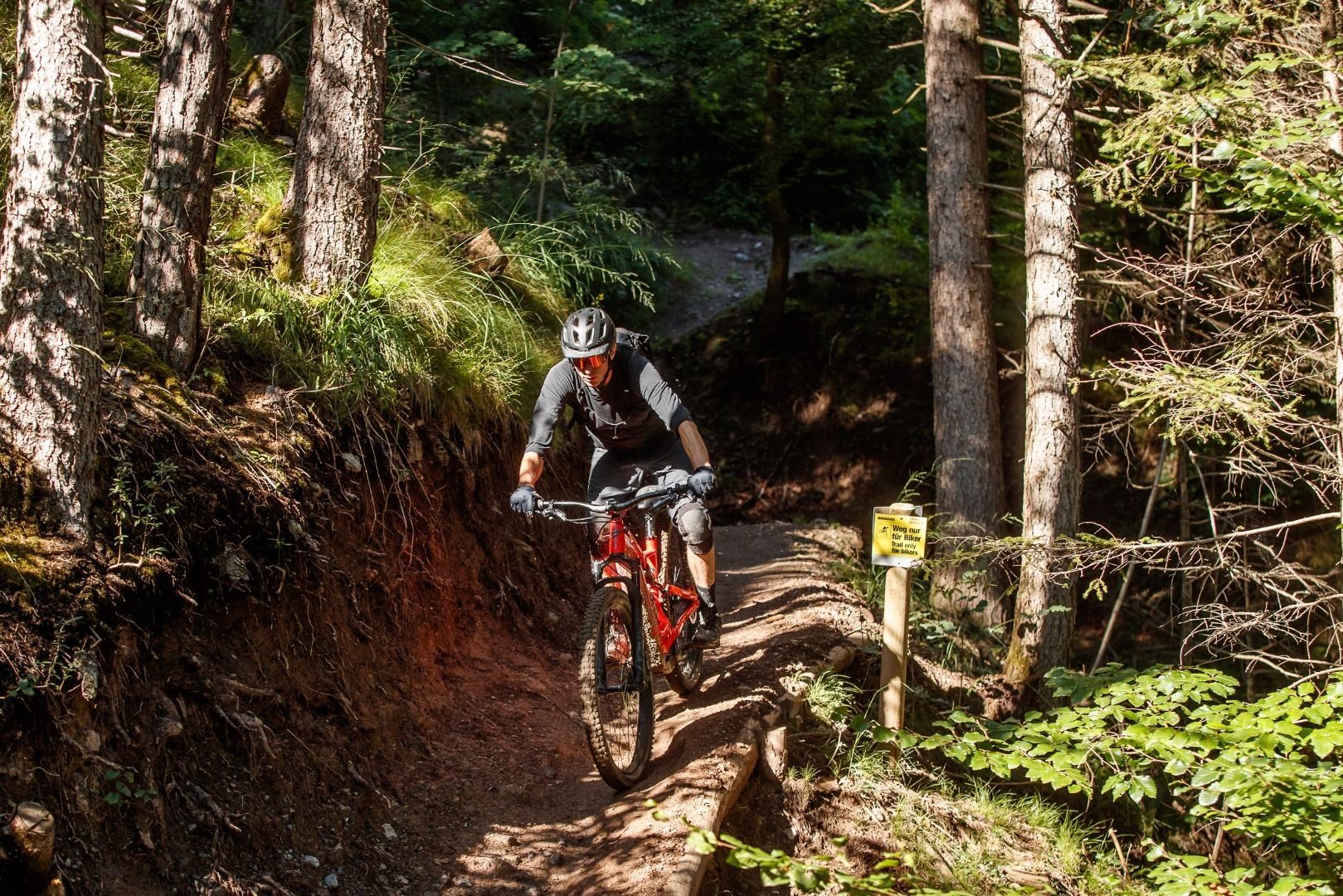
According to the motto "brevity is the spice of life", the Hungerburg Trail close to the city offers flowing downhill fun through wonderful forests. If you dare, you can overcome a few obstacles (doubles) or ride safely around them. After a short stopover at the Arzler Alm, the fun continues on the Arzler Alm Trail.

Tour information

  • Requirement: difficult
  • Length: 550 m
  • Duration: 0:15 h
  • Elevation downhill:100 hm

Starting point

Innsbruck-Hungerburg (870m)

Finishing point

Mühlau (640m)

Description

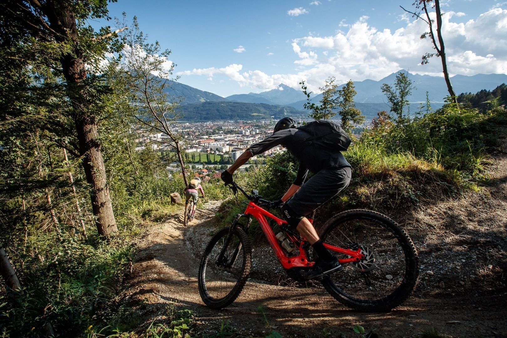
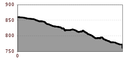
This moderately difficult route starts on the Hungerburg forest trail around 400 metres east of the Hungerburg or the Innsbrucker Nordkettenbahn valley station.
If you’re feeling daring, you can take on some constructed obstacles (doubles) or go for the safe option and ride round them. After riding for a good half a kilometre with 100 metres of elevation loss, the trail joins the Arzler Alm trail (5007) which has the same level of difficulty and similar trail characteristics in its lower section. From there it’s still about 1.6 kilometres along the Arzler Alm trail to Innsbruck's Mühlau district.

Nearby huts and mountain restaurants

More tours in the surrounding area

  • Klammljoch - Defereggental No. 102

    Difficulty: medium
    Length: 22.0 km Duration: 3:30 h Elevation uphill: 946 m
  • Supernatural

    Opening hours: open
    Difficulty: medium
    Length: 610 m
  • Wildbachtrail

    Difficulty: difficult
    Length: 3.4 km Duration: 0:30 h Elevation uphill: 480 m
  • OD Trails

    Opening hours: closed
    Difficulty: medium
  • Ehrwalder Alm Seebensee

    Difficulty: medium
    Length: 9.0 km Duration: 2:30 h Elevation uphill: 630 m
  • Bifang Tour

    Opening hours: closed
    Difficulty: easy
    Length: 10.4 km Duration: 1:00 h Elevation uphill: 320 m
  • Lechradweg

    Length: 244.6 km Duration: 18:00 h Elevation uphill: 1,702 m
  • Stubai Radroute 19

    Opening hours: closed
    Difficulty: easy
    Length: 24.0 km Elevation uphill: 364 m
  • MTB Tour Söll - Hochsöll

    Difficulty: medium
    Length: 5.1 km Elevation uphill: 480 m
  • 45 Gschnitztalradweg

    Difficulty: easy
    Length: 15.3 km Duration: 2:30 h Elevation uphill: 256 m
  • Biketour - Adventure Ride

    Difficulty: medium
    Length: 48.5 km Duration: 5:00 h Elevation uphill: 1,071 m
  • Alpbachtal Giro

    Difficulty: difficult
    Length: 117.4 km Duration: 5:45 h Elevation uphill: 2,250 m
Newsletter

The mountain is calling? So does our newsletter!

In our monthly newsletter we reveal the best holiday tips for Tyrol.