Hut hike Bayreuther Hut via Scherbensteinalm

Münster / Brandenberger Alpen (Rofan)
Difficulty ratings: difficult
Route length: 19.1 km
Duration: 8:00 h

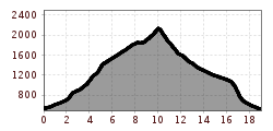
Challenging mountain route from Münster to the Scherbensteinalm and Bayreuther Hut

Tour information

  • Requirement: difficult
  • Length: 19.1 km
  • Duration: 8:00 h
  • Elevation uphill:1,622 hm
  • Elevation downhill:1,635 hm
Highest point2,137 m

Starting point

Münster Village

Finishing point

Münster Grünsbach
  • Fitness level 5 / 6

Best time of year

  • January
  • February
  • March
  • April
  • May
  • June
  • July
  • August
  • September
  • October
  • November
  • December

Equipment

Hiking equipment such as hiking boots, walking sticks, headgear, drinks, snacks up to the camera

Source: Alpbachtal Tourismus

Description

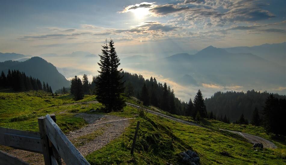
Are you looking for a challenging mountain route through the breathtaking mountain landscape around Münster? This route promises unforgettable views, historic alpine pastures, and diverse nature.

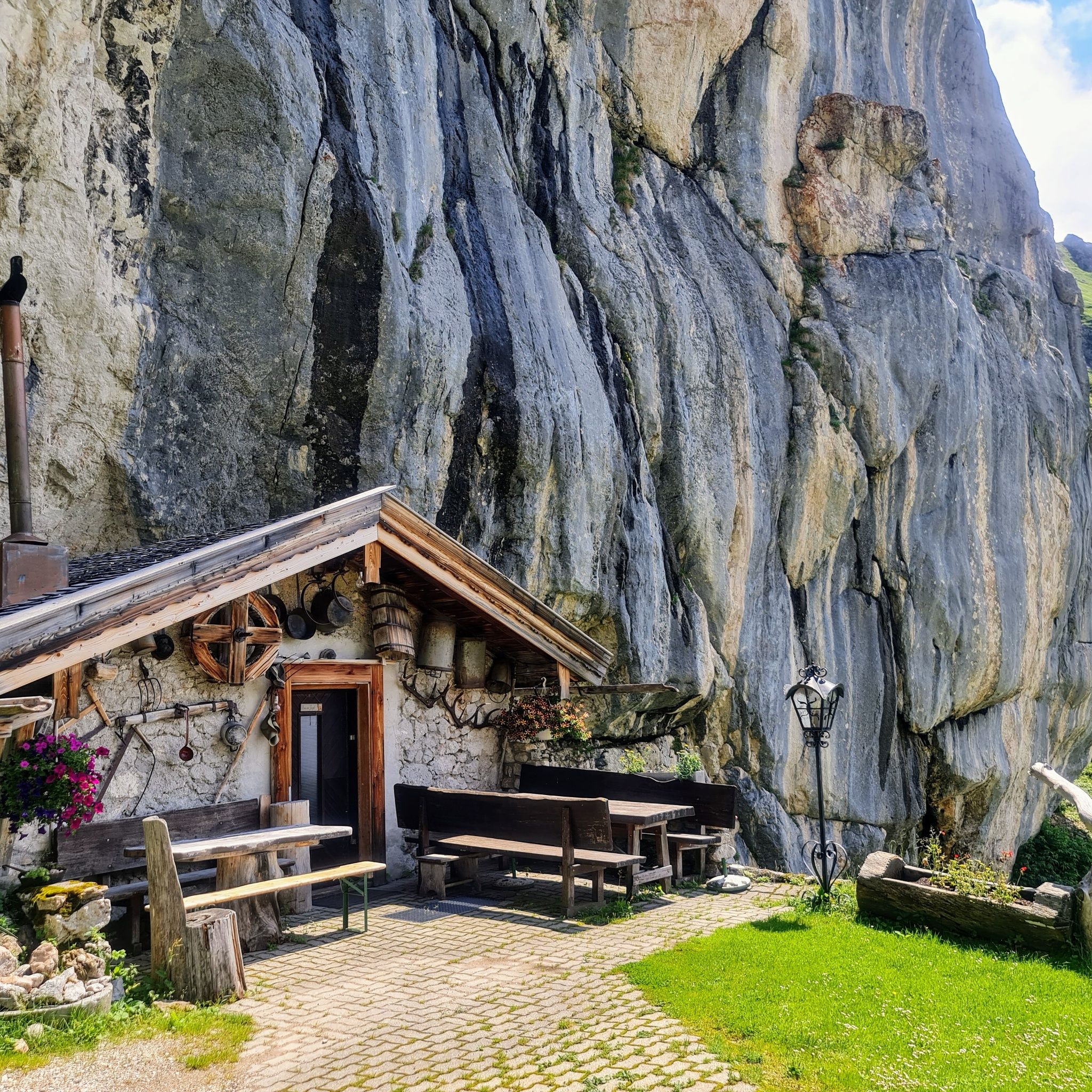
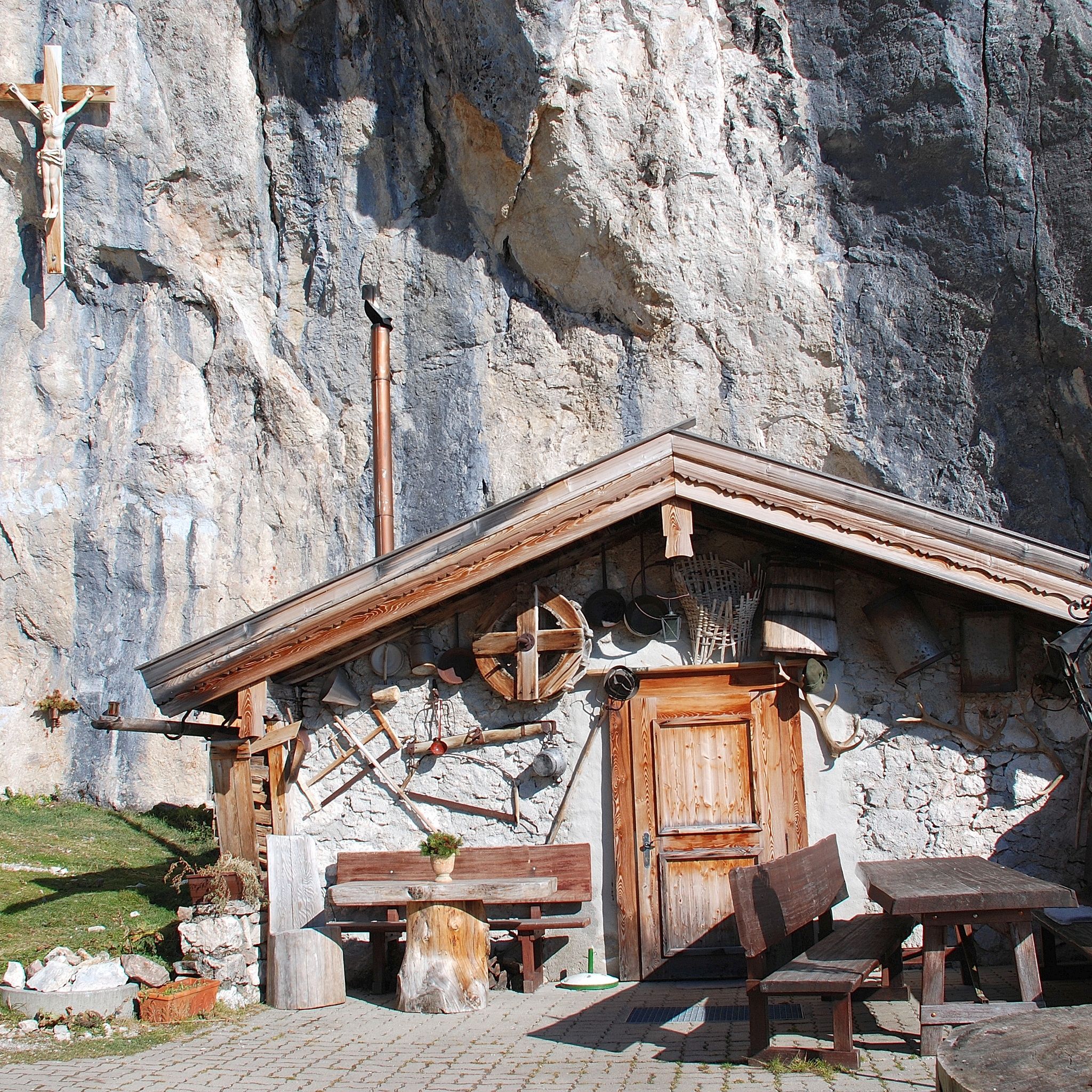
The starting point is the village center of Münster, from where you set off towards Höllenstein. Over a picturesque forest path, you continue to the unmanaged Alpbühelalm, where you can enjoy the peace of nature. From there, the path leads to the old yet charming Scherbensteinalm (also called Schermsteinalm), which will enchant you with its rustic charm.

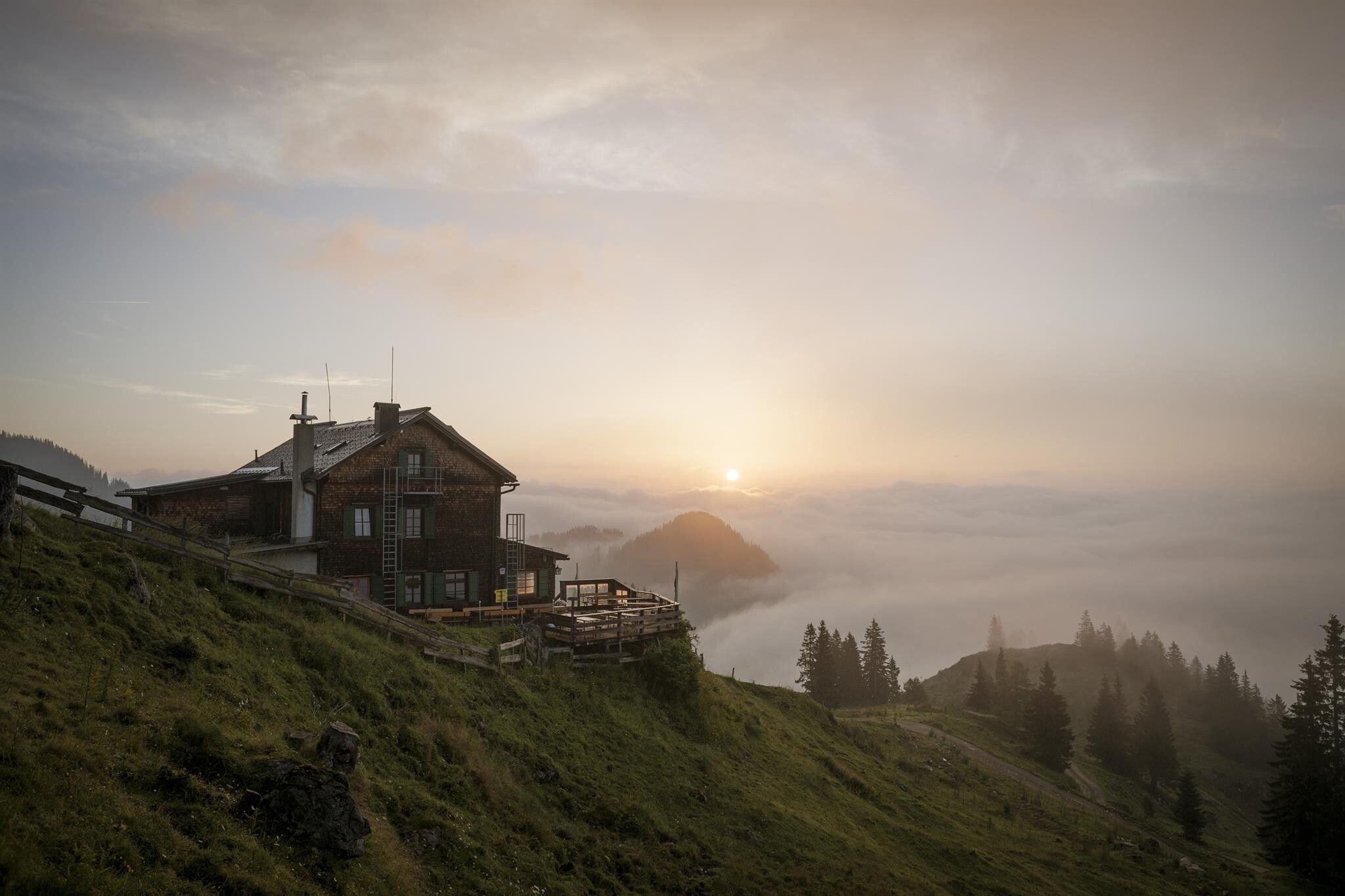
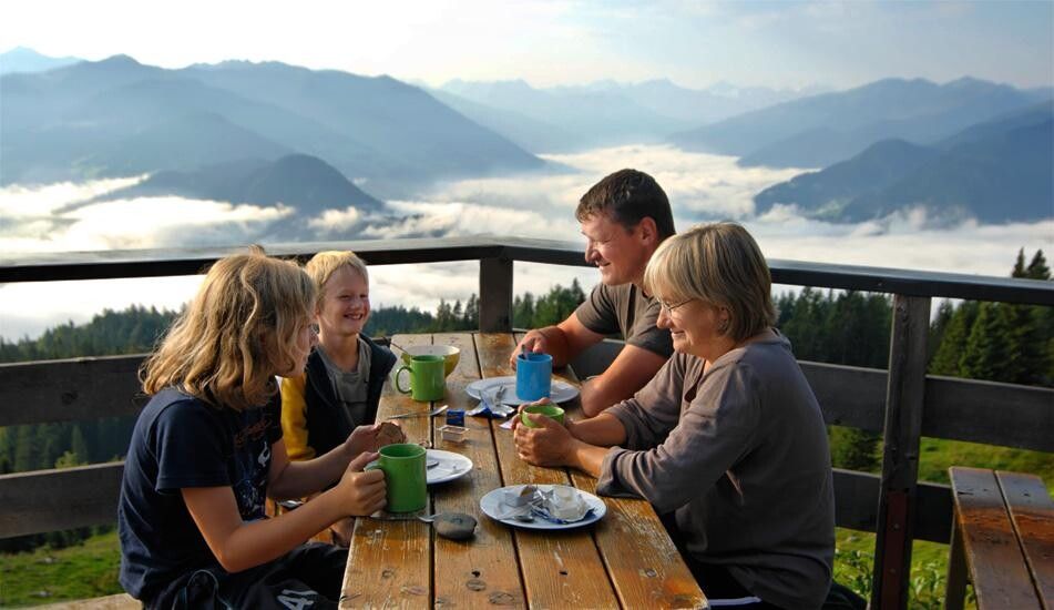
After a relaxing break, you continue the hike to reach the managed Bayreuther Hut, where you can strengthen yourself with a hearty meal. Enjoy the panoramic view of the surrounding peaks and valleys.

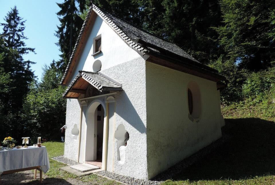
The return path leads over the Kniepass chapel down to the picturesque district of Grünsbach before you take the bus back to the village center of Münster.

This scenic hike with a total of 1600 meters in altitude offers a perfect mix of sporting challenge and scenic beauty. Experience the pristine nature and majestic mountain world on this unforgettable adventure!


Nearby huts and mountain restaurants

Getting here

  • Arrival by public transport

    www.vvt.at with bus 601

  • Parking

    Village center

More tours in the surrounding area

  • Voldöpper Spitze Loop Hike

    Difficulty: medium
    Length: 12.9 km Duration: 5:00 h Elevation uphill: 988 m
  • Day 1: 4 days - 4 summits tour

    Difficulty: medium
    Length: 9.8 km Duration: 5:00 h Elevation uphill: 984 m
  • 3-peak-tour Kienberg-Plessenberg-Heuberg

    Difficulty: medium
    Length: 8.6 km Duration: 4:30 h Elevation uphill: 779 m
  • Loop tour Juppi Zauberwald

    Difficulty: easy
    Length: 2.5 km Duration: 1:00 h Elevation uphill: 93 m
  • Kundler Klamm

    Opening hours: closed
    Difficulty: easy
    Length: 6.4 km Duration: 2:00 h Elevation uphill: 116 m
  • Farmkehralm 1.521 m

    Difficulty: medium
    Length: 9.3 km Duration: 3:30 h Elevation uphill: 506 m
  • Barrier-free path Lake Reintal

    Difficulty: easy
    Length: 6.5 km Duration: 1:45 h Elevation uphill: 15 m
  • Day 3: 4 days - 4 summits tour

    Difficulty: medium
    Length: 19.3 km Duration: 8:00 h Elevation uphill: 1,371 m
  • 4 days - 4 summits tour

    Difficulty: medium
    Length: 54.4 km Duration: 23:00 h Elevation uphill: 3,408 m
  • Kaiser Gorge - loop trail

    Opening hours: closed
    Difficulty: easy
    Length: 4.2 km Duration: 1:00 h Elevation uphill: 198 m
  • 3-day Family Tour Alpbachtal

    Difficulty: easy
    Length: 18.3 km Duration: 7:00 h Elevation uphill: 998 m
  • Wiedersberger Horn Panorama Path

    Difficulty: easy
    Length: 4.1 km Duration: 1:30 h Elevation uphill: 195 m
  • Discovering the Tiefenbach Gorge Hike

    Opening hours: closed
    Difficulty: medium
    Length: 5.7 km Duration: 3:30 h Elevation uphill: 669 m
Newsletter

The mountain is calling? So does our newsletter!

In our monthly newsletter we reveal the best holiday tips for Tyrol.