
Opening hours:Open today
Place:Scharnitz
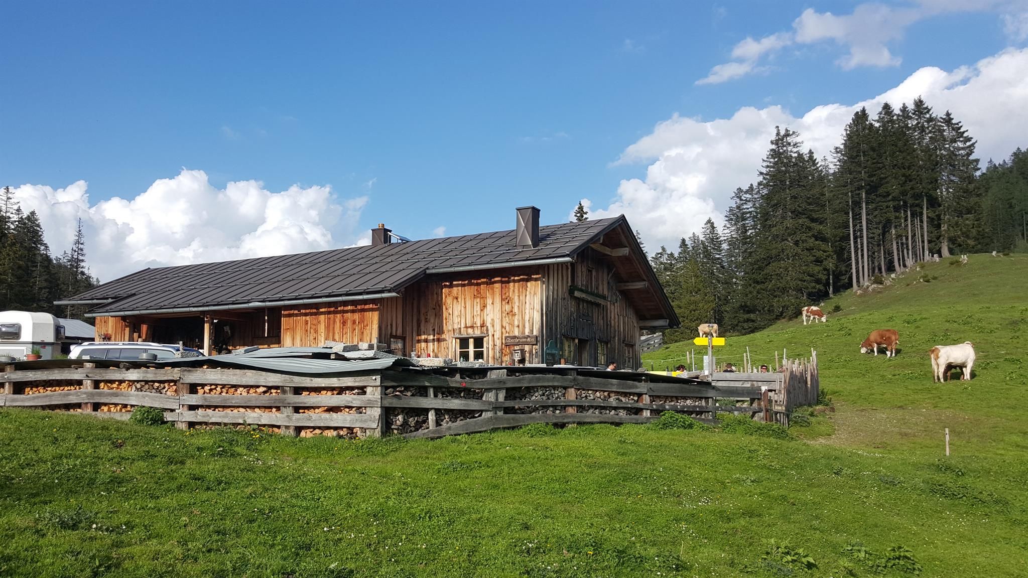
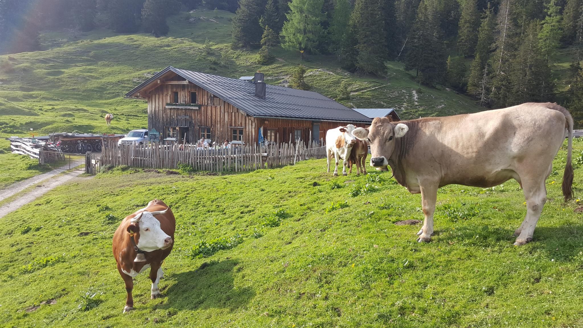
:Alpine pasture / hut / mountain restaurant
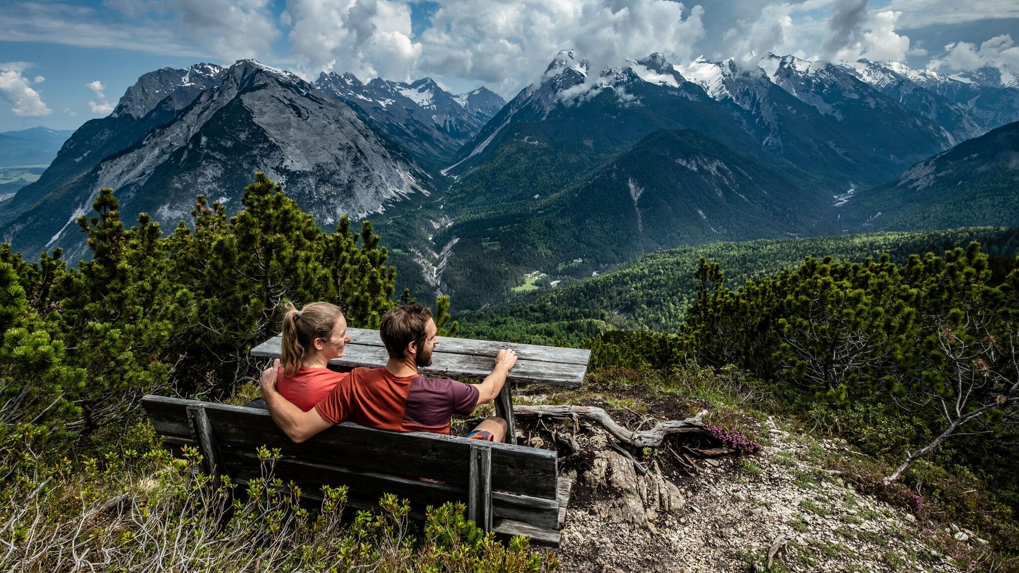
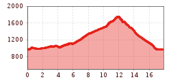
Moderate circular hike from Scharnitz through the wild and romantic Gleirschklamm with impressive rock formations and small waterfalls, continuing to the Oberbrunnalm and over the Zäunlkopf, offering splendid views of the Karwendel valleys.
Forest roads, woodland paths, and gravel trails.
All current information about the trail closures in the Region Seefeld can be found here.
Have you been out and about in the Region and discovered a spot that we should rework or repair? Fill out the form "Report a danger zone" and let us know where work is needed.
Sturdy hiking shoes, functional clothing, a backpack, water, snacks, alpine experience, and sure-footedness are necessary for this tour!
Also recommended: a hiking map or GPS, a first aid kit, sun protection, hiking poles, and an emergency blanket.
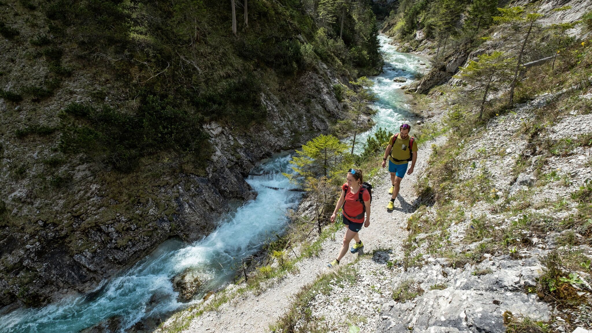
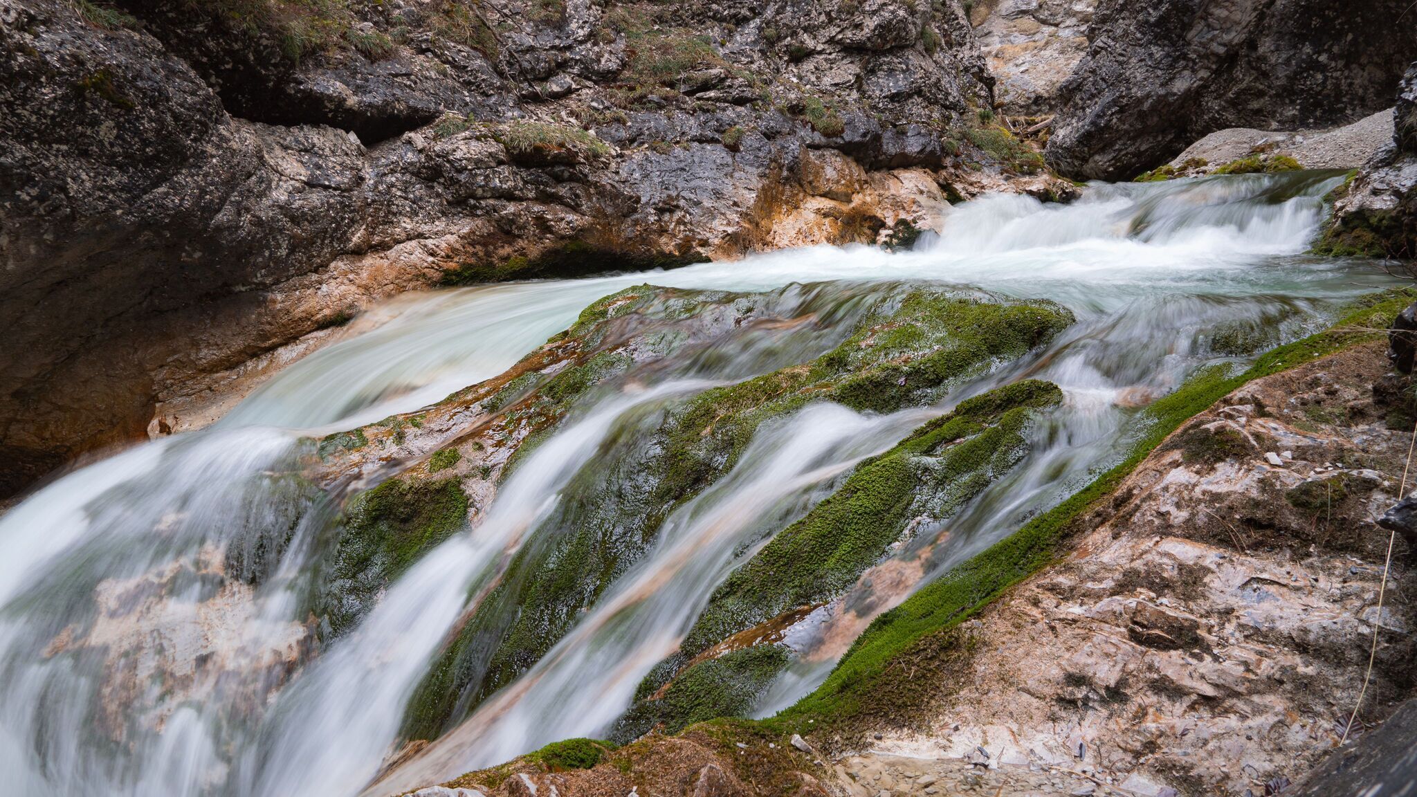
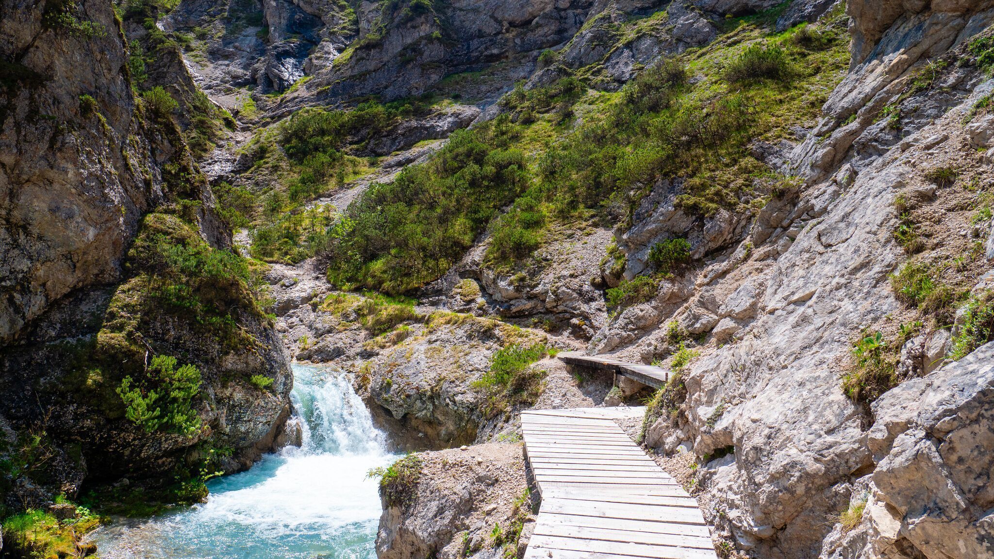
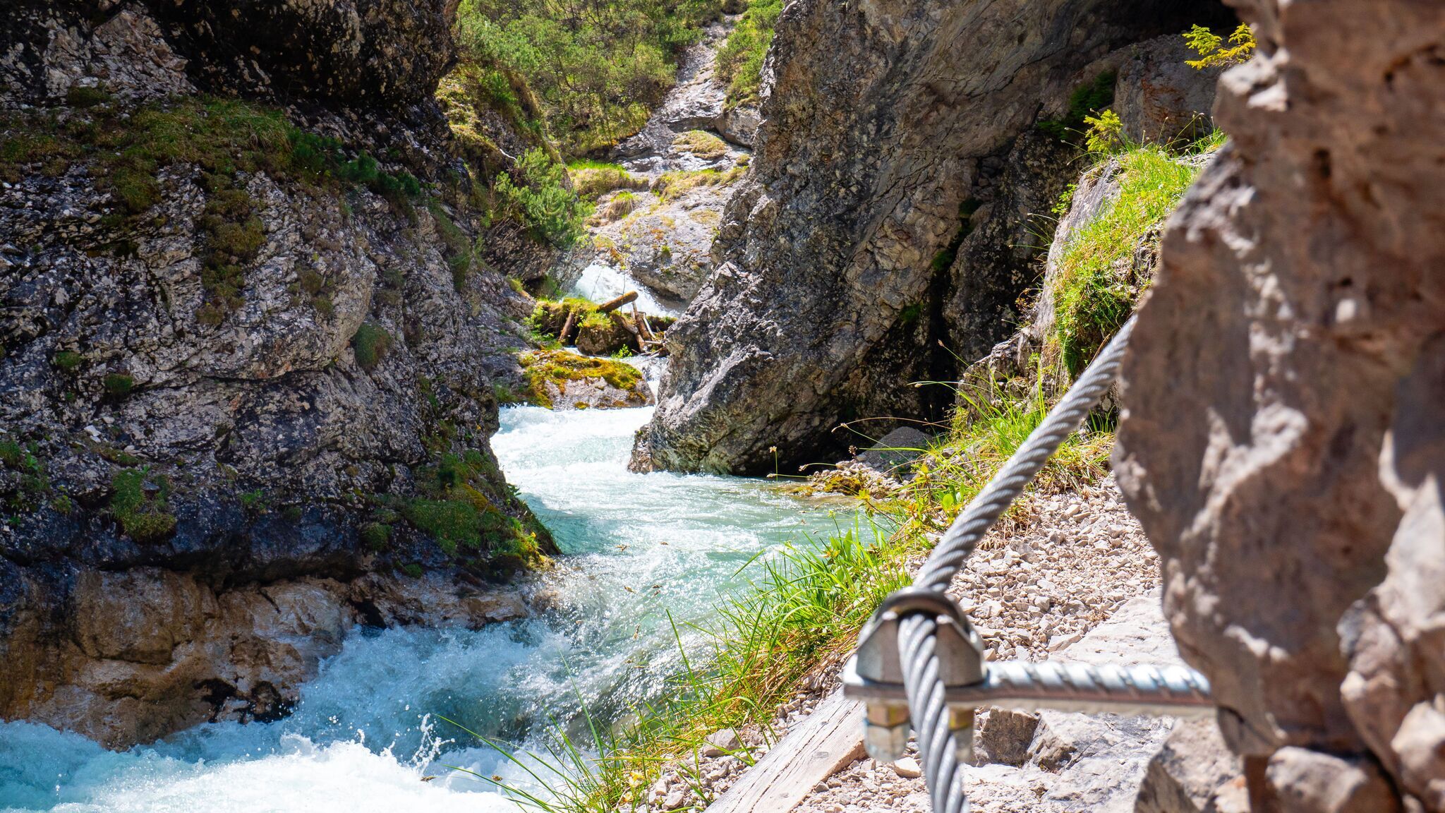
From the Nature Park Information Center in Scharnitz, the path leads to the rustic Scharnitzer Alm and continues along the Nederweg to the entrance of the Gleirschklamm Gorge. Important: The narrow trail through the wild and romantic gorge is only suitable for sure-footed hikers! The path impresses with its majestic rock formations, small waterfalls, and crystal-clear water. After the gorge, the path turns right and climbs up to the Oberbrunnalm. Alternatively, you can take a footpath from the forest road through the Isertal, which meets the forest road again a bit below the Alm.
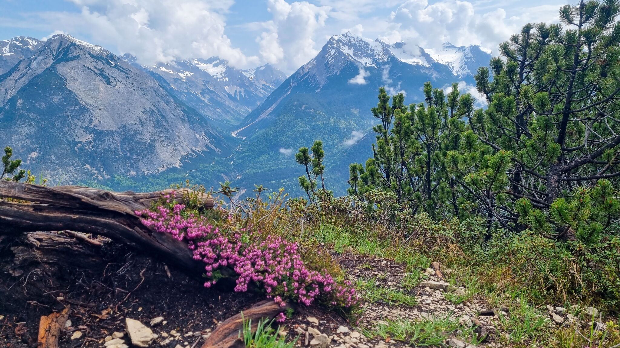
From the Oberbrunnalm, the trail steeply ascends via a narrow path to the Zäunlkopf; the roughly ten-minute detour to the "beautiful view" lives up to its promise. Afterwards, you can descend via the Mittagskopf to the former mountain station of the Mühlberg lift and follow the signs back to Scharnitz along the forest road. A small detour to the "Heart" viewpoint at Mühlberg can also be included. For sure-footed hikers, the route through the Bärenklamm is also recommended. Here, you can reach the parking lot P4 in Scharnitz directly via a narrow, partly steep path.
By train to Scharnitz train station, then a 10-minute walk to the starting point at the Nature Park Information Center.
All real-time connections can be found in the route planner.


.jpg")


.jpg")
.jpg")


.jpg")


.jpg")
.jpg")


 (2).jpg")


 Olympiaregion Seefeld")

