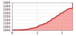
Open interactive mapOpen this POI on the interactive mapElevation profileHäselgehr zur Haglertalhütte.gpx
Wandern © Bernd Ritschel Narrenkogel - NiederthaiDifficulty: medium Length: 2.9 km Duration: 2:00 h Elevation uphill: 764 m See trailSee trail: Narrenkogel - Niederthai
Piccard bridge loop hike - ObergurglOpening hours: closed Difficulty: difficult Length: 18.2 km Duration: 8:00 h Elevation uphill: 1,111 m See trailSee trail: Piccard bridge loop hike - Obergurgl
Stuibenfall - Tirols größter Wasserfall © Ötztal Stuibenfall hike - UmhausenOpening hours: open Difficulty: easy Length: 2.9 km Duration: 1:45 h Elevation uphill: 456 m See trailSee trail: Stuibenfall hike - Umhausen
Similaunhütte © Roland Grüner Vent - Similaunhütte - Ötzi-FundstelleDifficulty: medium Length: 14.9 km Duration: 6:00 h Elevation uphill: 1,397 m See trailSee trail: Vent - Similaunhütte - Ötzi-Fundstelle
Lehner Wasserfall © Ötztal Tourismus Büro Längenfeld Lehner Wasserfall - Kraftquell LängenfeldOpening hours: closed Difficulty: easy Length: 540 m Duration: 0:25 h Elevation uphill: 239 m See trailSee trail: Lehner Wasserfall - Kraftquell Längenfeld
hochstubaihütte über seekarsee & himmelsleiter - sölden_img_56888636 © Ötztal Hochstubaihütte über Seekarsee & Himmelsleiter - SöldenDifficulty: difficult Length: 4.8 km Duration: 4:00 h Elevation uphill: 1,270 m See trailSee trail: Hochstubaihütte über Seekarsee & Himmelsleiter - Sölden
gipfeltour rosskopf_img_39972994 © Ötztal Tourismus Büro Oetz Mountain peak RosskopfDifficulty: medium Length: 2.0 km Duration: 2:00 h Elevation uphill: 379 m See trailSee trail: Mountain peak Rosskopf
Vent © Roland Grüner MutsbühlDifficulty: medium Length: 4.5 km Duration: 1:30 h Elevation uphill: 470 m See trailSee trail: Mutsbühl
vent - breslauer hütte - vernagthütte_img_23330472 © Katharina Nösig Vent - Breslauer Hütte - VernagthütteDifficulty: medium Length: 10.4 km Duration: 4:00 h Elevation uphill: 1,203 m See trailSee trail: Vent - Breslauer Hütte - Vernagthütte
Grenzgänger Weitwanderweg - ÜbserichtDifficulty: difficult Length: 93.5 km Elevation uphill: 7,700 m See trailSee trail: Grenzgänger Weitwanderweg - Übsericht
Ansbacher Hütte - Memminger HütteDifficulty: difficult Length: 10.0 km Duration: 6:00 h Elevation uphill: 878 m See trailSee trail: Ansbacher Hütte - Memminger Hütte
Adlerweg © Lechtal Tourismus Lechtaler Höhenweg: 6th stage: Württemberger Haus-Steinseehütte-Hanauer HütteDifficulty: difficult Length: 3.8 km Duration: 2:45 h Elevation uphill: 394 m See trailSee trail: Lechtaler Höhenweg: 6th stage: Württemberger Haus-Steinseehütte-Hanauer Hütte
Adlerweg © Lechtal Tourismus Lechtaler Höhenweg: 6th stage: Württemberger Haus-Steinseehütte-Hanauer HütteDifficulty: difficult Length: 9.7 km Duration: 6:30 h Elevation uphill: 1,026 m See trailSee trail: Lechtaler Höhenweg: 6th stage: Württemberger Haus-Steinseehütte-Hanauer Hütte
Leutkircher-Hütte © Lechtal Tourismus Lechtaler Höhenweg 1st stage: Stuttgarter Hütte-Leutkircher HütteDifficulty: difficult Length: 7.7 km Duration: 3:15 h Elevation uphill: 429 m See trailSee trail: Lechtaler Höhenweg 1st stage: Stuttgarter Hütte-Leutkircher Hütte
Adlerweg © Lechtal Tourismus Lechtaler Höhenweg: 6th stage: Württemberger Haus-Steinseehütte-Hanauer HütteDifficulty: medium Length: 7.3 km Duration: 5:00 h Elevation uphill: 847 m See trailSee trail: Lechtaler Höhenweg: 6th stage: Württemberger Haus-Steinseehütte-Hanauer Hütte
Grenzgänger Etappe 1 - Bschießer, Ponten, Zirleseck und Willersalpe - HintersteinDifficulty: difficult Length: 14.4 km Duration: 8:00 h Elevation uphill: 1,415 m See trailSee trail: Grenzgänger Etappe 1 - Bschießer, Ponten, Zirleseck und Willersalpe - Hinterstein
Grenzgänger Etappe 1 - Bschießer, Ponten, Zirleseck und Willersalpe - HintersteinDifficulty: medium Length: 12.3 km Duration: 6:00 h Elevation uphill: 1,035 m See trailSee trail: Grenzgänger Etappe 1 - Bschießer, Ponten, Zirleseck und Willersalpe - Hinterstein
Grenzgänger Etappe 1 - Bschießer, Ponten, Zirleseck und Willersalpe - HintersteinDifficulty: difficult Length: 13.0 km Duration: 7:30 h Elevation uphill: 1,054 m See trailSee trail: Grenzgänger Etappe 1 - Bschießer, Ponten, Zirleseck und Willersalpe - Hinterstein
Apfelmeile © Katharina Nösig Ötztaler UrwegLength: 189.1 km Duration: 72:19 h Elevation uphill: 9,428 m See trailSee trail: Ötztaler Urweg
Erlanger Hütte © Ötztal Ötztal Trek Stage 22Difficulty: difficult Length: 21.5 km Duration: 8:00 h Elevation uphill: 647 m See trailSee trail: Ötztal Trek Stage 22
Wildtierweg Fuchs.jpg © © Serfaus-Fiss-Ladis Marketing GmbH Wild Animals TrailOpening hours: open Difficulty: easy See trailSee trail: Wild Animals Trail
ötztal trek etappe 21_img_27378494 © Katharina Nösig Ötztal Trek Stage 21Difficulty: difficult Length: 9.4 km Duration: 4:30 h Elevation uphill: 1,270 m See trailSee trail: Ötztal Trek Stage 21
Grenzgänger Etappe 1 - Bschießer, Ponten, Zirleseck und Willersalpe - HintersteinDifficulty: difficult Length: 13.6 km Duration: 7:30 h Elevation uphill: 1,246 m See trailSee trail: Grenzgänger Etappe 1 - Bschießer, Ponten, Zirleseck und Willersalpe - Hinterstein
Adlerweg © Lechtal Tourismus Lechtaler Höhenweg: 6th stage: Württemberger Haus-Steinseehütte-Hanauer HütteDifficulty: difficult Length: 9.5 km Duration: 5:15 h Elevation uphill: 713 m See trailSee trail: Lechtaler Höhenweg: 6th stage: Württemberger Haus-Steinseehütte-Hanauer Hütte
Leutkircher-Hütte © Lechtal Tourismus Lechtaler Höhenweg 1st stage: Stuttgarter Hütte-Leutkircher HütteDifficulty: difficult Length: 6.6 km Duration: 3:15 h Elevation uphill: 469 m See trailSee trail: Lechtaler Höhenweg 1st stage: Stuttgarter Hütte-Leutkircher Hütte
Give feedback for a chance to win a special holiday experience!Click here for the surveyClick here for the survey

")


.jpg")
.jpg")


