
Opening hours:Today closed
Place:Obergurgl
:Alpine pasture / hut / mountain restaurant
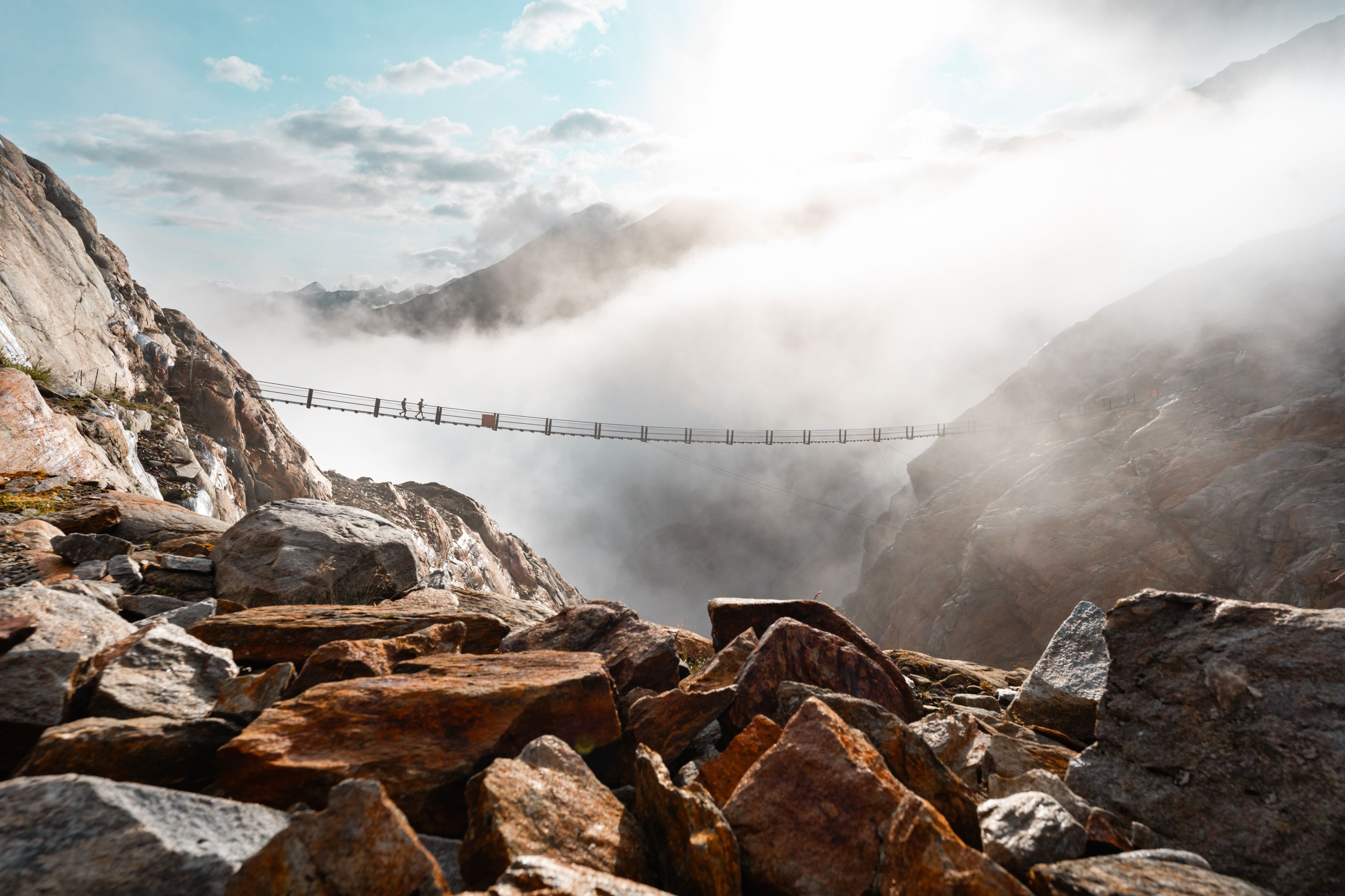
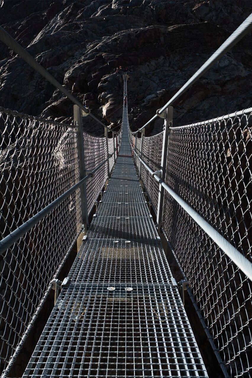
At the far end of the Ötztal valley, it can be hard to get your Gurgl to close, at least if you cross the airy Piccard Bridge. But the Langtalereckhütte and Ramolhaus are connected, where you can reward yourself for your courage before and after.
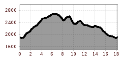
Challenging mountain hike from Obergurgl to the head of the valley. The tour leads over steep grassy slopes and past glacial streams to the Küppelealm. Further out of the valley, the view of the Ramolhaus, which stands spectacularly on a rocky outcrop, opens up. Impressive views of the Gurgler Ferner and the wild Ötztal Alps. You reach the Langtalereck hut via the 142-metre-long Piccard bridge. The tour takes you up to 2,688 meters and requires basic alpine experience as well as surefootedness and a head for heights.


For fearless, sure-footed, and highly alpine experienced mountaineers; Excellent physical condition, extensive mountain experience, alpine climbing equipment, securing and orientation aids, good weather conditions recommended Please note the current weather report at: www.oetztal.com/de/sommer.html
Appropriate equipment such as breathable and weather-appropriate outdoor clothing, ankle-high hiking boots, wind, rain and sun protection, a hat, and possibly gloves, is required for all hikes and routes. Carrying a first aid kit, a mobile phone, and possibly a hiking map, as well as sufficient provisions for hikes without refreshment opportunities, is necessary.From the town center, follow the signposted path to the Gurgler Ache. From there, climb up steep grassy slopes and cross several small glacier streams. At about 2300 m, you will reach the Küppelealm. If you continue hiking further into the valley, you can already see the Ramolhaus perched on a rock ledge. A little further, below the Ramolhaus, you reach the newly created path to the Piccard Bridge. Cross the bridge to the other side of the valley and follow the path into the Langtal to reach the Langtalereck Hut. From there, you descend back to Obergurgl.
Travel comfortably and safely by train to the Ötztal station. The final stop or exit point is ÖTZTAL station. Afterwards, travel conveniently and quickly by public transport or local taxi companies through the entire valley to your desired destination. The current bus schedule is available at: fahrplan.vvt.at
The following parking options are available in Gurgl:


