Mountain hikes Lehner Wasserfall - Kraftquell Längenfeld

closed
Längenfeld / Ötztaler Alpen
Difficulty ratings: easy
Route length: 540 m
Duration: 0:25 h

A drop of 80 meters and pure power: The Lehner Waterfall in the Ötztal Alps is an important element of the "Längenfeld Power Source" and a natural phenomenon that is bursting with energy.

Tour character

Not keen on climbing? Don't worry! There is a beautiful hiking circuit on moderately difficult mountain trails around the Lehner waterfall. It is 2.5 kilometers short and can be completed in an hour. But there is an even more direct route: from Längenfeld, a well-maintained hiking trail leads to about halfway up the waterfall in around twenty minutes and offers a close-up view of the roaring waters and the climbers scrambling up the rocks on the other side.

Tour information

  • Requirement: easy
  • Length: 540 m
  • Duration: 0:25 h
  • Elevation uphill:239 hm
  • Elevation downhill:55 hm
Highest point1,363 m

Starting point

Local History Museum Längenfeld/Lehn

Finishing point

Viewing platform at the waterfall
  • Fitness level 2 / 6

Best time of year

  • January
  • February
  • March
  • April
  • May
  • June
  • July
  • August
  • September
  • October
  • November
  • December

Equipment

Easy hiking trail; suitable for beginners and walkers. Please observe the current weather report.

Appropriate equipment such as breathable suitable outdoor clothes for the weather, ankle-high walking boots,

wind-, rain- & sun protection, hat, possibly gloves, is for all hikes and tours necessary.

Source: TVB Ötztal Tourismus

Description

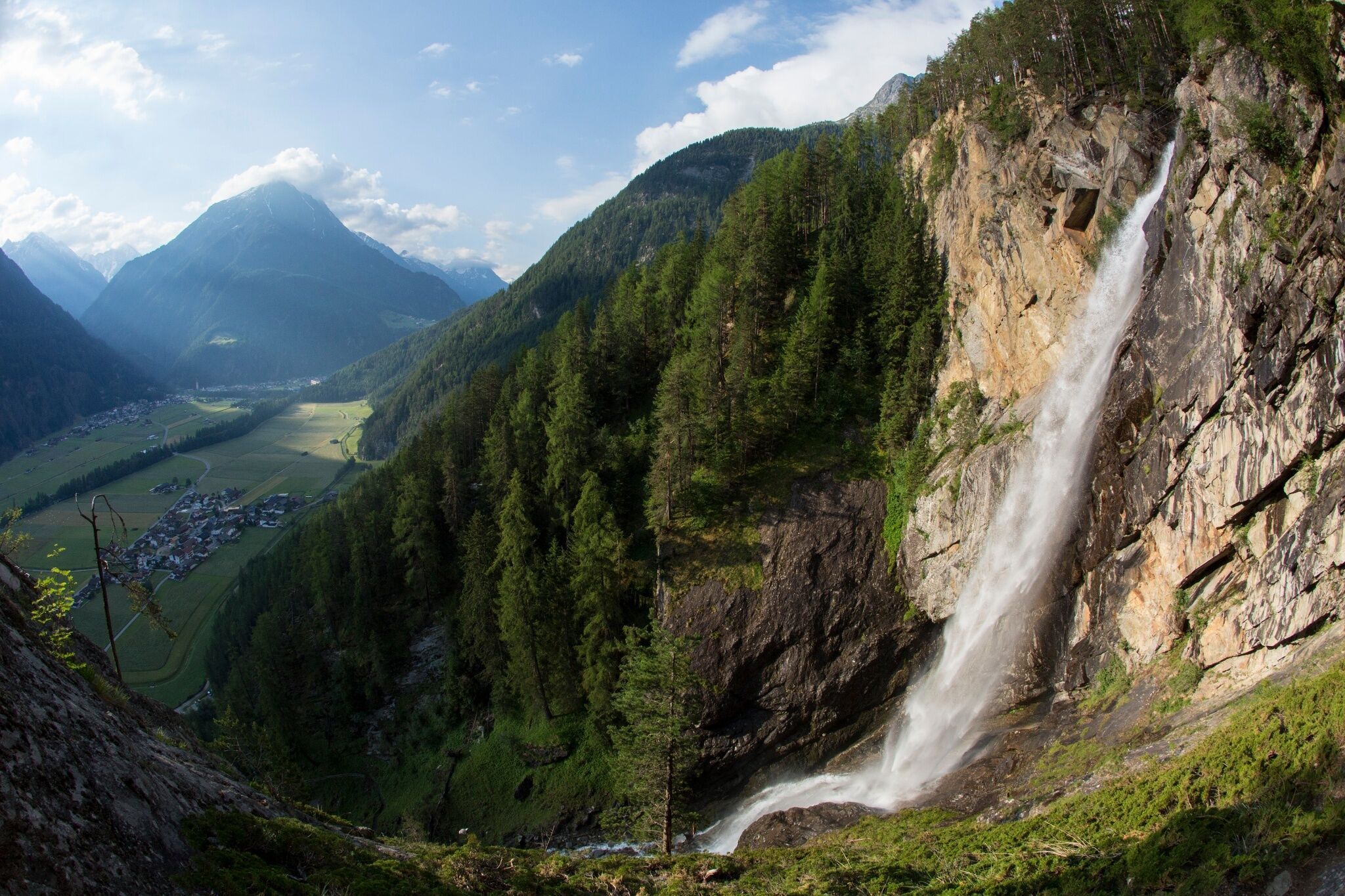
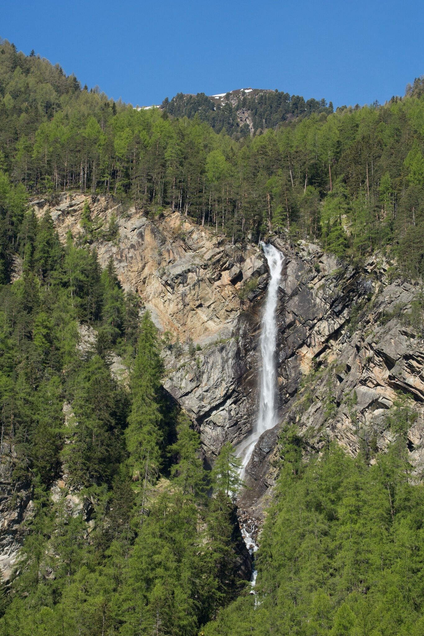
Thunderously, cascades of sparkling mountain water plunge 80 meters deep into the gorge – formed millions of years ago. Pure energy, primal force that seems to jump onto you!

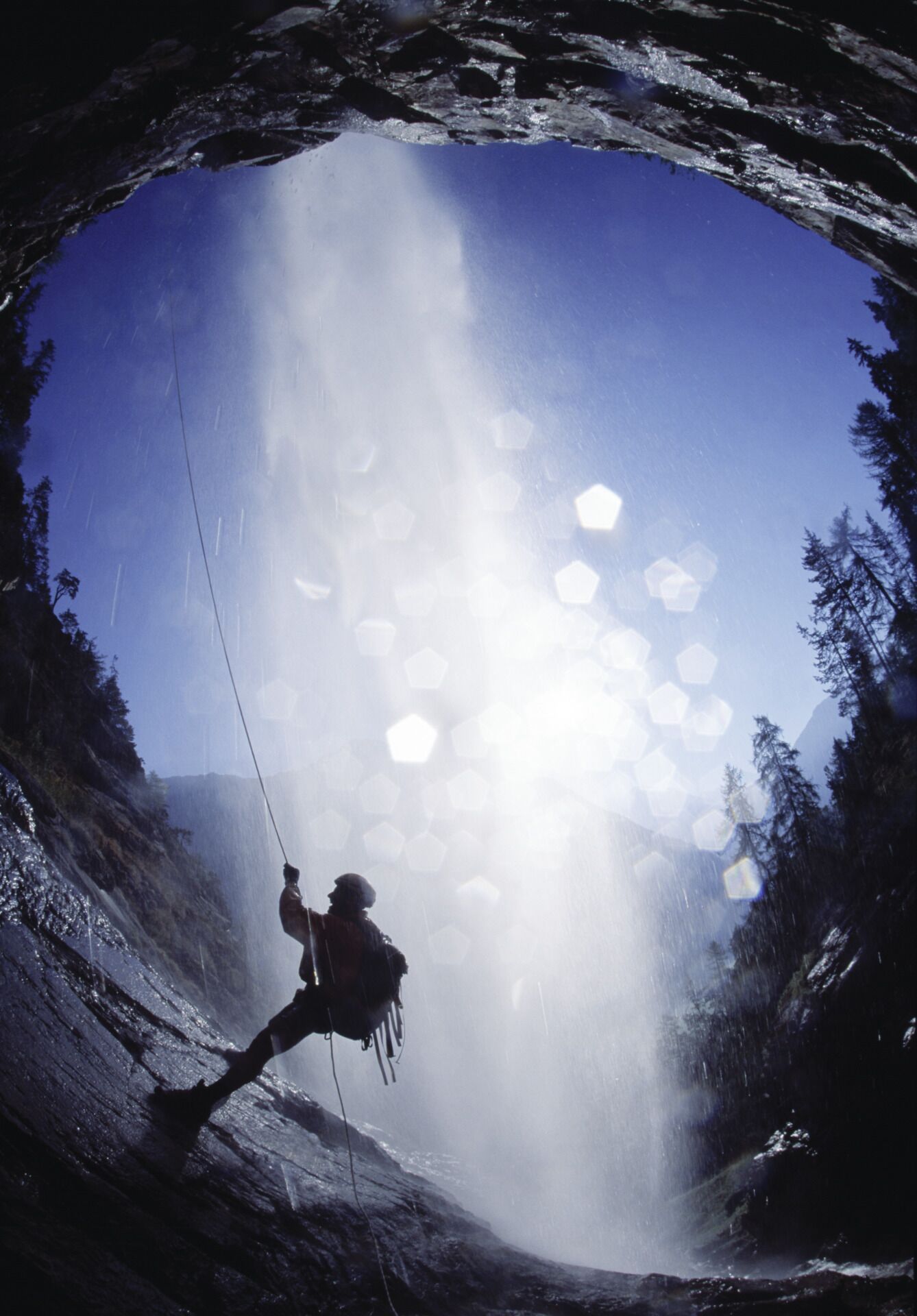
A well-maintained hiking trail accompanies the fall to about halfway down and offers double enjoyment: an up-close view of the roaring water masses and the spectacle of cool climbers scrambling up the rocks on the other side. Benches invite you to take a break; a spacious wooden platform at the upper end opens up great photo opportunities. The hike through the larch forest is pleasantly shady and completely safe, as a wooden railing provides support on steeper sections.

A higher point watches over the trail. At the beginning of the Way of the Cross, you will find the Zarrach chapel, accompanied by 14 small religious shrines (Marterln) leading up to the Marian Grotto.


Getting here

  • Arrival by public transport

    Travel comfortably and safely by train. The final stop or exit point is ÖTZTAL station. Afterwards, you can travel conveniently and quickly to your desired destination in the valley by public transport or local taxi services. The current bus schedule is available at: http://fahrplan.vvt.at

  • Parking

    The following parking options are available

    • Near the Local History Museum (paid)

More tours in the surrounding area

  • Ötztal Trek Stage 4

    Difficulty: difficult
    Length: 8.9 km Duration: 4:00 h Elevation uphill: 802 m
  • Ötztal Trek Stage 3

    Difficulty: difficult
    Length: 10.4 km Duration: 4:00 h Elevation uphill: 842 m
  • Ötztal Trek Stage 14

    Difficulty: difficult
    Length: 6.3 km Duration: 3:00 h Elevation uphill: 1,004 m
  • Ötztal Trek Stage 12

    Difficulty: difficult
    Length: 4.8 km Duration: 2:00 h Elevation uphill: 592 m
  • Ötztaler Urweg

    Length: 189.1 km Duration: 72:19 h Elevation uphill: 9,428 m
  • Ötztal Trek Stage 21

    Difficulty: difficult
    Length: 9.4 km Duration: 4:30 h Elevation uphill: 1,270 m
  • Ötztal Trek Stage 16

    Difficulty: difficult
    Length: 6.9 km Duration: 2:30 h Elevation uphill: 358 m
  • Ötztal Trek Stage 20

    Opening hours: closed
    Difficulty: medium
    Length: 6.4 km Duration: 3:00 h Elevation uphill: 610 m
  • Vent - Breslauer Hütte - Vernagthütte

    Difficulty: medium
    Length: 10.4 km Duration: 4:00 h Elevation uphill: 1,203 m
  • Ötztal Trek Stage 17

    Difficulty: difficult
    Length: 16.4 km Duration: 6:00 h Elevation uphill: 1,080 m
  • Mountain peak Rosskopf

    Difficulty: medium
    Length: 2.0 km Duration: 2:00 h Elevation uphill: 379 m
  • Mutsbühl

    Difficulty: medium
    Length: 4.5 km Duration: 1:30 h Elevation uphill: 470 m
  • Fundusfeiler - Umhausen

    Difficulty: difficult
    Length: 4.5 km Duration: 3:00 h Elevation uphill: 1,109 m
  • Loop trail Stuibenfall Umhausen

    Opening hours: open
    Difficulty: easy
    Length: 9.2 km Duration: 4:00 h Elevation uphill: 608 m
  • Ramolhaus - Obergurgl

    Difficulty: difficult
    Length: 7.8 km Duration: 4:00 h Elevation uphill: 1,095 m
  • Via Ferrate Stuibenfall | Umhausen

    Opening hours: closed
    Difficulty: medium
    Length: 1.5 km Duration: 4:00 h Elevation uphill: 162 m
  • Brizzisee

    Difficulty: medium
    Length: 9.0 km Duration: 3:30 h Elevation uphill: 1,057 m
Newsletter

The mountain is calling? So does our newsletter!

In our monthly newsletter we reveal the best holiday tips for Tyrol.