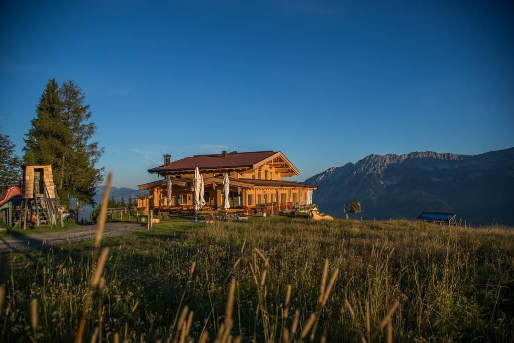
Mountain hikes Hartkaiser circuit

Ellmau / Kaiser Mountains
Difficulty ratings: easy
Route length: 17.1 km
Duration: 6:00 h

From the valley station of the Hartkaiserbahn to the Rübezahl-Alm and via the Schnitzfigurenweg to Ellmi’s Zauberwelt.
Tour information

  • Requirement: easy
  • Length: 17.1 km
  • Duration: 6:00 h
  • Elevation uphill:810 hm
  • Elevation downhill:810 hm
Highest point1,525 m

Starting point

Hiking starting point Tourism Info, Ellmau (800 m)

Finishing point

Hiking starting point Tourism Info, Ellmau (800 m)
  • Fitness level 4 / 6
  • Technique 2 / 6

Features

  • Circular route
  • Suitable for families

Best time of year

  • January
  • February
  • March
  • April
  • May
  • June
  • July
  • August
  • September
  • October
  • November
  • December

Trail condition

The trail conditions vary between access roads, hiking trails, gravel and forest paths, and mountain tracks.

Equipment

Backpack, sturdy hiking/mountaineering boots with non-slip tread soles, weather-appropriate hiking clothing (breathable), change of clothes, sun protection (sunglasses, sunscreen, lip balm, hat), rain protection (rain jacket/poncho, small umbrella, backpack cover), cold protection (beanie, gloves), provisions (sufficient fluids and snacks), optional hiking poles (adjustable height), first-aid kit, mobile phone with fully charged battery, headlamp, plastic bag for waste, hiking map, tour description and information material (GPX track), ID, insurance card, cash.
Source: TVB Wilder Kaiser

Description

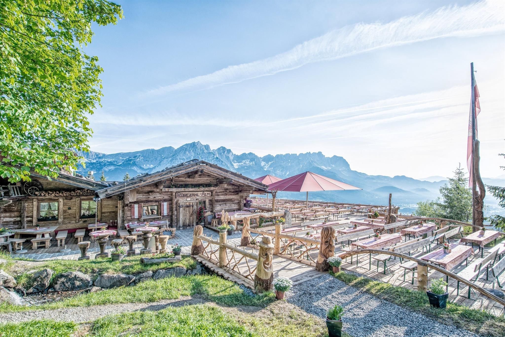
You start at the hiking information center in the village center and walk towards the Hartkaisebahn. Immediately after the valley station building, turn right onto hiking trail no. 7. Passing the Hausleit`n Stub`n  (only open in winter), you reach a path that you follow to the middle station of the cable car. Now continue for a short distance on hiking trail no. 4  until you reach the rustic Rübezahl-Alm with its spectacular terrace facing the Wilder Kaiser. This is where Austria's longest Schnitzfigurenweg (no. 3a) begins, leading up to the Jägerhütte (1,400 m).
Just one more short, steep climb and you reach the Bergstation Hartkaiser (1,520 m). In Ellmi's Zauberwelt, children can go on a treasure hunt in the fairytale forest, while the adults explore the nature trail. Hiking trail no. 1 leads you back down to the valley via the Berggasthaus Hochschwendt.

Our tip: Hikers with tired feet can also use the gondola lift for the ride down to the valley.

Nearby huts and mountain restaurants

Getting here

  • Arrival by public transport

    80 KaiserJet: Ellmau Dorfplatz (Steig A)
    865+866 VVT-Regiobuslines: Ellmau Dorf/Bauhof

    You can find further information and the timetables on this page: Local Transport | Wilder Kaiser

  • Parking

    Heading from Wörgl or Kufstein on the B178 road, take the first exit to Ellmau and then take the first exit at the roundabout. Drive along the bypass, then turn towards the centre of Ellmau when you reach the end (between MPreis and the Sporthotel). Continue straight on until you see the Tourist Info on the right-hand side (short-stay parking zone). The hiking starting point is located opposite this on the left-hand side.

    Heading from St. Johann on the B178 road, take the first exit to Ellmau and drive straight on through the town until you see the Tourist Info on the right-hand side (short-stay parking zone). The hiking starting point is located opposite this on the left-hand side.

    Public car parks in Ellmau centre or west (800 m) - pay & display

Weather

Today

moderate rain
9°C/4°C
90%5.9l5 km/h

Wed

cloudy
10°C/4°C
50%3.2l5 km/h

Thu

light rain showers
10°C/5°C
85%13.6l5 km/h
Go to weather forecast

More tours in the surrounding area

  • Astberg circular hiking route

    Difficulty:easy
    Length:1.5 kmDuration:0:30 hElevation uphill:80 m
  • Hintere Goinger Halt summit tour

    Difficulty:difficult
    Length:9.3 kmDuration:6:30 hElevation uphill:1,090 m
  • Panoramic circuit Brandstadl–Hartkaiser

    Difficulty:easy
    Length:6.0 kmDuration:1:50 hElevation uphill:170 m
  • “Moor & more” Rocky Way

    Difficulty:easy
    Length:8.0 kmDuration:3:00 hElevation uphill:380 m
  • Kaiserkrone - stage 1

    Difficulty:medium
    Length:8.0 kmDuration:4:30 hElevation uphill:1,120 m
  • Eagle Walk Stage 02: Gaudeamushütte - Kaindlhütte

    Difficulty:medium
    Length:15.1 kmDuration:6:30 hElevation uphill:888 m
  • Kaiserkrone - stage 3

    Difficulty:medium
    Length:9.3 kmDuration:4:30 hElevation uphill:840 m
  • Tauernblick panorama circular hiking route

    Difficulty:medium
    Length:13.6 kmDuration:6:00 hElevation uphill:980 m
  • 3-day hut tour Wilder Kaiser

    Difficulty:difficult
    Length:24.6 kmDuration:14:00 hElevation uphill:2,060 m
  • Hochalm hike

    Difficulty:medium
    Length:19.6 kmDuration:7:00 hElevation uphill:1,140 m
Newsletter

The mountain is calling? So does our newsletter!

In our monthly newsletter we reveal the best holiday tips for Tyrol.