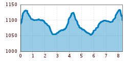
Mountain hikes Hike to Ritzenried

Jerzens im Pitztal /
Difficulty ratings: easy
Route length: 8.3 km
Duration: 2:00 h

Hike to Ritzenried

Tour information

  • Requirement: easy
  • Length: 8.3 km
  • Duration: 2:00 h
  • Elevation uphill:300 hm
  • Elevation downhill:300 hm
Highest point1,160 m

Starting point

fire station Jerzens

Finishing point

fire station Jerzens

Features

  • Suitable for families
  • suitable for pushchairs

Best time of year

  • January
  • February
  • March
  • April
  • May
  • June
  • July
  • August
  • September
  • October
  • November
  • December

Trail condition

forest path, asphalt
Source: Pitztal

Description

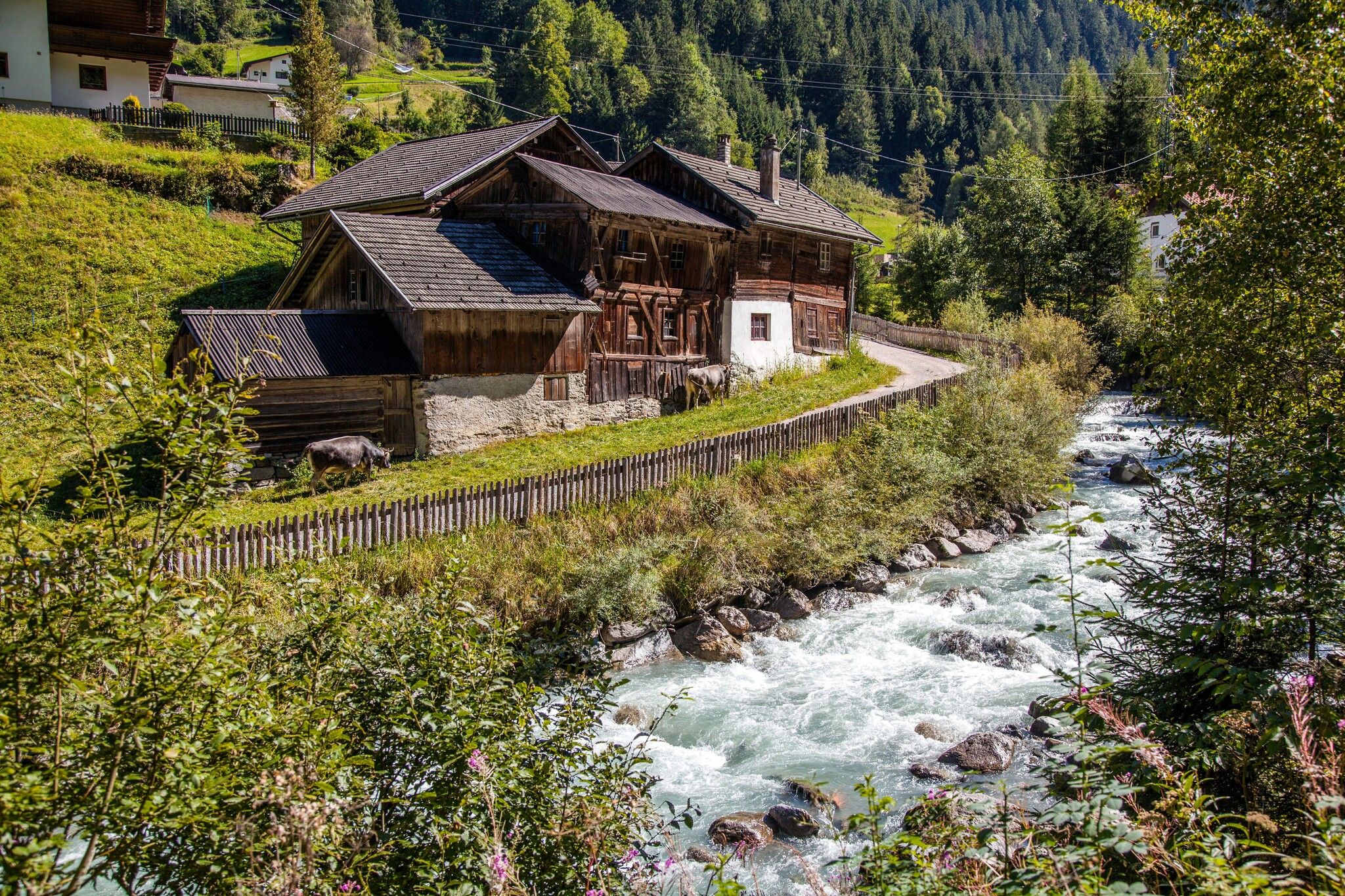
Starting point: opposite the fire station, on the right hand side of the Mühlbach stream. The track begins with an easy ascent, with only a few minor hills to climb. At the first fork, follow the path to the right to the hamlet of Schön and continue to Ritztenried. Return via the same route. 

More tours in the surrounding area

Newsletter

The mountain is calling? So does our newsletter!

In our monthly newsletter we reveal the best holiday tips for Tyrol.