
Öffnungszeiten:Heute geöffnet
Ort:Scharnitz
:Snack bar / StreetFood
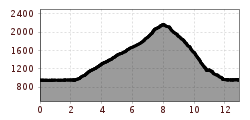
A challenging mountain tour from Scharnitz to the Brunnsteinspitze (2,180 m) with stunning views and a cozy stop at the Brunnsteinhütte.


Mountain path and gravel trails.
All current information about the trail closures in the Region Seefeld can be found here.
Have you been out and about in the Region and discovered a spot that we should rework or repair? Fill out the form "Report a danger zone" and let us know where work is needed.
Sturdy hiking shoes, functional clothing, a backpack, water, snacks, alpine experience, and sure-footedness are necessary for this tour!
Also recommended: a hiking map or GPS, a first aid kit, sun protection, hiking poles, and an emergency blanket.
From the P1 Riedboden parking lot, located idyllically at the northern edge of Scharnitz, an exciting and varied hike begins, perfect for adventurers and nature lovers alike. The trail first leads towards Mittenwald. At the first junction, keep right and, after a short distance, turn right again. Cross the Isar bridge and head towards the main road, which you cross slightly to the right near the railway crossing.
Beyond the tracks, a forest path begins, gently climbing towards Mittenwald. At a marked junction, turn right, and then immediately left, following the signs to the Brunnsteinhütte(1,560 m). This first stage rewards you with a cozy rest spot and beautiful views.
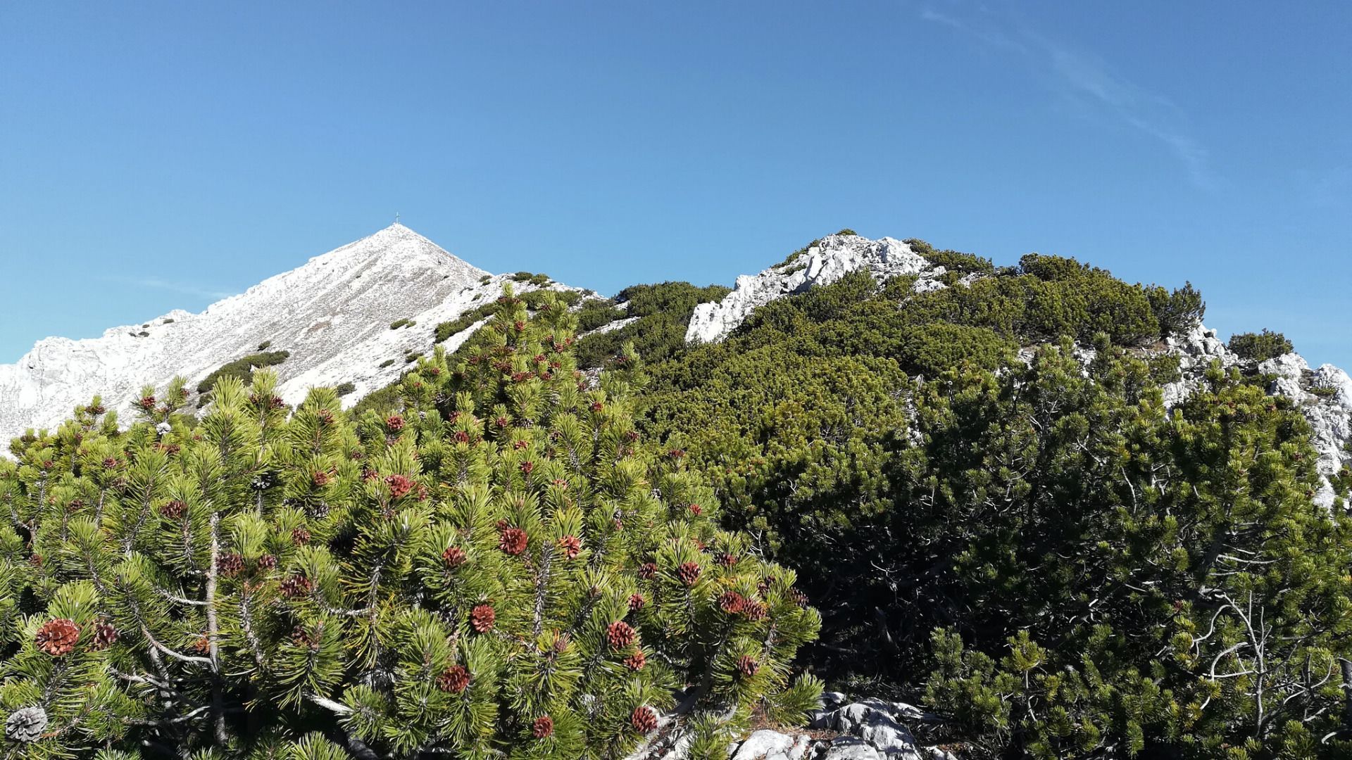
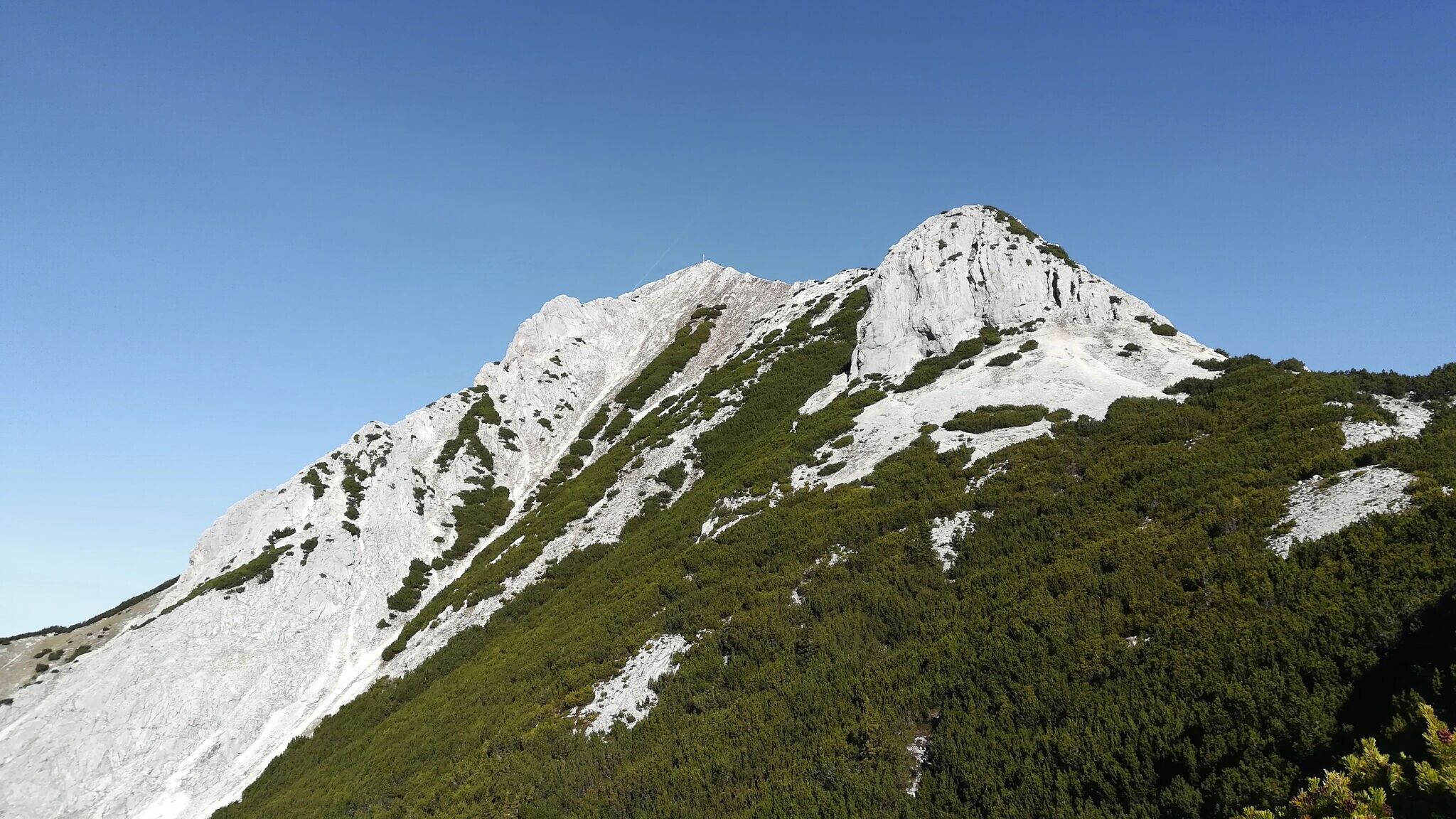
The trail continues via the Brunnsteinsteig, winding through countless switchbacks, dense mountain pine forests, and eventually rocky terrain, leading to the Tiroler Hütte at 2,153 meters. Though the hut is not serviced, it offers spectacular views and is an ideal spot to pause and enjoy the surroundings.
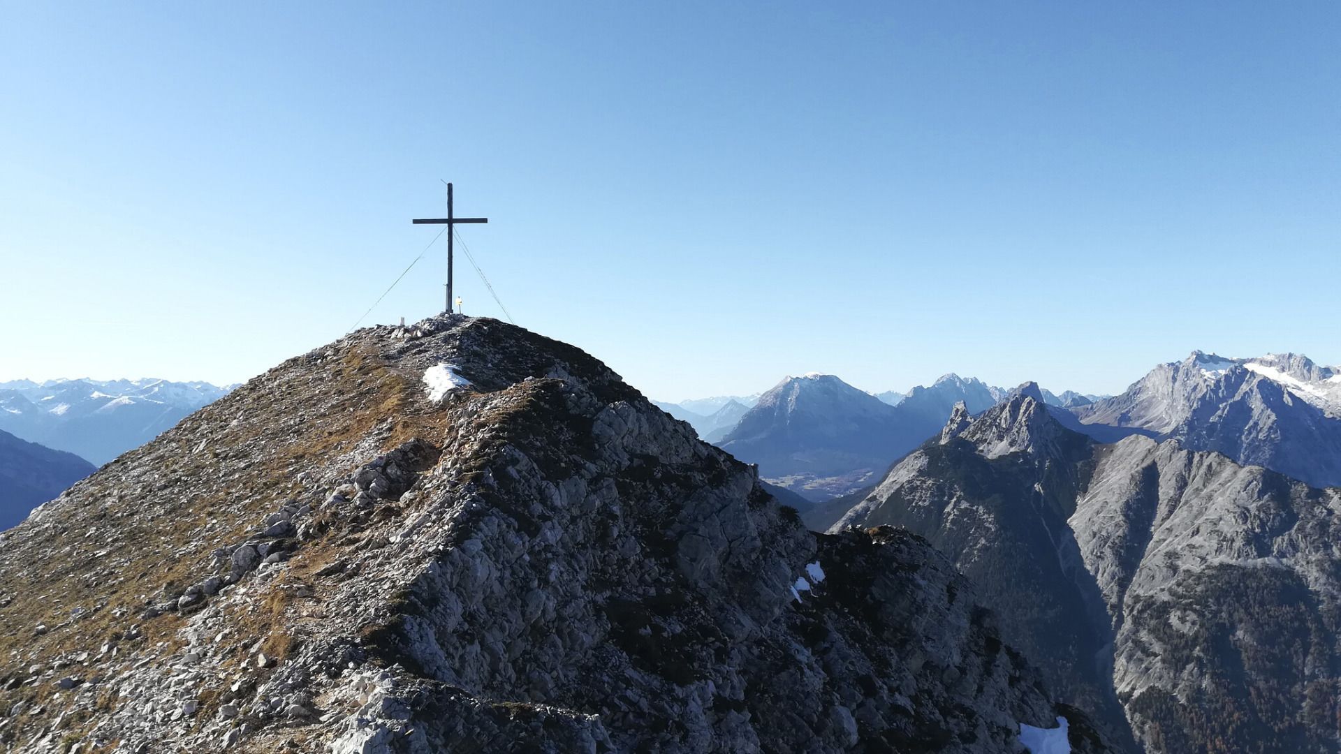
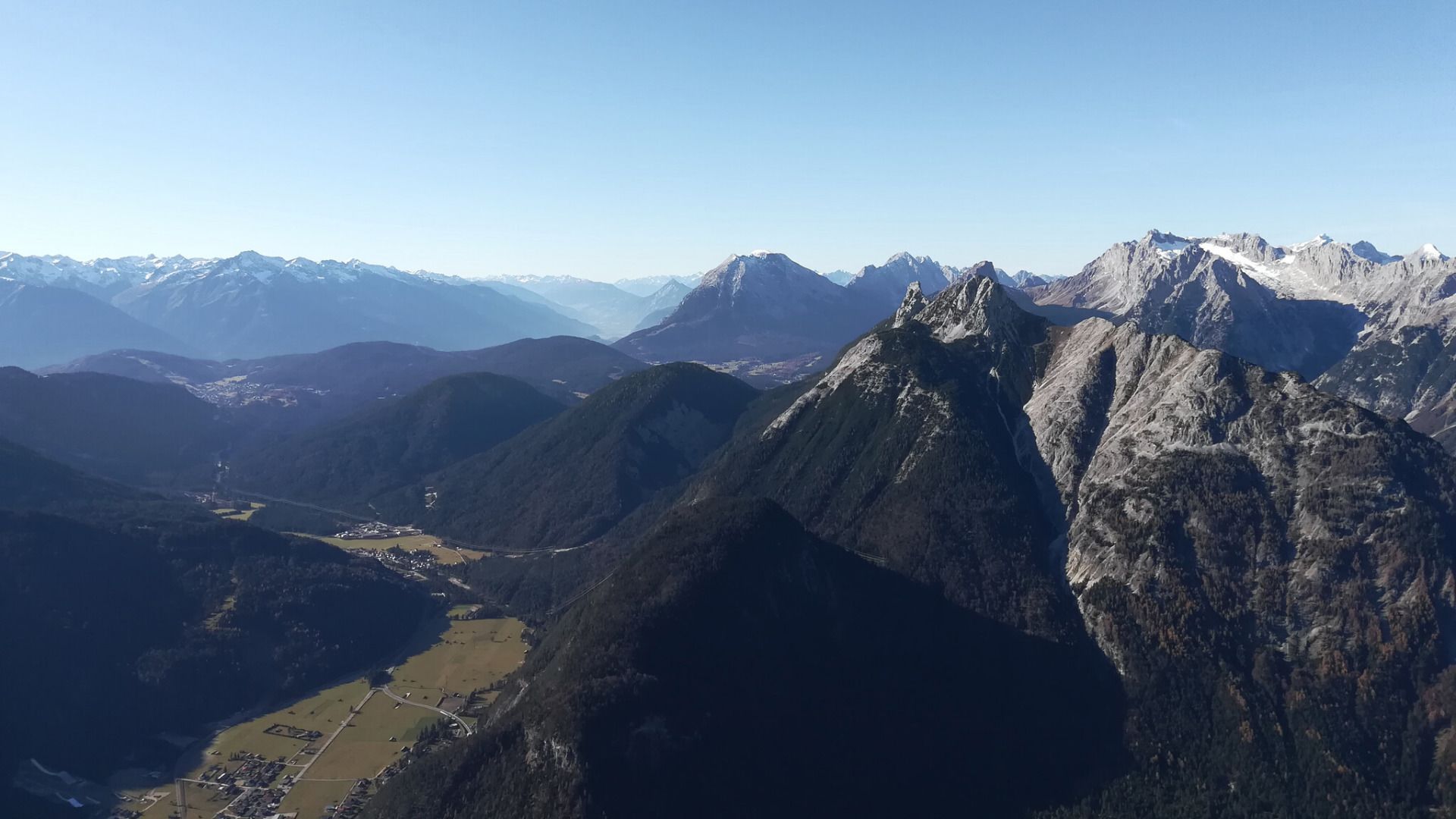
From there, continue right to the Rotwandlspitze, which also marks a border stone, and then proceed to the Brunnsteinspitze. The summit rewards your effort with breathtaking views over Scharnitz and Mittenwald, inviting you to linger and soak in the scenery.
The descent is challenging, leading down steep, rocky steps, past the Brunnsteinkopf, along the narrow Birzelgrat, and finally via the Adlerkanzel back to Scharnitz. This route requires excellent sure-footedness, a head for heights, and experience in alpine terrain.
If you prefer a more relaxed descent, you can follow the same path you took on the way up. Both options offer unforgettable nature experiences.
By train to Scharnitz train station, then a 10-minute walk to the starting point at the Scharnitz Parkplatz P1 Riedboden.
All real-time connections can be found in the route planner.


.jpg")
.jpg")
 (2).jpg")


.jpg")

.jpg")


.jpg")
.jpg")


