Hut hike Hike to the Buchacker and to the ice and stalactite cave

Angerberg / Brandenberg Alps (Rofan)
Difficulty ratings: medium
Route length: 13.7 km
Duration: 5:30 h

Hike to the Buchacker and to the ice and stalactite cave

Tour information

  • Requirement: medium
  • Length: 13.7 km
  • Duration: 5:30 h
  • Elevation uphill:890 hm
  • Elevation downhill:890 hm
Highest point1,495 m

Starting point

parking area Buchackeraufstieg/ parking area Lettenbichl

Finishing point

parking area Buchackeraufstieg/ parking area Lettenbichl
  • Fitness level 4 / 6
  • Technique 2 / 6

Best time of year

  • January
  • February
  • March
  • April
  • May
  • June
  • July
  • August
  • September
  • October
  • November
  • December

Trail condition

Forest path, wood trail

Equipment

outdoor clothing
Sturdy shoes
sufficient food and drinks
First aid kit
Mobile phone with full battery & charger Hiking map & guide literature
Possibly a GPS device or download the GPS data to your mobile phone
Sun protection (sunglasses, sunscreen & cap)
rainwear, cash
Source: Kitzbüheler Alpen Management GmbH

Description

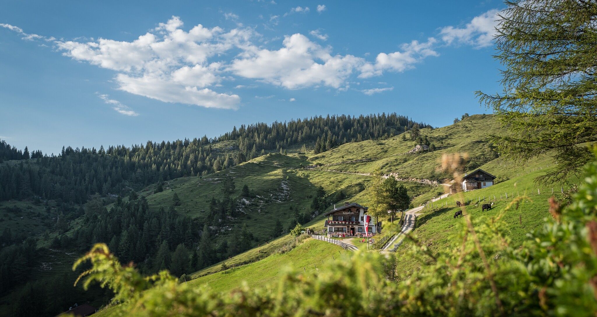
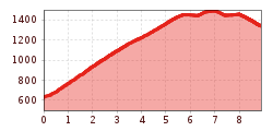
The starting point of this hike is the Lettenbichl car park in the Embach district of Angerberg. From there you walk upwards in serpentines along a well-built and secured forest path. After about 2.5 hours you reach the first waypoint: the cosy Buchacker Alm.
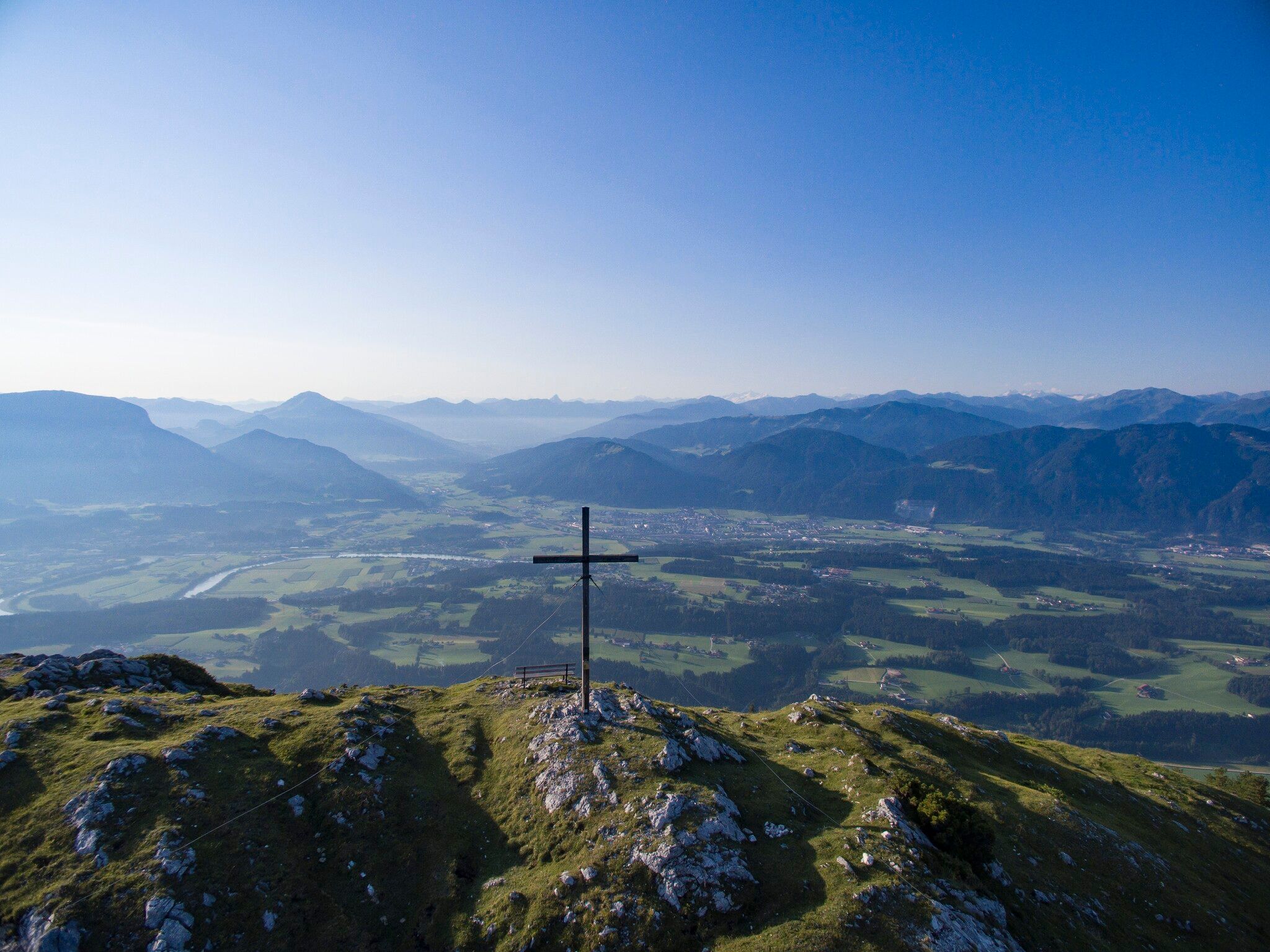
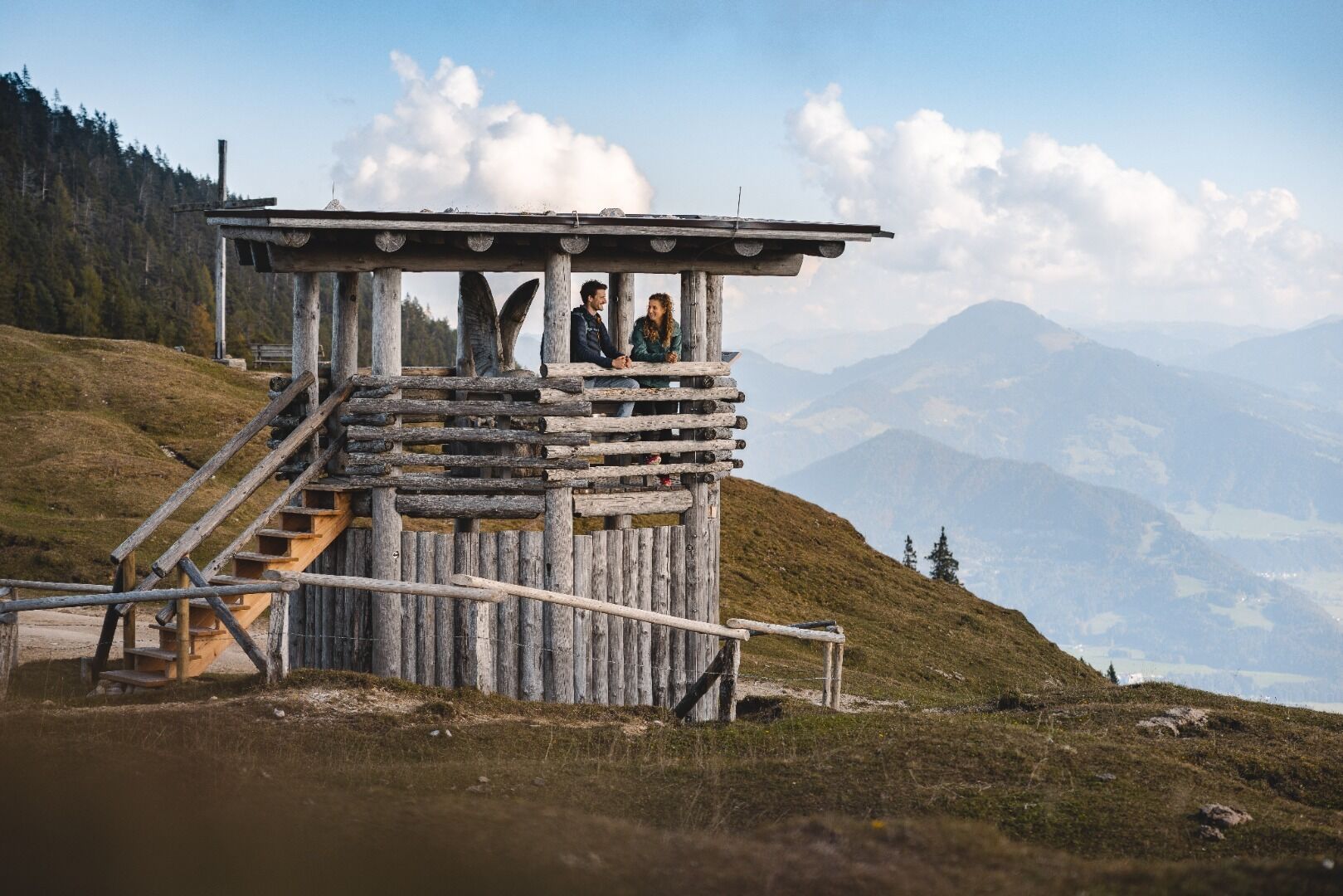
Then continue on the trail of the Tiroler Adlerweg to the Adlerhorst viewing platform. 
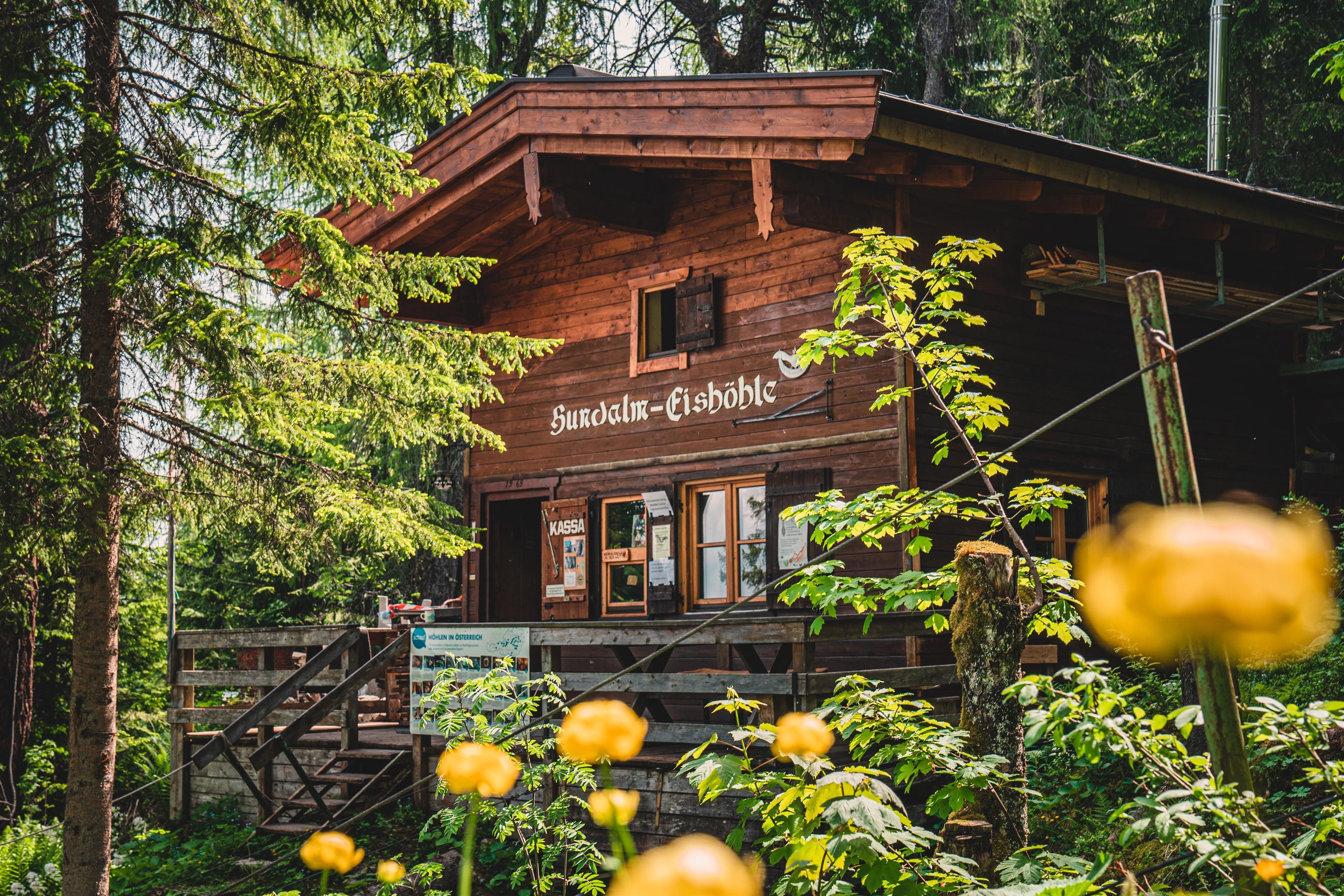
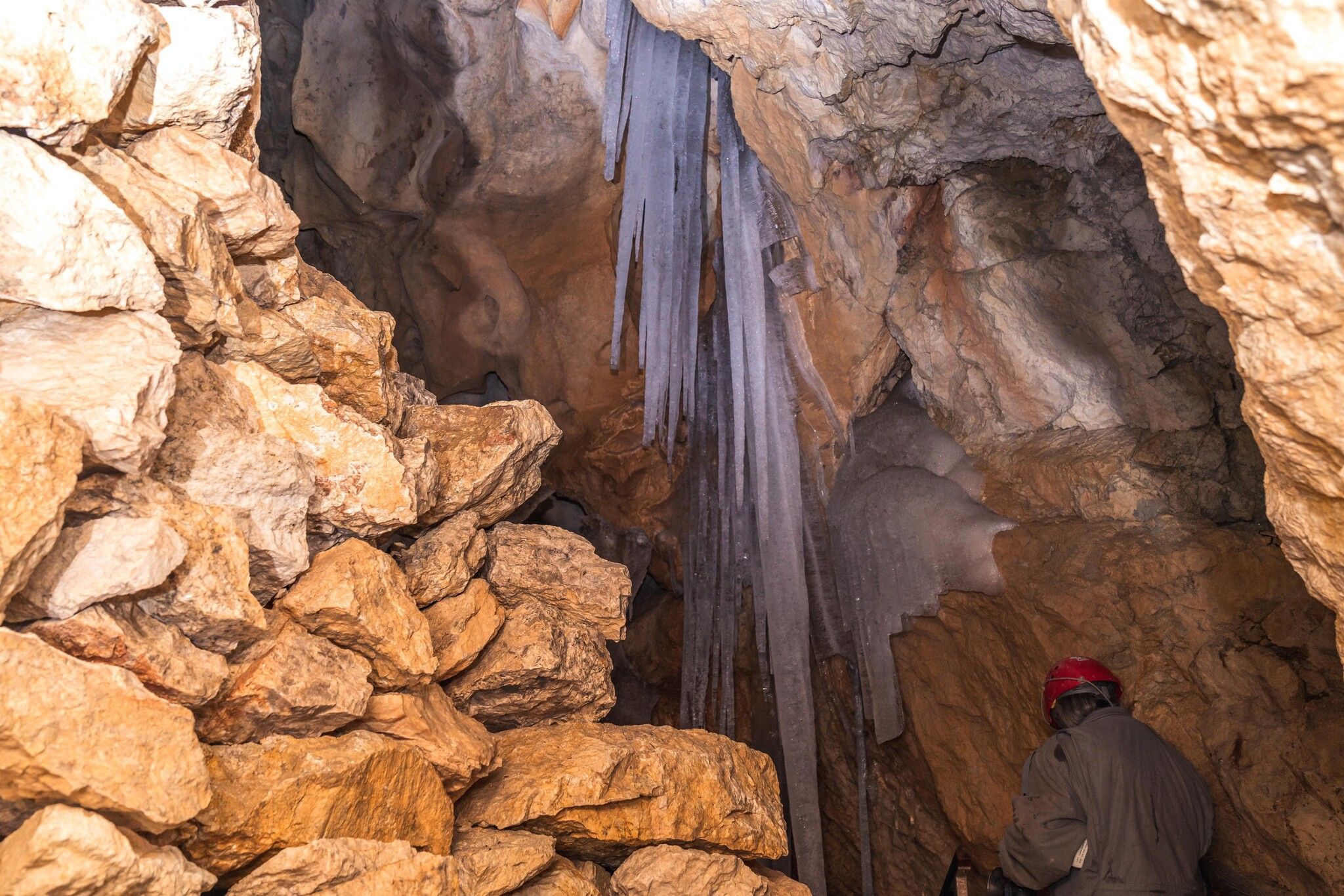
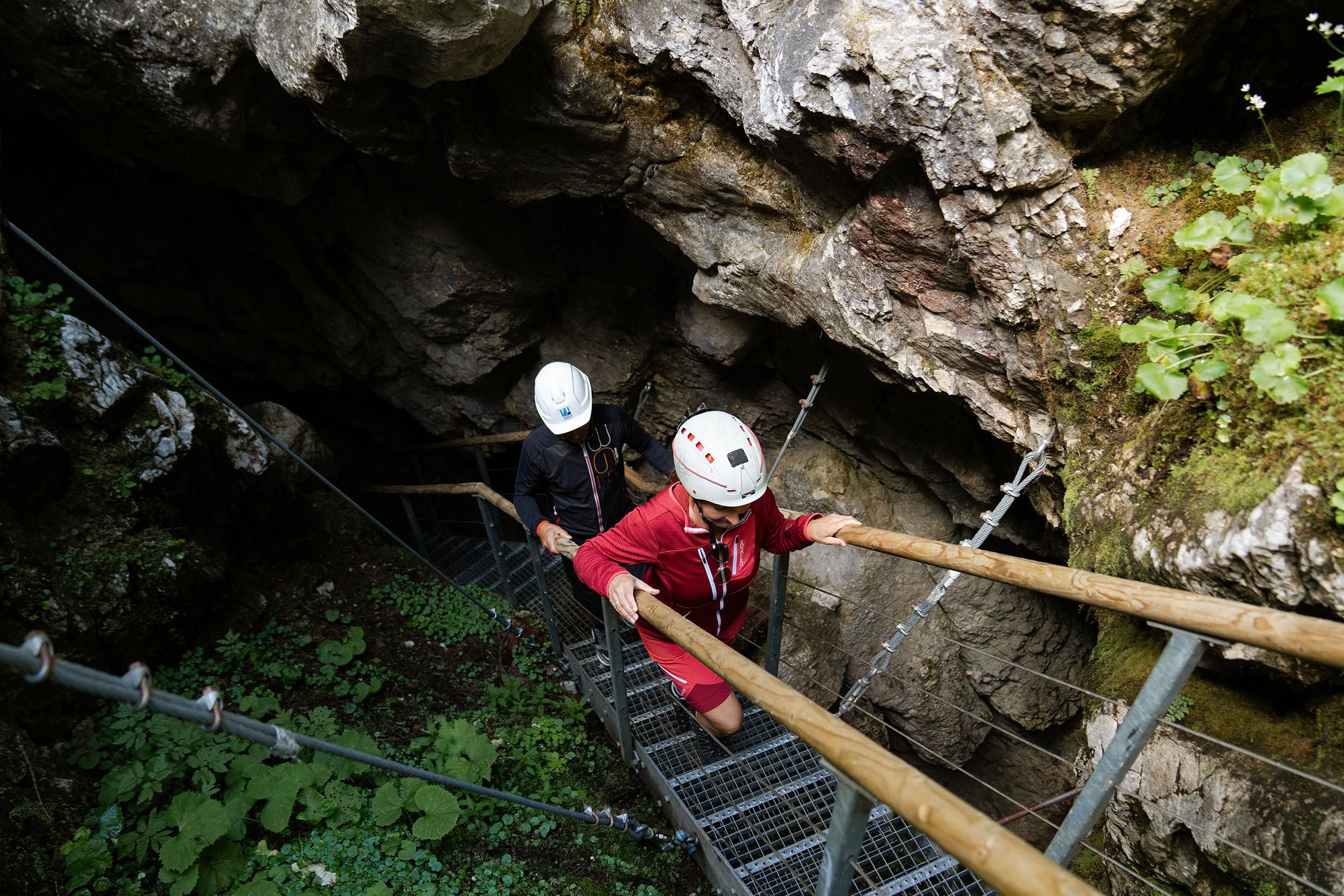
Here you hike along a forest and meadow path to the entrance of the ice and stalactite cave. The cave at Hundalmjoch is the only show cave in the North Tyrolean Alps where you can see ice and stalactite formations. Please note the opening hours and tour dates.
All further information about the Hundalm ice and stalactite cave: www.hohe-salve.com/ice-cave
You then return to the starting point via the ascent path.

Nearby huts and mountain restaurants

Getting here

  • Arrival by public transport

    bus: Angerberg Franzlerbrücke 

    Guest card of the region = train ticket from Wörgl to Hochfilzen + bus ticket from Mariastein to Kitzbühel
    includedvalid on ÖBB local trains (S, REX) and InterRegio trains (IR) between Kirchbichl - Wörgl
    and Hochfilzen.
    Not valid on RJ, RJX, EC, IC, ICE, D and NJ/EN trains.


    More detailed information: www.hohe-salve.com/mobility

  • Parking

    Car park Buchackeraufstieg

More tours in the surrounding area

  • Kaunerberger Wasserweg

    Difficulty:medium
    Length:15.2 kmDuration:6:00 hElevation uphill:935 m
  • Rolli-Wanderung Aifner Alm

    Difficulty:medium
    Length:6.0 kmDuration:2:30 hElevation uphill:460 m
  • Möslalmkogel via Wörgl

    Difficulty:medium
    Length:10.3 kmDuration:3:30 hElevation uphill:580 m
  • Hohe Aifnerspitze (2.779 m)

    Difficulty:medium
    Length:7.2 kmDuration:5:15 hElevation uphill:815 m
Newsletter

The mountain is calling? So does our newsletter!

In our monthly newsletter we reveal the best holiday tips for Tyrol.