
Place:Zams
:Restaurant, Alpine pasture / hut / mountain restaurant:Breakfast, vegetarian, vegan
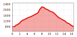
This route combines everything that makes alpine trail running special: a challenging climb, spectacular scenery, varied terrain, and an enjoyable descent back into the valley. With approximately 16 kilometres and nearly 1,400 metres of elevation gain, it is the perfect challenge for ambitious trail runners looking to experience a true mountain adventure in a relatively compact outing.
Your gear should therefore be designed with safety, sudden weather changes, and prolonged exertion in mind. Trail running vest, water, snacks (gels, bars, dried fruit, salt tablets in hot weather, etc.), lightweight rain jacket (waterproof, windproof, packable), cap or headband, thin gloves (spring/fall), GPS watch (with GPX track), cell phone (fully charged) with offline map, mini first-aid kit, emergency blanket, headlamp, trail running poles, thin insulated jacket, arm warmers.
The route begins in Landeck at around 800 metres above sea level. After a short warm-up through the valley, the climb towards Trams starts almost immediately. The first kilometres follow forest roads and woodland trails, making it easy to settle into a steady uphill rhythm.
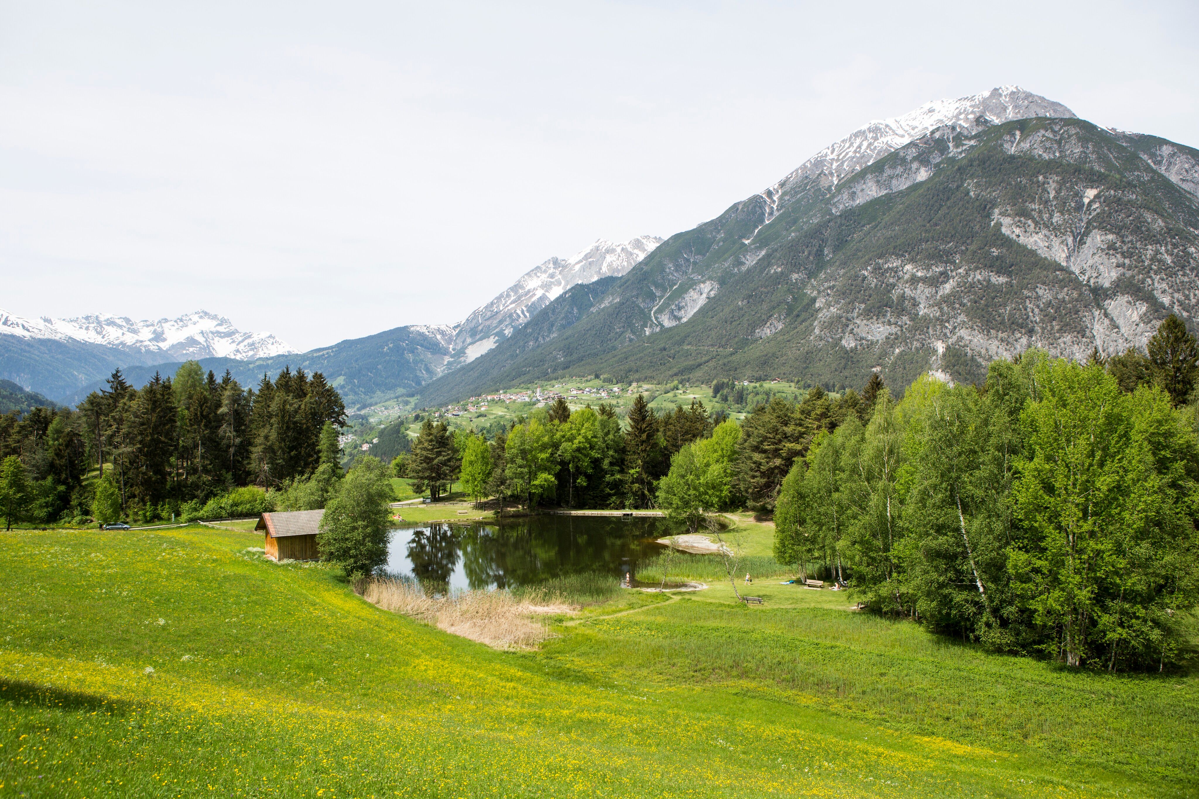
As the elevation increases, so do the views. The trail winds through shaded forests before emerging onto open alpine meadows. This is where the beauty of the Ferienregion TirolWest truly reveals itself: far below lies Landeck, while the surrounding peaks of the Ötztal Alps, Lechtal Alps, and Samnaun Mountains dominate the horizon.
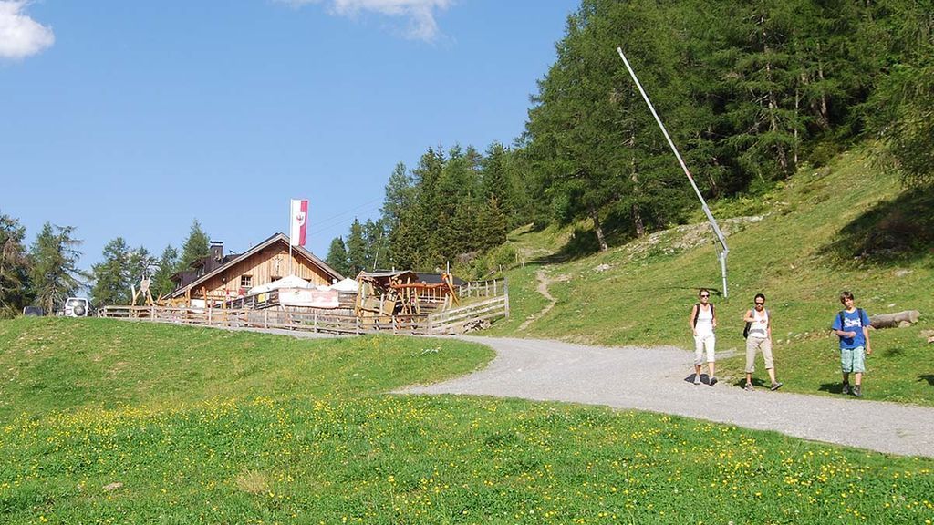
Above the tree line, the terrain becomes more alpine and varied. Narrow mountain paths replace the wider forest roads, and the surface alternates between grassy meadows, rocky sections, and well-worn single trails. The final climb towards Krahberg demands a final effort, but the reward is well worth it.
Standing at the highest point of the route at over 2,200 metres, runners are treated to spectacular panoramic views across the Tyrolean Alps. It is the perfect place to pause, catch your breath, and enjoy the scenery before beginning the descent.
The return journey follows a variety of mountain and alpine trails back towards the valley. This section is particularly enjoyable for trail runners, combining flowing downhill stretches with more technical terrain. The constantly changing landscape keeps the run exciting all the way back to Landeck.
As you descend, the trails become faster and more runnable. Forest sections alternate with scenic paths overlooking the valley, creating a memorable finish to an outstanding mountain run.
From the Landeck-Zams train station, take any VVT bus to the city center. From there, it’s about a 15–20-minute walk to the church, or you can take bus line 2 (Kirche stop). Check the SCHEDULE.
Landeck Long-Term parking lot at 44 Innstraße


.jpg")


.jpg")


