
Place:
Kals am Großglockner
:
Alpine pasture / hut / mountain restaurant
In the summer months, there is the possibility once a week to take the Glocknertaxi to Uttendorf, the starting point of the tour. At the end of the tour you will be picked up in Kals and chauffeured back to the starting point.
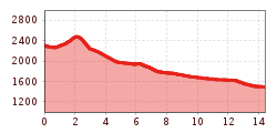
Very comfortable by cable car form Enzingerboden to Rudolfshütte at 2.311 m. The ascent to Kalser Tauern at 2.518 m by foot lasts about 1 hour.
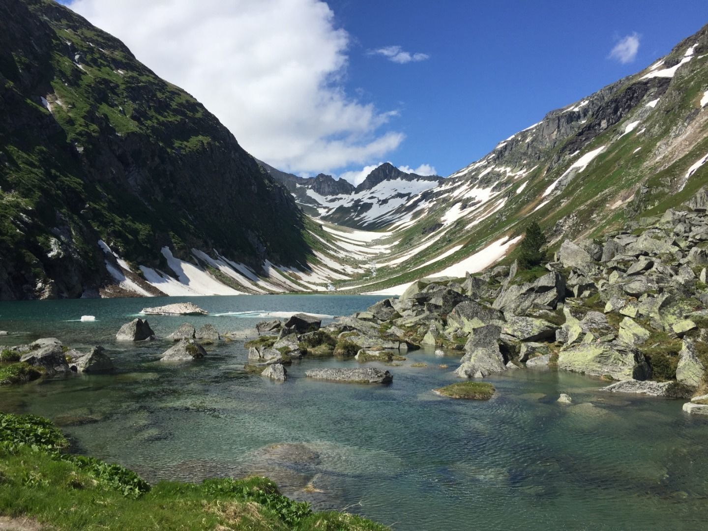
The surrounding mountain range of the Granatspitz- and Glocknergroup is characterized by deep blue lakes, white glaciers and rugged peaks.
Then , always focusing the Dorfersee (lake), in about 2 hours, through the Kalser Dorfertal valley along a singposted path surrounded by a marvellous alpine flora and fauna to the mountain lake at 1.941 m, which invites to rest.
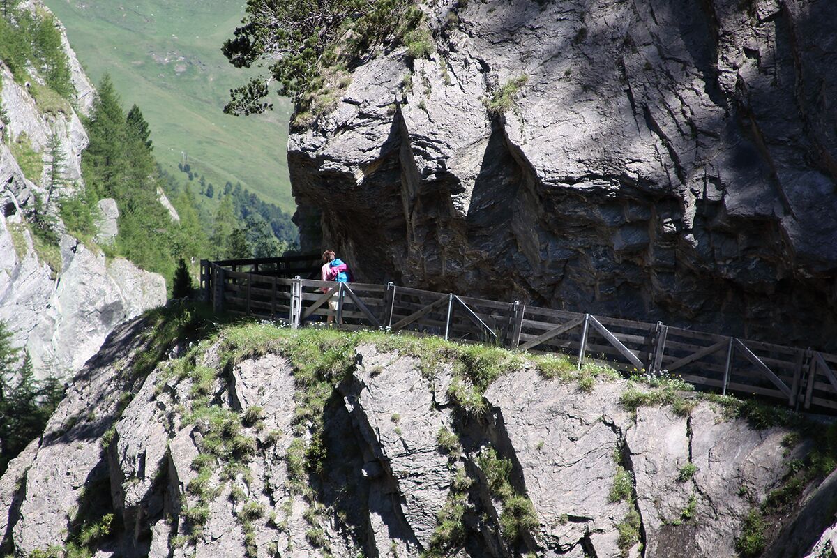
Further on along a larch forest with many old alp huts to Kalser Tauernhaus in about an hour. The following hike of this tour lasts about 1,5 - 2 hours and leads along a graveled street to Bergeralm in the Dorfertal valley and ends in the wild romantic Dabaklamm - canyon.
.


")

 Mirja Geh (26).jpg")


")


.jpg")


Manfred Pfister.jpg")


