
Opening hours:Open today
Place:Scheffau am Wilden Kaiser
:Alpine pasture / hut / mountain restaurant
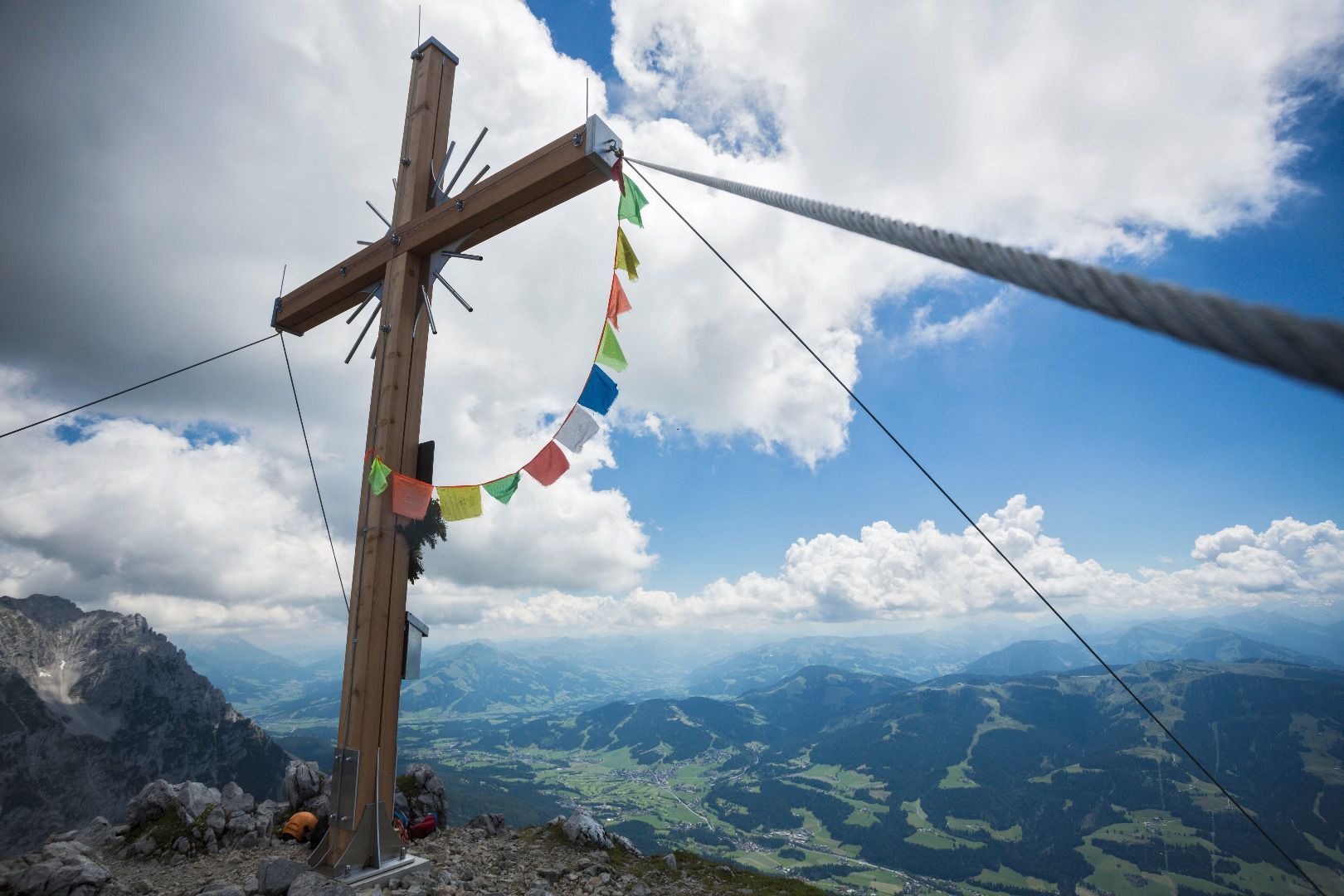
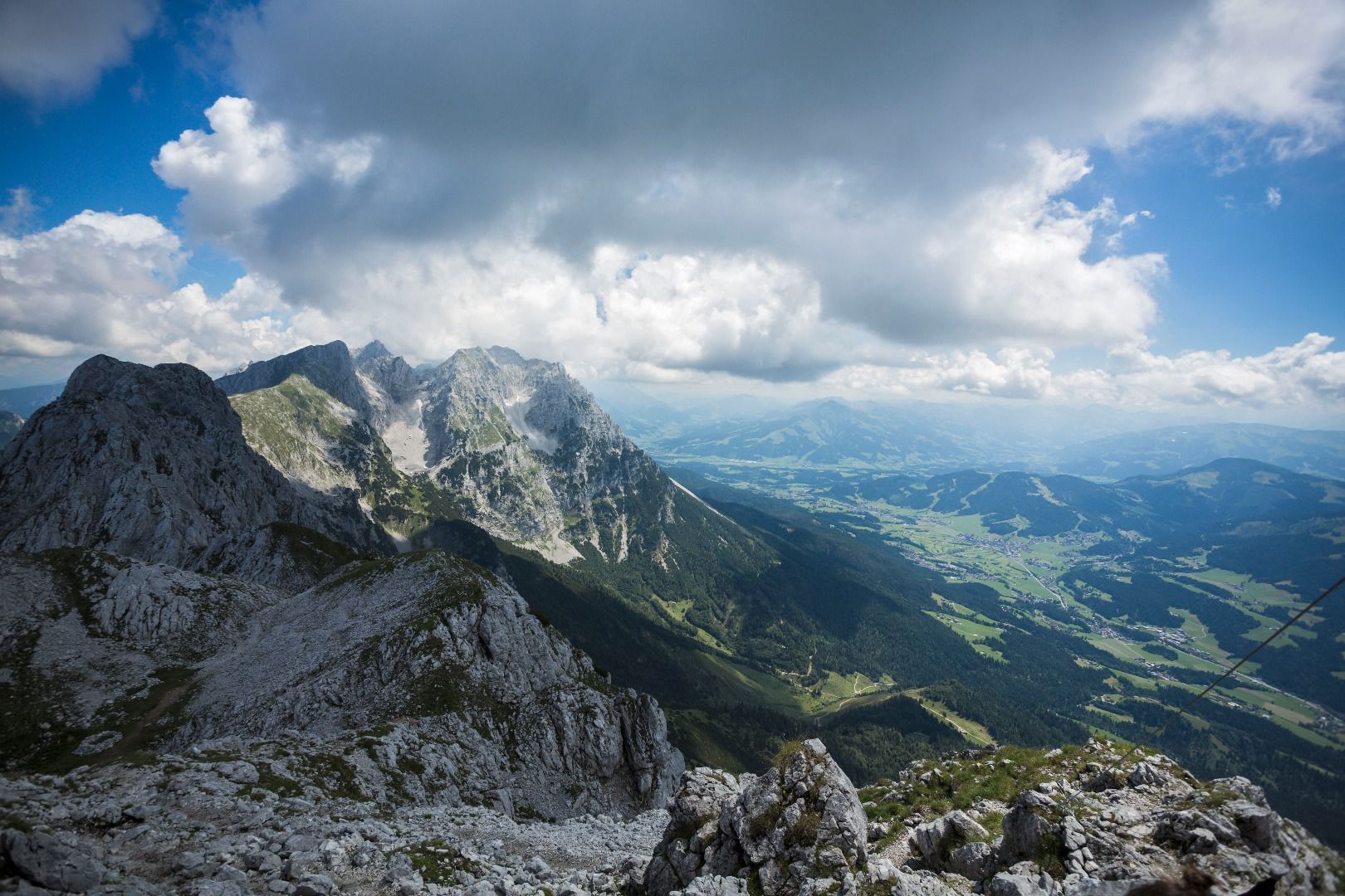
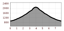
The panoramic Scheffauer is the last high peak in the west at 2,111 m above sea level.


Ascent:
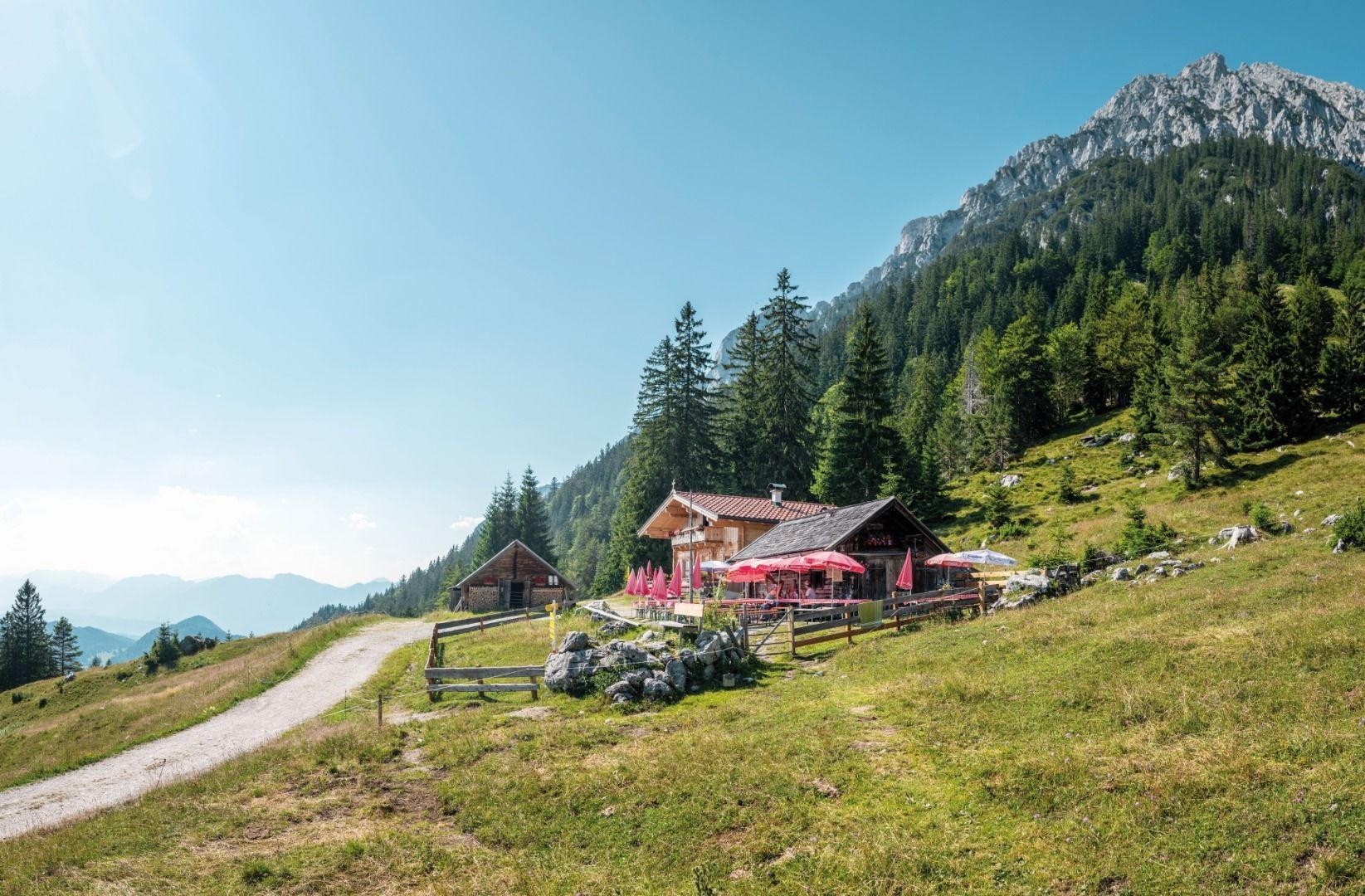
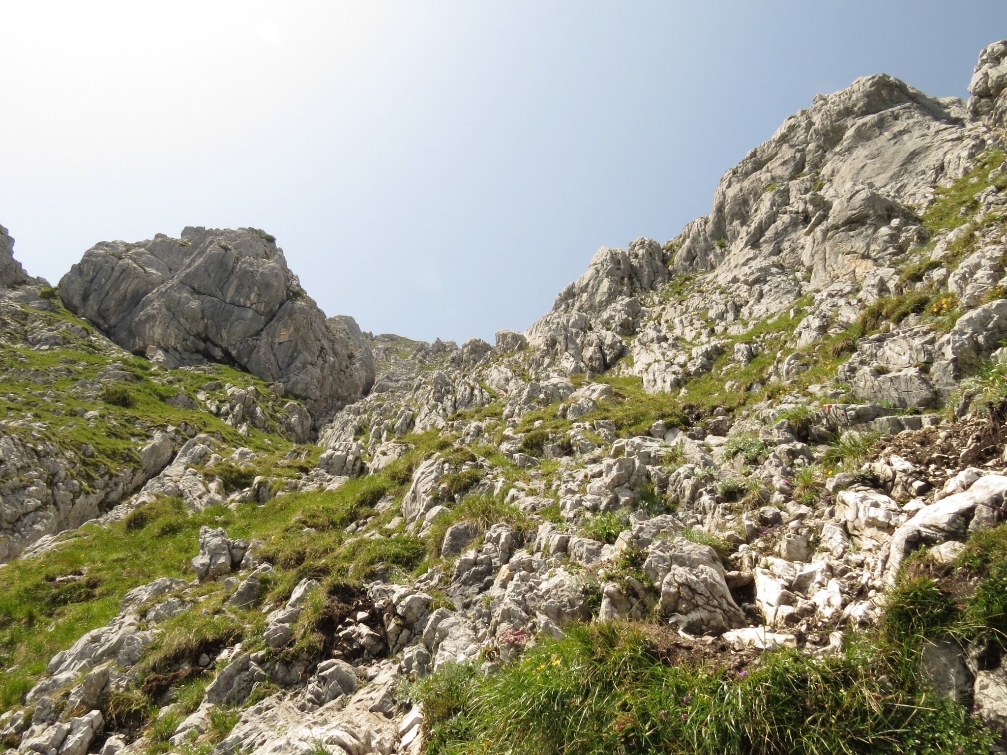
Depart from the hiking starting point by taking the forest road (barriers), always following the signs for “Scheffauer”. After about an hour of hiking, you will come to the mountain hut (1,257 m). You should then head uphill on the narrow trail 814a, passing through open meadows and then the thin deciduous forest before crossing the large field of scree until you reach the “Scheffauer” turnoff.
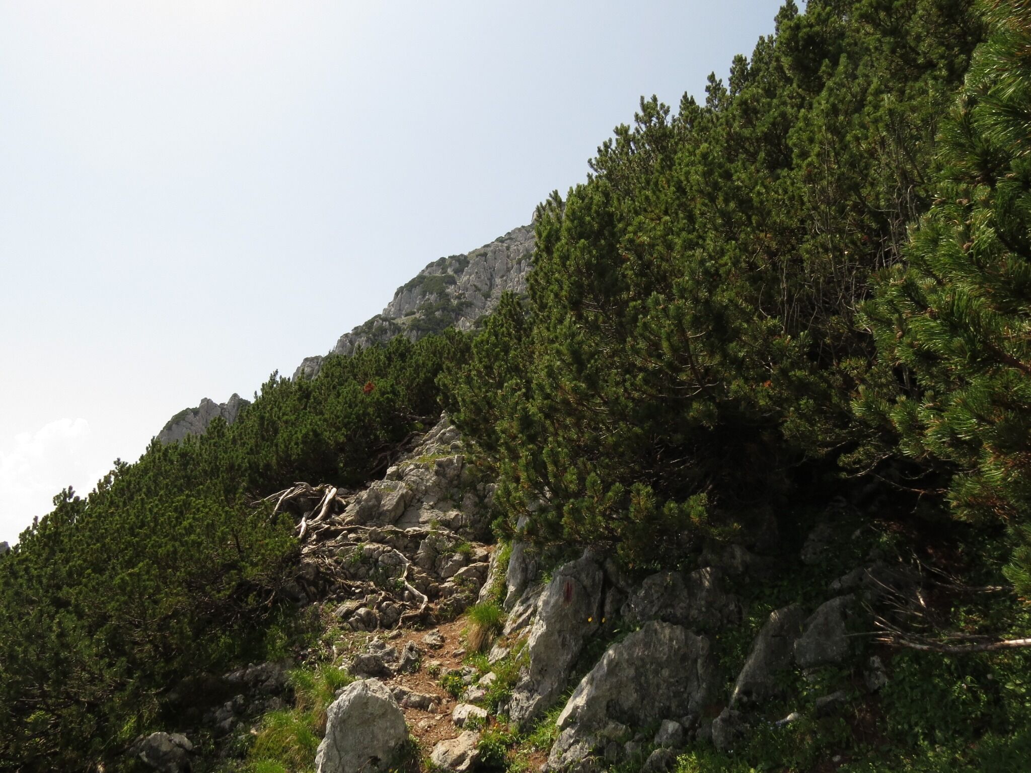
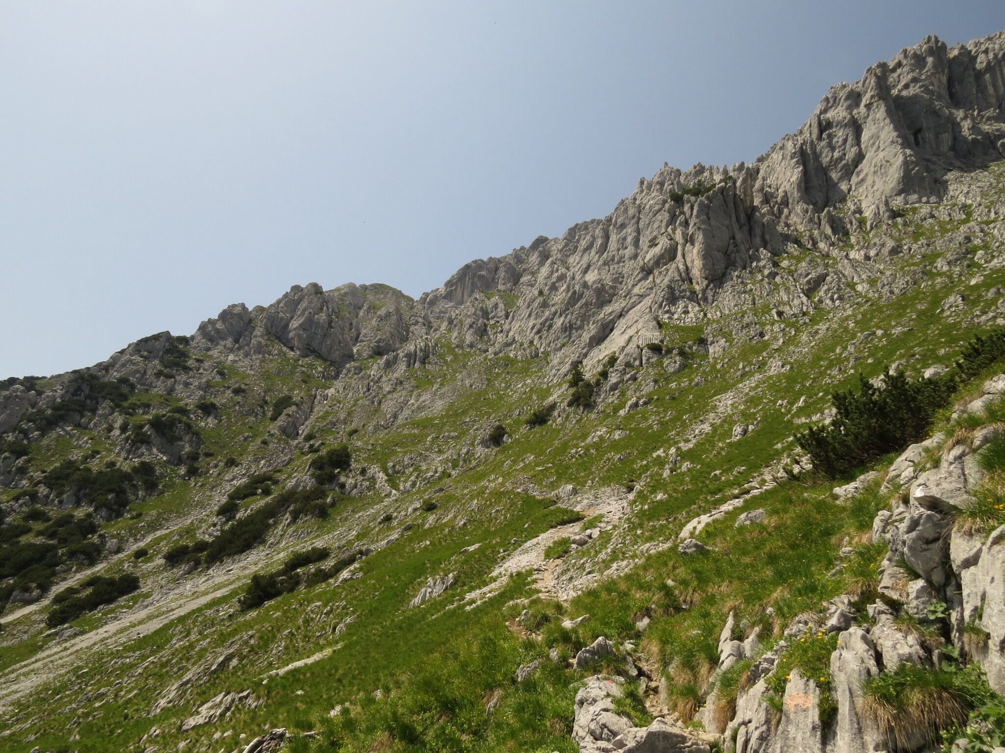
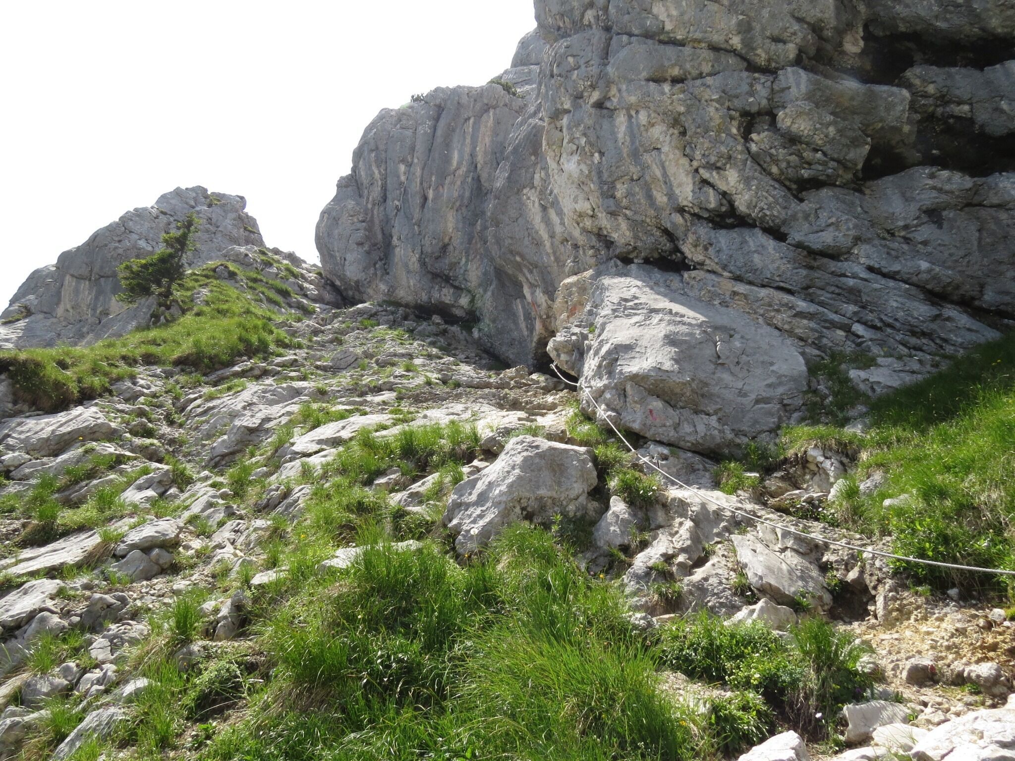
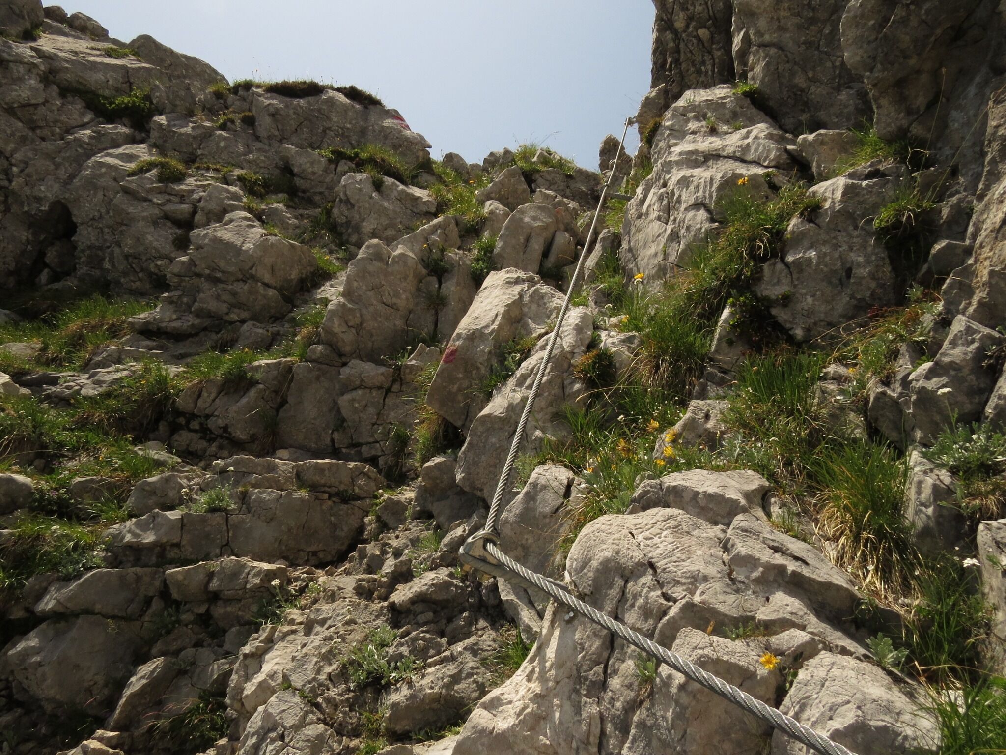
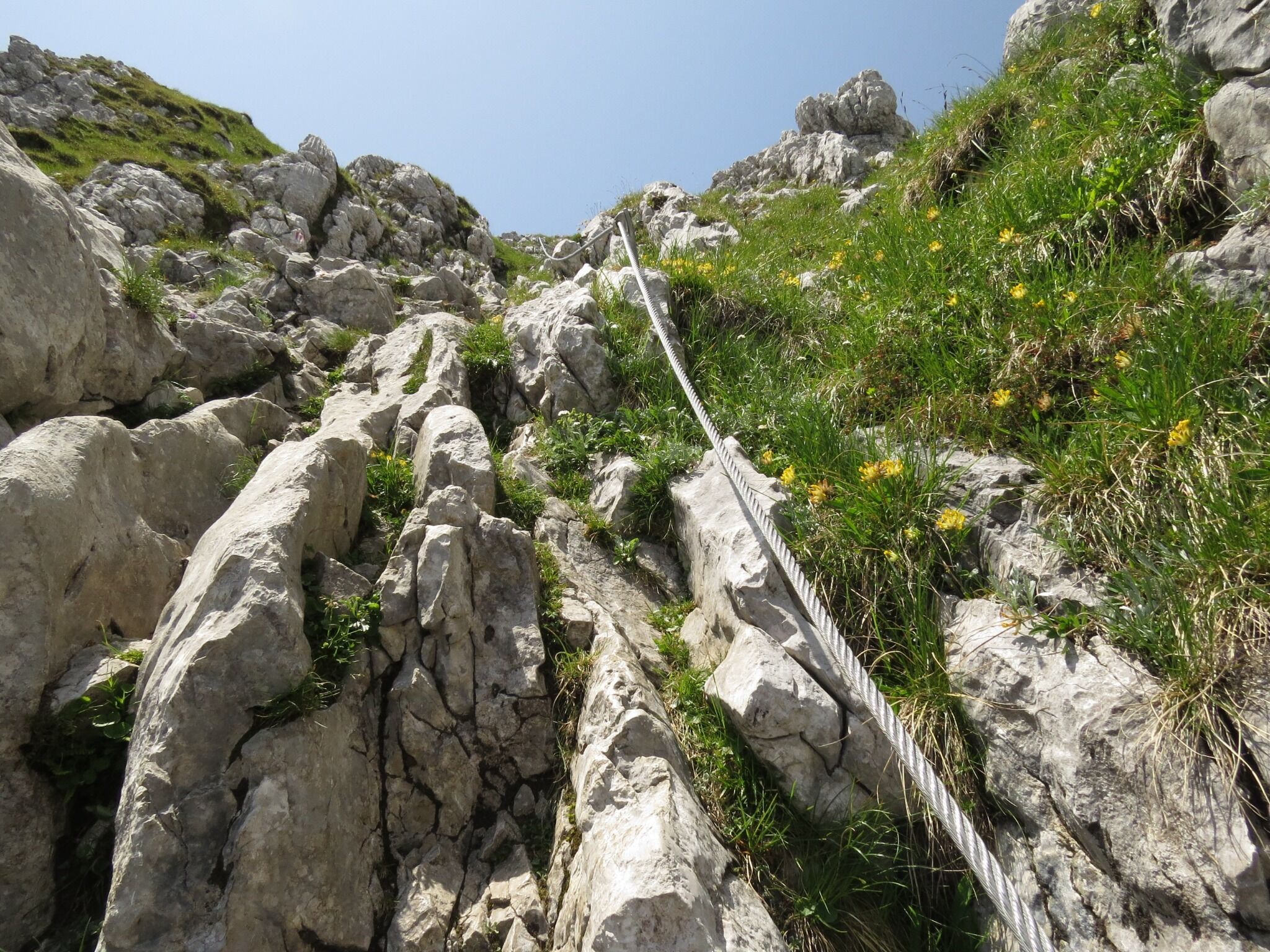
The terrain becomes more demanding as of this point, leading up through steep fields of mountain pine and steep rocky sections until you come to the ridge (the key part known as the “Wasserloch” is secured with steel ropes - ATTENTION: the ropes are not tensioned over the winter!). Continue west along the summit ridge for around 10 minutes via the “Kegelbahn” section to reach the summit with a magnificent view over the Inn Valley, the main Alpine ridge and far into the Bavarian region.
Descent:
as ascent
Variant:
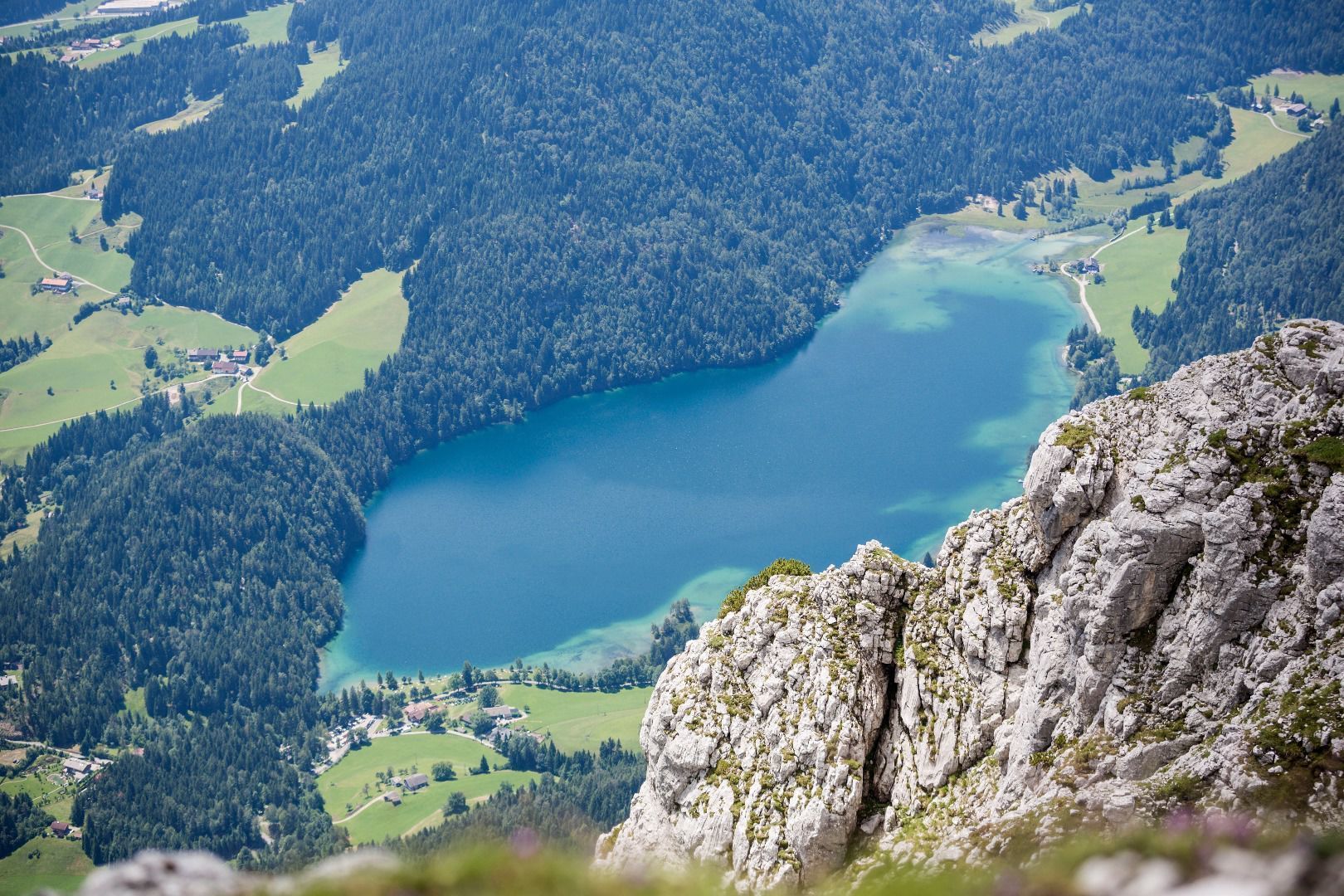
descent via the north side of the Scheffauer to the mountain hut, 1,318 m. This route takes you along the Widauersteig trail (largely secured with steel rope), which requires absolute surefootedness and a good head for heights. You should then continue via the Alpine pasture, making a large bend around the Scheffauer to reach the Hintersteiner See lake before returning to the car park. This extends the tour by around 3 hours!
Prerequisite: No fear of heights and surefootedness are absolutely necessary! HELM (danger of falling rocks)
80 KaiserJet and 865+866 VVT-Regiobuslines: Scheffau am Wilden Kaiser Dorf and then
30 KaiserJet: Scheffau am Wilden Kaiser Gh Bärnstatt
More information at: www.wilderkaiser.info/mobility
Car park at Bärnstatt hiking starting point, Scheffau (920 m) – pay & display


