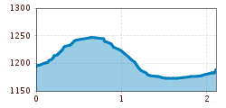
Mountain hikes Söllberg waterfall circular route

St. Leonhard im Pitztal /
Difficulty ratings: easy
Route length: 2.1 km
Duration: 0:30 h

Söllberg waterfall circular route

Tour information

  • Requirement: easy
  • Length: 2.1 km
  • Duration: 0:30 h
  • Elevation uphill:80 hm
  • Elevation downhill:80 hm
Highest point1,238 m

Starting point

Wiese

Finishing point

Söllberg-Wasserfall

Features

  • Circular route

Best time of year

  • January
  • February
  • March
  • April
  • May
  • June
  • July
  • August
  • September
  • October
  • November
  • December

Trail condition

trail
Source: Pitztal

Description

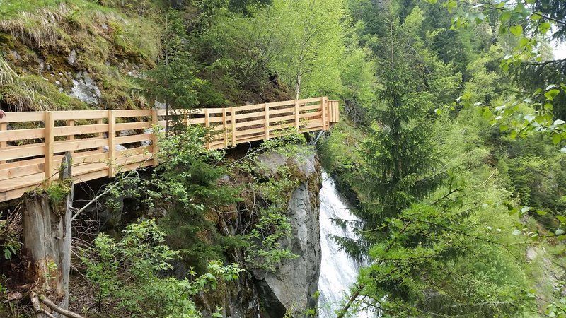
Starting point: Car park at the end of Wiese. From the starting point initially follow the forest road in the direction of Söllberg waterfall. The forest road eventually leads to a trail. Return via the same route back to the Söllbergalm turnoff, then turn left to walk down a trail. After approximately 500 metres you will reach the agricultural road on which you carry on walking downhill for approximately 150 metres before reaching the next turnoff. Then turn right onto the forest road that will take you back to your staring point. 

More tours in the surrounding area

Newsletter

The mountain is calling? So does our newsletter!

In our monthly newsletter we reveal the best holiday tips for Tyrol.