Mountain hikes Themed path "Dorfer valley history trail"

Kals am Großglockner / Glocknergruppe
Difficulty ratings: easy
Route length: 14.5 km
Duration: 4:30 h

The Dorfer valley history trail is no ordinary theme trail. It is actually an audio trail.

Tour information

  • Requirement: easy
  • Length: 14.5 km
  • Duration: 4:30 h
  • Elevation uphill:320 hm
  • Elevation downhill:320 hm
Highest point1,930 m

Starting point

Kals Parkplatz Taurer

Finishing point

Kalser Tauernhaus/Stotzbachfall
  • Fitness level 2 / 6
  • Technique 2 / 6

Features

  • Suitable for families
  • suitable for pushchairs

Best time of year

  • January
  • February
  • March
  • April
  • May
  • June
  • July
  • August
  • September
  • October
  • November
  • December
Source: Nationalparkregion Hohe Tauern Osttirol

Description

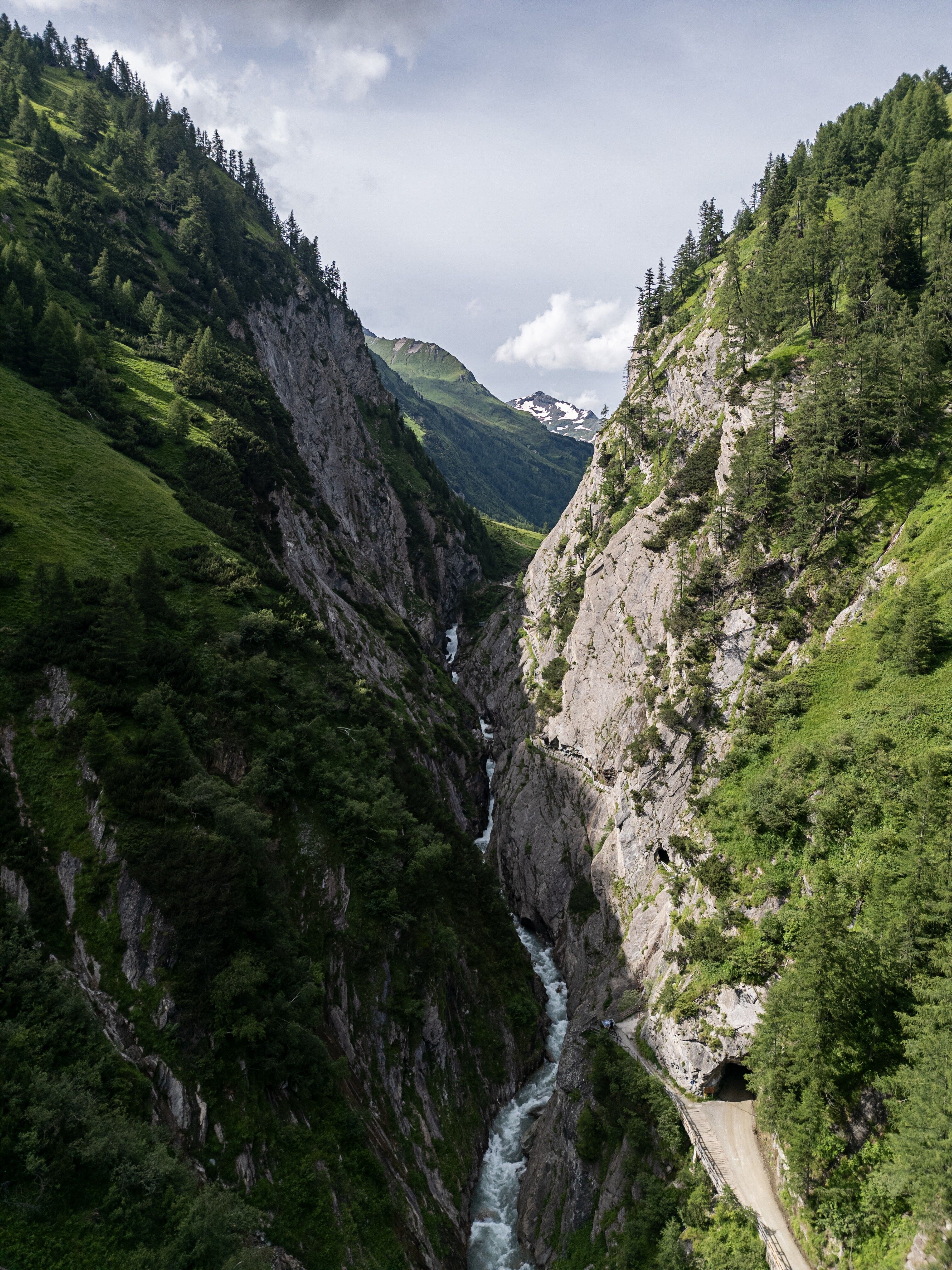
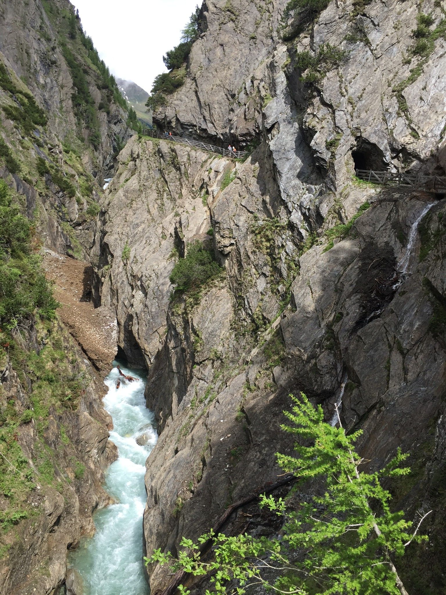
You enter the Kalser Dorfer valley, which is also considered to be the birthplace of the Hohe Tauern National Park, through the impressive Dabaklamm gorge - the spectacular prospect pulpit in the centre of Dabaklamm gorge is one of the highlights.
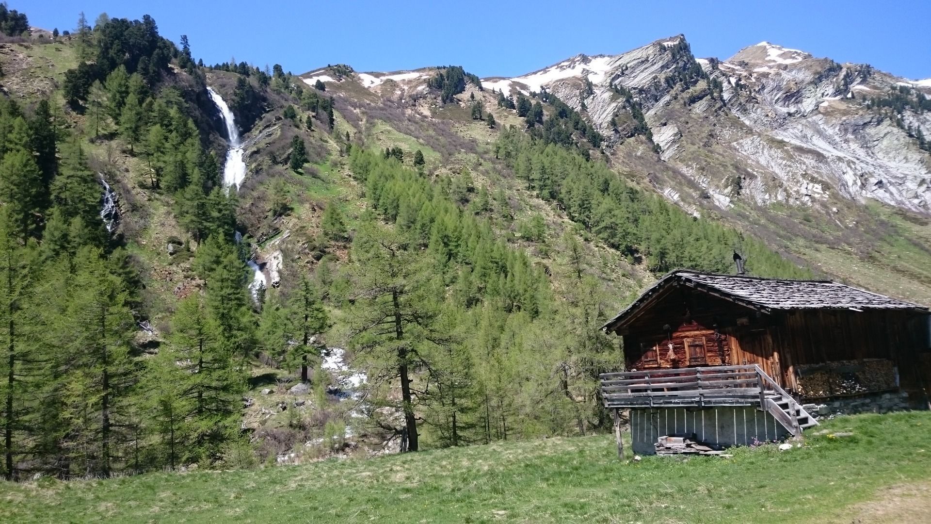
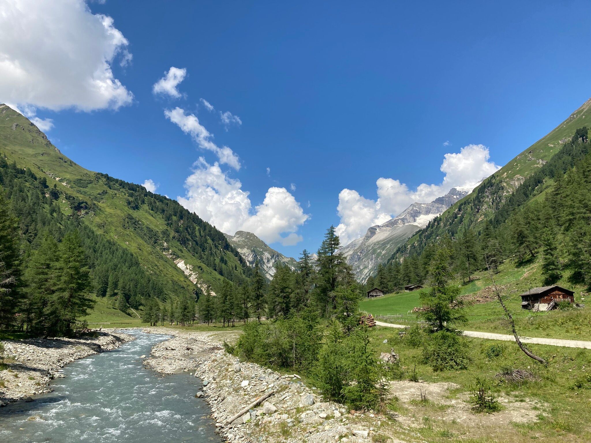
If you reach the valley through the gorge, voices of dairymaids, mountain farmers, hut owners and other locals in audio trees tell stories about their life in the valley. These are stories which people only get to hear if they know the storytellers personally - exciting, funny, yet harrowing incidents from many decades. There are also display boards which provide an insight into the nature and culture of the Dorfer valley.

Nearby huts and mountain restaurants

More tours in the surrounding area

  • Venediger altitude trail

    Difficulty: difficult
    Length: 55.5 km Duration: 27:00 h Elevation uphill: 3,915 m
  • Lasörling altitude trail

    Difficulty: medium
    Length: 57.0 km Duration: 25:00 h Elevation uphill: 3,740 m
  • Figerhorn

    Difficulty: difficult
    Length: 6.5 km Duration: 6:00 h Elevation uphill: 807 m
  • Rotenkogel

    Difficulty: difficult
    Length: 3.9 km Duration: 3:00 h Elevation uphill: 383 m
  • Umbal waterfalls nature force trail

    Difficulty: easy
    Length: 5.8 km Duration: 2:30 h Elevation uphill: 250 m
  • Lasörling 3.098m

    Difficulty: difficult
    Length: 21.9 km Duration: 12:00 h Elevation uphill: 1,940 m
  • Hike to the Venedigerhaus Innergschlöß

    Difficulty: easy
    Length: 8.5 km Duration: 2:30 h Elevation uphill: 180 m
  • Hike to Neuen Reichenberger Hütte

    Difficulty: medium
    Length: 9.1 km Duration: 9:00 h Elevation uphill: 1,210 m
  • Hiking tour to Lasörlinghütte 2.350m

    Difficulty: medium
    Length: 14.6 km Duration: 7:10 h Elevation uphill: 1,080 m
  • Hike to Kalser Tauernhaus

    Difficulty: medium
    Length: 12.2 km Duration: 4:00 h Elevation uphill: 244 m
  • Hiking tour to Neue Sajathütte 2.600m

    Difficulty: medium
    Length: 10.3 km Duration: 6:50 h Elevation uphill: 1,080 m
  • Badener Hütte

    Difficulty: difficult
    Length: 23.2 km Duration: 11:30 h Elevation uphill: 1,750 m
  • Lucknerhaus - Stüdlhütte

    Difficulty: medium
    Length: 9.3 km Duration: 5:30 h Elevation uphill: 862 m
Newsletter

The mountain is calling? So does our newsletter!

In our monthly newsletter we reveal the best holiday tips for Tyrol.