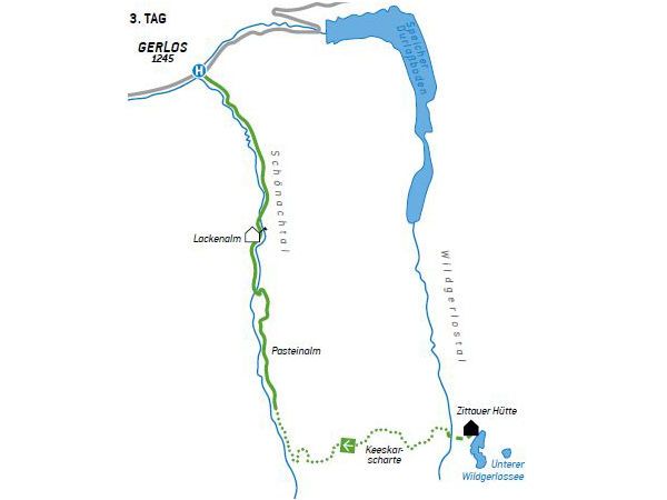
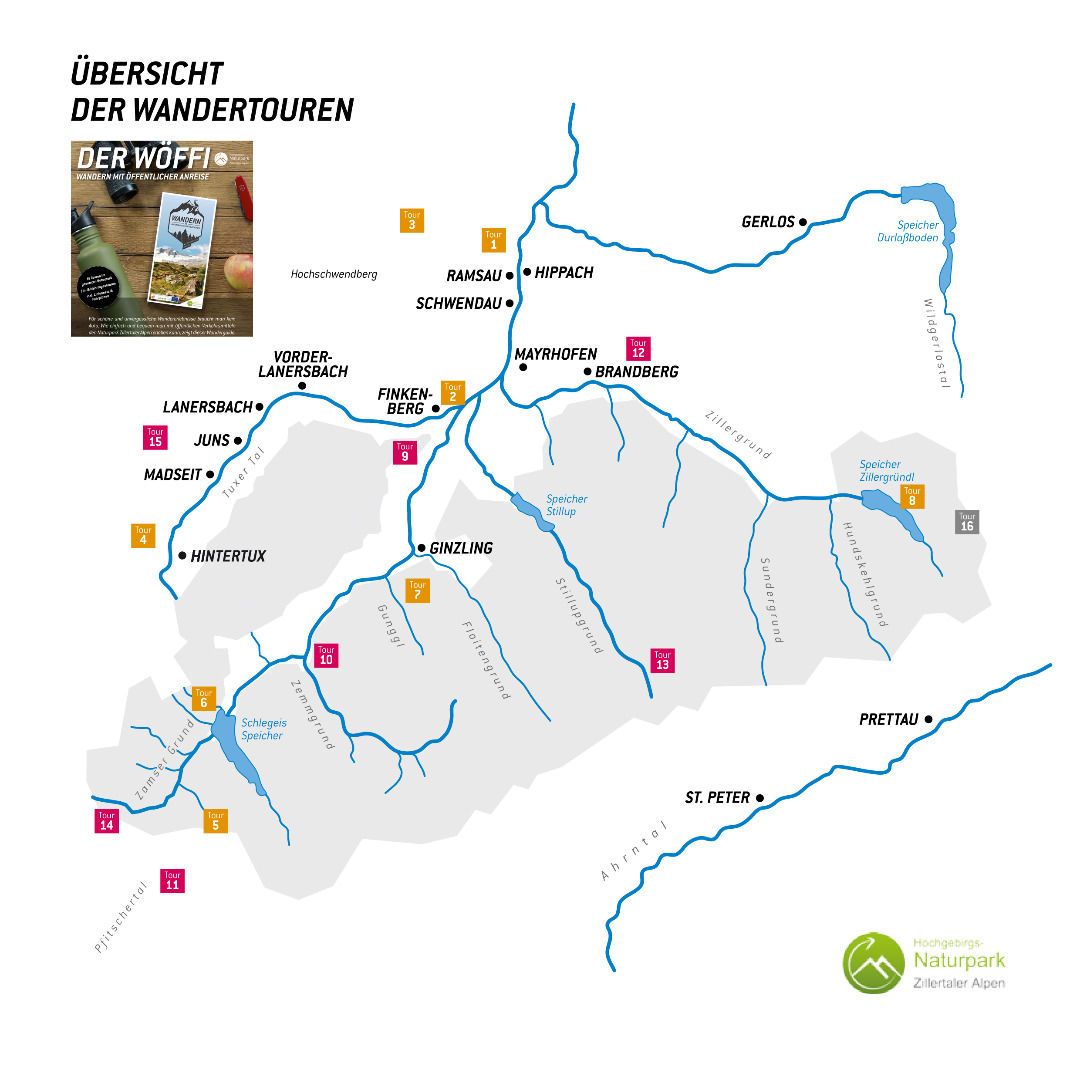
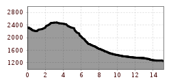
Open interactive mapOpen this POI on the interactive mapElevation profiledownloadWöffi Tour 16 / Tag 3: Von den Zillertaler Alpen in die Hohen Tauern.gpx
Etappe_6 (1).jpg © Tourismusverband Paznaun - Ischgl Stage 6: Through the VerwallDifficulty:mediumLength:15.0 kmDuration:8:00 hElevation uphill:1,481 mSee trailSee trail: Stage 6: Through the Verwall
Geraerhütte_JohannesBitter_TVB-Wipptal_170623_105.jpg © JOHANNES BITTER Hike to the Geraer Hütte | Austrian TyrolDifficulty:mediumLength:7.0 kmDuration:5:30 hElevation uphill:1,000 mSee trailSee trail: Hike to the Geraer Hütte | Austrian Tyrol
©-TVB-Tiroler-Oberland-Kaunertal-Michael-Veit-Klima-Führer-2018-Gepatsch-Nasserein © Michael Veit Sternenweg im GepatschDifficulty:mediumLength:4.0 kmDuration:1:30 hElevation uphill:202 mSee trailSee trail: Sternenweg im Gepatsch
2023_TVB-Ischgl-Paznaun_Sommer_Cross-Trail_Gruebele-See_WEST_3267.jpg © TVB Paznaun-Ischgl 01 Premium long-distance hiking trail - High route PaznaunDifficulty:mediumLength:138.6 kmDuration:10 daysElevation uphill:10,316 mSee trailSee trail: 01 Premium long-distance hiking trail - High route Paznaun
valentinkapelle-1.jpg © Archiv TVB Mayrhofen Mountain hike: Zillergrund - Valentins KapelleDifficulty:mediumLength:3.2 kmDuration:2:30 hElevation uphill:390 mSee trailSee trail: Mountain hike: Zillergrund - Valentins Kapelle
Round hike to Padauner KogelDifficulty:mediumLength:12.0 kmDuration:5:00 hElevation uphill:936 mSee trailSee trail: Round hike to Padauner Kogel
Burgenwelt Ehrenberg - Schlosskopf © Lea Zotz Barrier-free theme trail at the castle headDifficulty:easyLength:1.0 kmDuration:0:20 hElevation uphill:26 mSee trailSee trail: Barrier-free theme trail at the castle head
Lämmerbichl_Tirol Werbung_Sürth Paul_Tux-Hintertux.jpg © Sürth Paul Spring with late crocus blossom in Tux ValleyDifficulty:mediumLength:10.0 kmDuration:4:00 hElevation uphill:640 mSee trailSee trail: Spring with late crocus blossom in Tux Valley
Der Murmliweg in Serfaus © © Serfaus-Fiss-Ladis Marketing GmbH Marmot TrailOpening hours:openDifficulty:easyLength:573 mDuration:0:20 hElevation uphill:12 mSee trailSee trail: Marmot Trail
Kasseler Hütte © Reinhard Weber Stage Berliner Höhenweg (Zillertal Runde): Kasseler Hütte - EdelhütteDifficulty:difficultLength:13.0 kmDuration:9:00 hElevation uphill:800 mSee trailSee trail: Stage Berliner Höhenweg (Zillertal Runde): Kasseler Hütte - Edelhütte
Stage of the Berliner Höhenweg (Zillertal Runde): Greizer Hütte - Kasseler HütteDifficulty:difficultLength:9.8 kmDuration:6:00 hElevation uphill:650 mSee trailSee trail: Stage of the Berliner Höhenweg (Zillertal Runde): Greizer Hütte - Kasseler Hütte
Nauders mountain trailDifficulty:mediumLength:18.0 kmDuration:7:00 hElevation uphill:407 mSee trailSee trail: Nauders mountain trail
The Zirbenweg trailDifficulty:easyLength:7.0 kmDuration:2:30 hElevation uphill:200 mSee trailSee trail: The Zirbenweg trail
JuifenalmDifficulty:mediumLength:9.5 kmDuration:3:30 hElevation uphill:585 mSee trailSee trail: Juifenalm
Kaunergrathütte © TVB Pitztal/Roman Huber Kaunergrat Circular Route - 3 DaysDifficulty:difficultLength:22.8 kmDuration:3 daysElevation uphill:2,650 mSee trailSee trail: Kaunergrat Circular Route - 3 Days
Großer MutzkopfOpening hours:closedDifficulty:easyLength:10.3 kmDuration:4:00 hElevation uphill:507 mSee trailSee trail: Großer Mutzkopf
img_9853.jpg © @ualm.at 3-hut hikeDifficulty:mediumLength:13.2 kmDuration:6:00 hElevation uphill:1,120 mSee trailSee trail: 3-hut hike
Karwendelhaus mit Bergpanorama © Region Seefeld, Miriam Mayer Karwendelmarsch 52 kmDifficulty:mediumLength:53.5 kmDuration:3 daysElevation uphill:2,180 mSee trailSee trail: Karwendelmarsch 52 km
Naturparkhaus_mit Wanderer.JPG © TVB Pitztal Kaunergrat Circular Route - 7 DaysDifficulty:difficultLength:66.4 kmDuration:5 daysElevation uphill:5,496 mSee trailSee trail: Kaunergrat Circular Route - 7 Days
Abstieg in Richtung Oberstalleralm © edifilm75 Herz-Ass VillgratentalDifficulty:mediumLength:75.6 kmDuration:34:00 hElevation uphill:5,703 mSee trailSee trail: Herz-Ass Villgratental
St. Sigmund - Pforzheimer Hütte mountain hut (145)Difficulty:mediumLength:14.1 kmDuration:5:00 hElevation uphill:781 mSee trailSee trail: St. Sigmund - Pforzheimer Hütte mountain hut (145)
muhs-pyramide-panoramaweg-herbst23-c-anna-ladstaetter.jpeg © Anna Ladstätter Muhs panorama trailDifficulty:mediumLength:15.2 kmDuration:6:00 hElevation uphill:1,090 mSee trailSee trail: Muhs panorama trail
sommer-steinbockmarsch-foto-dominic-ebenbichler © Archiv TVB Mayrhofen Stage of the Berliner Höhenweg (Zillertal Runde): Berliner Hütte - Greizer HütteDifficulty:difficultLength:10.2 kmDuration:6:30 hElevation uphill:1,200 mSee trailSee trail: Stage of the Berliner Höhenweg (Zillertal Runde): Berliner Hütte - Greizer Hütte
Sulzkogel Kühtai © TI Kühtai Kühtai - SulzkogelDifficulty:mediumLength:12.7 kmDuration:6:30 hElevation uphill:1,079 mSee trailSee trail: Kühtai - Sulzkogel
Wanderer vor der Nördlinger Hütte © Region Seefeld, newcreatings Hike via Nördlinger Hütte to Reither SpitzeDifficulty:difficultLength:9.9 kmDuration:7:30 hElevation uphill:1,190 mSee trailSee trail: Hike via Nördlinger Hütte to Reither Spitze
Give feedback for a chance to win a special holiday experience!Click here for the surveyClick here for the survey