Hut Essener und Rostocker Hütte

Matrei

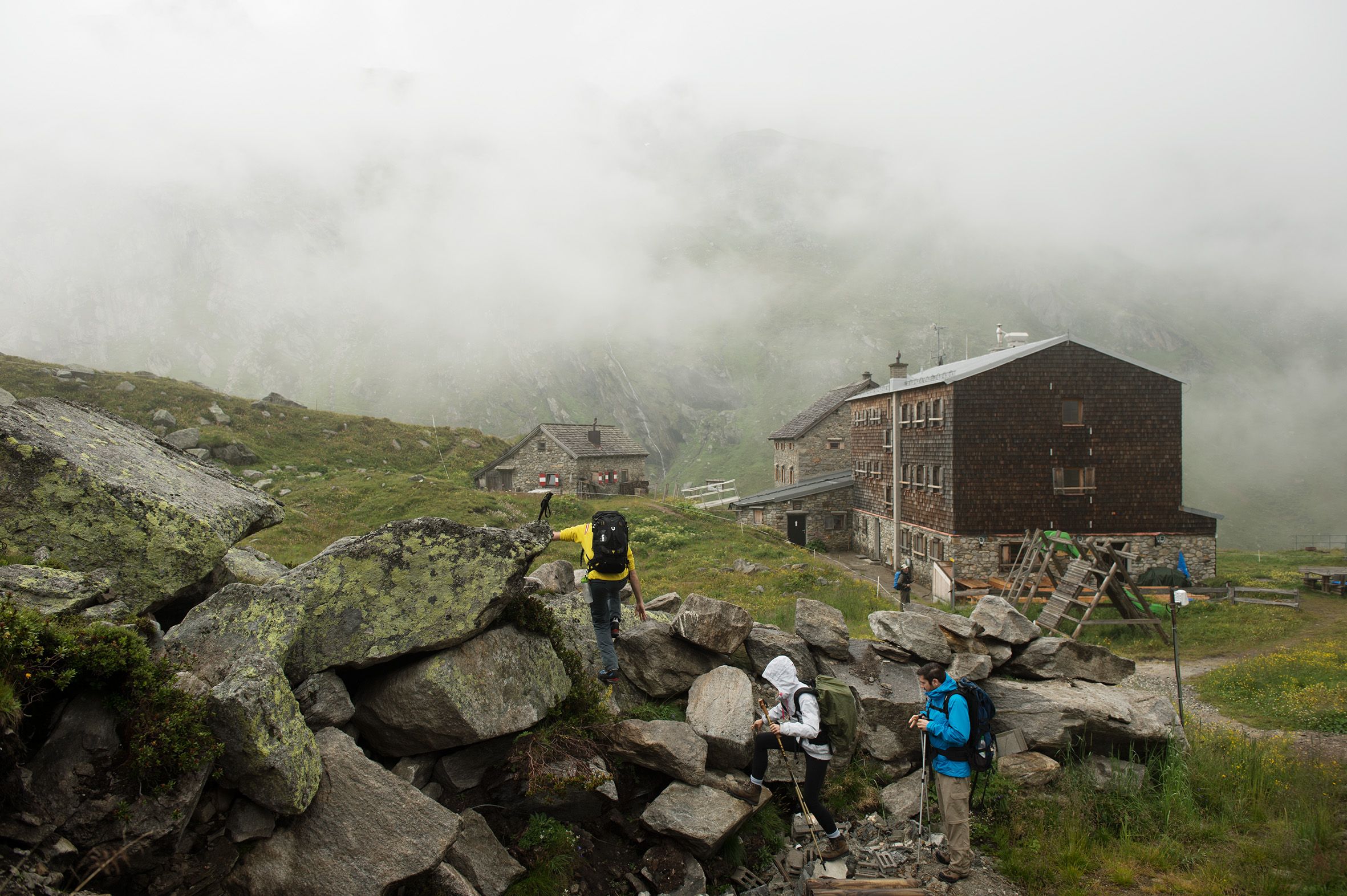
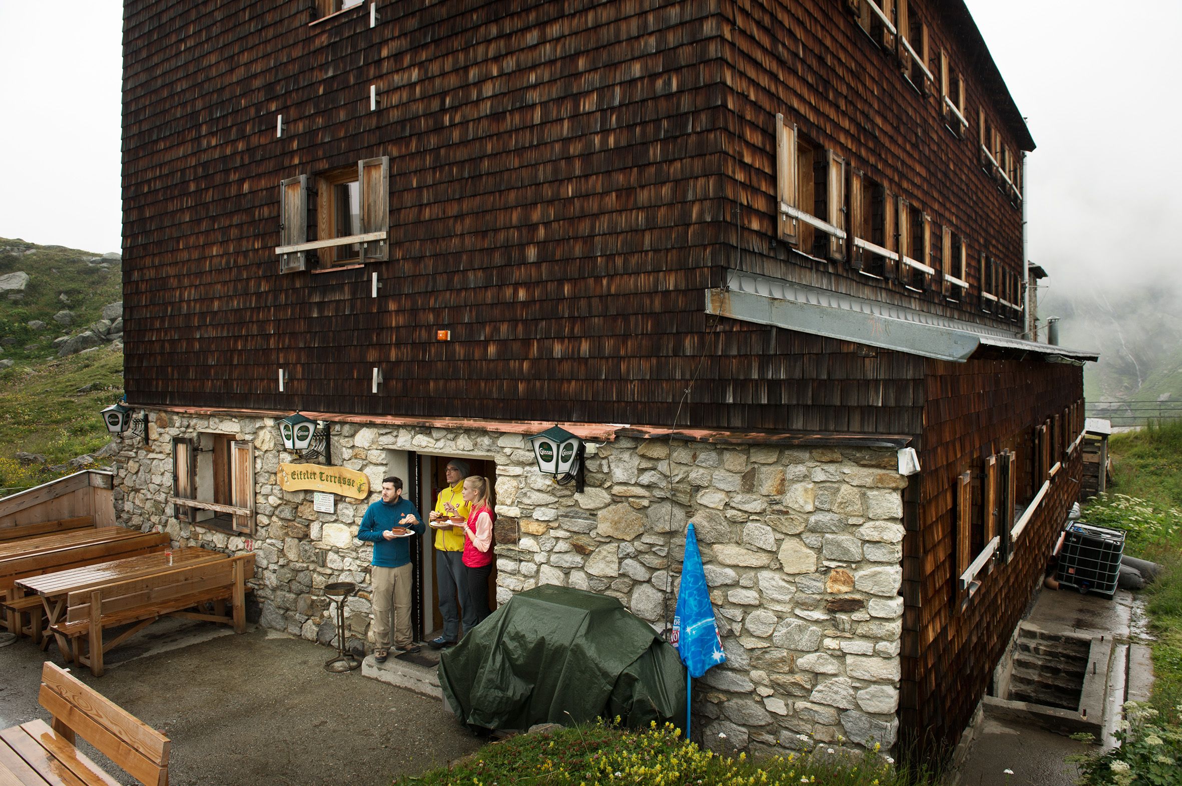
The Essener-Rostocker Hütte (2,208 metres) is a German Alpine Club mountain hut in the Maurertal Valley. It is an important base for walks and hikes in the Großvenediger region, East Tirol.

Information

Altitude

2,208 m

Mountain range

Venediger Mountains

Sleeps (number of guests)

  • Dormitory/beds:59
  • Dormitory with mattresses:16

Facilities

  • Family friendly
  • Showers
  • Suitable for seminars

Suitable for:

  • mountain hiking
  • High-altitude hikes
  • Rock climbing
  • Ski touring

Coordinates

  • Geographic length:12.297777777778
  • Geographic width:47.055
  • UTM (east):5214801
  • UTM (east):294779
  • Reference Meridian:15°
Source: Alpenverein

Description

Mountain hut at the Simony Glacier
German Alpine Club, Essen Division


Glistening glaciers, thundering waterfalls and rushing streams characterise the landscape around this refuge in the Venediger Mountains. High above towers the mighty Großvenediger, one of Austria's highest peaks. Indeed, visitors to the Essener-Rostocker Hütte will be able to enjoy views of no fewer than ten summits over 3,000 metres in altitude. It is little wonder that this hut is a popular base for walks and hikes in the region. It is open from June until October and from March until May. There is also a winter room which can be accessed all year round. Ambitious hikers and mountaineers should bring the necessary safety equipment. There are also a number of easy walks near the hut suitable for families. It is possible to walk from this hut to other huts in the area, but the distances are long.

How to get to the Essener-Rostocker Hütte

From Prägraten i. Osttirol / car park in Ströden 15 minutes to Stoan-Alm hut, then through the Maurertal Valley to the bottom of the small cable car used to transport food and materials to the hut (10 minutes) and on to the hut (2 hours).

Walks and hikes in the area (walking time to summit)

Rostocker Eck (2,749 metres), 2.25 hours, intermediate
Dellacher Keesflecke (2,879 metres), 2 hours, difficult
Östliche Simonyspitze (3,442 metres), 4.5 hours, difficult
Simonysee (2,380 metres), 45 minutes, intermediate
Türmljoch (2,790 metres), 2.5 hours, intermediate (via ferrata climbing route to "Türml", 2,844 metres, rated B/C - intermediate)

Further huts in the area, long-distance walking trails

Johannishütte, 3.5 hours
Clarahütte, 6 hours
Warnsdorfer Hütte, 4.5 hours
Kursinger Hütte, 5.5 hours

The Essener-Rostocker Hütte is on the Eagle Walk (Stage 1), a long-distance hiking trail with 33 stages crossing Tirol from east to west. The hut is also located on the Venediger High Trail.

Getting here

Nearby huts

  • Tribulaunhütte

    Place:Stubai Alps
    :2,064 m
    :Suitable formountain hikingRock climbing
  • Hans Berger Haus

    Place:Kaiser Mountains
    :936 m
    :Suitable formountain hikingRock climbing
  • Voldertalhütte

    Opening hours:Temporarily closed
    Place:Tux Alps
    :1,376 m
    :Suitable formountain hikingMountain bike
  • Padasterjochhaus

    :2,232 m
    :Suitable formountain hikingMountain bikeSki touring
  • Hochwildalm

    Place:Kitzbühel Alps
    :1,557 m
    :Suitable formountain hikingSki touring
  • Vinzenz-Biedner-Hütte

    Place:Schober Mountains
    :1,850 m
    :Suitable formountain hikingRock climbingMountain bikeSki touring
  • Peter-Anich-Hütte

    Place:Stubai Alps
    :1,909 m
    :Suitable formountain hikingMountain bike
  • Pfeishütte

    Place:Karwendel Mountains
    :1,922 m
    :Suitable formountain hikingRock climbingMountain bikeSki touring
  • Grünseehütte

    Place:Granatspitz Mountains
    :2,235 m
    :Suitable formountain hikingMountain bikeSki touring
  • Gruttenhütte

    Place:Kaiser Mountains
    :1,620 m
    :Suitable formountain hikingRock climbingSki touring
  • Ackerlhütte

    Place:Kaiser Mountains
    :1,465 m
    :Suitable formountain hikingRock climbing
  • Porzehütte

    Place:Carnic Alps
    :1,942 m
    :Suitable formountain hikingRock climbingMountain bikeSki touring
  • Alpenrosehütte

    Place:Kitzbühel Alps
    :1,555 m
    :Suitable foralpine skiingmountain hikingMountain bikeSki touring
  • Sillianer Hütte

    Place:Carnic Alps
    :2,447 m
    :Suitable formountain hikingMountain bikeSki touring
  • Hallerangerhaus

    Place:Karwendel Mountains
    :1,768 m
    :Suitable formountain hikingRock climbingMountain bike
  • Hanauer Hütte

    Place:Lechtal Alps
    :1,922 m
    :Suitable formountain hikingRock climbingSki touring
  • Amberger Hütte

    Place:Stubai Alps
    :2,135 m
    :Suitable formountain hikingHigh-altitude hikesRock climbingMountain bikeSki touring
  • Anhalter Hütte

    Place:Lechtal Alps
    :2,042 m
    :Suitable formountain hikingRock climbing
  • Reuttener Hütte

    Place:Lechtal Alps
    :1,740 m
    :Suitable formountain hikingMountain bikeSki touring
  • Ansbacher Hütte

    Place:Lechtal Alps
    :2,376 m
    :Suitable formountain hikingRock climbing
  • Heidelberger Hütte

    Place:Silvretta Alps
    :2,264 m
    :Suitable formountain hikingHigh-altitude hikesRock climbingMountain bikeSki touring
  • Anton-Karg-Haus

    Place:Kaiser Mountains
    :829 m
    :Suitable formountain hikingRock climbing
  • Heiterwandhütte

    Place:Lechtal Alps
    :2,020 m
    :Suitable formountain hiking
  • Kaiserjochhaus

    Place:Lechtal Alps
    :2,310 m
    :Suitable formountain hikingRock climbingSki touring
Newsletter

The mountain is calling? So does our newsletter!

In our monthly newsletter we reveal the best holiday tips for Tyrol.