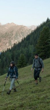
Kitzbühel Alps – PillerseeTal Region: Winter hikes in the region

on mapFieberbrunn - Zillstatt - Streuböden
Starting point: Fieberbrunn
Length: 6km
Elevation uphill: 460m
Total hiking time: 2h
Difficulty rating: medium

on mapHoametzlhütte
Starting point: Car park at bottom of ski lift in Hochfilzen
Length: 2km
Elevation uphill: 220m
Total hiking time: 1 h 30 min
Difficulty rating: medium

on mapHoametzlhütte Hut
Starting point: Hochfilzen
Length: 4km
Elevation uphill: 230m
Total hiking time: 1 h 45 min
Difficulty rating: medium

on mapWaidring - St. Ulrich am Pillersee
Starting point: Waidring
Length: 9km
Elevation uphill: 220m
Total hiking time: 2 h 30 min
Difficulty rating: easy
can be found on the official website of the tourism office.