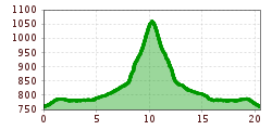
Open interactive mapOpen this POI on the interactive mapElevation profileCR2 | Espresso | Ruetzenhof.gpx
biken102_klammljoch_2019_(c)Erwin Haiden, bikeboard.at.jpg © Erwin Haiden, bikeboard.at Klammljoch - Defereggental No. 102Difficulty: medium Length: 22.0 km Duration: 3:30 h Elevation uphill: 946 m Go to biketourGo to biketour: Klammljoch - Defereggental No. 102
rennradtour - sölden - ötztaler gletscherstraße zum rettenbachgletscher_img_26244766 © Dominic Kuen Road cycling tour: Sölden - Ötztal Glacier Road up to Rettenbach GlacierDifficulty: difficult Length: 29.6 km Duration: 3:28 h Elevation uphill: 1,457 m Go to biketourGo to biketour: Road cycling tour: Sölden - Ötztal Glacier Road up to Rettenbach Glacier
amberger-huette1 (1) © Ötztal Tourismus 694 Amberger HütteOpening hours: closed Difficulty: medium Length: 23.7 km Duration: 3:00 h Elevation uphill: 960 m Go to biketourGo to biketour: 694 Amberger Hütte
Supernatural Trail im Bikepark © © Serfaus-Fiss-Ladis Marketing GmbH SupernaturalOpening hours: open Difficulty: medium Length: 610 m Go to biketourGo to biketour: Supernatural
Tiroler Zugspitz Arena, Ehrwald, Seebensee_Tirol Werbung_Heinzlmeier Bert_Ehrwald (2) © Tirol Werbung | Bert Heinzlmeier Ehrwalder Alm SeebenseeDifficulty: medium Length: 9.0 km Duration: 2:30 h Elevation uphill: 630 m Go to biketourGo to biketour: Ehrwalder Alm Seebensee
Labalm KirchbergDifficulty: medium Length: 26.0 km Duration: 3:00 h Elevation uphill: 450 m Go to biketourGo to biketour: Labalm Kirchberg
On the Lech Cycle Path ⒸRobert Eder, Reutte Nature Park Region © Naturparkregion Reutte | Robert Eder LechradwegLength: 244.6 km Duration: 18:00 h Elevation uphill: 1,702 m Go to biketourGo to biketour: Lechradweg
Gravelbike Tour 3Difficulty: difficult Length: 83.0 km Duration: 7:00 h Elevation uphill: 880 m Go to biketourGo to biketour: Gravelbike Tour 3
Milky Way Start.jpg © (c) Serfaus-Fiss-Ladis Marketing GmbH_Manuel Kokseder Milky WayOpening hours: closed Difficulty: easy Length: 2.9 km Go to biketourGo to biketour: Milky Way
mtb-flimjochtrail-15 © TVB Paznaun - Ischgl Uphill Idalp I.3Difficulty: medium Length: 7.8 km Duration: 2:00 h Elevation uphill: 967 m Go to biketourGo to biketour: Uphill Idalp I.3
St. Johann, Angerer Alm_Tirol Werbung_Bauer Frank_Sankt Johann in Tirol (1) © Tirol Werbung | Frank Bauer Angereralm - HarschbichlDifficulty: medium Length: 18.2 km Duration: 2:00 h Elevation uphill: 942 m Go to biketourGo to biketour: Angereralm - Harschbichl
St_Johann23©MirjaGeh_2817.jpg © Mirja Geh Flusserlebnisweg GroßacheDifficulty: easy Length: 3.2 km Duration: 0:30 h Elevation uphill: 20 m Go to biketourGo to biketour: Flusserlebnisweg Großache
Söll_Hexenwasser_Hohe Salve_Wilder Kaiser © TVB Wilder Kaiser/Martin Raffeiner MTB Tour Söll - HochsöllDifficulty: medium Length: 5.1 km Elevation uphill: 480 m Go to biketourGo to biketour: MTB Tour Söll - Hochsöll
kulinarische radtour. durch die region_img_614426181 © Tourismusverband Region Hall-Wattens Culinary bike route. Through the regionDifficulty: easy Length: 25.1 km Duration: 2:00 h Elevation uphill: 302 m Go to biketourGo to biketour: Culinary bike route. Through the region
Singletrail Kals © Miriam Raneburger Gornerwald Trail No. 139Difficulty: difficult Length: 2.3 km Duration: 0:30 h Go to biketourGo to biketour: Gornerwald Trail No. 139
©-TVB-Tiroler-Oberland-Rudi-Wyhlidal-Wildbachtrails-2021 (97).jpg © Rudi Wyhlidal WildbachtrailDifficulty: difficult Length: 3.4 km Duration: 0:30 h Elevation uphill: 480 m Go to biketourGo to biketour: Wildbachtrail
The Rough OneDifficulty: difficult Length: 2.0 km Duration: 0:10 h Go to biketourGo to biketour: The Rough One
The First OneDifficulty: medium Length: 2.4 km Duration: 0:15 h Go to biketourGo to biketour: The First One
The Hungerburg Trail (596)Difficulty: difficult Length: 550 m Duration: 0:15 h Go to biketourGo to biketour: The Hungerburg Trail (596)
Lakata Trail © bikeboard/Roland Kachelhauser Alban Lakata Trail No. 142Difficulty: medium Length: 2.0 km Duration: 0:20 h Elevation uphill: 10 m Go to biketourGo to biketour: Alban Lakata Trail No. 142
2031 | Sonnenrast TrailDifficulty: easy Length: 1.7 km Go to biketourGo to biketour: 2031 | Sonnenrast Trail
Bayreuther Hütte & BergalmOpening hours: open Difficulty: difficult Length: 9.1 km Duration: 3:00 h Elevation uphill: 1,050 m Go to biketourGo to biketour: Bayreuther Hütte & Bergalm
Tour of the Alps © Hannes Sautner Alpbachtal GiroDifficulty: difficult Length: 117.4 km Duration: 5:45 h Elevation uphill: 2,250 m Go to biketourGo to biketour: Alpbachtal Giro
web-wilder-kaiser-bergdoktorpraxis-ellmaul-sommer2022-mathaeusgartner-2©mathaeusgartner © Mathäus Gartner Wilder Kaiser cycle route no. 14Difficulty: medium Length: 38.3 km Elevation uphill: 520 m Go to biketourGo to biketour: Wilder Kaiser cycle route no. 14
Sölden, Fernar Trail crop (2) © Tirol Werbung | Sebastian Schels Fernar Trail (6041)Difficulty: difficult Length: 6.0 km Duration: 0:49 h Elevation uphill: 18 m Go to biketourGo to biketour: Fernar Trail (6041)
Give feedback for a chance to win a special holiday experience!Click here for the surveyClick here for the survey