Arrival by public transport
By city bus, take line 1 to the Ebbs Kaisertal stop, directly at the starting point.
With the KufsteinerlandCard, you can use buses within the region for free.
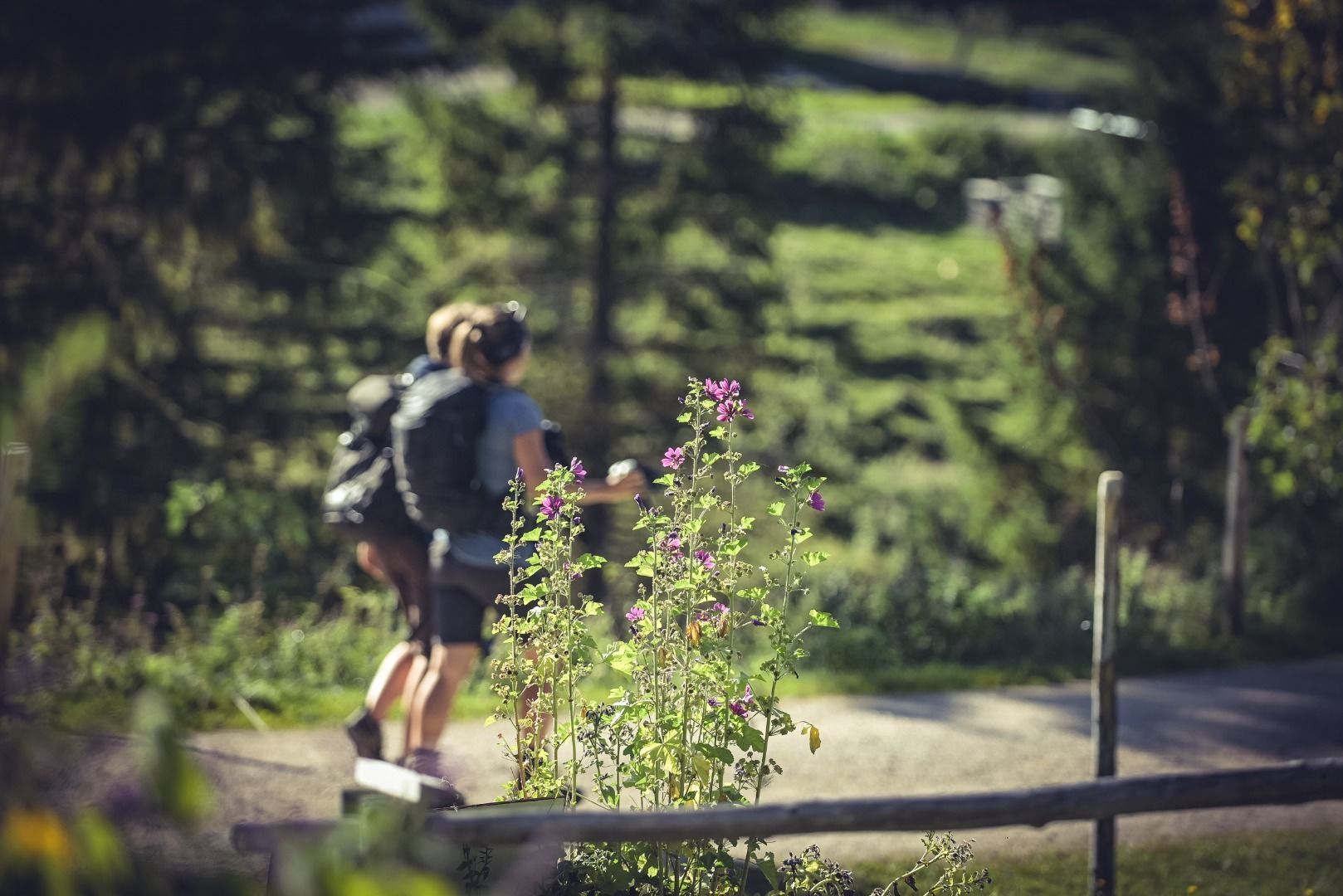
Hike through the breathtaking high-altitude trails of the Kaisergebirge over two days. Far below, the Kaisertal accompanies you continuously as you circle it from above. The southern side of the Zahmer Kaiser reveals itself at its very best.
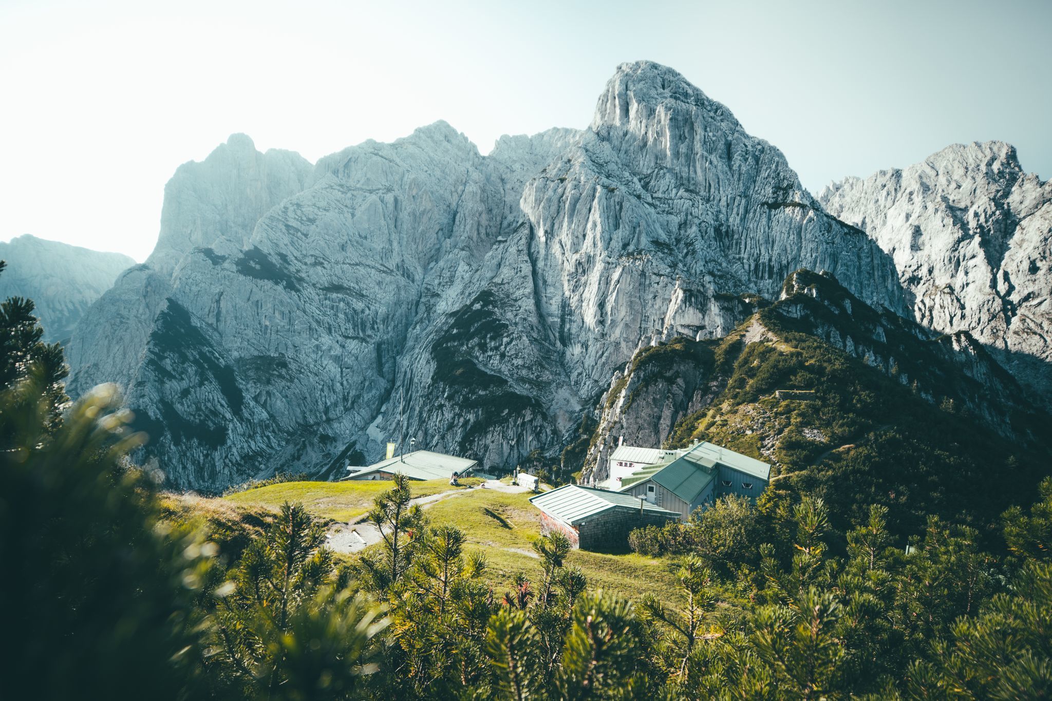
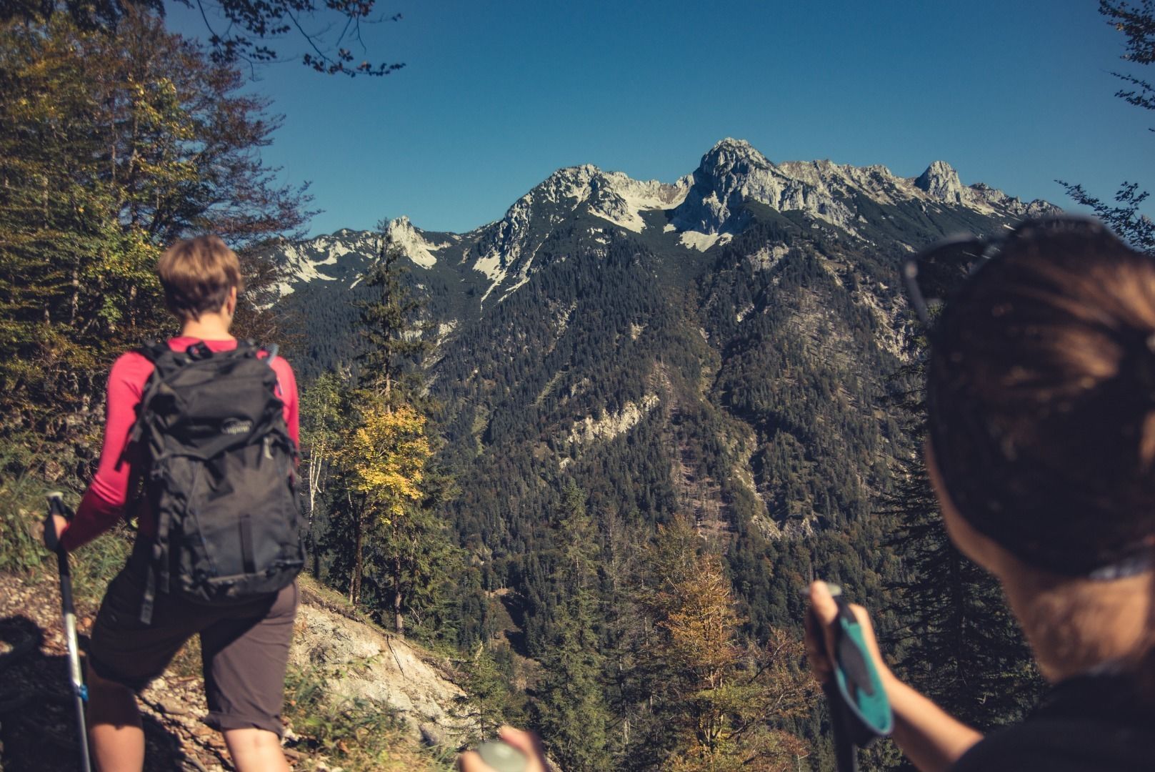
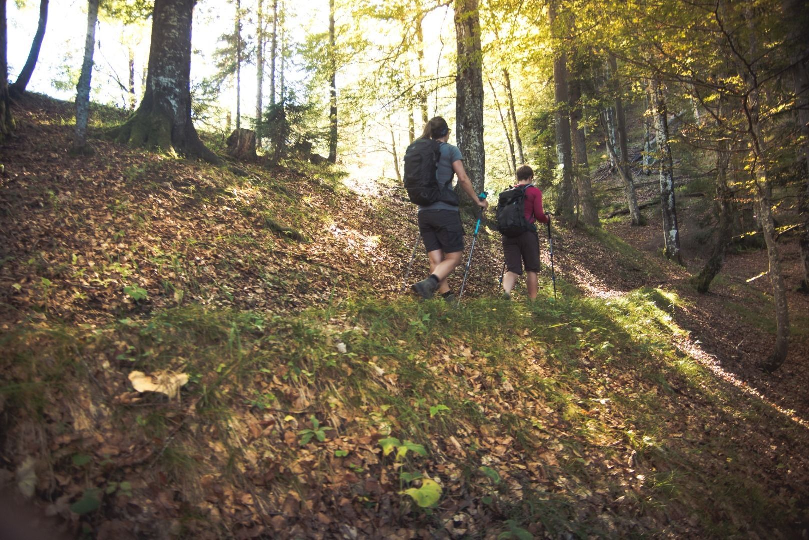
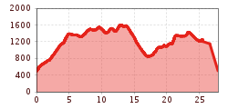
This challenging and partially alpine tour begins on Day 1 with a climb of 280 steps to one of Austria's most beautiful spots (selected in the "9 Places – 9 Treasures" contest). The ascent to the Vorderkaiserfeldenhütte offers few opportunities to catch your breath, as the path is mostly steep but not technically difficult. From there, the most scenic portion of the tour starts along the Zahmer Kaiser High Trail. Always with views of the Wilder Kaiser, the trail traverses the flanks of the Zahmer Kaiser with minimal elevation changes. Passing by the Hochalm, you’ll reach the first day's destination, the Stripsenjochhaus, after 14 kilometers, 1500 meters of elevation gain, and about 6.5 hours of hiking.
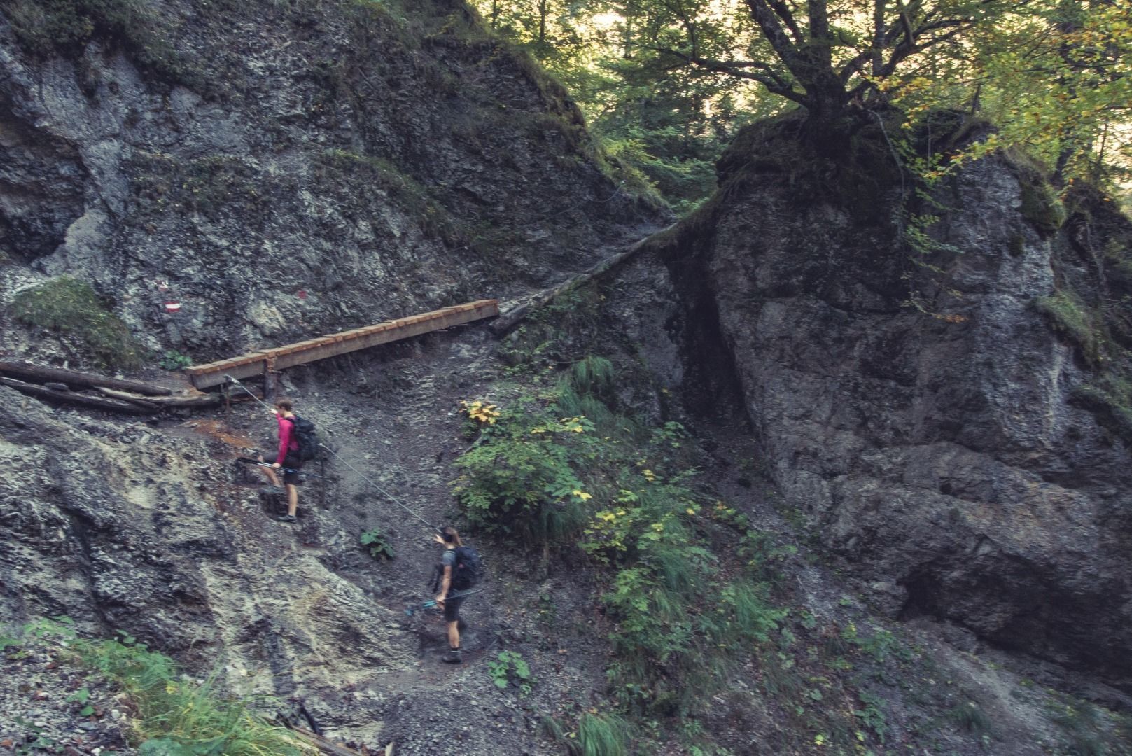
On Day 2, the route initially descends several hundred meters via steps into the Kaisertal to the Anton-Karg-Haus (Hinterbärenbad). From there, the Bettlersteig trail starts on the northern side, climbing steeply through several ravines to the Steinberg Alms. Shortly after reaching the alpine meadows, the trail veers right and continues over the Gamskogel to the Kaiserlift mountain station. Those who wish can descend into the valley on foot, but it is recommended to take the Kaiserlift for a gentle glide down. Tickets can be purchased at the top station. Total hiking time for Day 2 is approximately 5.5 hours, covering 11.9 kilometers and 730 meters of elevation gain.
By city bus, take line 1 to the Ebbs Kaisertal stop, directly at the starting point.
With the KufsteinerlandCard, you can use buses within the region for free.
For the ascent: Ebbs Kaiseraufstieg, subject to charges.
For the descent: Kaiserlift valley station, subject to charges.


.jpg")


")
.jpg")


