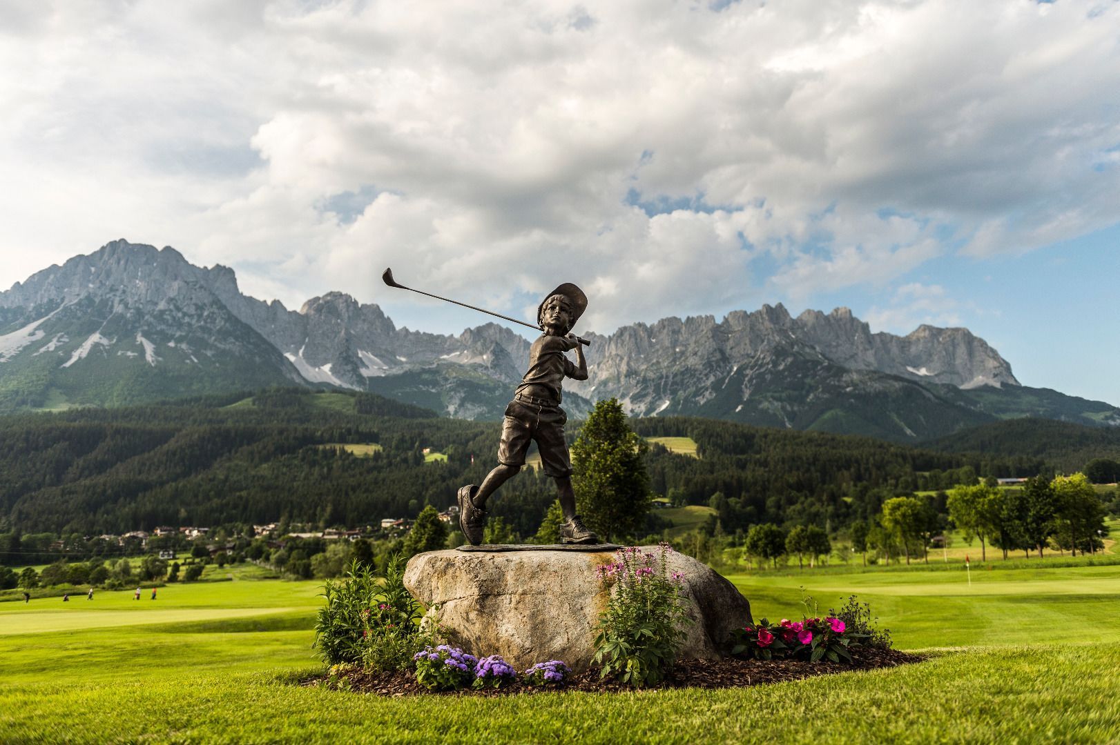
Ellmau golf course circuit

Ellmau / Kaiser Mountains
Route length: 3.0 km
Duration: 0:20 h

Gentle walking or running course in Ellmau

Tour information

  • Length: 3.0 km
  • Duration: 0:20 h
  • Elevation uphill:54 hm
  • Elevation downhill:55 hm
Highest point810 m

Starting point

Hiking starting point Tourist Info, Ellmau (800 m)

Finishing point

Hiking starting point Tourist Info, Ellmau (800 m)
  • Fitness level 1 / 6
  • Technique 1 / 6

Best time of year

  • January
  • February
  • March
  • April
  • May
  • June
  • July
  • August
  • September
  • October
  • November
  • December

Equipment

Running shoes, water bottle, energy bar, possibly gpx track
Source: TVB Wilder Kaiser

Description

You start this moderately challenging circuit at the hiking info point in Ellmau and walk/run towards the Sporthotel. Immediately after the hotel, an overpass takes you directly to the 27-hole golf course. You now follow the trail to the farms and then walk/run to the left towards Kaiserbad pool. At the next fork you walk/run along the Alleestrasse back to the hiking info point.

Getting here

  • Arrival by public transport

    KaiserJet stop “Ellmau Alte Post” or Postbus stop “Ellmau Dorf Bauhof”.
    More information at: www.wilderkaiser.info/mobility

  • Parking

    Heading from Wörgl or Kufstein on the B178 road, take the first exit to Ellmau and then take the first exit at the roundabout. Drive along the bypass, then turn towards the centre of Ellmau when you reach the end (between MPreis and the Sporthotel). Continue straight on until you see the Tourist Info on the right-hand side (short-stay parking zone). The hiking starting point is located opposite this on the left-hand side. 
    Heading from St. Johann on the B178 road, take the first exit to Ellmau and drive straight on through the town until you see the Tourist Info on the right-hand side (short-stay parking zone). The hiking starting point is located opposite this on the left-hand side.
    Public car parks in Ellmau centre or west (800 m) - for free

Weather

Today

clear sky
5°C/-5°C
0%0l5 km/h

Sun

clear sky
7°C/-5°C
30%0.6l5 km/h

Mon

partly Cloudy
8°C/-1°C
40%1.2l5 km/h
Go to weather forecast

More tours in the surrounding area

  • Kaiserkrone - stage 3

    Difficulty:medium
    Length:9.3 kmDuration:4:30 hElevation uphill:840 m
  • Tauernblick panorama circular hiking route

    Difficulty:medium
    Length:13.6 kmDuration:6:00 hElevation uphill:980 m
  • 3-day hut tour Wilder Kaiser

    Difficulty:difficult
    Length:24.6 kmDuration:14:00 hElevation uphill:2,060 m
  • Prama winter circuit

    Opening hours:closed
    Length:7.9 kmDuration:3:00 hElevation uphill:80 m
  • Hochalm hike

    Difficulty:medium
    Length:19.6 kmDuration:7:00 hElevation uphill:1,140 m
  • MTB Tour Söll - Hochsöll

    Difficulty:medium
    Length:5.1 kmElevation uphill:480 m
  • Winter walking Biedringer Platte

    Opening hours:closed
    Length:12.7 kmDuration:5:30 hElevation uphill:470 m
  • “Moor & more” Rocky Way

    Difficulty:easy
    Length:8.0 kmDuration:3:00 hElevation uphill:380 m
  • Hintere Goinger Halt summit tour

    Difficulty:difficult
    Length:9.3 kmDuration:6:30 hElevation uphill:1,090 m
  • Panoramic circuit Brandstadl–Hartkaiser

    Difficulty:easy
    Length:6.0 kmDuration:1:50 hElevation uphill:170 m
  • Astberg circular hiking route

    Difficulty:easy
    Length:1.5 kmDuration:0:30 hElevation uphill:80 m
  • Kaiserkrone - stage 1

    Difficulty:medium
    Length:8.0 kmDuration:4:30 hElevation uphill:1,120 m
  • Eagle Walk Stage 02: Gaudeamushütte - Kaindlhütte

    Difficulty:medium
    Length:15.1 kmDuration:6:30 hElevation uphill:888 m
  • Astberg Trail

    Length:9.7 kmElevation uphill:500 m
Newsletter

The mountain is calling? So does our newsletter!

In our monthly newsletter we reveal the best holiday tips for Tyrol.