High and sacred – Stage 09 from Kals to Heiligenblut

Kals am Großglockner / Glockner Group
Difficulty ratings: medium
Route length: 22.5 km
Duration: 8:00 h

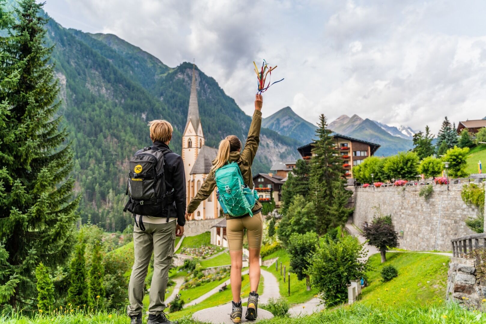
Almost at home: under the sky-high Großglockner along to the destination of your Pilgrimage Trail, the legendary mountaineering village Heiligenblut.

Tour information

  • Requirement: medium
  • Length: 22.5 km
  • Duration: 8:00 h
  • Elevation uphill:1,411 hm
  • Elevation downhill:1,438 hm
Highest point2,654 m

Starting point

Kals

Finishing point

Heiligenblut
Source: TVB Osttirol

Description

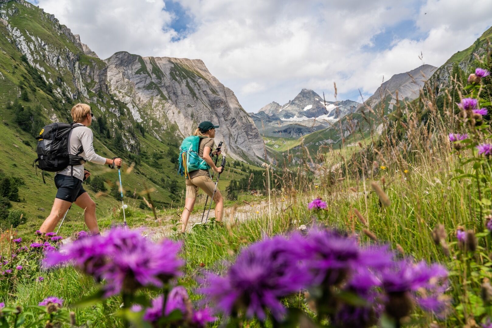
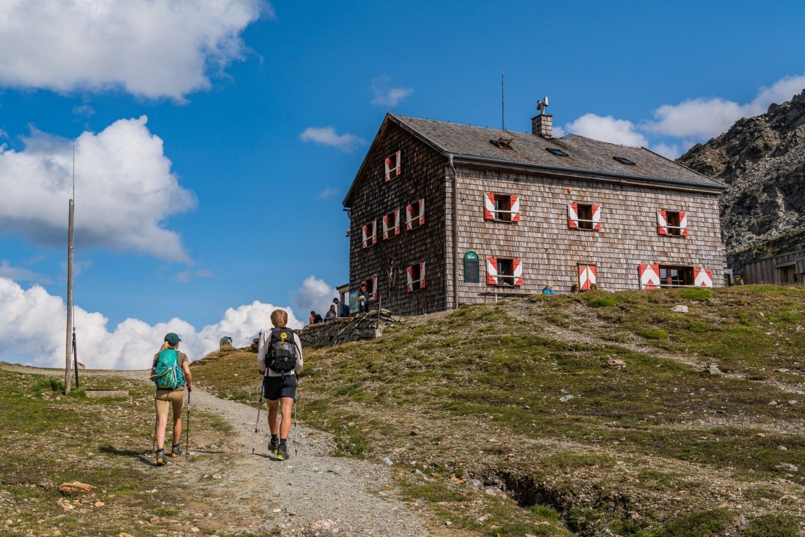
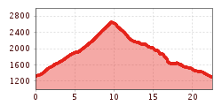
You start your pilgrimage stage in the center of Kals and walk in an easterly direction along path no. 702B to the Lucknerhaus, which invites you to stop for a bite to eat. From here the ascent begins along trail no. 714 past the Schliederle Alm to the Glorer Hütte at Berger Törl, a high alpine shelter at 2.642 m above sea level offering accommodation and refreshments.

After a break, continue along the increasingly flat path no. 714 in the direction of Berger Ochsnerhütte and there turn right onto path no. 702B in the direction of Leiteralm. After you have reached the Trogalm at the exit of the Leitertal valley, another steeper descent follows towards the Leiterfall and Briccius Chapel, where you take a rest and look at the information panels about the legendary village and the healing power of its spring water. Following the "Heilwasserweg Briccius" you hike through the Sattelalm and reach the Haritzersteig, which after a long pilgrimage brings you to your destination, the pilgrimage church of Heiligenblut.

Along the Trail

Gössnitz Waterfall
Shortly before Heiligenblut, the Gössnitzbach stream demonstrates the power of nature. It falls from a height of 70 m into the valley. You need to be sure-footed at the viewing platform.

St. Vinzenz (Heiligenblut)
In the famous pilgrimage church, on the left side of the sanctuary in the so-called sacrament house, there is a bottle of the "Holy Blood" of the Danish commander Briccius. His legend is depicted in impressive pictures in the church. Also worth seeing is the Gothic high altar from 1520 by the Pacher school.
In Kals as well as in Heiligenblut there are impressive memorials for the mountaineers that passed away at the Glockner, including name, age, origin and date of accident.


More tours in the surrounding area

  • Lucknerhaus - Stüdlhütte

    Difficulty:medium
    Length:9.3 kmDuration:4:30 hElevation uphill:862 m
  • Hiking tour to St. Pöltner Hütte and 3 lakes

    Difficulty:difficult
    Length:14.8 kmDuration:7:40 hElevation uphill:1,119 m
  • Badener Hütte

    Difficulty:difficult
    Length:23.2 kmDuration:12:00 hElevation uphill:1,754 m
  • Muhs panorama trail

    Difficulty:medium
    Length:15.2 kmDuration:6:00 hElevation uphill:1,090 m
  • Figerhorn

    Difficulty:difficult
    Length:6.5 kmDuration:6:00 hElevation uphill:807 m
  • Theme path "Virgen crossroads"

    Difficulty:easy
    Length:3.2 kmDuration:1:00 hElevation uphill:104 m
  • Hike to Neuen Reichenberger Hütte

    Difficulty:medium
    Length:18.2 kmDuration:9:00 hElevation uphill:1,252 m
  • Hiking tour to Lasörlinghütte 2.350m

    Difficulty:medium
    Length:14.6 kmDuration:7:50 hElevation uphill:1,135 m
  • Hike to Kalser Tauernhaus

    Difficulty:medium
    Length:12.2 kmDuration:4:00 hElevation uphill:244 m
  • Hiking tour to Neue Sajathütte 2.600m

    Difficulty:medium
    Length:10.3 kmDuration:6:50 hElevation uphill:1,086 m
  • Hiking tour to Zupalsee Hütte 2.350m

    Difficulty:medium
    Length:14.9 kmDuration:8:30 hElevation uphill:1,261 m
  • Hike to the Venedigerhaus Innergschlöß

    Difficulty:easy
    Length:8.6 kmDuration:2:30 hElevation uphill:184 m
  • Rotenkogel

    Difficulty:difficult
    Length:3.9 kmDuration:3:00 hElevation uphill:383 m
  • Rollitour with Swiss Trac

    Difficulty:easy
    Length:3.2 kmDuration:1:30 hElevation uphill:135 m
Newsletter

The mountain is calling? So does our newsletter!

In our monthly newsletter we reveal the best holiday tips for Tyrol.