
Difficulty:easy
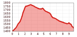
Length:15.3 kmDuration:5:00 hElevation uphill:325 m
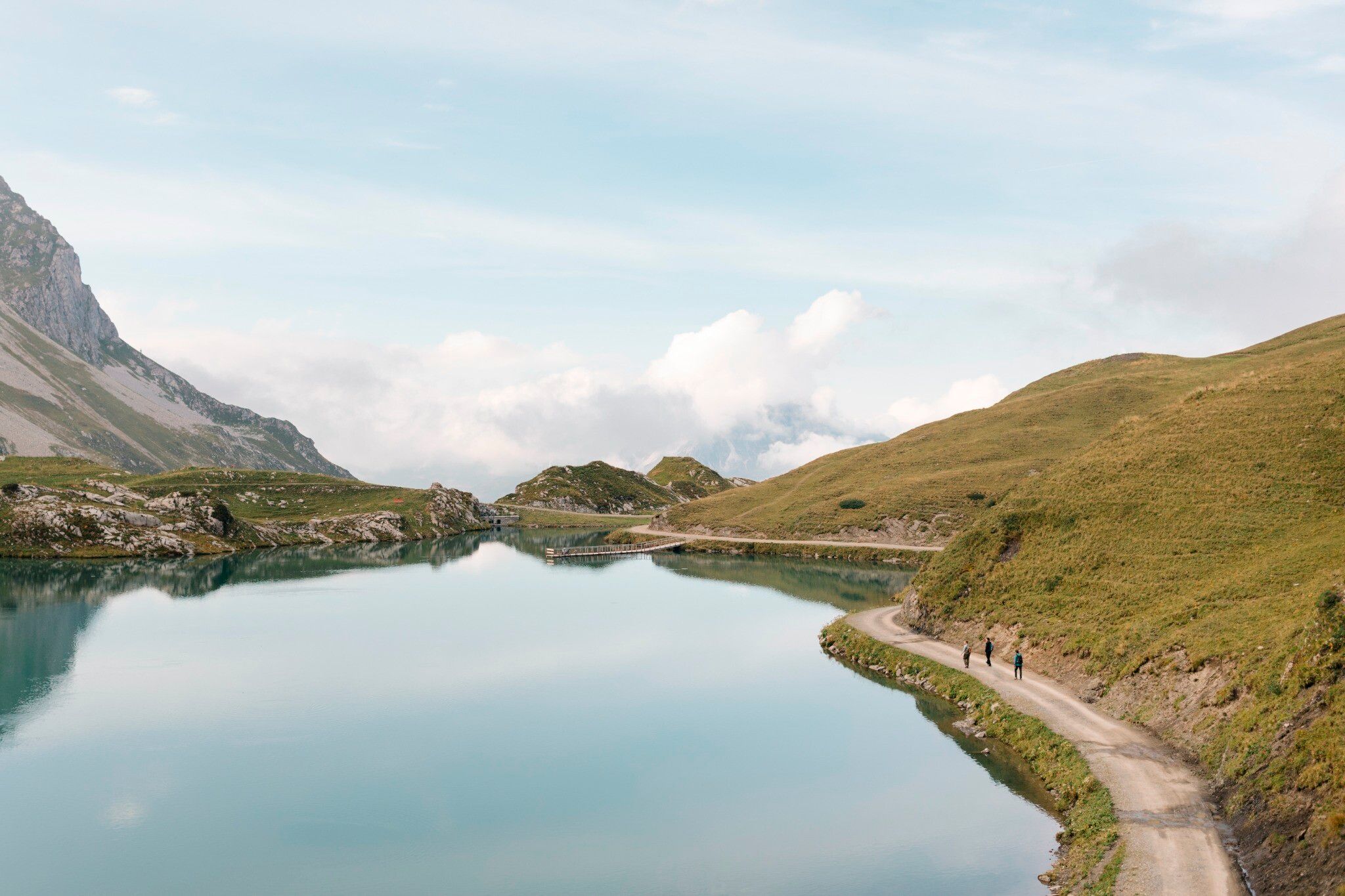
Stuben is considered the “Gateway to the Arlberg,” and on this stage, it opens up to beautiful high-mountain regions—including the European watershed at the Flexen Pass and Lake Zürser.
Stage 3 has more elevation loss (1,144 m) than elevation gain (667 m). But the natural experience doesn’t take a downturn; the high-mountain landscape once again showcases its beauty: streams, mountain lakes, cotton grass meadows, cliffs, and alpine pastures. The Seekopfbahn cable car provides a leisurely mid-stage ascent. Before the end of this stage, the view opens up to the stage’s destination, Lech am Arlberg, situated at an elevation of 1,450 m. Alternative route: Stuben – Flexen Pass – Zürs – Lech.


.jpg")


.jpg")


")


")


