Mountain hikes Bichler waterfall circular route

St. Leonhard im Pitztal / Ötztaler Alpen
Difficulty ratings: easy
Route length: 3.8 km
Duration: 1:10 h

Bichler waterfall circular route

Tour information

  • Requirement: easy
  • Length: 3.8 km
  • Duration: 1:10 h
  • Elevation uphill:100 hm
  • Elevation downhill:100 hm
Highest point1,428 m

Starting point

bus stop St. Leonhard Enger

Finishing point

bus stop St. Leonhard Enger

Features

  • Circular route

Best time of year

  • January
  • February
  • March
  • April
  • May
  • June
  • July
  • August
  • September
  • October
  • November
  • December

Trail condition

asphalt, forest path, track
Source: Pitztal

Description

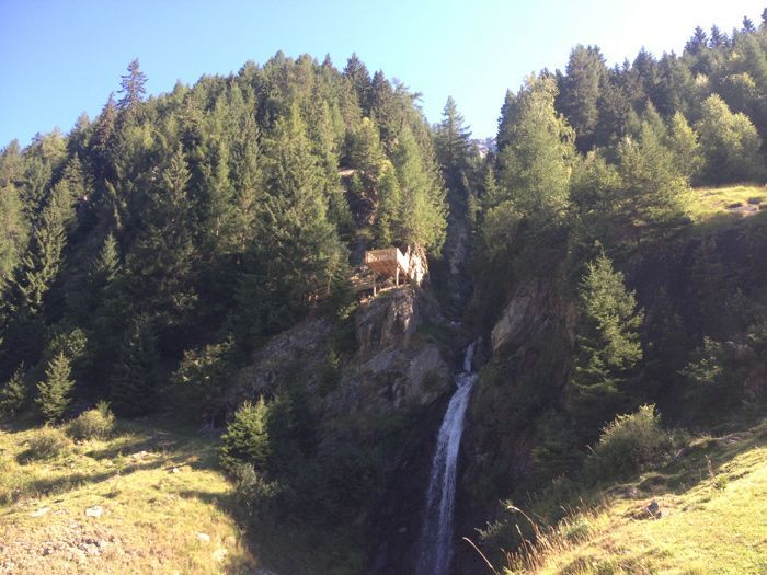
This circular route starts at the Enger bus stop and leads on a slightly steeper tarmac road in the direction of the waterfall for a short stretch (ca. 250 m) only. Then a forest road with several serpentines takes you directly beneath the viewing platform. The platform can then be reached by climbing a simple steep path for about 50 m. Continue the tour  along the forest path to Eggenstall. In Eggenstall you cross the street and turn right to the village Innerwald. From Innerwald you hike back to Enger to the starting point at the bus stop.

Nearby huts and mountain restaurants

  • Hotel Alpenhof

    Opening hours:Today closed
    Place: St. Leonhard im Pitztal
    : Restaurant

More tours in the surrounding area

Newsletter

The mountain is calling? So does our newsletter!

In our monthly newsletter we reveal the best holiday tips for Tyrol.