
Opening hours:Today closed
Place:Matrei in Osttirol
:Restaurant, Alpine pasture / hut / mountain restaurant
A listed rock chapel, two picturesque alpine settlements, the ice cap of the Großvenediger massif, the "Eye of God" and circling bearded vultures in the sky. Remembered everything? Then please repeat it now and off you go to the Gschlösstal!
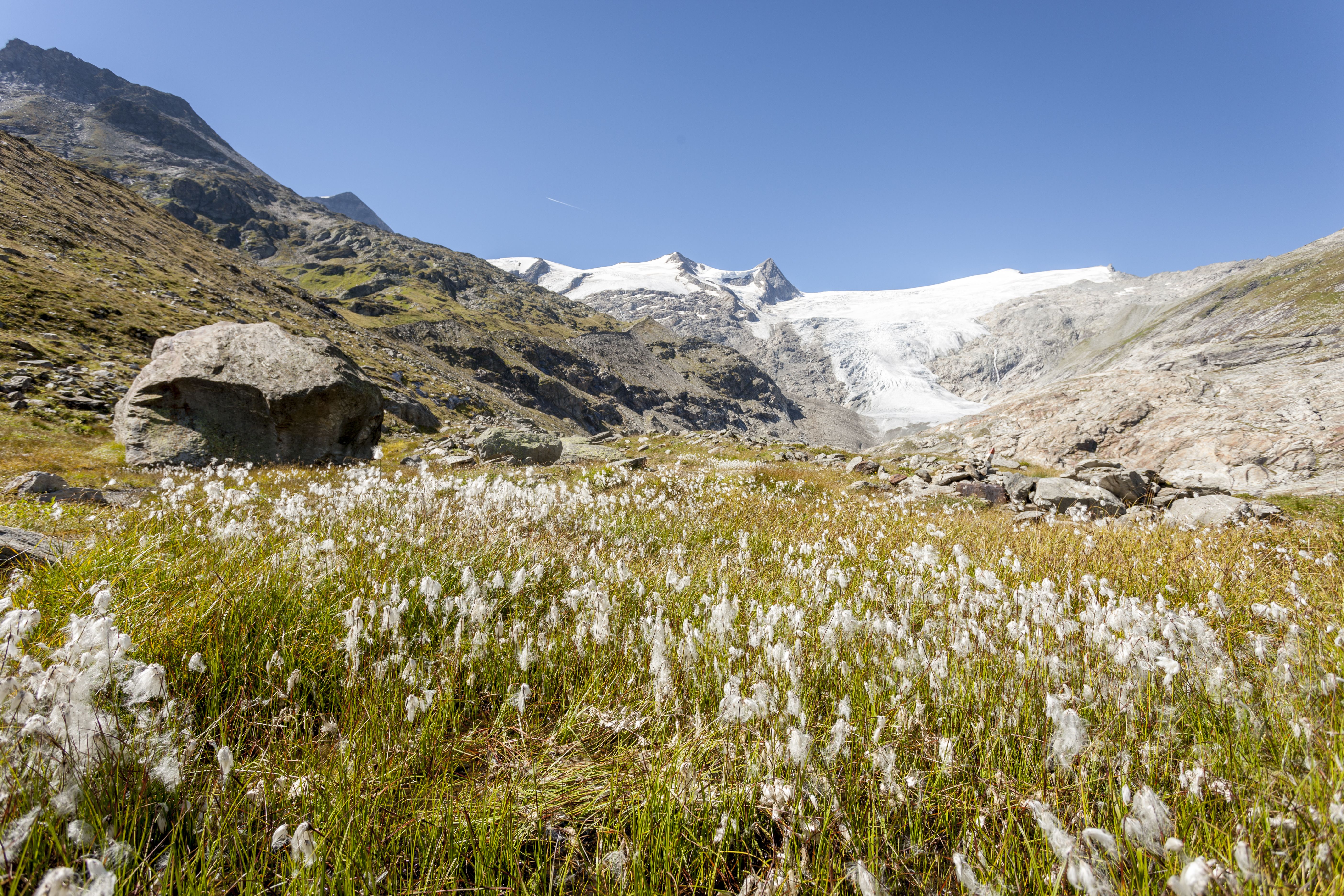
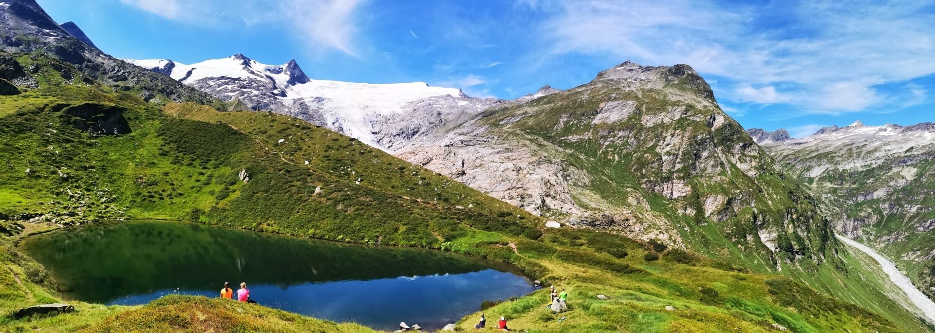
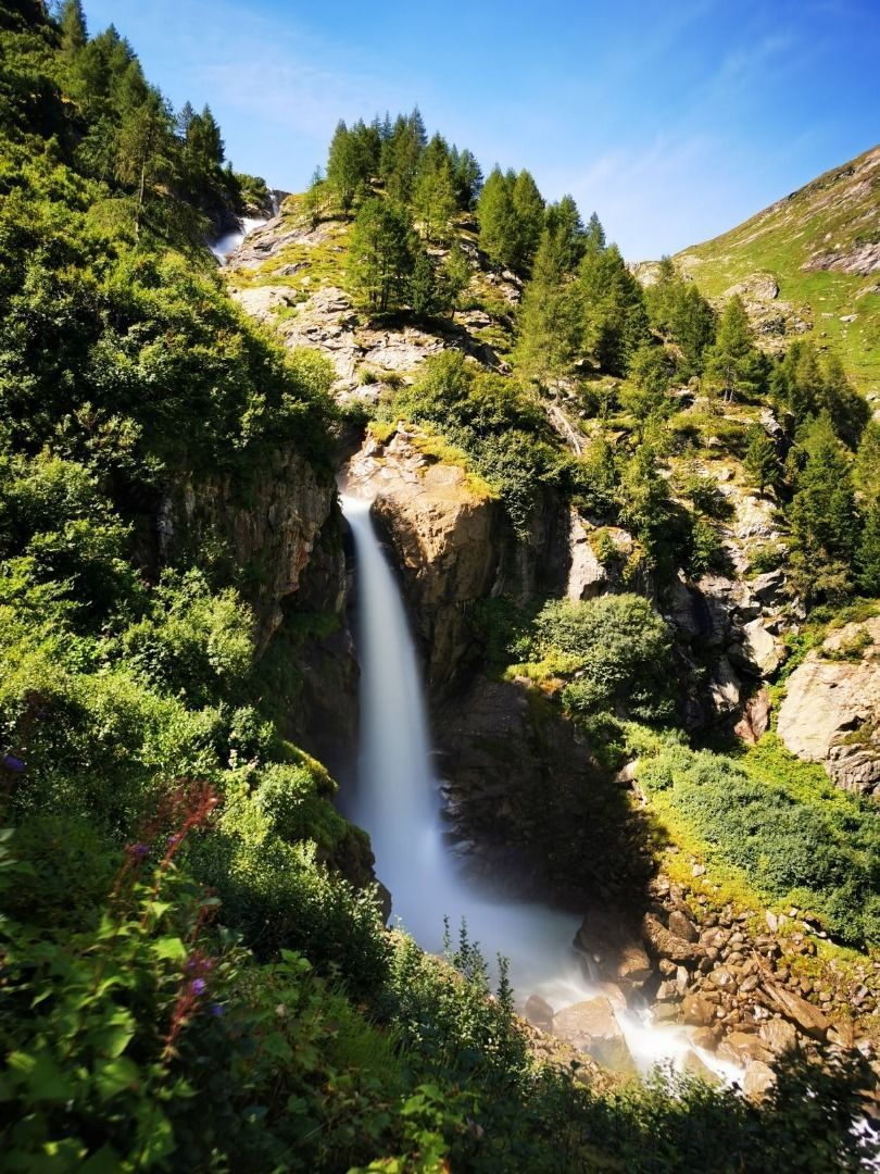
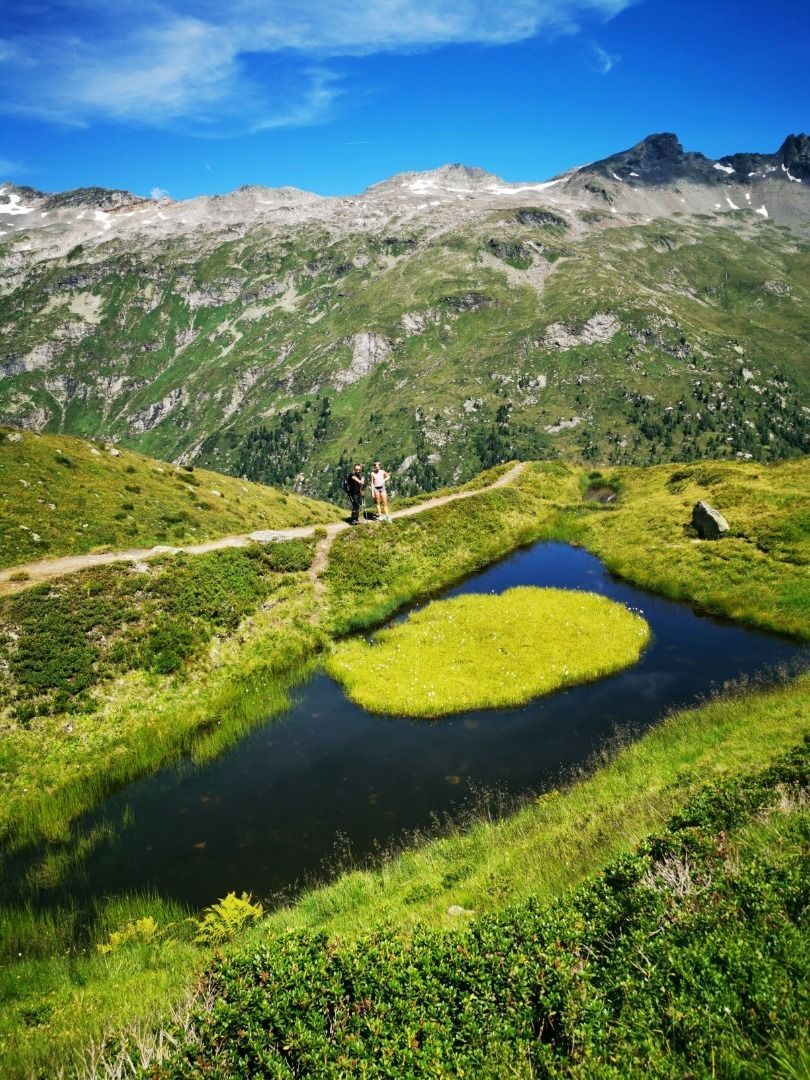
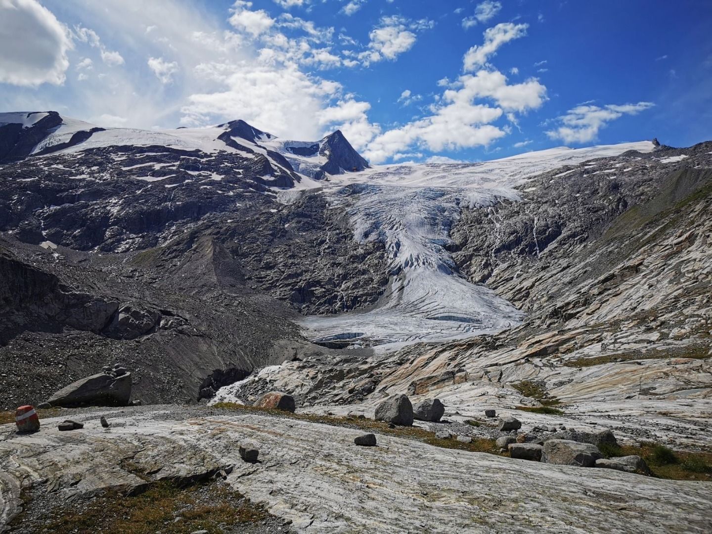
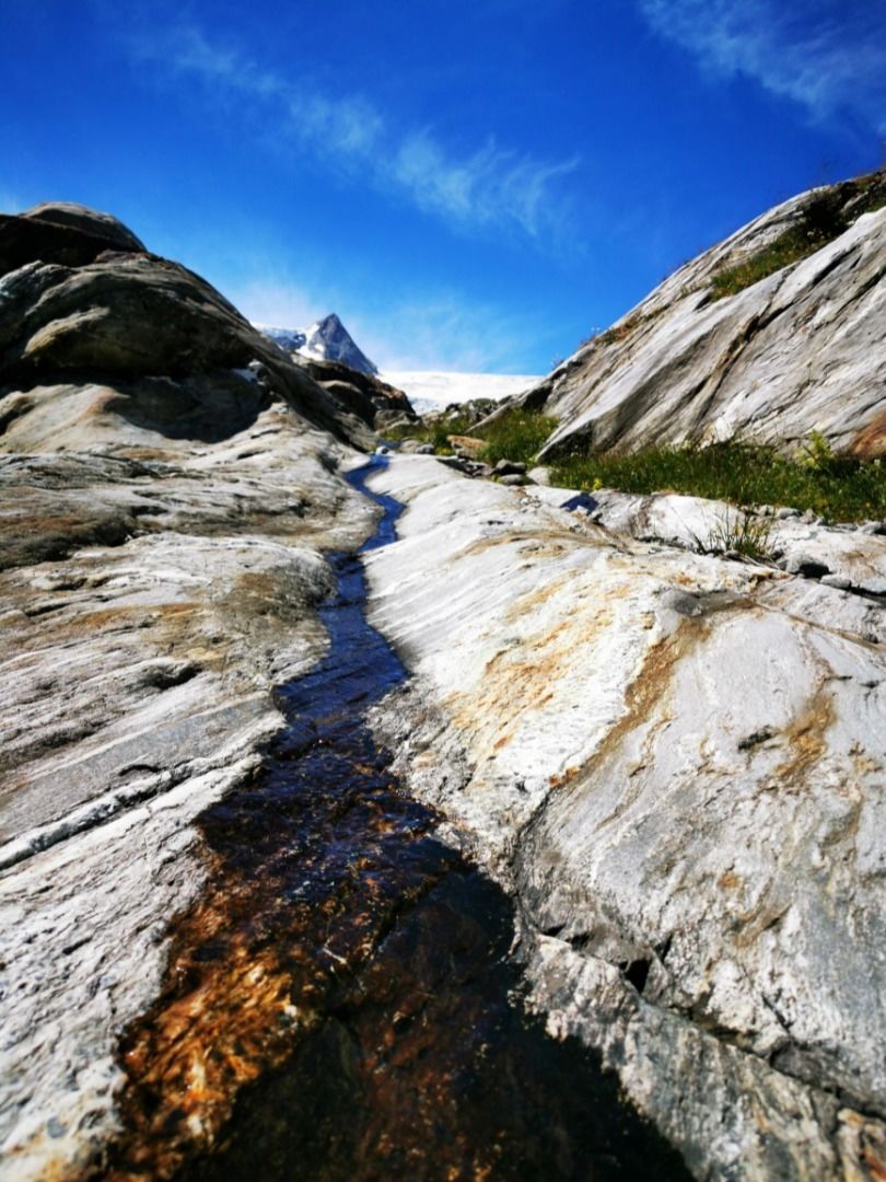
Medium-difficulty hike on well-marked hiking trails, initially easy along a stream and through forests, later more alpine with some easier climbs. The Innergschlöß glacier trail offers fantastic views of the Großvenediger and the Schlatenkees as well as special natural beauties such as waterfalls, mountain lakes and the colorful glacier polish.
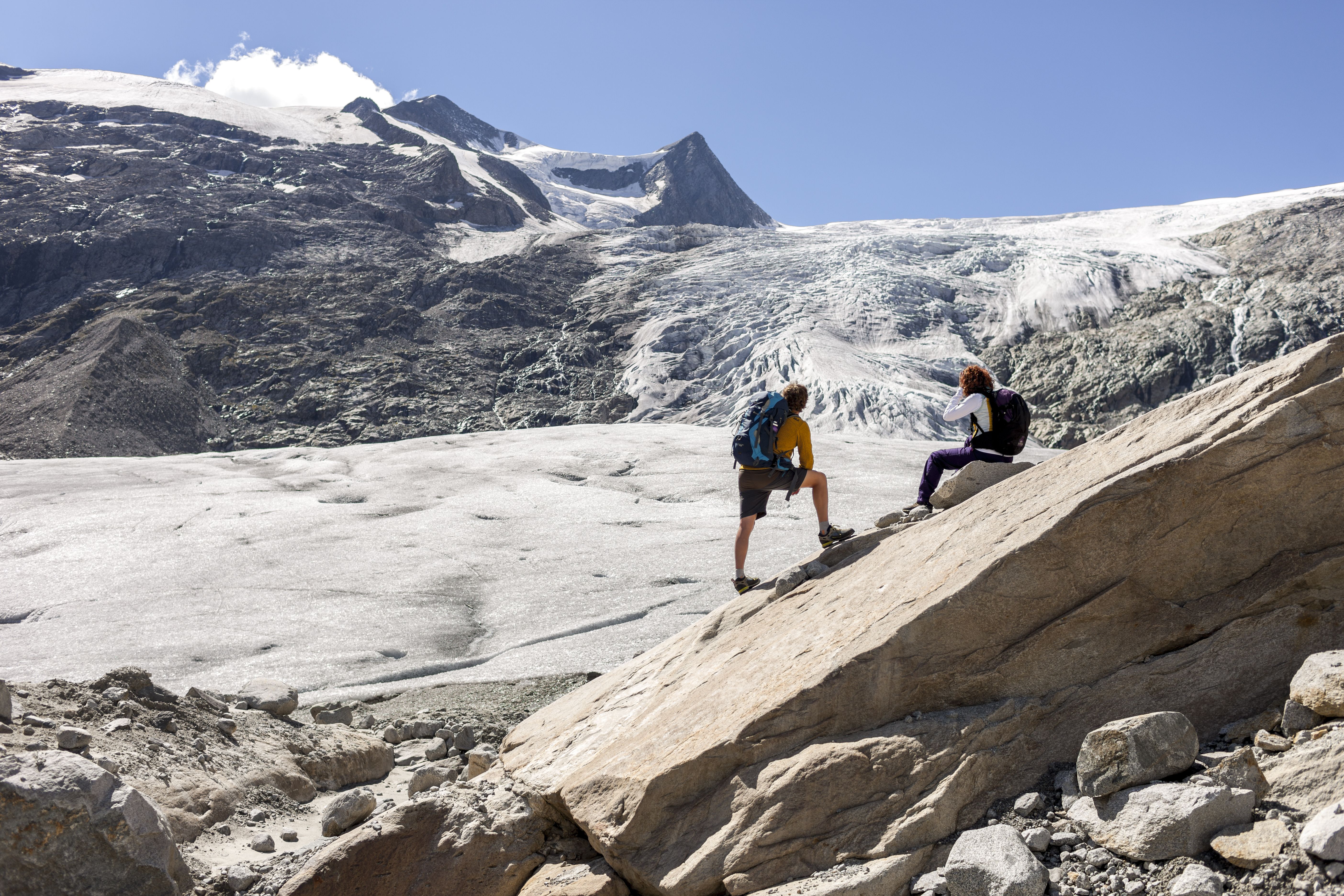

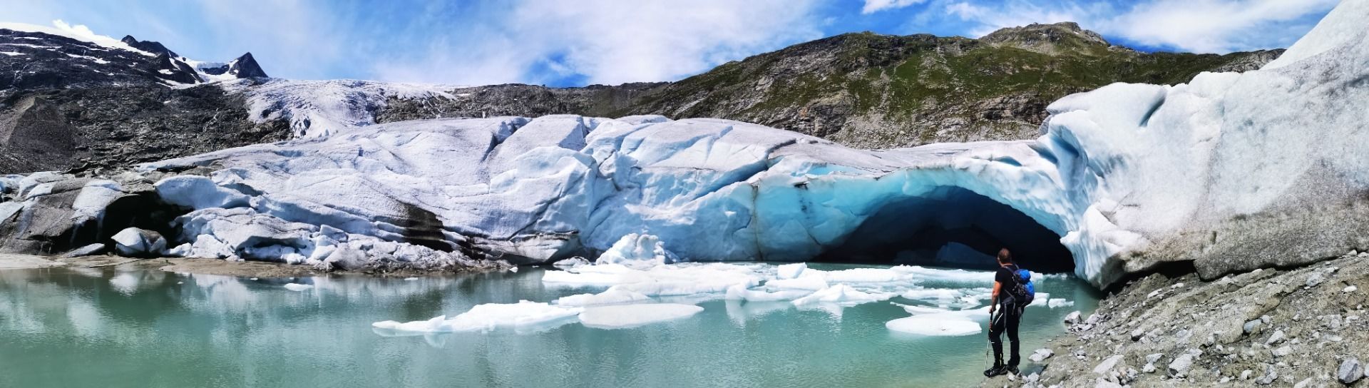
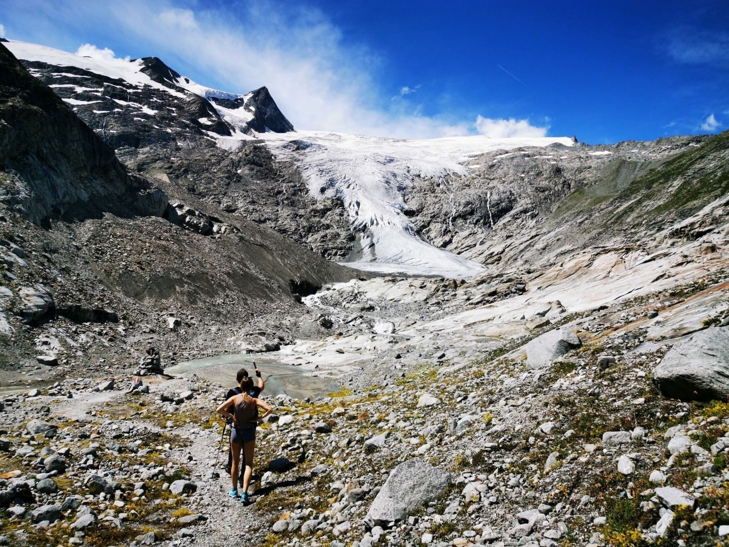


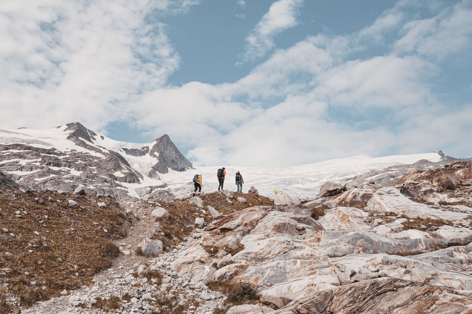
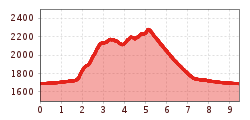
The Innergschlöss glacier trail takes visitors right into the centre of the “eternal ice” in the core zone of the national park "Naionalpark Hohe Tauern". You have to start your trip at the Matrei Tauernhaus in Matrei in Osttirol. It is possible to take the "local train Gschlösser Panoramazug", take a taxi or walk in the direction of the most beautiful valley head of the Eastern Alps - the Gschlösstal. The glacier trail starts at the valley head on the left side of the mountain with an ascent of approx. 500 metres.
After this ascent, you will first reach the lake "Salzbodensee". Continue to the so-called "Auge Gottes" and finally to the glacier snout of the Schalatenkees at the foot of the Großvenediger. You will be provided with exciting insights on the glacier trail into the landscape-forming force of the glaciers in the alps and be able to enjoy the change in climate and receding glaciers close up.
Car park Matreier Tauernhaus


.jpg")


.jpg")


")


