
Opening hours:Open today
Place:Pertisau am Achensee
:Restaurant, Alpine pasture / hut / mountain restaurant:Breakfast, vegetarian, vegan
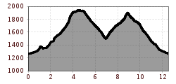
Gramai Alm - Lamsenjochhütte - Binsalm - Binssattel - Gramai Hochleger - Gramai Alm
From the Gramai Alm, walk in the direction of the Lamsenjochhütte. Before you reach the mountain hut, turn right and follow the signpost “Binsalm”. From the Binsalm at 1,502 meters, the path leads back over the Binssattel (1,900 meters) to the Gramai Hochleger (1,756 meters, serviced) and finally to the starting point of the Gramai Alm. Allow about 3 hours walking time for the way back.
By regional bus (lines 8332 or 390) to the toll station at the entrance to the Karwendel valleys in Pertisau (get off at the "Pertisau Karwendeltäler" stop), change to the vintage bus to the Gramai Alm (service suspended since August 2025). View timetable and contact.
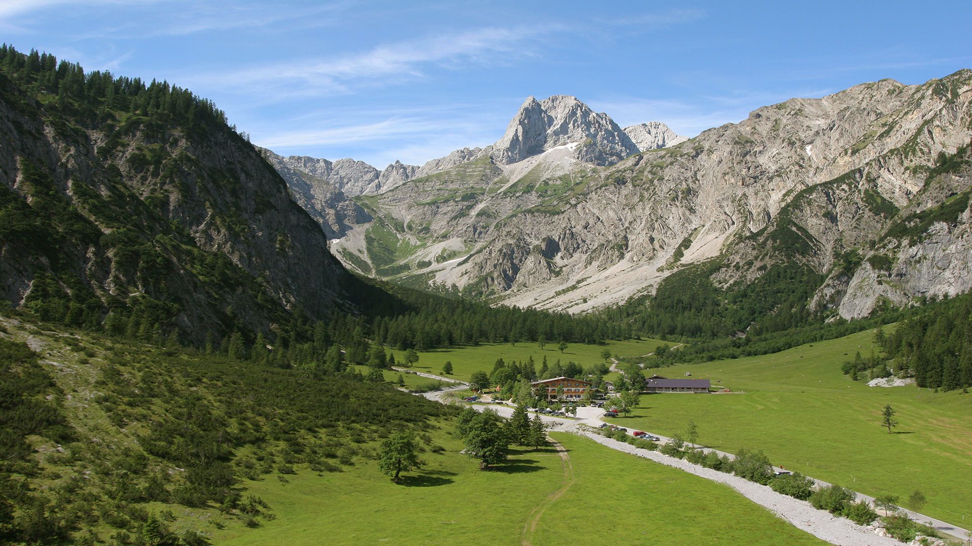
Car park at the Gramai Alm


.jpg")


.jpg")
_FULL12.jpg")


 TVB Kitzbüheler Alpen-Brixental (7).jpg")


 neu.jpg")

