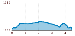
Open interactive mapOpen this POI on the interactive mapElevation profileHäselgehr - Schönau Runde.gpx
Lasörling altitude trailDifficulty: medium Length: 57.0 km Duration: 25:00 h Elevation uphill: 3,740 m See trailSee trail: Lasörling altitude trail
FigerhornDifficulty: difficult Length: 6.5 km Duration: 6:00 h Elevation uphill: 807 m See trailSee trail: Figerhorn
The sunny plateau circuitDifficulty: easy Length: 33.0 km Duration: 8:00 h Elevation uphill: 740 m See trailSee trail: The sunny plateau circuit
Bergdoktor-Winter Hiking TrailDifficulty: easy Length: 2.1 km Duration: 0:45 h Elevation uphill: 40 m See trailSee trail: Bergdoktor-Winter Hiking Trail
St. Sigmund - Pforzheimer Hütte mountain hut (145)Difficulty: medium Length: 14.1 km Duration: 5:00 h Elevation uphill: 781 m See trailSee trail: St. Sigmund - Pforzheimer Hütte mountain hut (145)
Hochfügen - Kleiner Gilfert (2388m) Walk no. 27Difficulty: medium Length: 14.4 km Duration: 6:00 h Elevation uphill: 925 m See trailSee trail: Hochfügen - Kleiner Gilfert (2388m) Walk no. 27
Along the Goetheweg trail to thePfeishütte mountain hutDifficulty: difficult Length: 5.2 km Duration: 5:00 h Elevation uphill: 344 m See trailSee trail: Along the Goetheweg trail to thePfeishütte mountain hut
At the foot of Fleischbank and TotenkirchlDifficulty: easy Length: 9.3 km Duration: 3:00 h Elevation uphill: 250 m See trailSee trail: At the foot of Fleischbank and Totenkirchl
Venediger altitude trailDifficulty: difficult Length: 55.5 km Duration: 27:00 h Elevation uphill: 3,915 m See trailSee trail: Venediger altitude trail
Kaunergrat Circular Route - 7 DaysDifficulty: difficult Length: 66.4 km Duration: 7 days Elevation uphill: 5,496 m See trailSee trail: Kaunergrat Circular Route - 7 Days
Herz-Ass VillgratentalDifficulty: medium Length: 76.0 km Duration: 34:00 h Elevation uphill: 5,750 m See trailSee trail: Herz-Ass Villgratental
Zams - Württemberger HausDifficulty: medium Length: 10.1 km Duration: 11:20 h Elevation uphill: 1,554 m See trailSee trail: Zams - Württemberger Haus
Suspension bridge to Maria Locherboden pilgrimage churchDifficulty: medium Length: 8.5 km Duration: 3:00 h Elevation uphill: 370 m See trailSee trail: Suspension bridge to Maria Locherboden pilgrimage church
The Zirbenweg trailDifficulty: easy Length: 7.0 km Duration: 2:30 h Elevation uphill: 200 m See trailSee trail: The Zirbenweg trail
Karwendelmarsch 52 kmDifficulty: difficult Length: 52.0 km Duration: 19:00 h Elevation uphill: 2,281 m See trailSee trail: Karwendelmarsch 52 km
Kaunergrat Circular Route - 3 DaysDifficulty: difficult Length: 22.8 km Duration: 3 days Elevation uphill: 2,650 m See trailSee trail: Kaunergrat Circular Route - 3 Days
Carnic altitude trail. Stage 3: Obstansersee Hütte – PorzehütteDifficulty: medium Length: 11.3 km Duration: 6:00 h Elevation uphill: 650 m See trailSee trail: Carnic altitude trail. Stage 3: Obstansersee Hütte – Porzehütte
Carnic altitude trail. Stage 1: Arnbach - Sillianer HütteDifficulty: easy Length: 9.5 km Elevation uphill: 1,350 m See trailSee trail: Carnic altitude trail. Stage 1: Arnbach - Sillianer Hütte
Carnic altitude trail. Stage 2: Sillianer Hütte- Obstansersee HütteDifficulty: medium Length: 8.7 km Elevation uphill: 503 m See trailSee trail: Carnic altitude trail. Stage 2: Sillianer Hütte- Obstansersee Hütte
Mountain Hike to the WedelhütteDifficulty: medium Length: 3.0 km Duration: 3:00 h Elevation uphill: 490 m See trailSee trail: Mountain Hike to the Wedelhütte
Foodie TrailDifficulty: easy Length: 3.0 km Duration: 1:39 h Elevation uphill: 210 m See trailSee trail: Foodie Trail
Mountain station Spieljochbahn - Hochfügen Difficulty: medium Length: 12.2 km Duration: 4:00 h Elevation uphill: 270 m See trailSee trail: Mountain station Spieljochbahn - Hochfügen
Hamberg (2095m) from the Gasthof Almluft (Trail No. 37)Difficulty: medium Length: 9.4 km Duration: 4:45 h Elevation uphill: 865 m See trailSee trail: Hamberg (2095m) from the Gasthof Almluft (Trail No. 37)
KarwendeltourDifficulty: medium Length: 42.1 km Duration: 14:00 h Elevation uphill: 1,924 m See trailSee trail: Karwendeltour
Hölltal - Trail of the Senses - Bschlaber HöhenwegDifficulty: medium Length: 7.4 km Duration: 2:45 h Elevation uphill: 315 m See trailSee trail: Hölltal - Trail of the Senses - Bschlaber Höhenweg
Give feedback for a chance to win a special holiday experience!Click here for the surveyClick here for the survey

")


")
 Mirja Geh (26).jpg")


Manfred Pfister.jpg")
.jpg")


