High Trail Trophy Power Trail

Wildschönau / Kitzbüheler Alpen
Difficulty ratings: medium
Route length: 19.7 km
Duration: 3:00 h

20-kilometer trail run along the Wildschönau High Trail

Tour information

  • Requirement: medium
  • Length: 19.7 km
  • Duration: 3:00 h
  • Elevation uphill:1,010 hm
  • Elevation downhill:1,300 hm
Highest point1,989 m

Starting point

Markbachjochbahn mountain station, Niederau

Finishing point

Schönangeralm, Auffach
  • Fitness level 4 / 6
  • Technique 3 / 6

Best time of year

  • January
  • February
  • March
  • April
  • May
  • June
  • July
  • August
  • September
  • October
  • November
  • December

Equipment

Participants must carry complete safety equipment. Equipment will be checked at random at the start.

  • Folding cup or soft flask with a total capacity of 1 liter
  • Backpack or run belt
  • Gels & bars labeled with your start number
  • Fully charged cell phone (always switched on)
  • Start number
  • Emergency blanket
  • First aid kit
  • Rain jacket with hood (minimum 10k water column recommended)
  • Long overtrousers/running pants or leg warmers
Source: TVB Wildschönau

Description

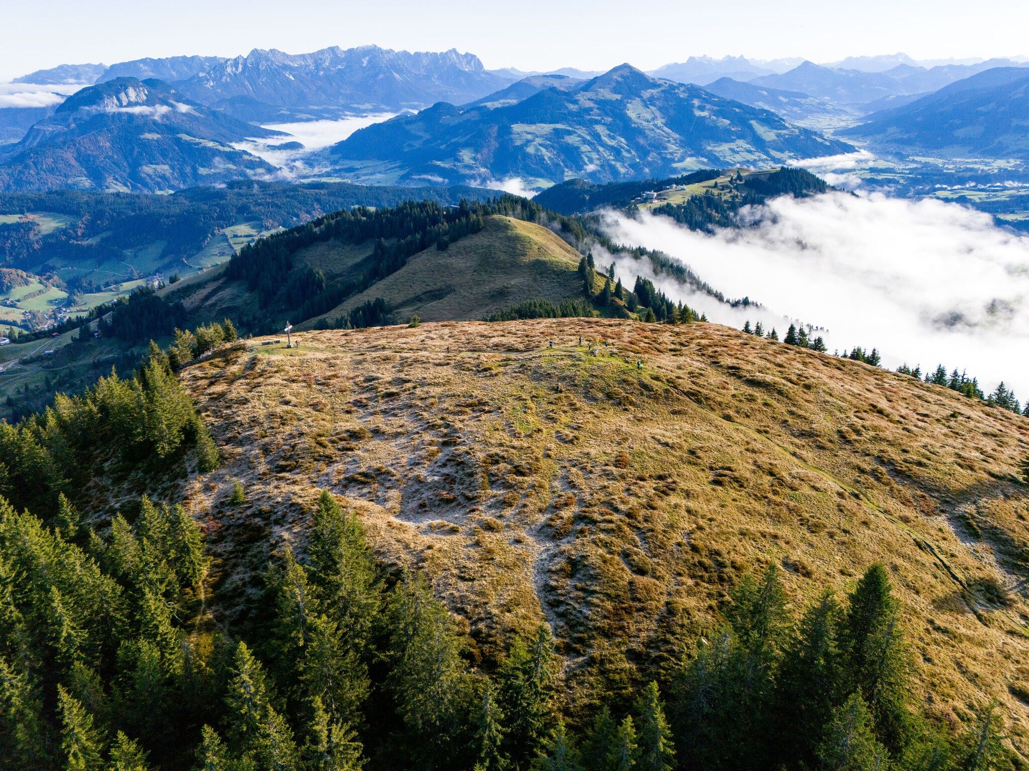
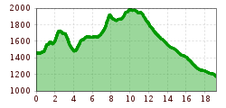
The Power Trail starts at the Markbachjochbahn mountain station in Niederau. It continues over the following peaks:

  • Rosskopf
  • Feldalphorn
  • Schwaigberghorn
  • Breiteggern
  • Breiteggspitze
Via the Siedljoch at the end of the Wildschönau valley, it leads to the destination, the Schönangeralm.

Getting here

  • Parking

    There is ample parking available at the Markbachjochbahn valley station.

    Address:

    Dorfstraße, Niederau 91a
    6314 Wildschönau
    Tyrol

More tours in the surrounding area

  • Breitegg tour

    Difficulty: medium
    Length: 11.0 km Duration: 5:00 h Elevation uphill: 680 m
  • Kundl Gorge

    Opening hours: closed
    Difficulty: easy
    Length: 6.5 km Duration: 3:00 h Elevation uphill: 10 m
  • The Wildschönau High Trail

    Difficulty: medium
    Length: 14.8 km Duration: 6:30 h Elevation uphill: 760 m
  • Winter walk Schönanger

    Difficulty: easy
    Length: 3.6 km Duration: 1:00 h Elevation uphill: 80 m
  • Schatzberg and Joel Spitze

    Difficulty: medium
    Length: 7.3 km Duration: 3:00 h Elevation uphill: 400 m
Newsletter

The mountain is calling? So does our newsletter!

In our monthly newsletter we reveal the best holiday tips for Tyrol.