Mountain hikes hike Kleine Salve to KRAFTalm

Hopfgarten im Brixental /
Difficulty ratings: medium
Route length: 2.3 km
Duration: 0:45 h

A leisurely family hike from the Salvistabahn mountain station to the KRAFTalm at the middle station, where a playground and culinary delights invite you to linger. 

Tour information

  • Requirement: medium
  • Length: 2.3 km
  • Duration: 0:45 h
  • Elevation uphill:0 hm
  • Elevation downhill:207 hm

Starting point

Bergstation Salvistabahn

Finishing point

KRAFTalm
  • Fitness level 2 / 6
  • Technique 2 / 6

Features

  • suitable for pushchairs

Best time of year

  • January
  • February
  • March
  • April
  • May
  • June
  • July
  • August
  • September
  • October
  • November
  • December

Trail condition

Forest road, mountain paths 

Equipment

outdoor clothing
Sturdy shoes
sufficient water and snacks
first-aid kit
fully charged mobile phone incl. charger hiking map & guide literature probably gps device or gps data on mobile phone
sun protection (sunglasses, sunscreen, hat)
rainwear
cash
Source: Kitzbüheler Alpen Management GmbH

Description

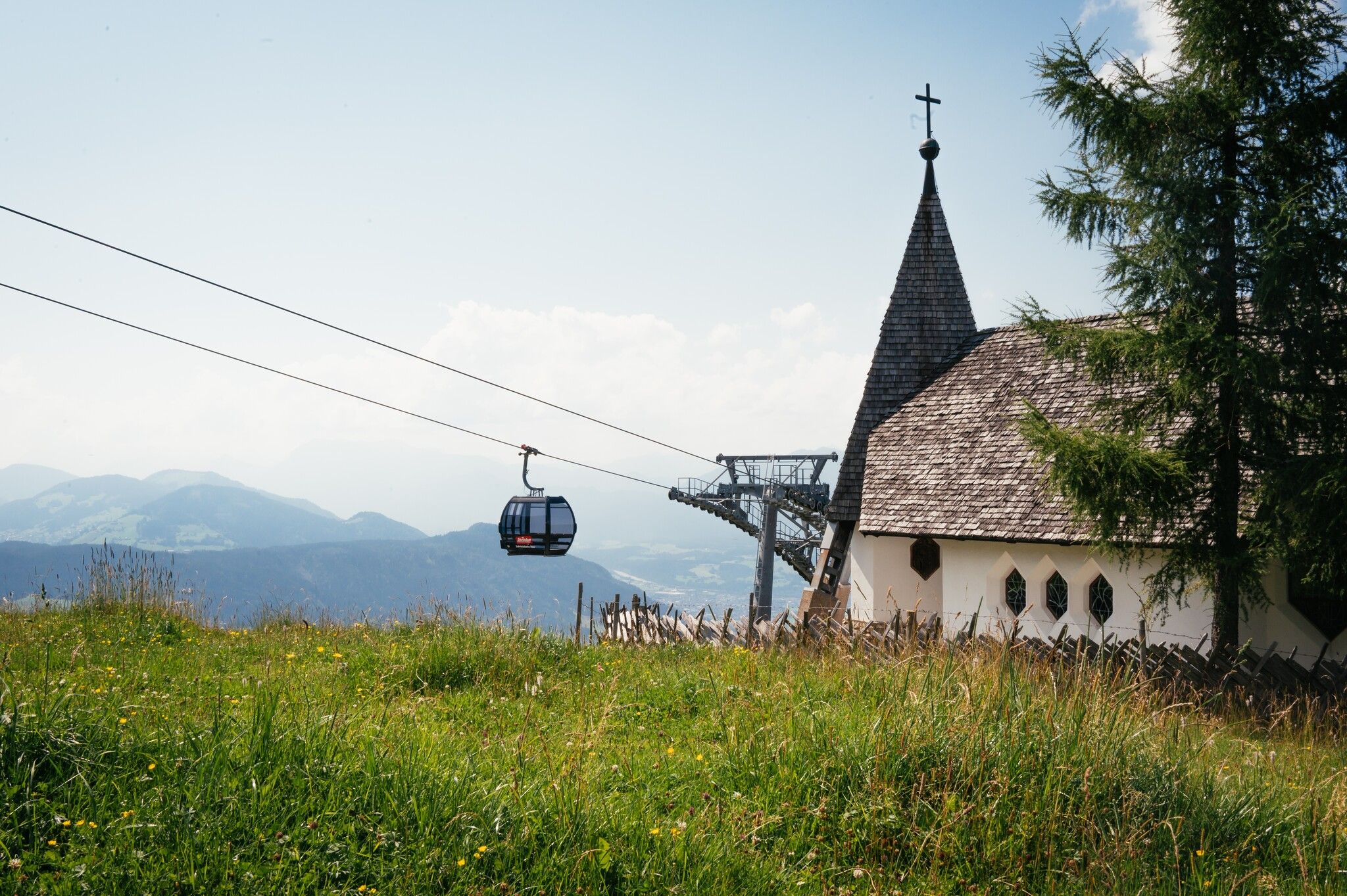
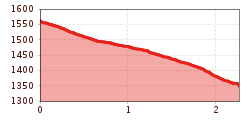
The starting point for this family-friendly hike is the mountain station of the Salvista cable car in Itter. The forest path (no. 70) leads through the forest and over a few bends down to the KRAFTalm. There you will find a playhouse for the little hikers and a refreshment stop at the KRAFTalm. The Salvista cable car takes you back down to the valley from the middle station. 

Getting here

  • Arrival by public transport

    bus: Salvistabahn Itter

    Guest card of the region = train ticket from Kirchbichl to Hochfilzen + bus ticket from Mariastein to Kitzbühel included!
     
    More detailed information: www.hohe-salve.com/mobility

  • Parking

    Lift car park 

More tours in the surrounding area

  • Schafsiedel

    Difficulty:medium
    Length:15.6 kmDuration:6:45 hElevation uphill:1,280 m
  • KAT WALK FAMILY

    Difficulty:medium
    Length:52.5 kmDuration:4 daysElevation uphill:3,390 m
  • KAT WALK COMPACT

    Difficulty:medium
    Length:83.0 kmDuration:5 daysElevation uphill:5,462 m
  • 2nd stage KAT Walk Alpine

    Difficulty:medium
    Length:18.0 kmDuration:8:00 hElevation uphill:1,140 m
  • 1st stage KAT Walk Alpine

    Difficulty:medium
    Length:20.0 kmDuration:6:00 hElevation uphill:800 m
  • 1st stage KAT Walk Family

    Difficulty:medium
    Length:10.0 kmDuration:5:30 hElevation uphill:700 m
Newsletter

The mountain is calling? So does our newsletter!

In our monthly newsletter we reveal the best holiday tips for Tyrol.