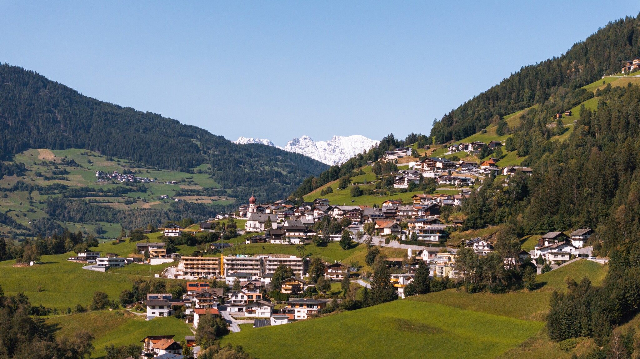
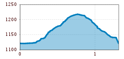
Open interactive mapOpen this POI on the interactive mapElevation profileDownloadHike to the Bichl Chapel.gpx
DescriptionAt the first turning for the Hochzeiger Mountain Lifts the path on the right leads to the Gotthardbühel.
Hotel zum Lammwirt © Hotel zum Lammwirt Hotel zum LammwirtOpening hours:Open todayPlace:Jerzens:Restaurant, Tavernsee restaurant detailssee restaurant details: Hotel zum Lammwirt
Café Restaurant Zirm4 © Café Restaurant Zirm Café Restaurant Zirm JerzensOpening hours:Open todayPlace:Jerzens:Restaurant, cafésee restaurant detailssee restaurant details: Café Restaurant Zirm Jerzens
Pitzloch.JPG © Pitzloch Restaurant PitzlochOpening hours:Open todayPlace:Jerzens:Restaurant, cafésee restaurant detailssee restaurant details: Restaurant Pitzloch
Putzen-Alm © TVB St. Anton am Arlberg Patrick Bätz St. Anton - PutzenalpeDifficulty:mediumLength:10.8 kmDuration:4:00 hElevation uphill:605 mSee trailSee trail: St. Anton - Putzenalpe
Evening winter hike Kleinmutzkopf, NaudersDifficulty:easyLength:6.0 kmDuration:2:00 hElevation uphill:70 mGo to winter hikeGo to winter hike: Evening winter hike Kleinmutzkopf, Nauders
Muttereralm - Saile (Nockspitze)Difficulty:difficultLength:7.5 kmDuration:4:00 hElevation uphill:789 mSee trailSee trail: Muttereralm - Saile (Nockspitze)
GenießerRundWeg am Ahorn © Christian Lorenz Circular & themed hike: "GenießerRundWeg" at Mount AhornDifficulty:easyLength:2.0 kmDuration:0:45 hElevation uphill:70 mSee trailSee trail: Circular & themed hike: "GenießerRundWeg" at Mount Ahorn
Herrlicher Ausblick © Lechtal Tourismus PanoramawegDifficulty:mediumLength:6.6 kmDuration:3:00 hElevation uphill:470 mSee trailSee trail: Panoramaweg
Ackernalm Hütte Sommer © Gipfelfieber/Andreas Gruhle Up to Hinteres SonnwendjochDifficulty:mediumLength:10.9 kmElevation uphill:848 mSee trailSee trail: Up to Hinteres Sonnwendjoch
The WiegalmDifficulty:mediumLength:10.5 kmDuration:4:45 hElevation uphill:680 mSee trailSee trail: The Wiegalm
Winter walk Schwarzer See, NaudersDifficulty:easyLength:10.5 kmDuration:3:30 hElevation uphill:255 mGo to winter hikeGo to winter hike: Winter walk Schwarzer See, Nauders
large-Weg-der-Sinne-Pfafflar-5.jpg © Raimund Krabacher Hölltal - Trail of the Senses - Bschlaber HöhenwegDifficulty:mediumLength:7.4 kmDuration:2:45 hElevation uphill:315 mSee trailSee trail: Hölltal - Trail of the Senses - Bschlaber Höhenweg
Wandern Bettlersteig Kaistertal Naturerlebnis Kaisergebirge © Thomas Laukat Kaiserlift Tourentipp 5: From Brentenjoch into the Kaiser ValleyDifficulty:difficultLength:17.6 kmElevation uphill:425 mSee trailSee trail: Kaiserlift Tourentipp 5: From Brentenjoch into the Kaiser Valley
Rundwanderung um den PlanseeDifficulty:mediumLength:14.6 kmDuration:3:30 hElevation uphill:85 mSee trailSee trail: Rundwanderung um den Plansee
Hermann v. Barth Hütte © Lechtal Tourismus Elbigenalp - Hermann v. Barth HütteDifficulty:mediumLength:6.7 kmDuration:3:50 hElevation uphill:1,062 mSee trailSee trail: Elbigenalp - Hermann v. Barth Hütte
Horn-Gipfel-Höhenweg auf der Kitzbüheler Seite © Mirja Geh Kitzbüheler Horn via Horn-Gipfel-HöhenwegDifficulty:mediumLength:5.0 kmDuration:3:00 hElevation uphill:455 mSee trailSee trail: Kitzbüheler Horn via Horn-Gipfel-Höhenweg
sunnenseiten-weg-stubai-contwise-02.jpg © Andre Schönherr Sunnenseit'n Weg: Round tourDifficulty:mediumLength:8.2 kmDuration:3:00 hElevation uphill:400 mSee trailSee trail: Sunnenseit'n Weg: Round tour
Wanderung am Schlegeis mit Blick auf dem Stausee © Archiv TVB Mayrhofen Summit hike: Ginzling Schlegeis reservoir - Hoher RifflerDifficulty:difficultLength:17.0 kmDuration:7:30 hElevation uphill:1,500 mSee trailSee trail: Summit hike: Ginzling Schlegeis reservoir - Hoher Riffler
2018-Wandern-Bergsteigen-Tarrenz-Sinnesbrunn-Alpleskopf-web-©Rudi Wyhlidal (60).jpg © Rudi Wyhlidal / WEST - Kollreider falscher KogelDifficulty:difficultLength:1.7 kmDuration:2:30 hElevation uphill:364 mSee trailSee trail: falscher Kogel
Wildtierweg Fuchs.jpg © © Serfaus-Fiss-Ladis Marketing GmbH Wild Animals TrailOpening hours:openDifficulty:easySee trailSee trail: Wild Animals Trail
Leutkircher-Hütte © Lechtal Tourismus Lechtaler Höhenweg 1st stage: Stuttgarter Hütte-Leutkircher HütteDifficulty:difficultLength:6.6 kmDuration:3:15 hElevation uphill:469 mSee trailSee trail: Lechtaler Höhenweg 1st stage: Stuttgarter Hütte-Leutkircher Hütte
Hütte.jpg © (c) Serfaus-Fiss-Ladis Marketing GmbH_Andreas Kirschner Panorama - GenusswegOpening hours:openDifficulty:easyLength:1.1 kmDuration:1:15 hElevation uphill:282 mSee trailSee trail: Panorama - Genussweg
Round hike to Padauner KogelDifficulty:mediumLength:12.0 kmDuration:5:00 hElevation uphill:936 mSee trailSee trail: Round hike to Padauner Kogel
Geraerhütte_JohannesBitter_TVB-Wipptal_170623_105.jpg © JOHANNES BITTER Hike to the Geraer Hütte | Austrian TyrolDifficulty:mediumLength:7.0 kmDuration:5:30 hElevation uphill:1,000 mSee trailSee trail: Hike to the Geraer Hütte | Austrian Tyrol
valentinkapelle-1.jpg © Archiv TVB Mayrhofen Mountain hike: Zillergrund - Valentins KapelleDifficulty:mediumLength:3.2 kmDuration:2:30 hElevation uphill:390 mSee trailSee trail: Mountain hike: Zillergrund - Valentins Kapelle
Lämmerbichl_Tirol Werbung_Sürth Paul_Tux-Hintertux.jpg © Sürth Paul Spring with late crocus blossom in Tux ValleyDifficulty:mediumLength:10.0 kmDuration:4:00 hElevation uphill:640 mSee trailSee trail: Spring with late crocus blossom in Tux Valley
Barrierefreier Themenweg am Schlosskopf © Inn-Frame Fotografie www.inn-frame.at Barrier-free theme trail at the castle headDifficulty:easyLength:1.0 kmDuration:0:20 hElevation uphill:26 mSee trailSee trail: Barrier-free theme trail at the castle head
Kaiserbachtal (c) Sportalpen (21).jpg © ©Sportalpen Alpine Outdoor GalleryDifficulty:easyLength:6.7 kmDuration:2:00 hElevation uphill:117 mSee trailSee trail: Alpine Outdoor Gallery
Give feedback for a chance to win a special holiday experience!Click here for the surveyClick here for the survey


.jpg")
.jpg")


.jpg")


.jpg")


 Sportalpen (21).jpg")
