Mountain hikes Hike via Arzler Alm to Höttinger Alm

Difficulty ratings: medium
Route length: 10.0 km
Duration: 4:30 h

Hungerburg - Arzler Alm - Höttinger Alm

Tour information

  • Requirement: medium
  • Length: 10.0 km
  • Duration: 4:30 h
  • Elevation uphill:600 hm
  • Elevation downhill:600 hm
Highest point1,502 m

Starting point

Hungerburg mountain station

Finishing point

Höttinger Alm (1487 m)

Trail condition

Forest path/ forest road

Equipment

Wanderschuhe, Wanderkleidung
Source: Innsbruck Tourismus

Description

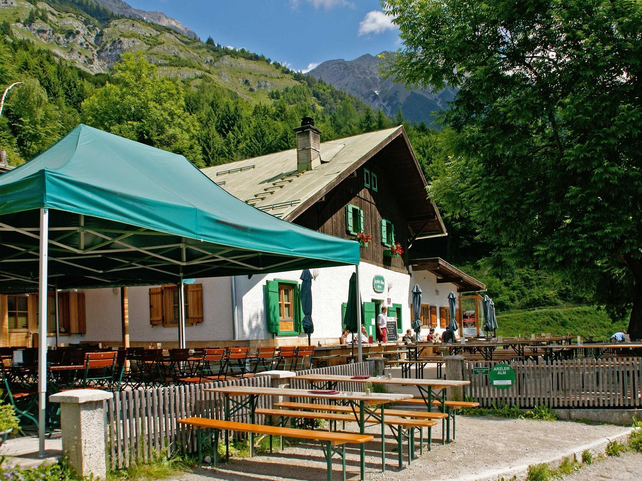
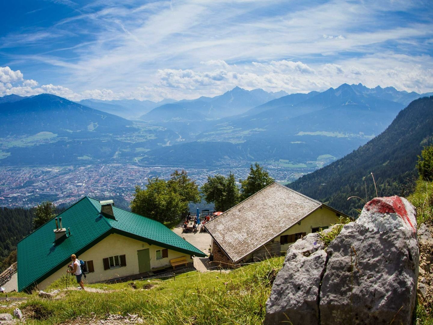
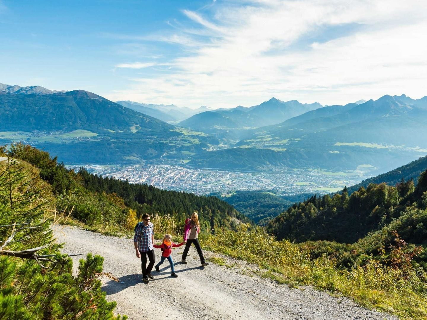
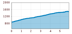
This hike starts just above the bottom station of the Nordkettenbahn cable car. Head northeast through the village for a short distance before taking the first left onto a forest trail. Shortly afterwards, the trail crosses the Rosnerweg path and continues uphill. The route leads through areas of mixed forest and various glades to the Arzler Alm mountain hut (1,067 metres). From there, continue west along the forest road until you reach the first large intersection. Turn right and follow the signs to the Höttinger Alm mountain hut (1,487 metres). This section has fantastic views of the valley below. 

Culinary tips: Both of the mountain huts offer typical local dishes and excellent Tyrolean cuisine. 

Another route option is to start from Sadrach (bus stop for the A bus) and follow the trail past the Planötzenhof restaurant, past Höttinger Bild chapel and up through the forest to the Höttinger Alm mountain hut. It is well-worth making a short stop at the Höttinger Bild pilgrimage site. This small mountain chapel is hidden deep in the forest next to a picturesque fountain. 

Nearby huts and mountain restaurants

More tours in the surrounding area

  • Lechtaler Höhenweg

    Difficulty: difficult
    Length: 84.5 km Duration: 45:00 h Elevation uphill: 6,773 m
  • Bärenkopf

    Difficulty: medium
    Length: 16.3 km Duration: 6:15 h Elevation uphill: 1,065 m
  • Guffert

    Difficulty: difficult
    Length: 10.3 km Duration: 6:30 h Elevation uphill: 1,195 m
  • Pertisau - Falzthurnalm - Gramai Alm - Pertisau

    Difficulty: easy
    Length: 14.1 km Duration: 4:30 h Elevation uphill: 280 m
  • Steinberg - Panoramarunde

    Difficulty: easy
    Length: 6.1 km Duration: 2:00 h Elevation uphill: 200 m
  • Bärenwald circuit

    Difficulty: easy
    Length: 4.8 km Duration: 1:30 h Elevation uphill: 180 m
  • Carnic altitude trail

    Difficulty: medium
    Length: 150.0 km Duration: 26:50 h Elevation uphill: 9,100 m
  • Dalfazer Falls

    Difficulty: medium
    Length: 9.2 km Duration: 4:00 h Elevation uphill: 760 m
  • Rosengartenschlucht

    Opening hours: closed
    Difficulty: easy
    Length: 4.4 km Duration: 2:30 h Elevation uphill: 282 m
  • Arzl - Benni-Raich-Bridge - Wald

    Difficulty: easy
    Length: 1.8 km Duration: 0:40 h Elevation uphill: 120 m
  • Breitegg tour

    Difficulty: medium
    Length: 11.0 km Duration: 5:00 h Elevation uphill: 680 m
Newsletter

The mountain is calling? So does our newsletter!

In our monthly newsletter we reveal the best holiday tips for Tyrol.