Mountain hikes Hiking tour to Defreggerhaus 2.964m

Prägraten am Großvenediger / Venedigergruppe
Difficulty ratings: difficult
Route length: 20.5 km
Duration: 10:30 h

Hiking tour to Defreggerhaus 2.964m

Tour information

  • Requirement: difficult
  • Length: 20.5 km
  • Duration: 10:30 h
  • Elevation uphill:1,470 hm
  • Elevation downhill:1,480 hm
Highest point2,960 m

Starting point

Parking place Wiesen

Finishing point

Parking place Wiesen
  • Fitness level 5 / 6
  • Technique 4 / 6

Best time of year

  • January
  • February
  • March
  • April
  • May
  • June
  • July
  • August
  • September
  • October
  • November
  • December
Source: TVB Osttirol

Description

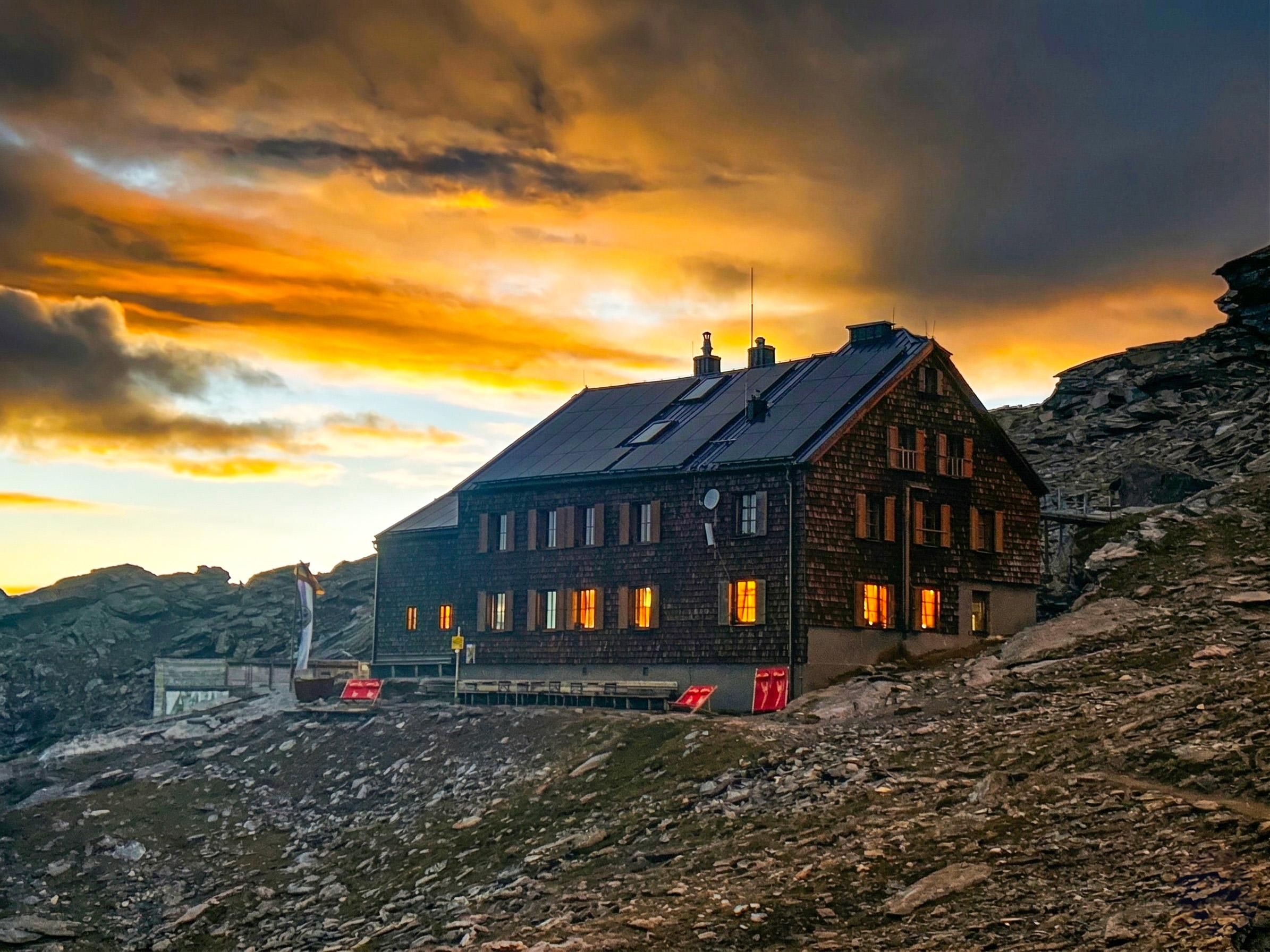
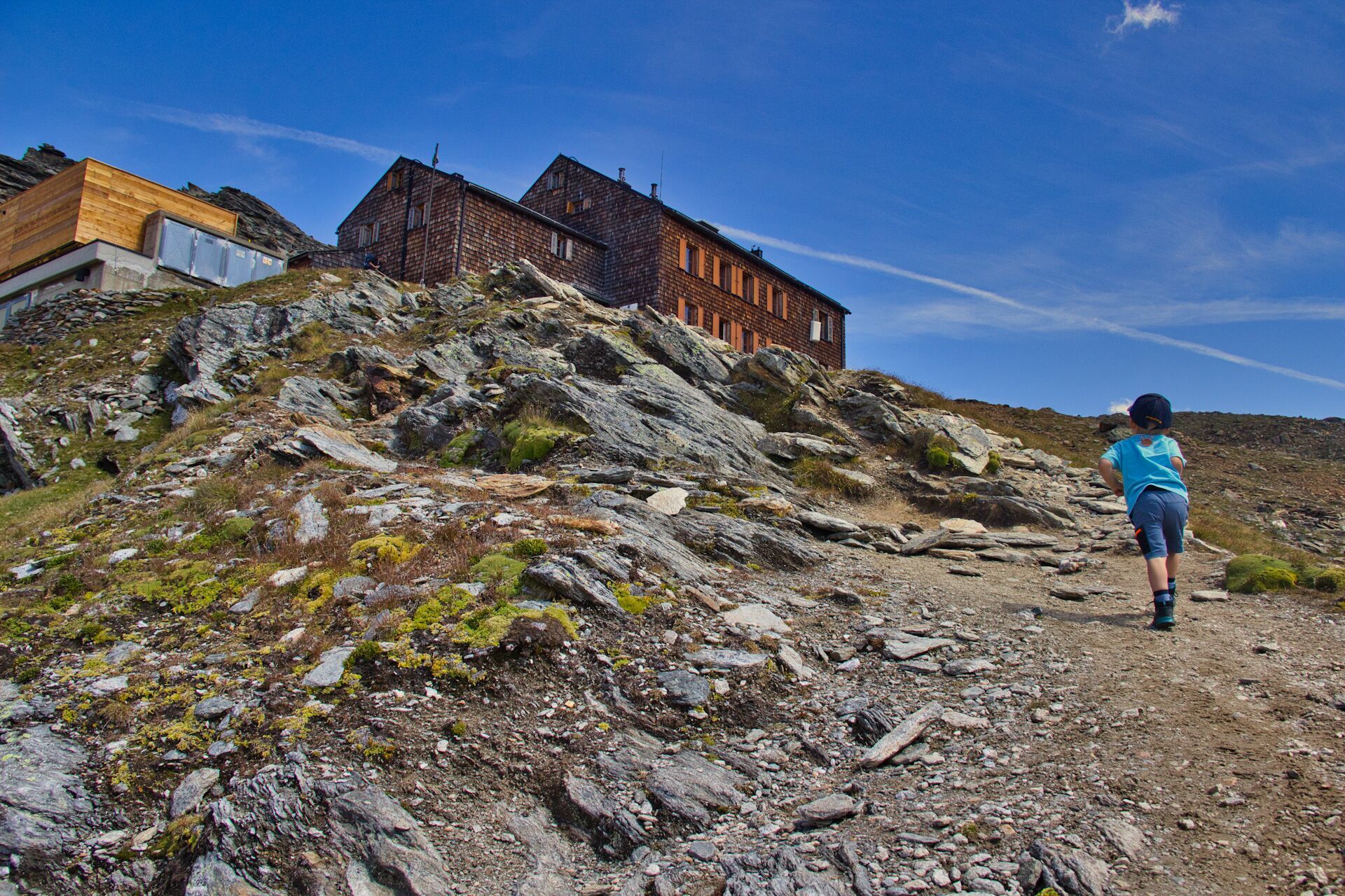
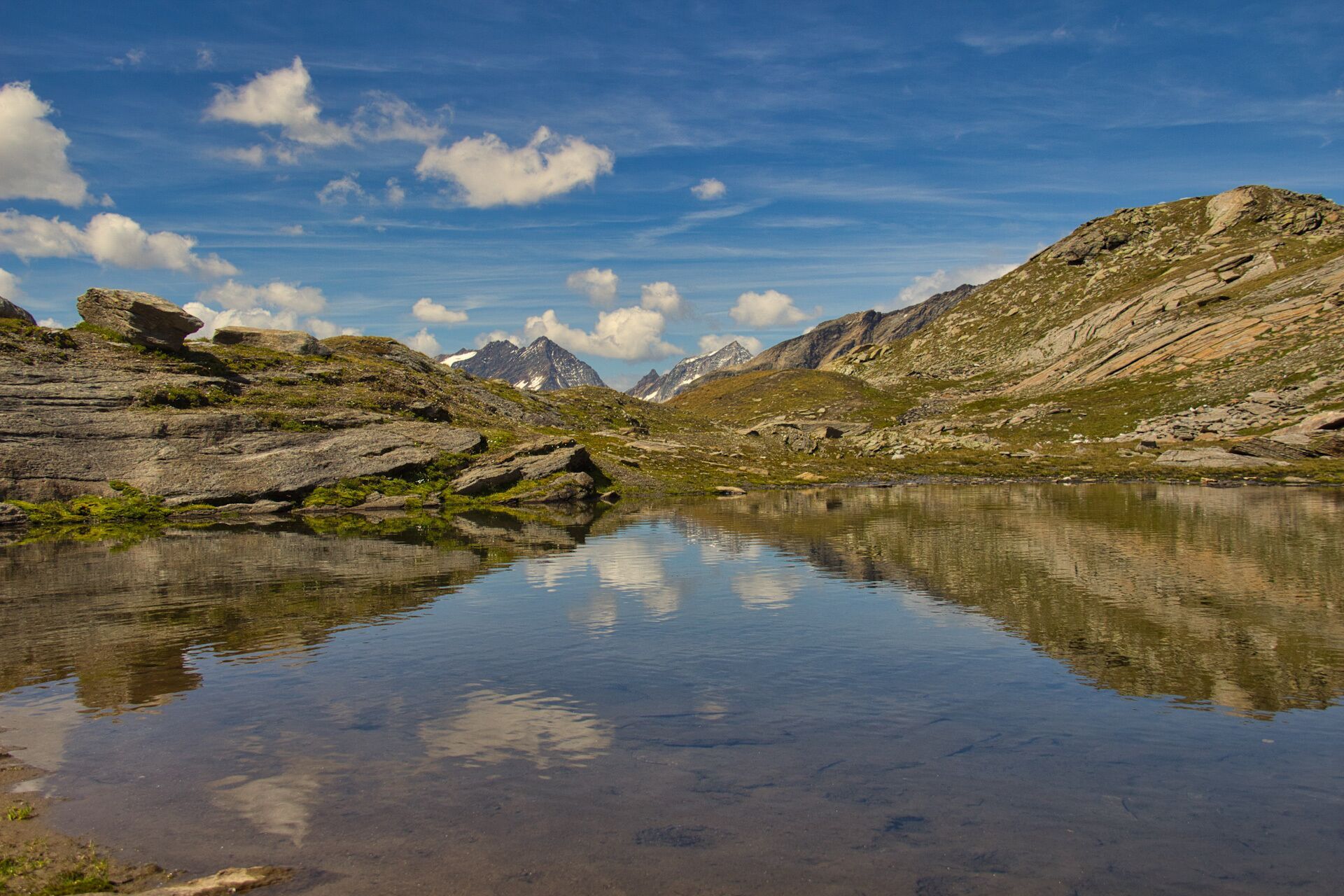
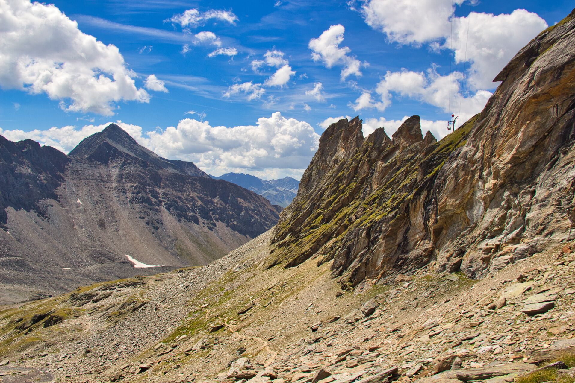
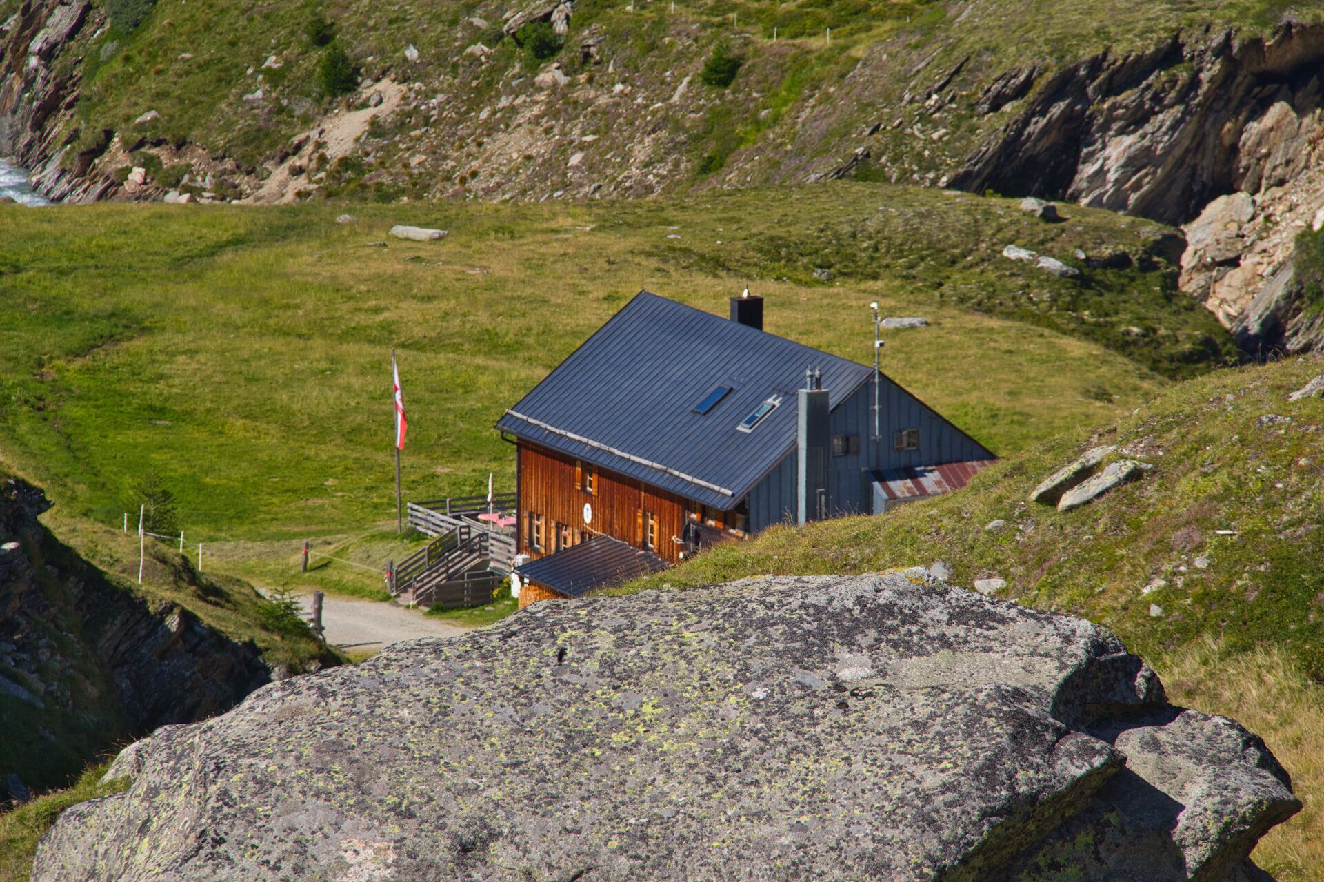
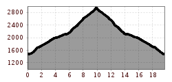
Starting point for this challenging hike is the parking place Wiesen. Here, you can either take a Hüttentaxi (taxi shuttle) to the hut Johannishütte or walk up the broad driveway for about 2.5 hours. After the Johannishütte a narrow path leads towards "Mullwitzkees" to the hut Defreggerhaus at 2.964 m. This section requires surefootedness and takes about 3 hours. The Defreggerhaus is the ideal starting point for mountain tours to the most 3.000m peaks of the moutain massif Venedigergruppe and an ideal starting point for guided tours to the Großvenediger (3.658m).

Nearby huts and mountain restaurants

Getting here

  • Arrival by public transport

    Prägraten a.G. Hinterbichl

  • Parking

    Parking place Wiesen

More tours in the surrounding area

  • Lasörling altitude trail

    Difficulty: medium
    Length: 57.0 km Duration: 25:00 h Elevation uphill: 3,740 m
  • Venediger altitude trail

    Difficulty: difficult
    Length: 55.5 km Duration: 27:00 h Elevation uphill: 3,915 m
  • Figerhorn

    Difficulty: difficult
    Length: 6.5 km Duration: 6:00 h Elevation uphill: 807 m
  • Hike to the Venedigerhaus Innergschlöß

    Difficulty: easy
    Length: 8.5 km Duration: 2:30 h Elevation uphill: 180 m
  • Rotenkogel

    Difficulty: difficult
    Length: 3.9 km Duration: 3:00 h Elevation uphill: 383 m
  • Lasörling 3.098m

    Difficulty: difficult
    Length: 21.9 km Duration: 12:00 h Elevation uphill: 1,940 m
  • Umbal waterfalls nature force trail

    Difficulty: easy
    Length: 5.8 km Duration: 2:30 h Elevation uphill: 250 m
  • Muhs panorama trail

    Difficulty: medium
    Length: 15.2 km Duration: 6:00 h Elevation uphill: 1,090 m
  • Hike to Neuen Reichenberger Hütte

    Difficulty: medium
    Length: 9.1 km Duration: 9:00 h Elevation uphill: 1,210 m
  • Hiking tour to Lasörlinghütte 2.350m

    Difficulty: medium
    Length: 14.6 km Duration: 7:10 h Elevation uphill: 1,080 m
  • Badener Hütte

    Difficulty: difficult
    Length: 23.2 km Duration: 11:30 h Elevation uphill: 1,750 m
  • Lucknerhaus - Stüdlhütte

    Difficulty: medium
    Length: 9.3 km Duration: 5:30 h Elevation uphill: 862 m
  • Hike to Kalser Tauernhaus

    Difficulty: medium
    Length: 12.2 km Duration: 4:00 h Elevation uphill: 244 m
  • Hiking tour to Neue Sajathütte 2.600m

    Difficulty: medium
    Length: 10.3 km Duration: 6:50 h Elevation uphill: 1,080 m
  • Böses Weibl

    Difficulty: difficult
    Length: 14.1 km Duration: 8:00 h Elevation uphill: 1,193 m
  • Eagle Walk Stage O1: Ströden - Johannis Hütte

    Difficulty: medium
    Length: 13.0 km Duration: 6:30 h Elevation uphill: 1,430 m
Newsletter

The mountain is calling? So does our newsletter!

In our monthly newsletter we reveal the best holiday tips for Tyrol.