Arrival by public transport
Line 4166 - Regiobus Sellraintal
Line 4196 - Regionalbus Oetz - Ochsengarten - Kühtai
Kühtai – Kraspesspitze
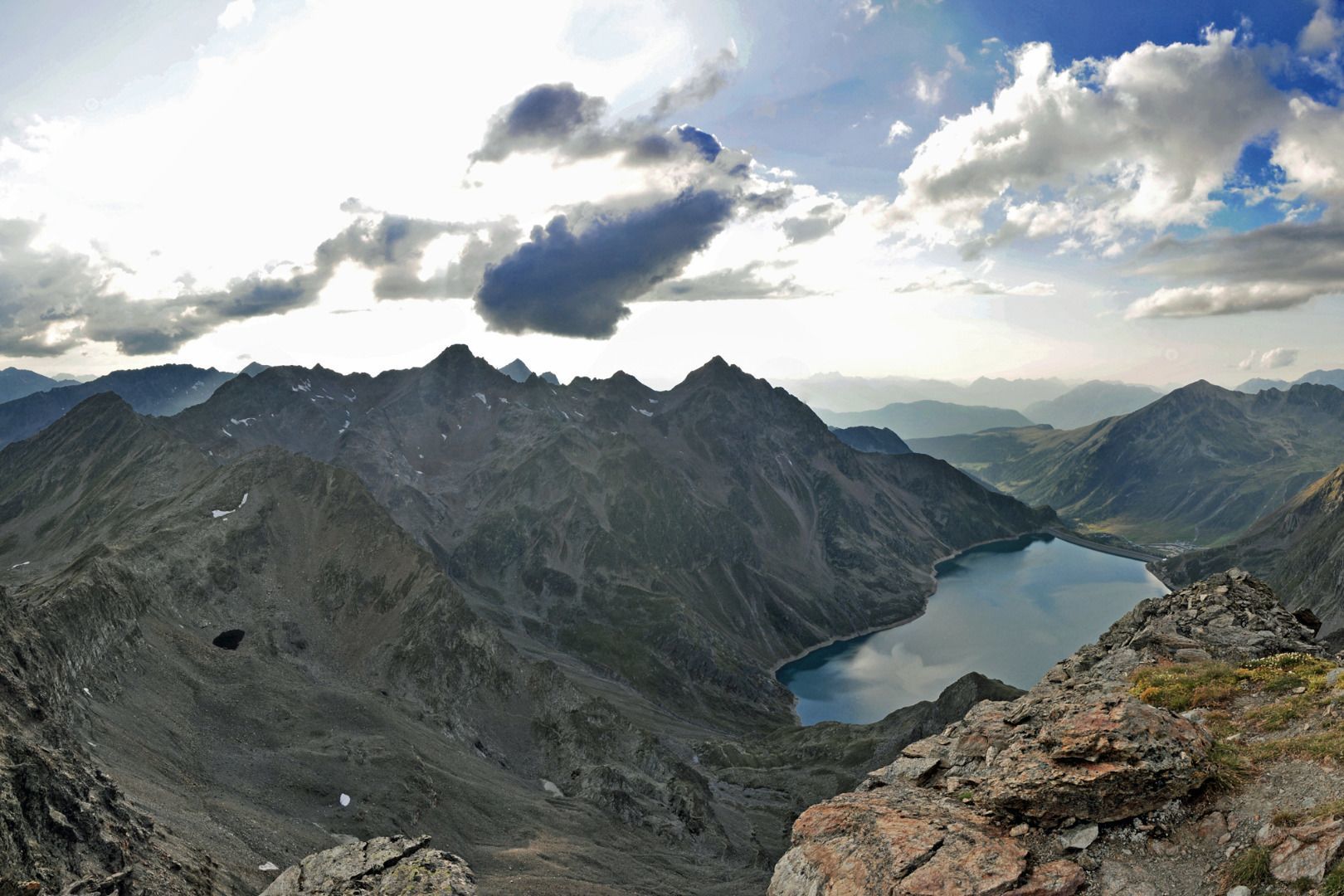
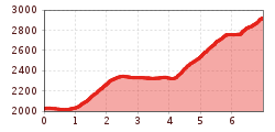
From the tourist office, you can either ascend via Wiesberg and the Drei-Seen-Hütte or past the Hotel Astoria through the Finstertal to the dam of the Finstertal reservoir.
Both routes offer wonderful views and lead through idyllic, unspoilt mountain valleys. From the dam, follow the AV146 along the reservoir to its end. The view of the lake and the surrounding mountains is particularly impressive at this point. At the start of the ascent to the Sulzkogel, the entrance to the Finstertaler Scharte (AV146) is on the left. This saddle leads to a vantage point from which you can enjoy the surrounding mountain panorama to the full.
From the saddle, the path to the Kraspesspitze, which is well marked with red dots, leads off to the left. Alternatively, instead of following this path, you can also ascend to the right to the Finstertaler Schartenkogel. This option also offers impressive views and is a worthwhile summit tour away from the main paths.
To get back to the starting point, hike back along the same route.
Line 4166 - Regiobus Sellraintal
Line 4196 - Regionalbus Oetz - Ochsengarten - Kühtai

")


")


.jpg")
.jpg")
.jpg")

 Mirja Geh (26).jpg")


