Mountain hikes Lasörling 3.098m

Virgen in Osttirol / Venedigergruppe
Difficulty ratings: difficult
Route length: 21.9 km
Duration: 12:00 h

The great guardian of the Lasörling group - even we have to gasp for air. Finally, the climb to the summit is really steep. And yes, the view of the Großvenediger, Großglockner and Dolomites perhaps does the rest.

Tour character

Striking 3,000 m peak and highest summit in the Lasörling group. An easy but long mountain trail leads from the Virgental valley to the Prägrater Törl, from there on a steep and challenging climb to the exposed summit of the Lasörling. With a distance of just under 22 km, the entire tour requires good stamina, which is why it is often broken up with an overnight stay at the Lasörlinghütte. This alpine mountain tour requires basic alpine experience, surefootedness and a head for heights, and the current weather conditions (snow conditions) must be taken into account.

Tour information

  • Requirement: difficult
  • Length: 21.9 km
  • Duration: 12:00 h
  • Elevation uphill:1,940 hm
Highest point3,098 m

Starting point

Parkplatz Lasörlinghütte

Finishing point

Lasörling 3.098m
  • Fitness level 5 / 6
  • Technique 4 / 6

Best time of year

  • January
  • February
  • March
  • April
  • May
  • June
  • July
  • August
  • September
  • October
  • November
  • December
Source: Nationalparkregion Hohe Tauern Osttirol

Description

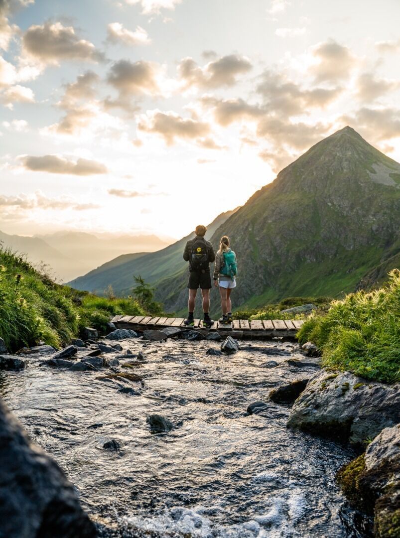
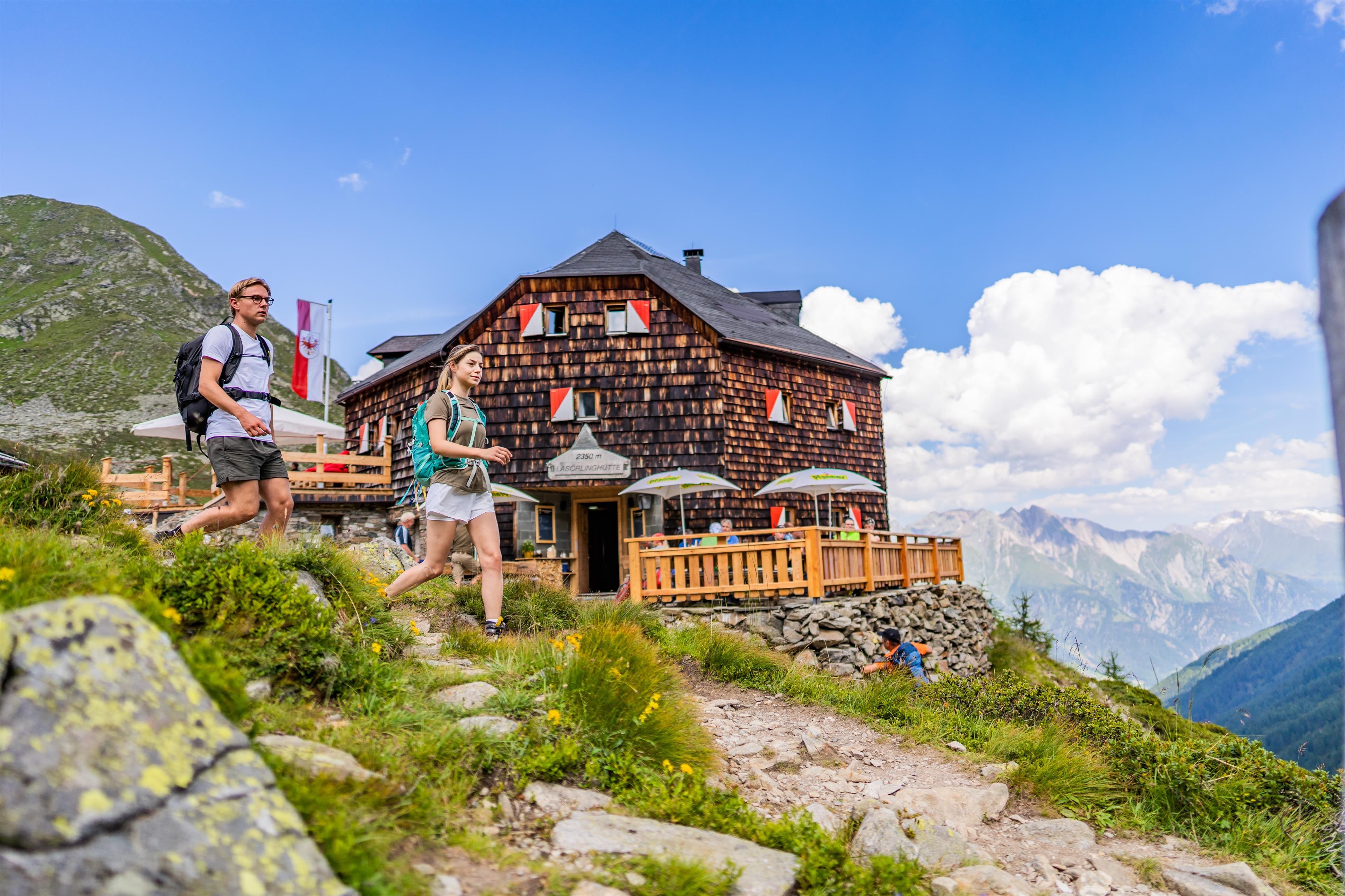
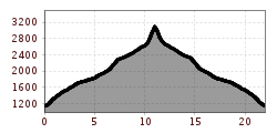
This demanding tour starts at the parking place "Lasörlinghütte" in the district Niedermauern. After the bridge, turn left and follow a moderately steep climb until reaching the wide forest path (after about 1km). At the end of the valley Mullitztal, after the goods lift of the hut Lasörlinghütte, the forest path rejoins a steep path that leads in several serpentines to the hut Lasörlinghütte. The fantastic view of the mountain range Venedigergruppe and regional delicacies invite you to take a short break. 
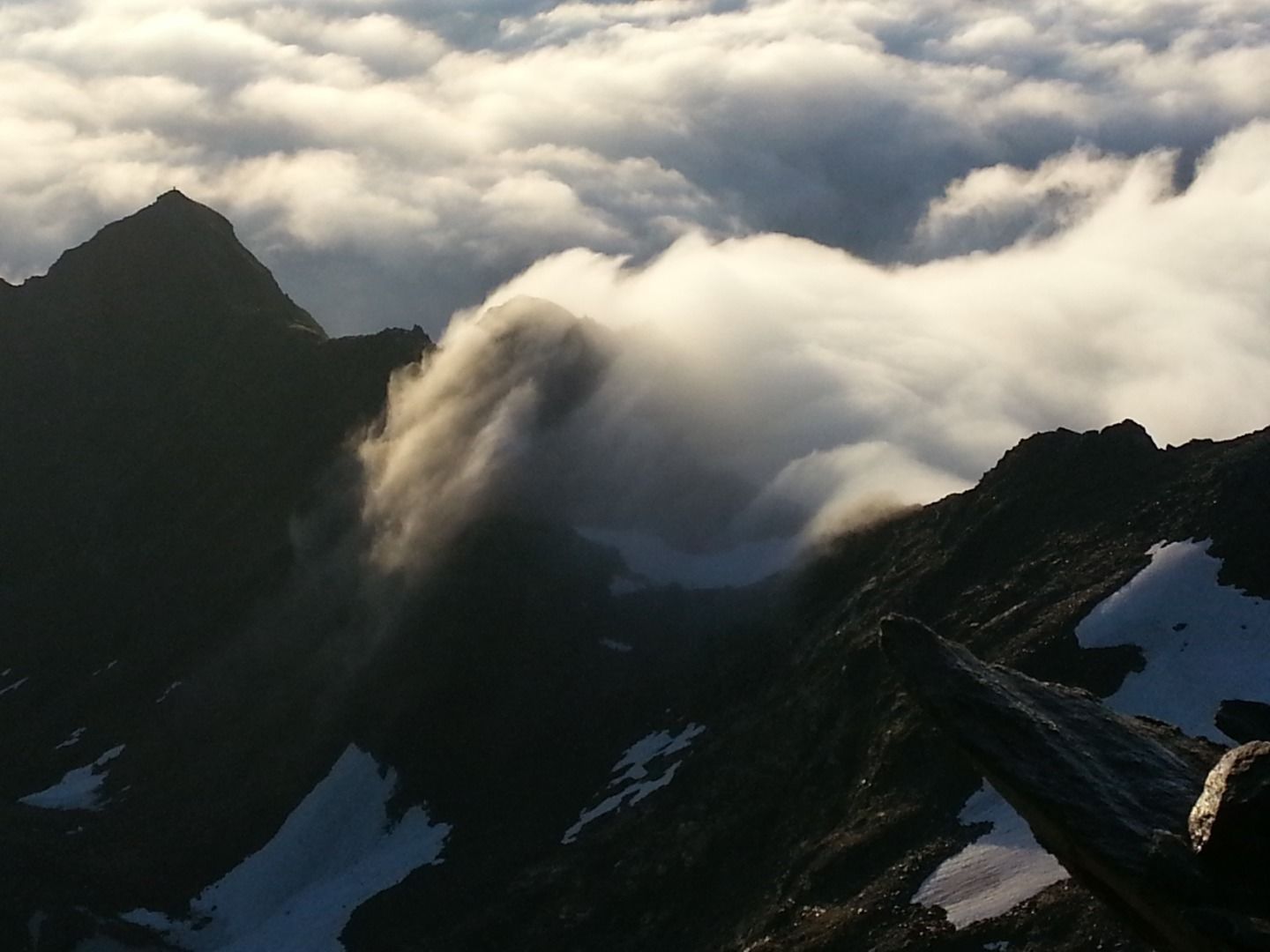
From here it takes about 3 hours to reach the summit. Follow the path Lasörling Höhenweg (No. 90) in a westerly direction. At the end of the valley, shortly before the striking ascent to the so-called Prägrater Törl, you have to turn right towards the summit Lasörling.This path leads over a scree. Continue following it and watch it become steeper and steeper. The last section leads past imposing boulders and finally ends at the summit of the Lasörling. The highest peak of the mountain range Lasörlinggruppe offers one of the best views of almost all 3.000-metre peaks in Osttirol and also of the South Tyrolean Dolomites. 

Nearby huts and mountain restaurants

More tours in the surrounding area

  • Hike to Kalser Tauernhaus

    Difficulty: medium
    Length: 12.2 km Duration: 4:00 h Elevation uphill: 244 m
  • Hiking tour to Lasörlinghütte 2.350m

    Difficulty: medium
    Length: 14.6 km Duration: 7:10 h Elevation uphill: 1,080 m
  • Badener Hütte

    Difficulty: difficult
    Length: 23.2 km Duration: 11:30 h Elevation uphill: 1,750 m
  • Lasörling altitude trail

    Difficulty: medium
    Length: 57.0 km Duration: 25:00 h Elevation uphill: 3,740 m
  • Figerhorn

    Difficulty: difficult
    Length: 6.5 km Duration: 6:00 h Elevation uphill: 807 m
  • Rotenkogel

    Difficulty: difficult
    Length: 3.9 km Duration: 3:00 h Elevation uphill: 383 m
  • Umbal waterfalls nature force trail

    Difficulty: easy
    Length: 5.8 km Duration: 2:30 h Elevation uphill: 250 m
  • Hike to Neuen Reichenberger Hütte

    Difficulty: medium
    Length: 9.1 km Duration: 9:00 h Elevation uphill: 1,210 m
  • Hiking tour to Neue Sajathütte 2.600m

    Difficulty: medium
    Length: 10.3 km Duration: 6:50 h Elevation uphill: 1,080 m
  • Lucknerhaus - Stüdlhütte

    Difficulty: medium
    Length: 9.3 km Duration: 5:30 h Elevation uphill: 862 m
  • Böses Weibl

    Difficulty: difficult
    Length: 14.1 km Duration: 8:00 h Elevation uphill: 1,193 m
  • Muhs panorama trail

    Difficulty: medium
    Length: 15.2 km Duration: 6:00 h Elevation uphill: 1,090 m
  • Venediger altitude trail

    Difficulty: difficult
    Length: 55.5 km Duration: 27:00 h Elevation uphill: 3,915 m
  • Hike to the Venedigerhaus Innergschlöß

    Difficulty: easy
    Length: 8.5 km Duration: 2:30 h Elevation uphill: 180 m
Newsletter

The mountain is calling? So does our newsletter!

In our monthly newsletter we reveal the best holiday tips for Tyrol.