Mountain hikes Pettneu - Stöcklweg - Nessleralm

Pettneu / Lechtaler Alpen
Difficulty ratings: medium
Route length: 4.5 km
Duration: 2:45 h

Pettneu - Stöcklweg - Nessleralm

Tour information

  • Requirement: medium
  • Length: 4.5 km
  • Duration: 2:45 h
  • Elevation uphill:510 hm
Highest point1,667 m

Starting point

Pettneu am Arlberg

Finishing point

Pettneu am Arlberg

Best time of year

  • January
  • February
  • March
  • April
  • May
  • June
  • July
  • August
  • September
  • October
  • November
  • December

Trail condition

forest-, meadow-, panoramic hike

Equipment

Good walking boots, poles and drinks/snacks, rain jacket, sun protection
Source: St. Anton am Arlberg (Region)

Description

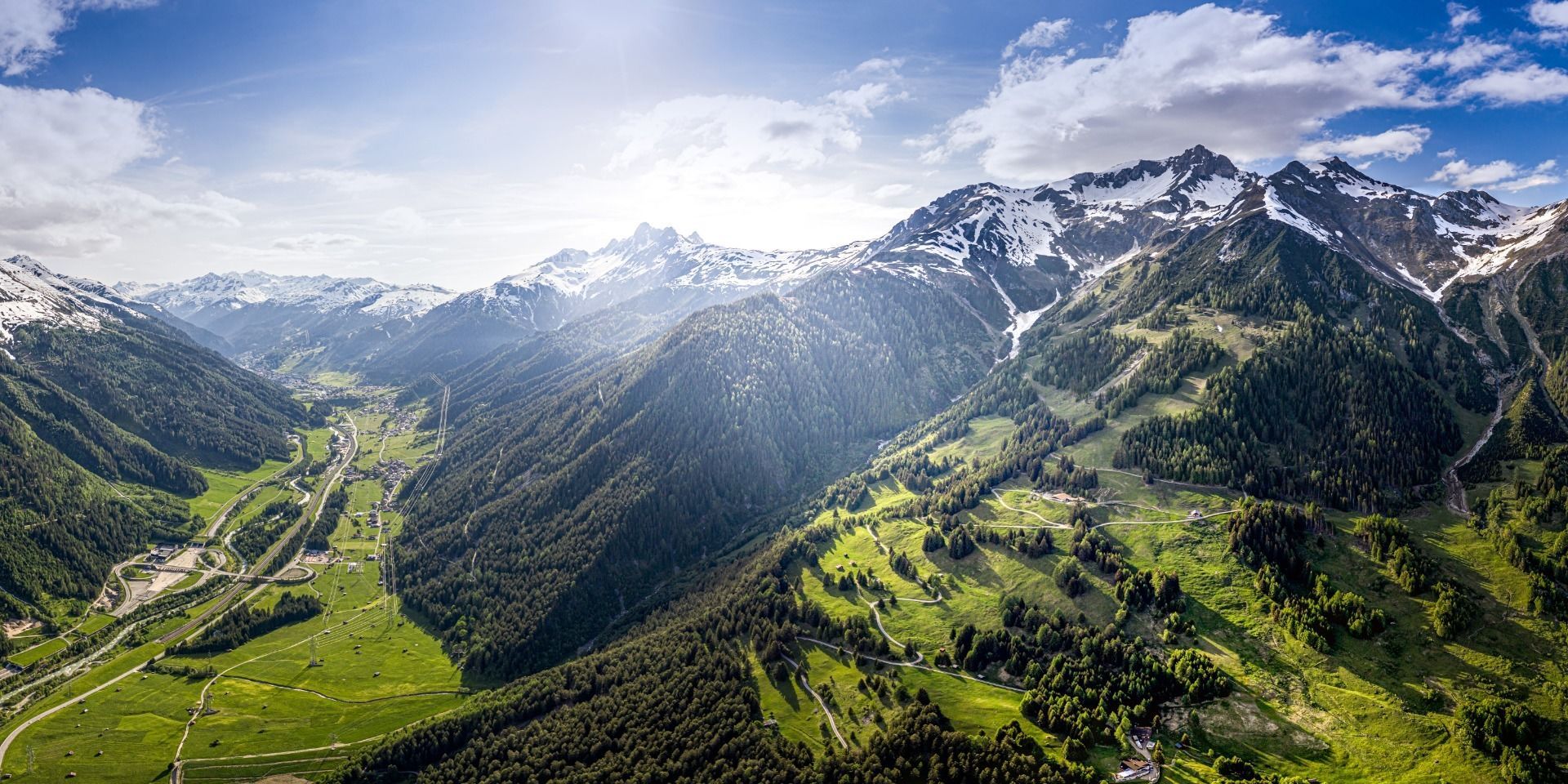
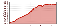
From the information office, head east and turn left before the Raiffeisenbank and head upwards. Follow the signs for Stöcklweg, passing the avalanche barrier, on to Gridlonbach. There the trail turns to the north, passing along the catchment basin, and continues to Pleißlereck. The trail heads west to the Nessleralm. For the climb down to Pettneu, take the road way down into the village.

More tours in the surrounding area

Newsletter

The mountain is calling? So does our newsletter!

In our monthly newsletter we reveal the best holiday tips for Tyrol.