Long-distance hike Pilgrimage Way "Quo vadis"

Difficulty ratings: medium
Route length: 22.0 km
Duration: 7:30 h

Pilgrimage Way "Quo vadis"

Tour information

  • Requirement: medium
  • Length: 22.0 km
  • Duration: 7:30 h
  • Elevation uphill:1,362 hm
  • Elevation downhill:298 hm
Highest point1,690 m

Starting point

Dom zu St. Jakob in Innsbruck

Finishing point

Maria Waldrast

Best time of year

  • January
  • February
  • March
  • April
  • May
  • June
  • July
  • August
  • September
  • October
  • November
  • December
Source: TVB Stubai

Description

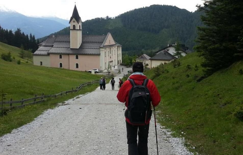
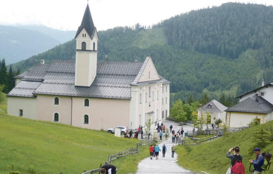
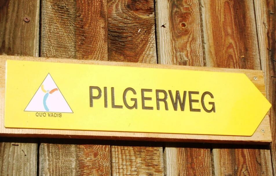
The "Quo vadis" pilgrimage route leads from the cathedral to St. Jakob in Innsbruck to Maria Waldrast.

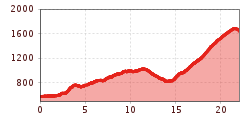
The 21 km long path, from the cathedral through Innsbruck, via Natters, Mutters, Telfes and Mieders up to Maria Waldrast, is signposted with a total of 80 signposts. This also makes it possible for those who are unfamiliar with the area and guests to complete the pilgrimage at any time and apart from the annual joint hike.

Pilgrimage route map as pdf download

Nearby huts and mountain restaurants

  • Maria Waldrast 1.640m

    Opening hours:Open today
    Place: Mühlbachl
    : Alpine pasture / hut / mountain restaurant

More tours in the surrounding area

  • Wilder-Kaiser-Steig - Detour

    Difficulty: difficult
    Length: 33.0 km Duration: 16:49 h Elevation uphill: 2,311 m
  • Ötztal Trek Stage 6

    Difficulty: difficult
    Length: 7.6 km Duration: 3:30 h Elevation uphill: 640 m
  • Ötztal Trek Stage 3

    Difficulty: difficult
    Length: 10.4 km Duration: 4:00 h Elevation uphill: 842 m
  • Ötztal Trek Stage 7

    Difficulty: difficult
    Length: 5.3 km Duration: 2:00 h Elevation uphill: 376 m
  • Ötztal Trek Stage 1

    Difficulty: medium
    Length: 18.6 km Duration: 6:30 h Elevation uphill: 1,561 m
  • Ötztal Trek Stage 17

    Difficulty: difficult
    Length: 16.4 km Duration: 6:00 h Elevation uphill: 1,080 m
  • Ötztal Trek Stage 14

    Difficulty: difficult
    Length: 6.3 km Duration: 3:00 h Elevation uphill: 1,004 m
  • Ötztal Trek Stage 12

    Difficulty: difficult
    Length: 4.8 km Duration: 2:00 h Elevation uphill: 592 m
  • Ötztaler Urweg

    Length: 189.1 km Duration: 72:19 h Elevation uphill: 9,428 m
  • Ötztal Trek Stage 4

    Difficulty: difficult
    Length: 8.9 km Duration: 4:00 h Elevation uphill: 802 m
  • Ötztal Trek Stage 2

    Difficulty: difficult
    Length: 10.7 km Duration: 4:00 h Elevation uphill: 926 m
  • Ötztal Trek Stage 9

    Difficulty: difficult
    Length: 12.8 km Duration: 6:00 h Elevation uphill: 1,623 m
  • Ötztal Trek Stage 10

    Difficulty: difficult
    Length: 11.1 km Duration: 4:30 h Elevation uphill: 1,476 m
  • Ötztal Trek Stage 15

    Difficulty: difficult
    Length: 6.5 km Duration: 2:30 h Elevation uphill: 332 m
  • Ötztal Trek Stage 16

    Difficulty: difficult
    Length: 6.9 km Duration: 2:30 h Elevation uphill: 358 m
  • Ötztal Trek Stage 19

    Difficulty: difficult
    Length: 11.0 km Duration: 5:00 h Elevation uphill: 1,246 m
  • Ötztal Trek Stage 13

    Opening hours: closed
    Difficulty: difficult
    Length: 8.5 km Duration: 3:30 h Elevation uphill: 390 m
  • Ötztal Trek Stage 11

    Difficulty: difficult
    Length: 12.0 km Duration: 5:00 h Elevation uphill: 705 m
Newsletter

The mountain is calling? So does our newsletter!

In our monthly newsletter we reveal the best holiday tips for Tyrol.