Description
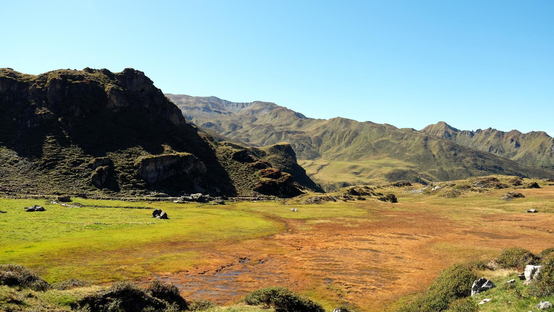
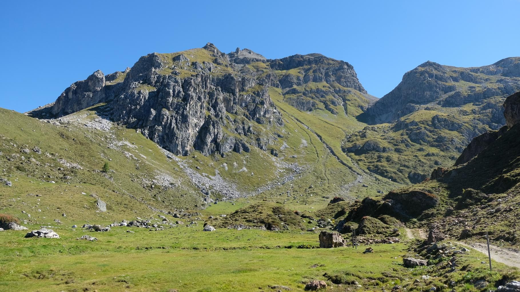
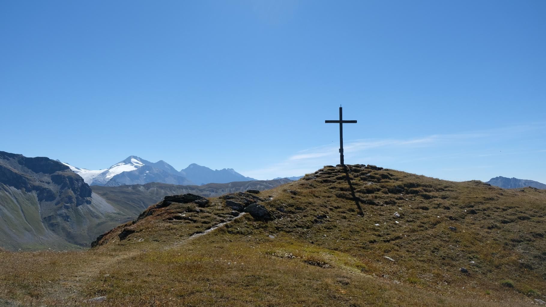
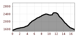
From the car park at the end of the valley, you first walk along the Almrunde past the Peeralm to the Klammalm. This rustic and beautifully situated hut in a wide valley basin is ideal for a first short stop. The trail then continues in a curve over species-rich alpine pastures and past numerous bodies of water up to the Klammjoch, the transition to the Wattental. Around the Joch there are several smaller lakes, in whose atmosphere another short rest is particularly beautiful. Then continue along the ridge over the Schoberspitzen to the Mösljoch and from there on to the Naviser Sonnenspitz, situated on a stone plateau, the highest point of the tour. During the entire time on the ridge, you have an outstanding view of the peaks of the Tuxer Hauptkamm and the distant glaciers of the Stubai Alps, as well as of the Navis valley below you. From the Naviser Sonnenspitze, the trail then leads via the Naviserjöchl down to the colourful grounds of the Grafmartalm and from there via the Zeheter and Peeralm back to the starting point.
ROUTE DESCRIPTION
Starting from the "Grün" car park, the trail first follows the forest path of the Naviser Almrunde (327, 520) for about 5 km, climbing relatively gently to the Klammalm. There the forest path first becomes a cart track, later a normal trail (unchanging no. 327), which leads up over the Kuchlböden to the Klammjoch. From the Klammjoch, the trail then leads, partly as a forest trail in a westerly direction along the ridge out of the valley over the Nördlicher Schober to the Mösljoch. Here the forest trail turns off again into the Wattental valley and continues on the so-called Glungezer-Geier Steig (No. 27) to the Naviserjöchl. If you want to do the Naviser Sonnenspitze, you have to turn back here and climb a good 150 m along the ridge in an easterly direction to reach the beautifully shaped summit plateau. On the last few metres to the cross there is even a little climbing to do. Once you have mastered this challenge, you return to the Naviserjöchl and from there, via the Grafmart and Zeheteralm, you follow the path with the No. 331 back to the Peeralm. Here you meet up again with the path of the Naviser Almrunde already used in the ascent, which leads back to the starting point.
TIP FROM THE AUTHOR
The circular tour leads past a large number of different alpine pastures. Many of them offer wonderful homemade products. A stop for refreshments is therefore definitely recommended.


.jpg")


.jpg")


")


