Mountain hikes St. Ulrichskopf

Pfunds / Ötztal Alps
Difficulty ratings: medium
Route length: 11.8 km
Duration: 7:30 h

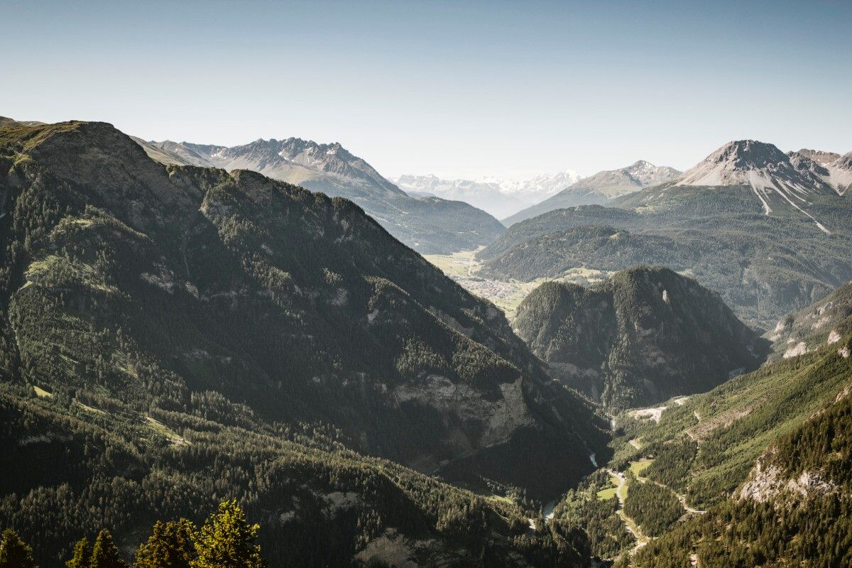
Scenic hike to St. Ulrichskopf with diverse alpine flora and wide views.
Tour information

  • Requirement: medium
  • Length: 11.8 km
  • Duration: 7:30 h
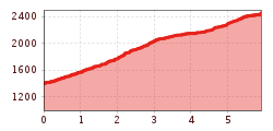
  • Elevation uphill:1,132 hm
  • Elevation downhill:1,132 hm
Highest point2,453 m

Starting point

Parkplatz Wildmoos | Pfunds

Finishing point

Parkplatz Wildmoos | Pfunds
  • Fitness level 5 / 6
  • Technique 4 / 6

Best time of year

  • January
  • February
  • March
  • April
  • May
  • June
  • July
  • August
  • September
  • October
  • November
  • December

Trail condition

forest road, trail

Equipment

We recommend equipment suitable for the tour and weather conditions, including sturdy shoes, weatherproof clothing, food, and appropriate maps.
Source: TVB Tiroler Oberland

Description

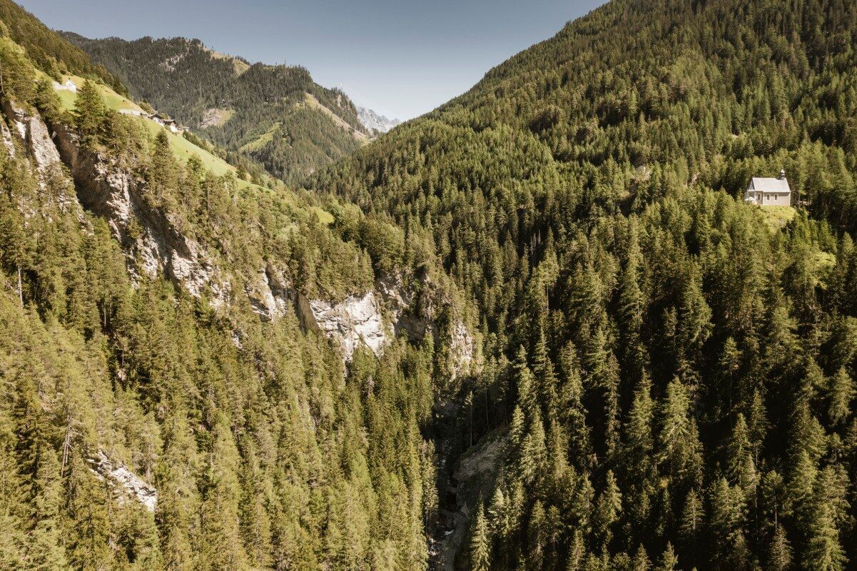
The hike starts at the Kaltenwirt in the Radurschltal valley. From there, the path first leads to the right into the forest. Shortly afterwards the trail branches off to the right again, where you follow trail marker no. 26. The route passes the drinking water spring of the municipality of Pfunds and continues steadily uphill to the Lukaskreuz.

From Lukaskreuz, trail no. 27 continues towards St. Ulrichskopf. This trail, awarded the Alpine Trail Quality Seal, leads through a varied mountain landscape rich in alpine flowers and medicinal herbs. Along the way, the sound of bells from grazing cattle of the Saderer Alm accompanies the hike.

At the summit of St. Ulrichskopf, hikers are rewarded with an excellent panoramic view of the surrounding mountains. The descent follows the same route back to the Kaltenwirt.

Getting here

  • Arrival by public transport

    Tip: there is a hiking shuttle to the Radurschl every Tuesday

  • Parking

    Parking area Wildmoos, paid parking

Weather

Today

partly Cloudy
18°C/6°C
45%0.9l5 km/h

Fri

clear sky
18°C/5°C
0%0l5 km/h

Sat

clear sky
21°C/6°C
0%0l5 km/h
Go to weather forecast

More tours in the surrounding area

  • Großer Mutzkopf

    Opening hours:closed
    Difficulty:easy
    Length:10.3 kmDuration:4:00 hElevation uphill:507 m
  • Sternenweg im Gepatsch

    Difficulty:medium
    Length:4.0 kmDuration:1:30 hElevation uphill:202 m
  • Talwanderweg Kaunertal

    Difficulty:easy
    Duration:2:30 hElevation uphill:295 m
  • Kaunerberger Wasserweg

    Opening hours:open
    Difficulty:medium
    Length:15.2 kmDuration:6:00 hElevation uphill:935 m
  • Rolli-Wanderung Aifner Alm

    Difficulty:medium
    Length:6.0 kmDuration:2:30 hElevation uphill:460 m
  • Rolli-Wanderung Nassereinalm

    Difficulty:medium
    Length:5.5 kmDuration:1:45 hElevation uphill:269 m
  • Rolli-Wanderung Gepatschhaus

    Length:8.5 kmDuration:1:45 hElevation uphill:156 m
  • Rolli-Wanderung Falkaunsalm

    Difficulty:medium
    Length:4.5 kmDuration:1:45 hElevation uphill:392 m
  • Kapelle Maria Schnee

    Difficulty:easy
    Length:1.7 kmDuration:0:30 hElevation uphill:90 m
  • Radurschlklamm Gorge

    Opening hours:open
    Difficulty:medium
    Length:7.5 kmDuration:3:20 hElevation uphill:442 m
  • Rundwanderung Frudiger

    Difficulty:medium
    Length:13.5 kmDuration:4:55 hElevation uphill:588 m
  • Gletscherlehrpfad Gepatschferner

    Difficulty:medium
    Length:8.4 kmDuration:3:45 hElevation uphill:400 m
  • Hohe Aifnerspitze (2.779 m)

    Difficulty:medium
    Length:7.2 kmDuration:5:15 hElevation uphill:815 m
  • Verpeilschlucht

    Opening hours:open
    Difficulty:medium
    Duration:3:00 hElevation uphill:386 m
  • Ötztal Trek Stage 15

    Difficulty:difficult
    Length:6.5 kmDuration:2:30 hElevation uphill:332 m
Newsletter

The mountain is calling? So does our newsletter!

In our monthly newsletter we reveal the best holiday tips for Tyrol.