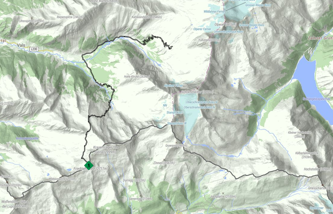
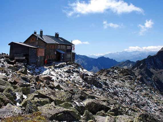
Mountain hikes Stage of the Peter Habeler Runde: Landshuter Europahütte - Geraerhütte

Gries am Brenner / Zillertal Alps
Difficulty ratings: difficult
Route length: 11.6 km
Duration: 7:00 h

We make our way down through the deserted head of the lovely Vals Valley and then back up again to the Geraer Mountain hut.

Tour character

A challenging stage on Difficult Trails. Sure-footedness, basic knowledge of alpine terrain, and good physical conditioning are required.

Tour information

  • Requirement: difficult
  • Length: 11.6 km
  • Duration: 7:00 h
  • Elevation uphill:1,100 hm
  • Elevation downhill:1,440 hm
Highest point2,670 m

Starting point

Landshuter Europahütte, 6156 St. Jakob, Südtirol-Italien

Finishing point

Geraer Hütte, 6154 Vals, Italien
  • Fitness level 5 / 6
  • Technique 5 / 6

Best time of year

  • January
  • February
  • March
  • April
  • May
  • June
  • July
  • August
  • September
  • October
  • November
  • December

Trail condition

  • Well-marked hiking trail
  • Challenging terrain after Sumpfschartl with rock slabs and boulder fields
  • Cable-secured sections and ladders at the Langen Wand
  • Wider and easier path from Innere Zeischalm onward
  • Gravel road passing Nockeralm to Touristenrast
  • Ascending switchbacks above the material cable car
  • Open terrain above the tree line leading to the Geraer Hütte

Equipment

The decision regarding the equipment to bring is your own responsibility. Make sure to take care of your personal safety as well as that of the group, and plan accordingly.
Source: Zillertal Tourismus GmbH

Description

From the Landshuter Europahütte, 2.693 m, the Geistbeckweg trail No. 529 leads to the Sumpfschaftl, 2.666 m. The path becomes more challenging after the Sumpfschartl, with rocky terrain and boulders. A secured passage with ladders leads from the Lange Wand to the Stierkar and further to the Inneren Zeischalm. Then the trail widens, and a gravel road passes by the Nockeralm to the Touristenrast, 1.345 meters. From the Touristenrast in the Valsertal, you hike on trail No. 502 for about an hour to the material cable car. From there, it winds in switchbacks on a path to the forest limit and then continues openly to the Geraer Hütte, 2.326 m.

Nearby huts and mountain restaurants

Getting here

  • Arrival by public transport

    Linie: 4144, Haltestelle: Vals Touristenrast 

  • Parking

    • Starting Point: Valsertal, Touristenrast parking lot
    • Via St. Jodok am Brenner into the Valsertal
    • Parking available at the Touristenrast
      • Parking is limited
    • Starting point of the hike: Gasthaus Touristenrast

Weather

Today

partly Cloudy
6°C/0°C
65%1.9l5 km/h

Sat

light snow showers
5°C/-2°C
60%0.7l5 km/h

Sun

light snowfall
3°C/-3°C
75%6.8l5 km/h
Go to weather forecast

More tours in the surrounding area

Newsletter

The mountain is calling? So does our newsletter!

In our monthly newsletter we reveal the best holiday tips for Tyrol.