Mountain hikes Umbal waterfalls nature force trail

Prägraten am Großvenediger / Venedigergruppe
Difficulty ratings: easy
Route length: 5.8 km
Duration: 2:30 h

The Isel carves its way through millennia-old mountain nature and forms the largest waterfalls in East Tyrol on steep cataracts. The debris carried along polishes the rocks into smooth waves. A natural monument in a class of its own!

Tour character

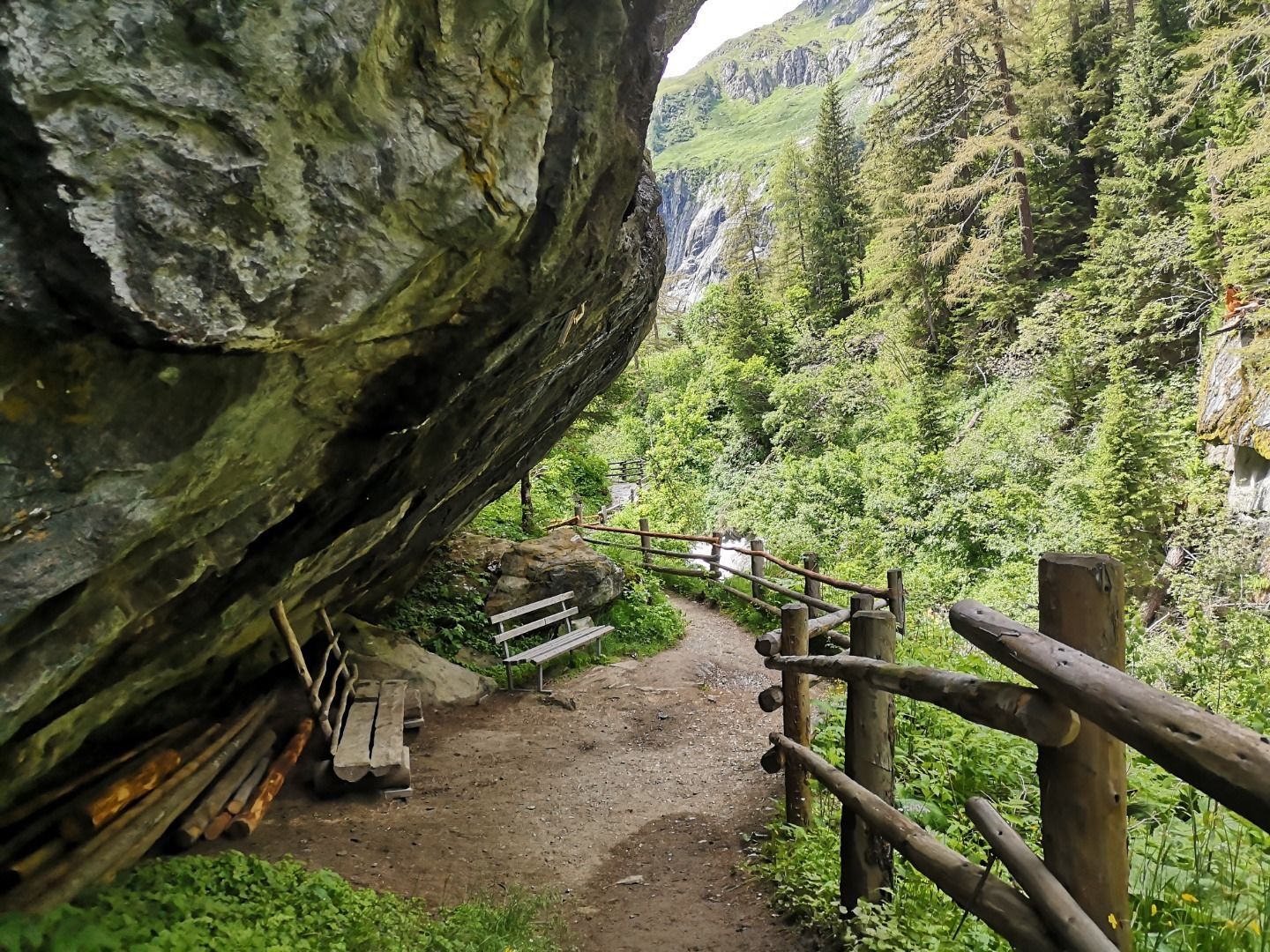
From Ströden and Hinterbichl, the hiking trail leads along the roaring Isel for around two hours up into the narrow Umbaltal valley, while the water show trail takes around an hour to walk. Several viewing platforms offer spectacular views of the Isel, whose water collects in pools before plunging down another level. The tour is suitable for children aged six and over who enjoy hiking. However, be careful: the paths around the waterfalls can be slippery.

Tour information

  • Requirement: easy
  • Length: 5.8 km
  • Duration: 2:30 h
  • Elevation uphill:250 hm
  • Elevation downhill:250 hm
Highest point1,660 m

Starting point

Prägraten Parkplatz Ströden (Maut)

Finishing point

Umbalfälle
  • Fitness level 1 / 6
  • Technique 1 / 6

Features

  • Circular route
  • Suitable for families

Best time of year

  • January
  • February
  • March
  • April
  • May
  • June
  • July
  • August
  • September
  • October
  • November
  • December

Trail condition

Schotterweg
Source: Nationalparkregion Hohe Tauern Osttirol

Description

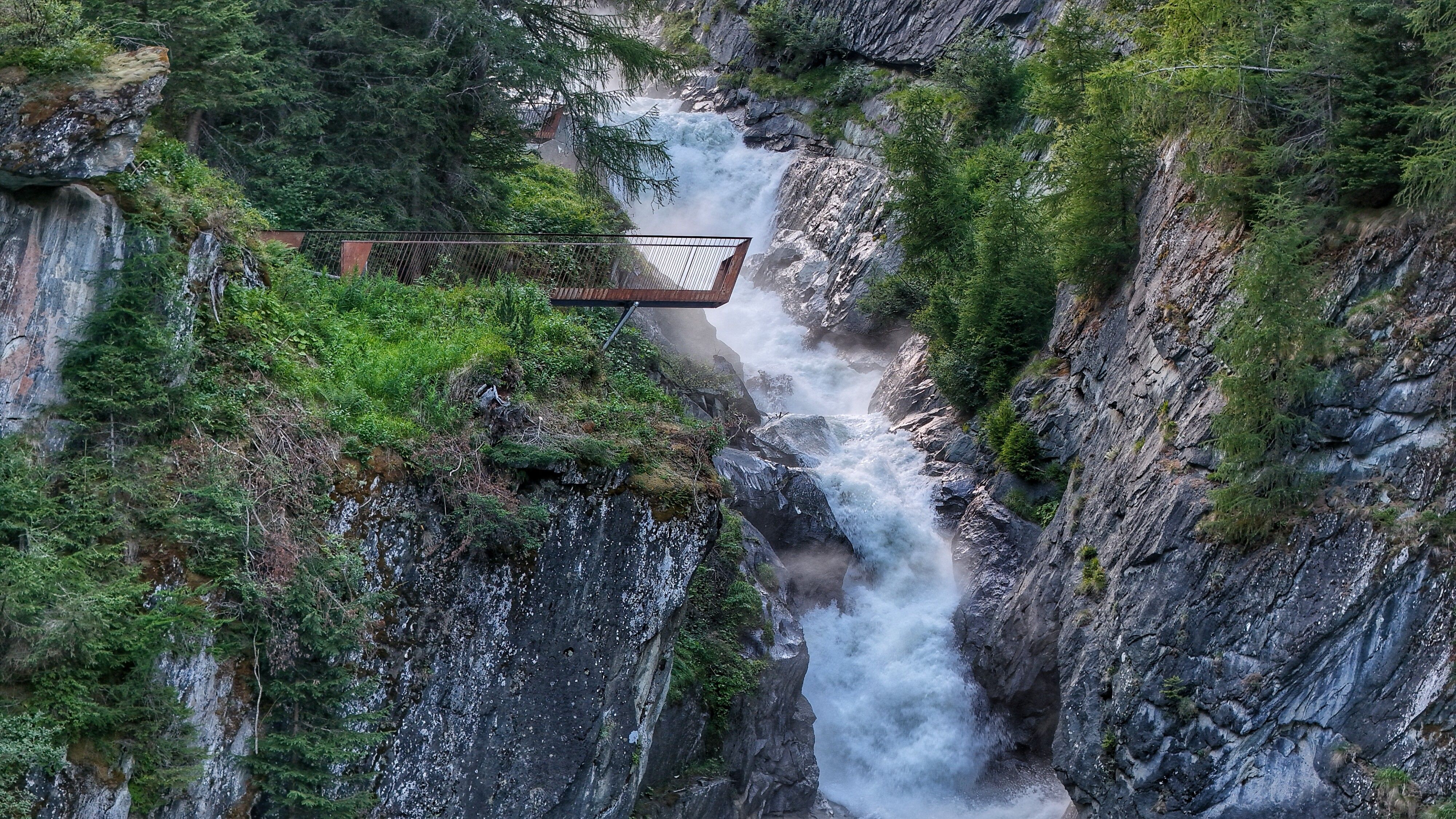
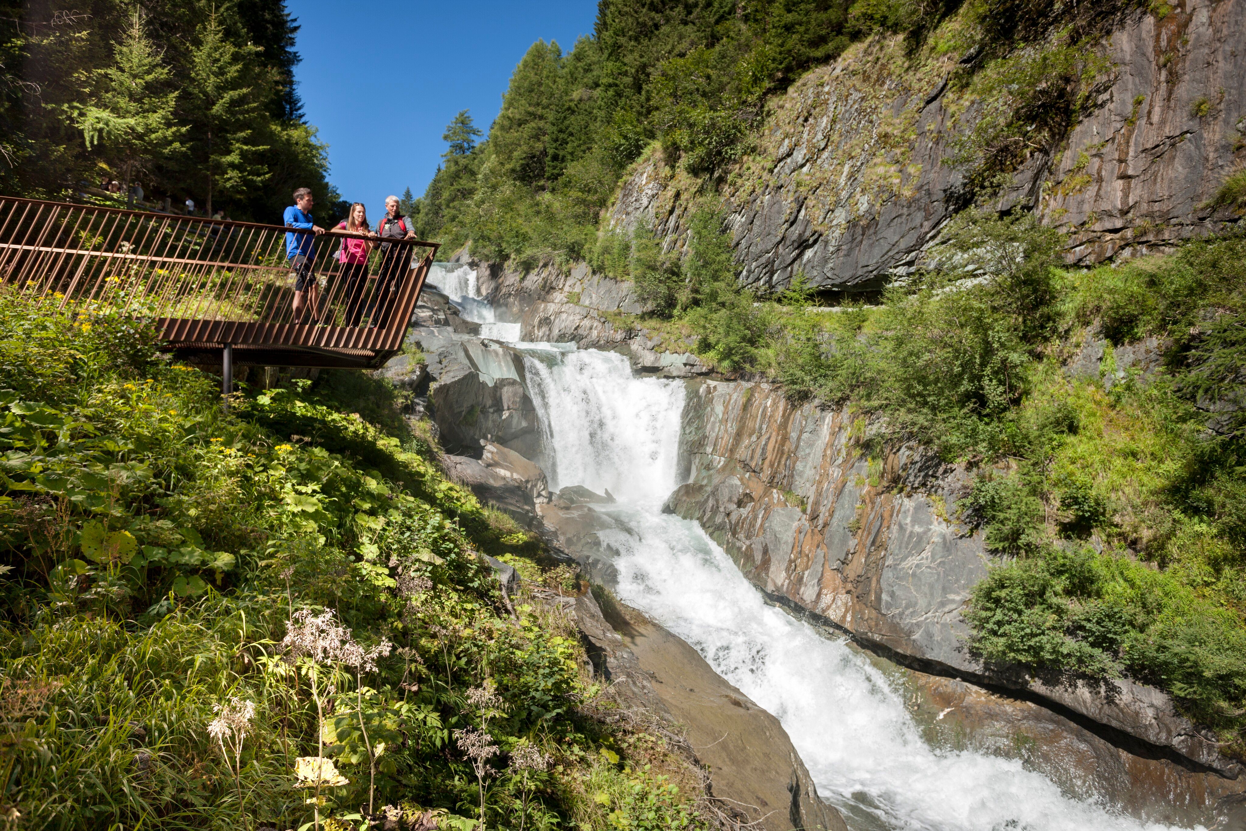
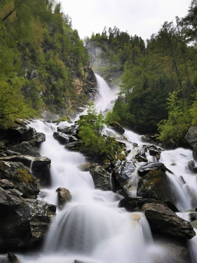
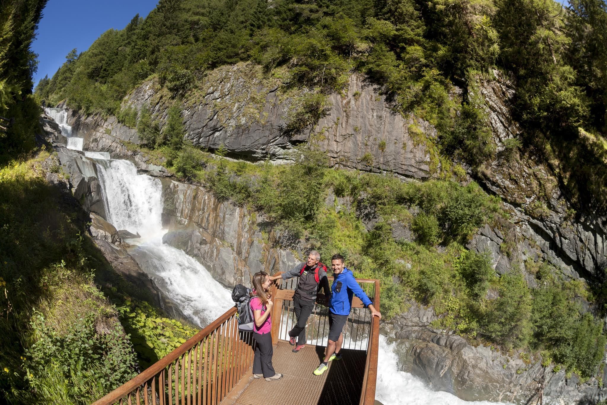
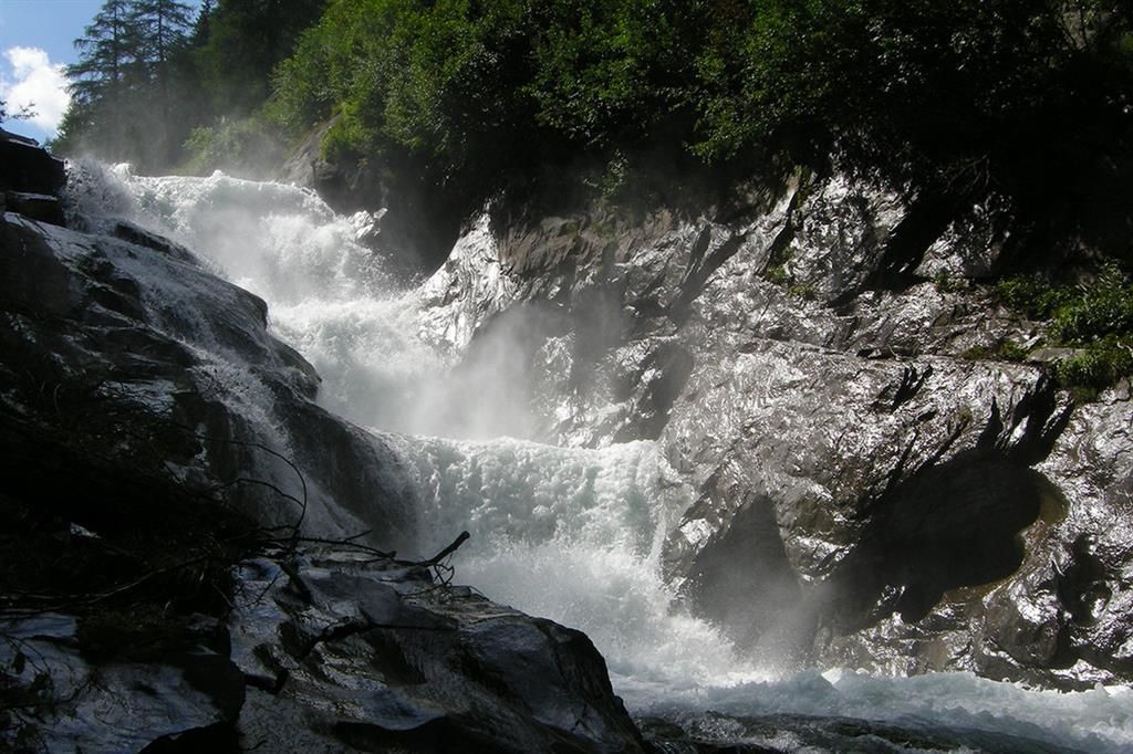
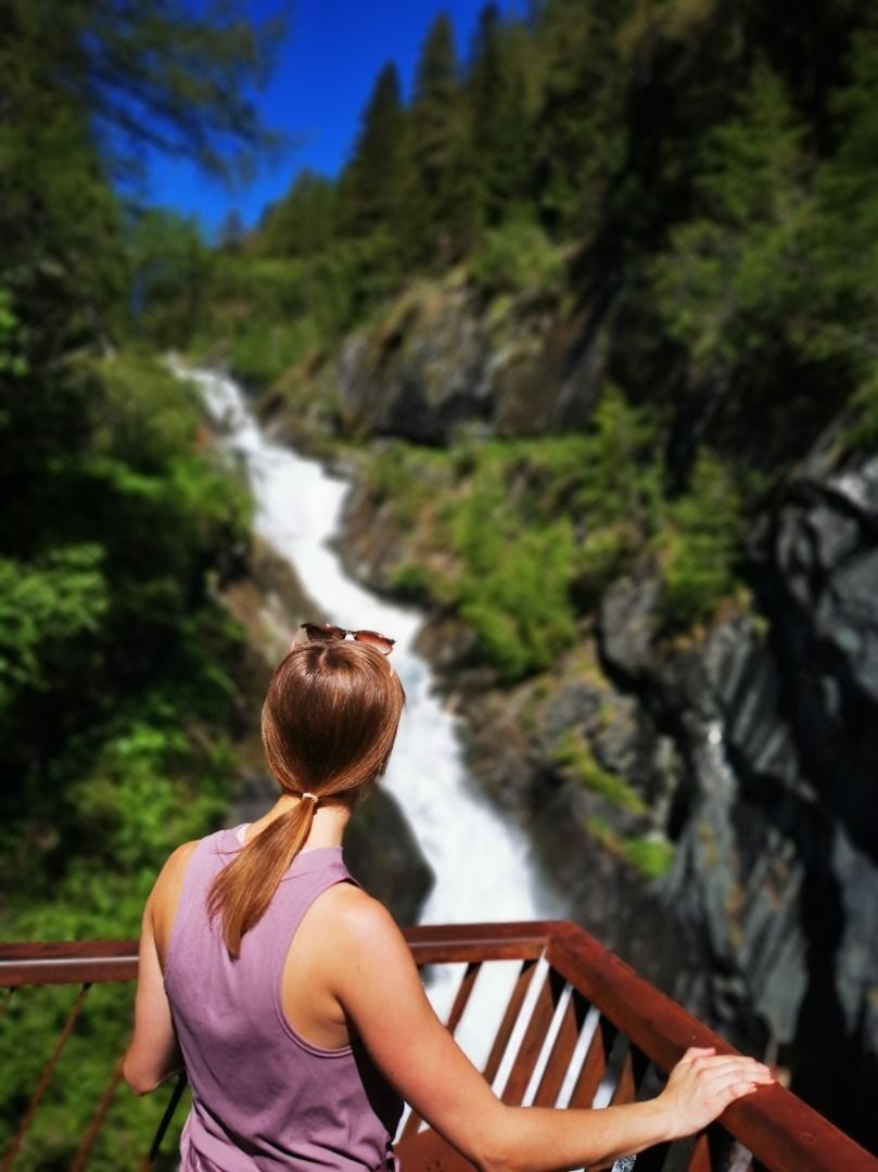
The nature trail "NaturKraftWeg Umbalfälle" at the end of the valley Virgental leads very close to the source of the glacier river Isel and shows its landscape-forming effect and its character in an impressive way. Especially in the summer months, when the glacier melts, impressive masses of water thunder down to the valley.  Along the circular route, there are not only interesting information boards, also visitor platforms make the unbelievable natural force of the water directly tangible, whether high above the gorge or up close to the water.

Access is not possible during the winter months!

Nearby huts and mountain restaurants

Getting here

  • Arrival by public transport

    Prägraten a.G. Ströden

  • Parking

    Parkplatz Ströden

More tours in the surrounding area

  • Hike to Kalser Tauernhaus

    Difficulty: medium
    Length: 12.2 km Duration: 4:00 h Elevation uphill: 244 m
  • Hiking tour to Lasörlinghütte 2.350m

    Difficulty: medium
    Length: 14.6 km Duration: 7:10 h Elevation uphill: 1,080 m
  • Badener Hütte

    Difficulty: difficult
    Length: 23.2 km Duration: 11:30 h Elevation uphill: 1,750 m
  • Lasörling altitude trail

    Difficulty: medium
    Length: 57.0 km Duration: 25:00 h Elevation uphill: 3,740 m
  • Figerhorn

    Difficulty: difficult
    Length: 6.5 km Duration: 6:00 h Elevation uphill: 807 m
  • Rotenkogel

    Difficulty: difficult
    Length: 3.9 km Duration: 3:00 h Elevation uphill: 383 m
  • Lasörling 3.098m

    Difficulty: difficult
    Length: 21.9 km Duration: 12:00 h Elevation uphill: 1,940 m
  • Hike to Neuen Reichenberger Hütte

    Difficulty: medium
    Length: 9.1 km Duration: 9:00 h Elevation uphill: 1,210 m
  • Hiking tour to Neue Sajathütte 2.600m

    Difficulty: medium
    Length: 10.3 km Duration: 6:50 h Elevation uphill: 1,080 m
  • Lucknerhaus - Stüdlhütte

    Difficulty: medium
    Length: 9.3 km Duration: 5:30 h Elevation uphill: 862 m
  • Böses Weibl

    Difficulty: difficult
    Length: 14.1 km Duration: 8:00 h Elevation uphill: 1,193 m
  • Muhs panorama trail

    Difficulty: medium
    Length: 15.2 km Duration: 6:00 h Elevation uphill: 1,090 m
  • Venediger altitude trail

    Difficulty: difficult
    Length: 55.5 km Duration: 27:00 h Elevation uphill: 3,915 m
  • Hike to the Venedigerhaus Innergschlöß

    Difficulty: easy
    Length: 8.5 km Duration: 2:30 h Elevation uphill: 180 m
Newsletter

The mountain is calling? So does our newsletter!

In our monthly newsletter we reveal the best holiday tips for Tyrol.