Mountain hikes Voldöpper Spitze Loop Hike

Kramsach / Brandenberger Alpen (Rofan)
Difficulty ratings: medium
Route length: 12.9 km
Duration: 5:00 h

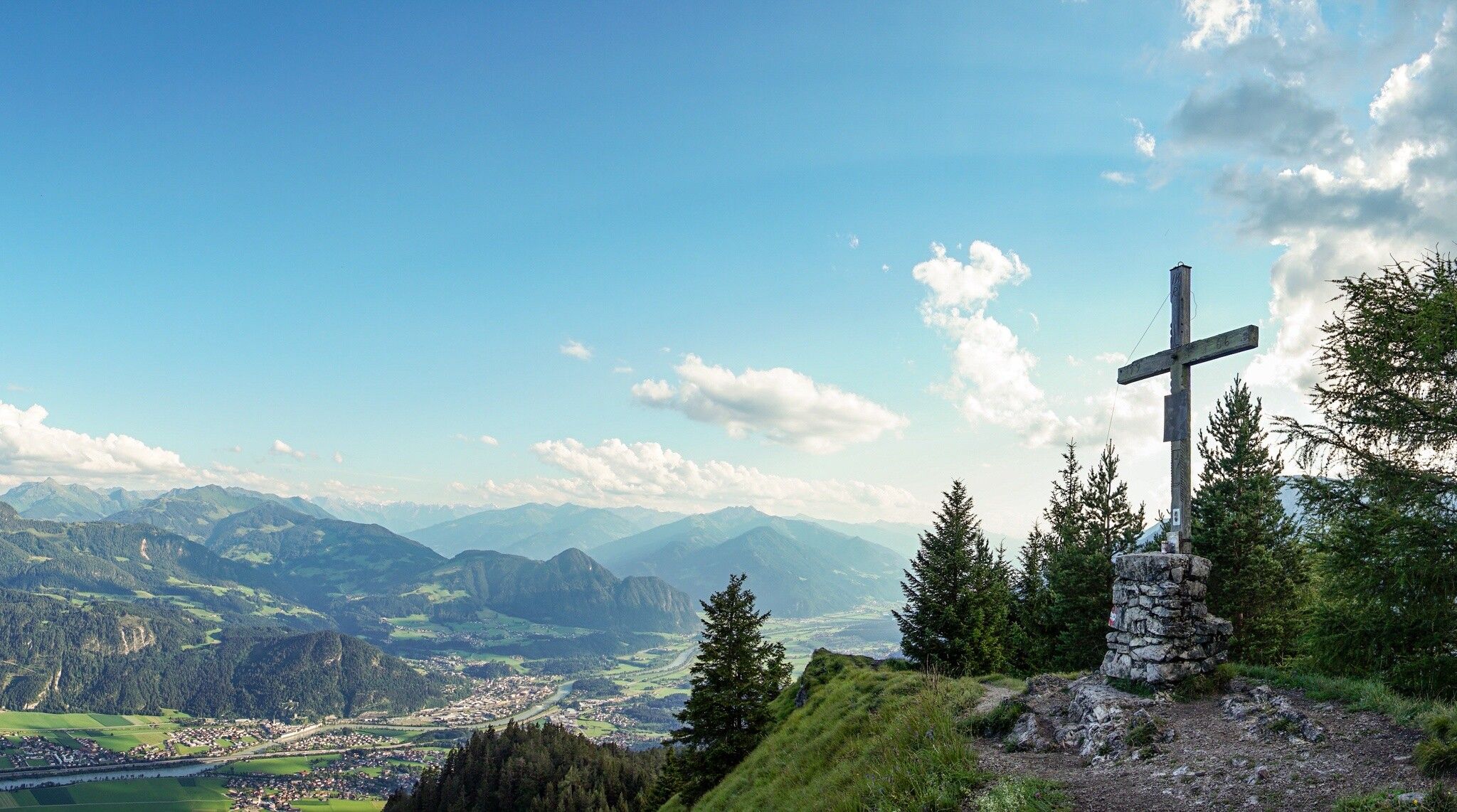
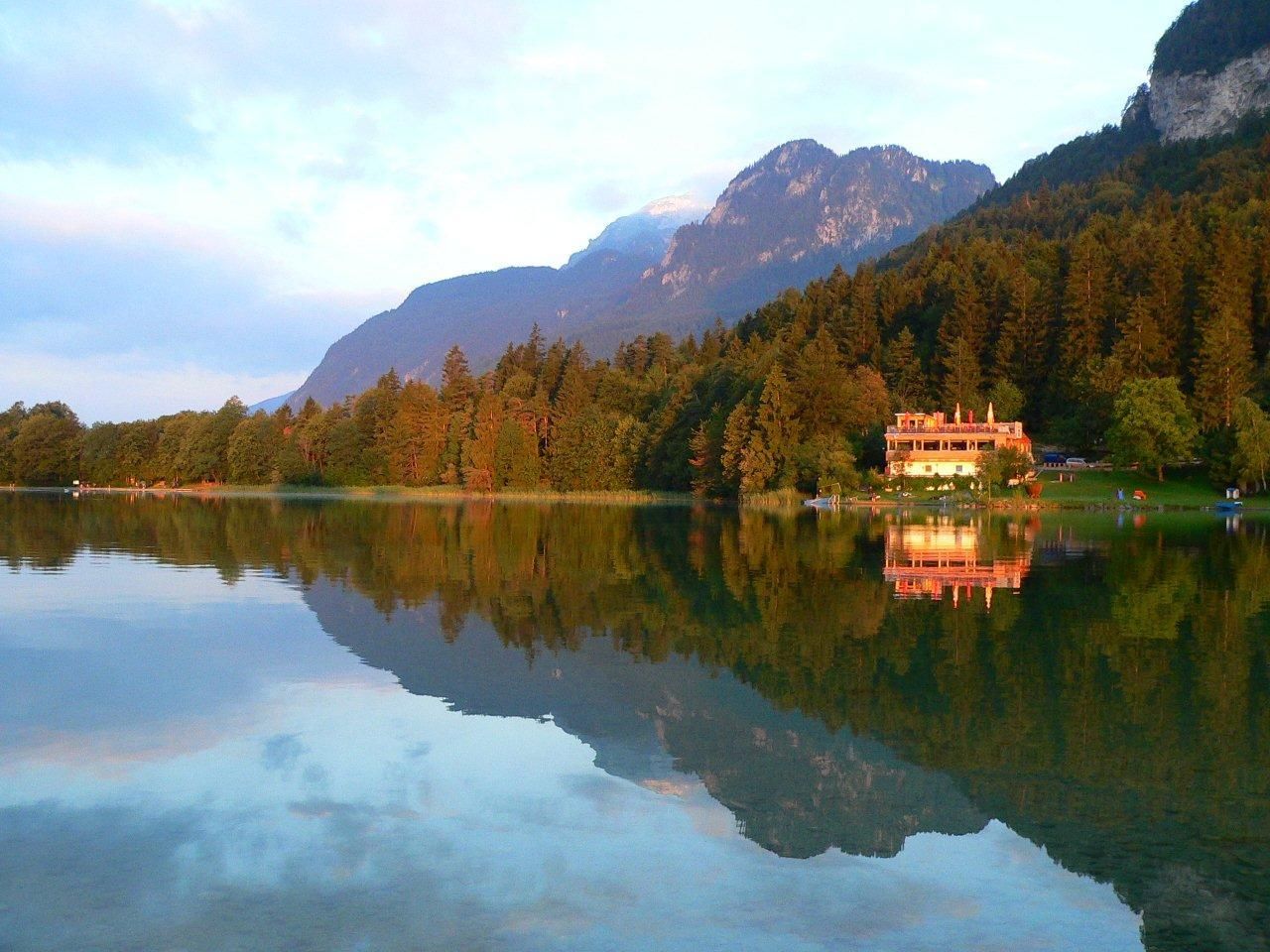
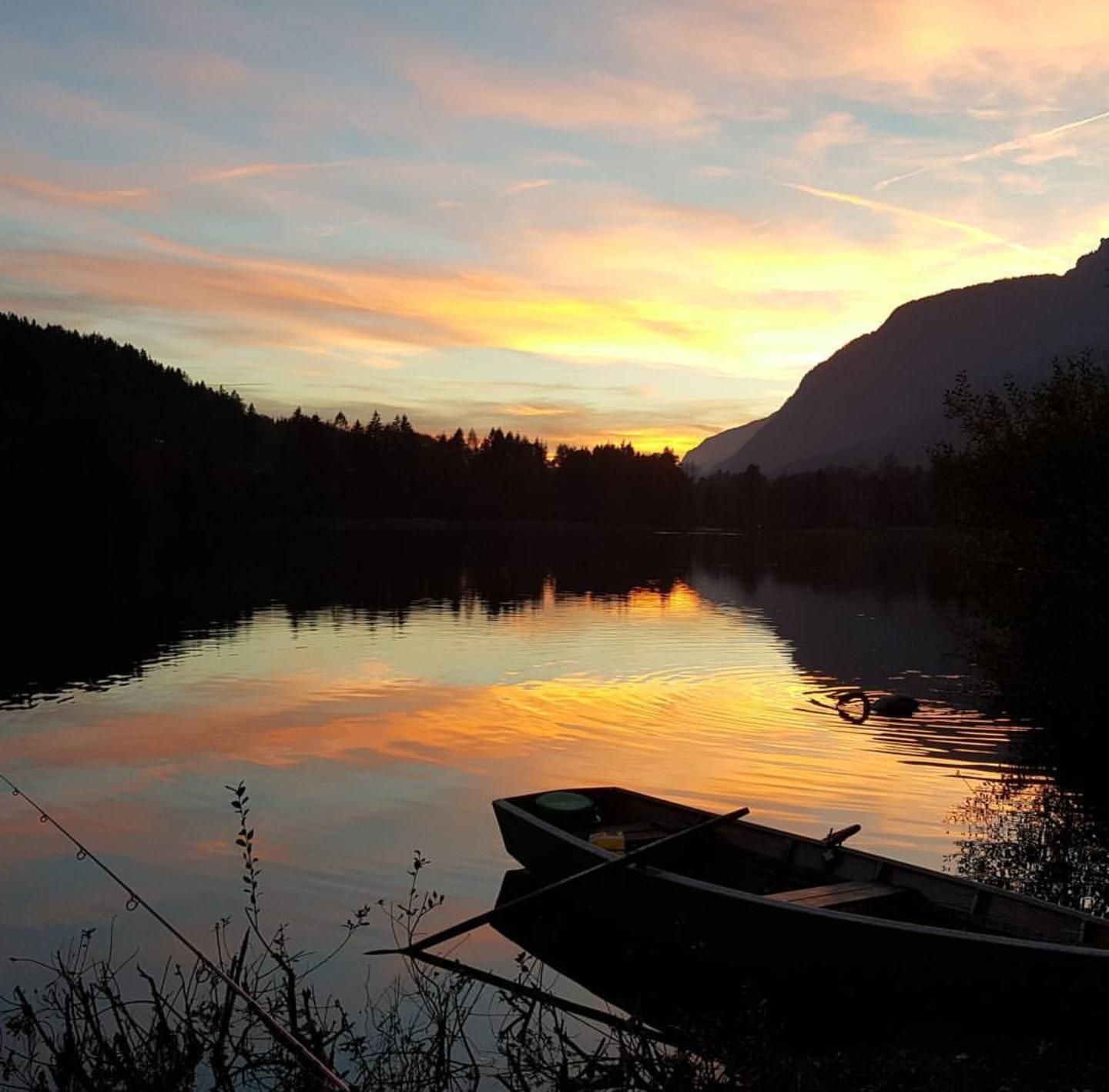
First enjoy the view over the Inn Valley. Then take a nap on the sun-drenched summit meadow. And finally a dip in Lake Reintal. That's how a day on the Voldöpper Spitze goes.

Tour character

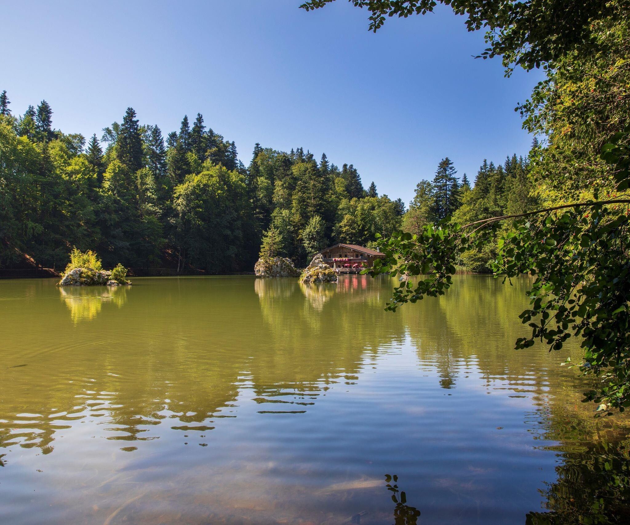
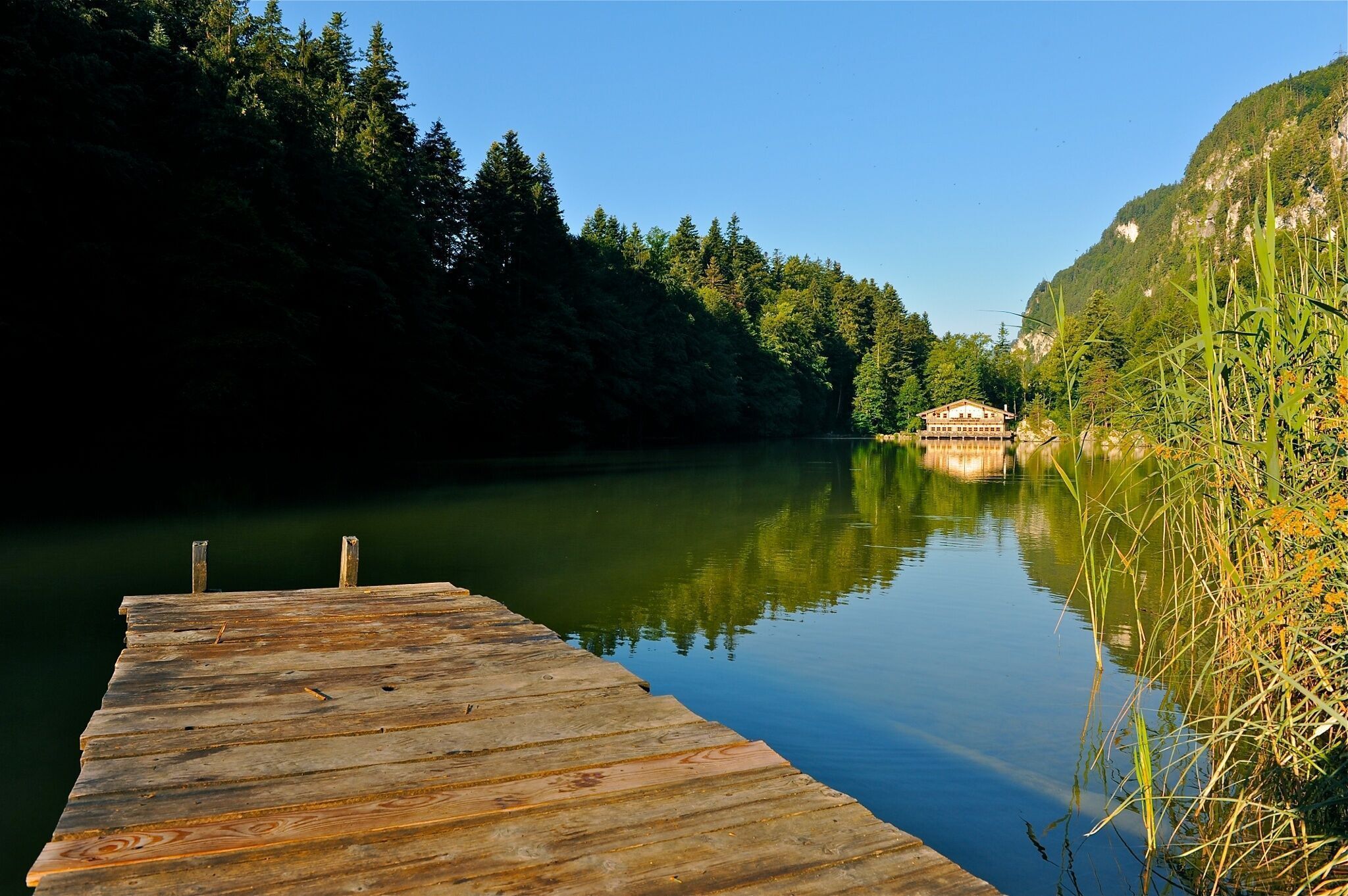
Fantastic, moderately difficult circular tour over a rewarding panoramic summit with a long hiking season due to its south-facing orientation directly above the Inntal valley. Beautiful forest paths and unobstructed views from the summit to the Rofan mountains and across the Inn Valley to the Zillertal Alps. The Berglsteiner See lake is a surprising natural gem along the way just before the end. A dip in the Reintalersee after the tour is not to be missed in the summer months. The refreshment stops along the route are all located at the lakes at the end of the tour. All in all, a program to fill a whole day.

Tour information

  • Requirement: medium
  • Length: 12.9 km
  • Duration: 5:00 h
  • Elevation uphill:988 hm
  • Elevation downhill:988 hm
Highest point1,509 m

Starting point

Kramsach, Reintalersee West parking lot

Finishing point

Kramsach, Reintalersee West parking lot
  • Fitness level 4 / 6

Features

  • Circular route

Best time of year

  • January
  • February
  • March
  • April
  • May
  • June
  • July
  • August
  • September
  • October
  • November
  • December

Equipment

Sturdy shoes, weather-appropriate clothing, provisions

Source: Alpbachtal Tourismus

Description

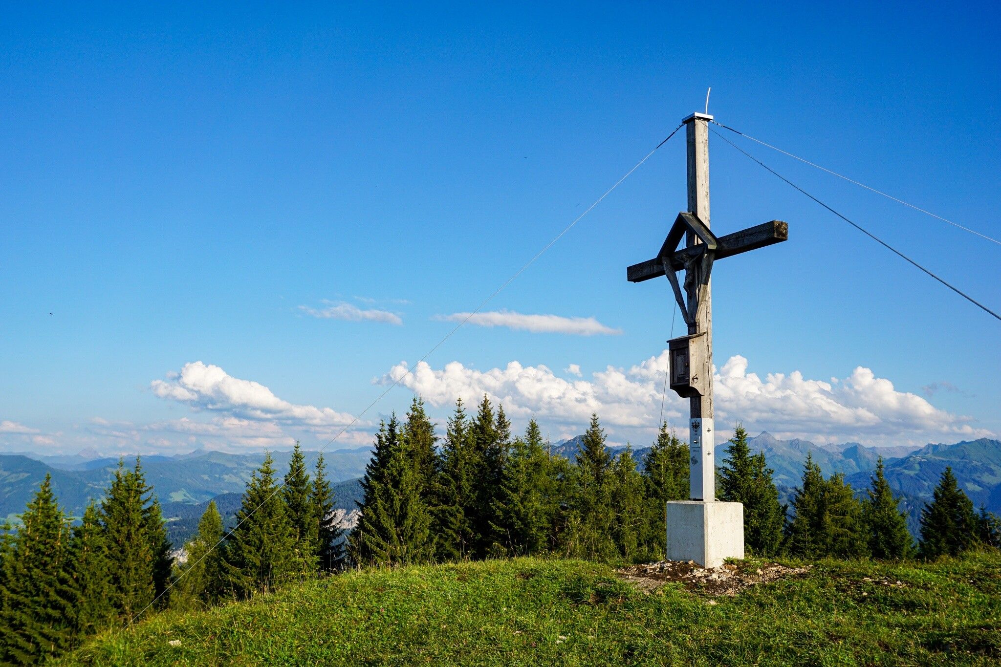
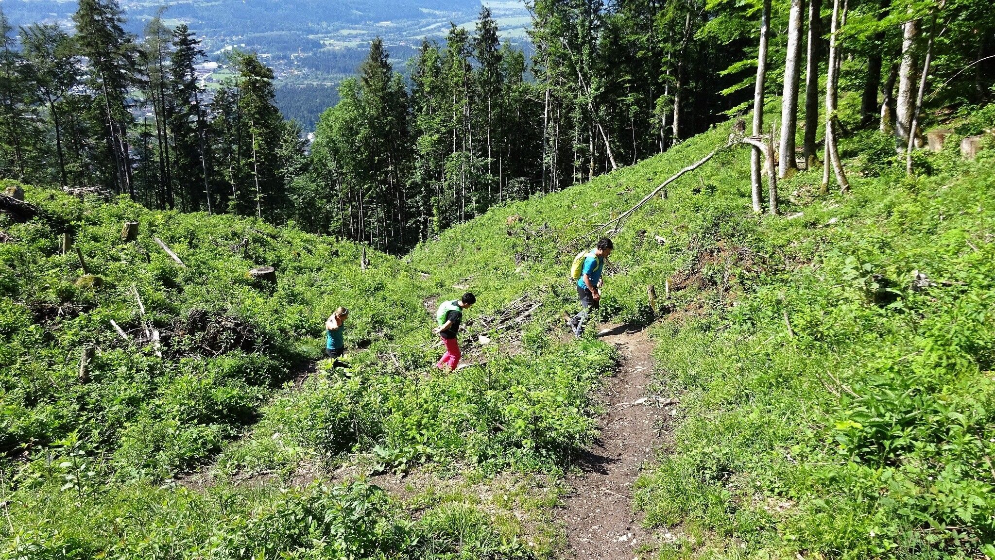
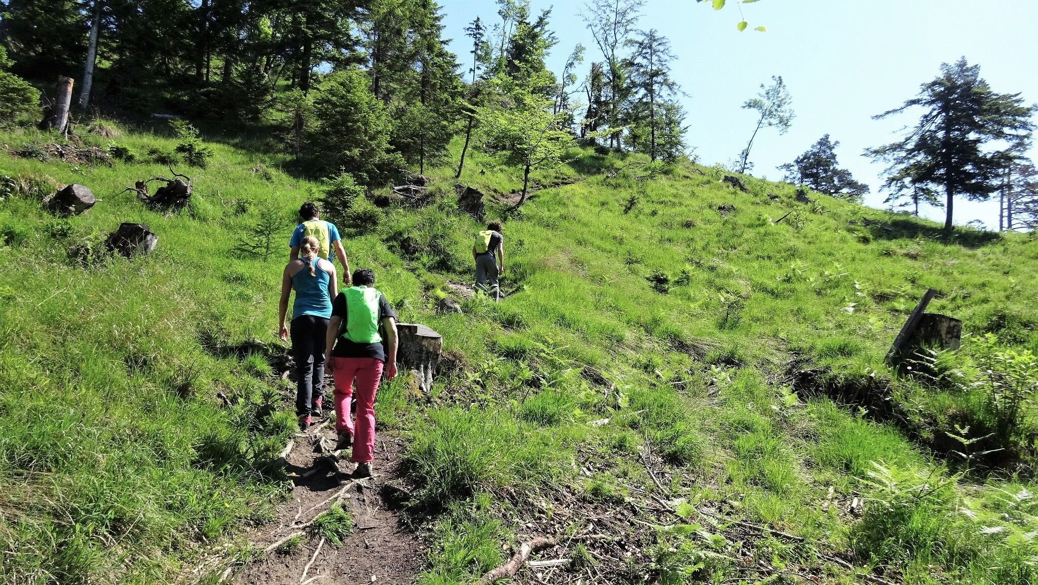
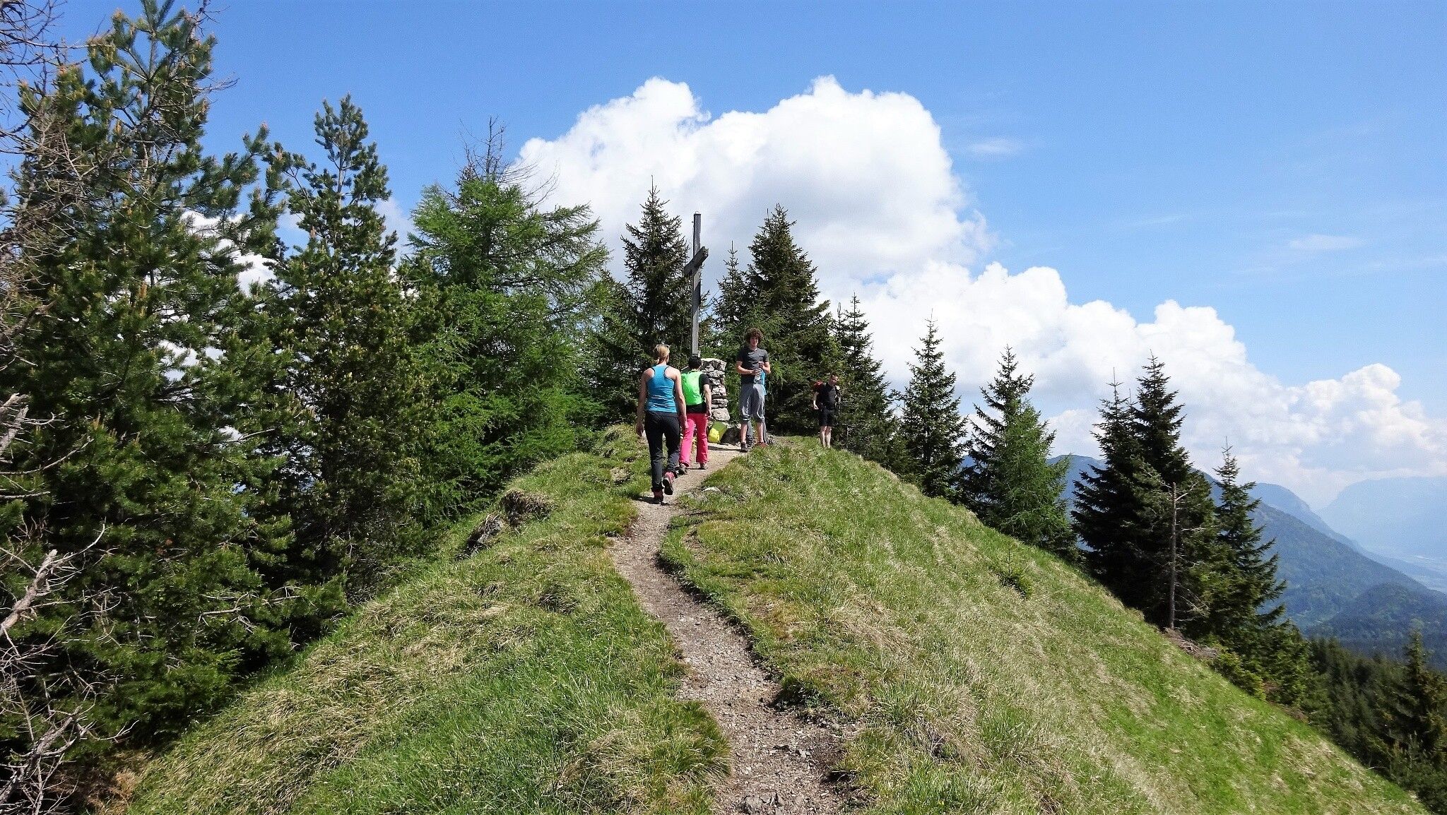
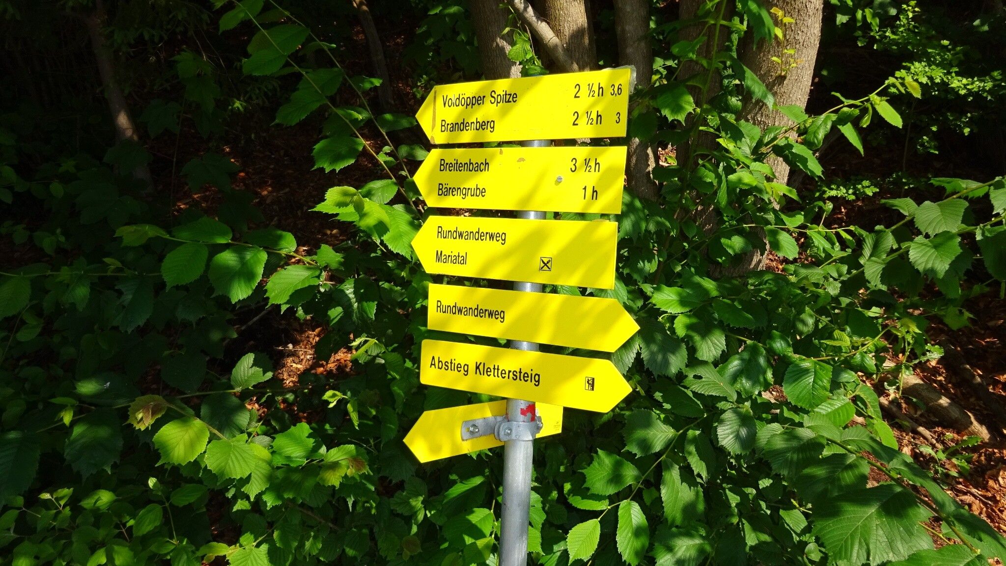
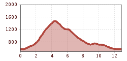
This demanding circular route leads from the Reintalersee in Kramsach directly to the Voldöpper Spitze at 1,509 m. You first walk briefly on a forest road, later continue on a trail to the summit. From there you enjoy an outstanding view in all directions. Especially the Rofan mountains west of the summit impress with their distinctive appearance. All summit climbers still have the possibility to climb the neighboring summit on the Brandenberg side in just 5 minutes on foot. After a relaxing rest with a summit snack, the descent goes via Heumösernalm, Berglsteinersee back to Reintalersee.


Nearby huts and mountain restaurants

Getting here

  • Parking

    Kramsach, Reintalersee West parking lot

More tours in the surrounding area

  • Barrier-free path Lake Reintal

    Difficulty: easy
    Length: 6.5 km Duration: 1:45 h Elevation uphill: 15 m
  • Day 1: 4 days - 4 summits tour

    Difficulty: medium
    Length: 9.8 km Duration: 5:00 h Elevation uphill: 984 m
  • 4 days - 4 summits tour

    Difficulty: medium
    Length: 54.4 km Duration: 23:00 h Elevation uphill: 3,408 m
  • 3-peak-tour Kienberg-Plessenberg-Heuberg

    Difficulty: medium
    Length: 8.6 km Duration: 4:30 h Elevation uphill: 779 m
  • Kaiser Gorge - loop trail

    Opening hours: closed
    Difficulty: easy
    Length: 4.2 km Duration: 1:00 h Elevation uphill: 198 m
  • Day 3: 4 days - 4 summits tour

    Difficulty: medium
    Length: 19.3 km Duration: 8:00 h Elevation uphill: 1,371 m
  • 3-day Family Tour Alpbachtal

    Difficulty: easy
    Length: 18.3 km Duration: 7:00 h Elevation uphill: 998 m
  • Loop tour Juppi Zauberwald

    Difficulty: easy
    Length: 2.5 km Duration: 1:00 h Elevation uphill: 93 m
  • Kundler Klamm

    Opening hours: closed
    Difficulty: easy
    Length: 6.4 km Duration: 2:00 h Elevation uphill: 116 m
  • Farmkehralm 1.521 m

    Difficulty: medium
    Length: 9.3 km Duration: 3:30 h Elevation uphill: 506 m
  • Wiedersberger Horn Panorama Path

    Difficulty: easy
    Length: 4.1 km Duration: 1:30 h Elevation uphill: 195 m
  • Discovering the Tiefenbach Gorge Hike

    Opening hours: closed
    Difficulty: medium
    Length: 5.7 km Duration: 3:30 h Elevation uphill: 669 m
Newsletter

The mountain is calling? So does our newsletter!

In our monthly newsletter we reveal the best holiday tips for Tyrol.