Mountain hikes Zireiner Lake (guided)

Brandenberg / Brandenberger Alpen (Rofan)
Difficulty ratings: difficult
Route length: 17.9 km
Duration: 6:00 h

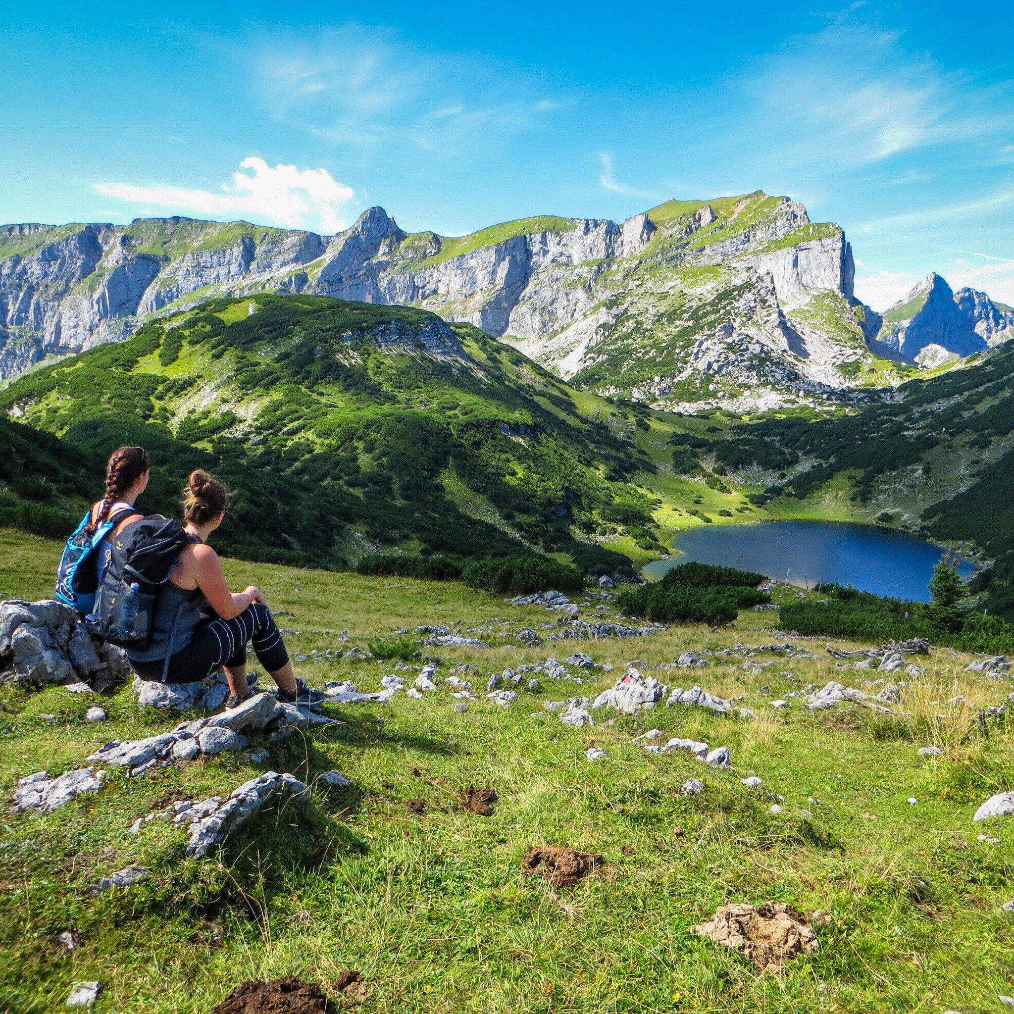
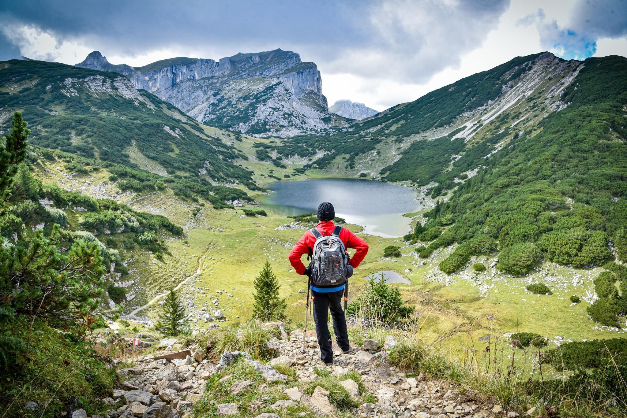
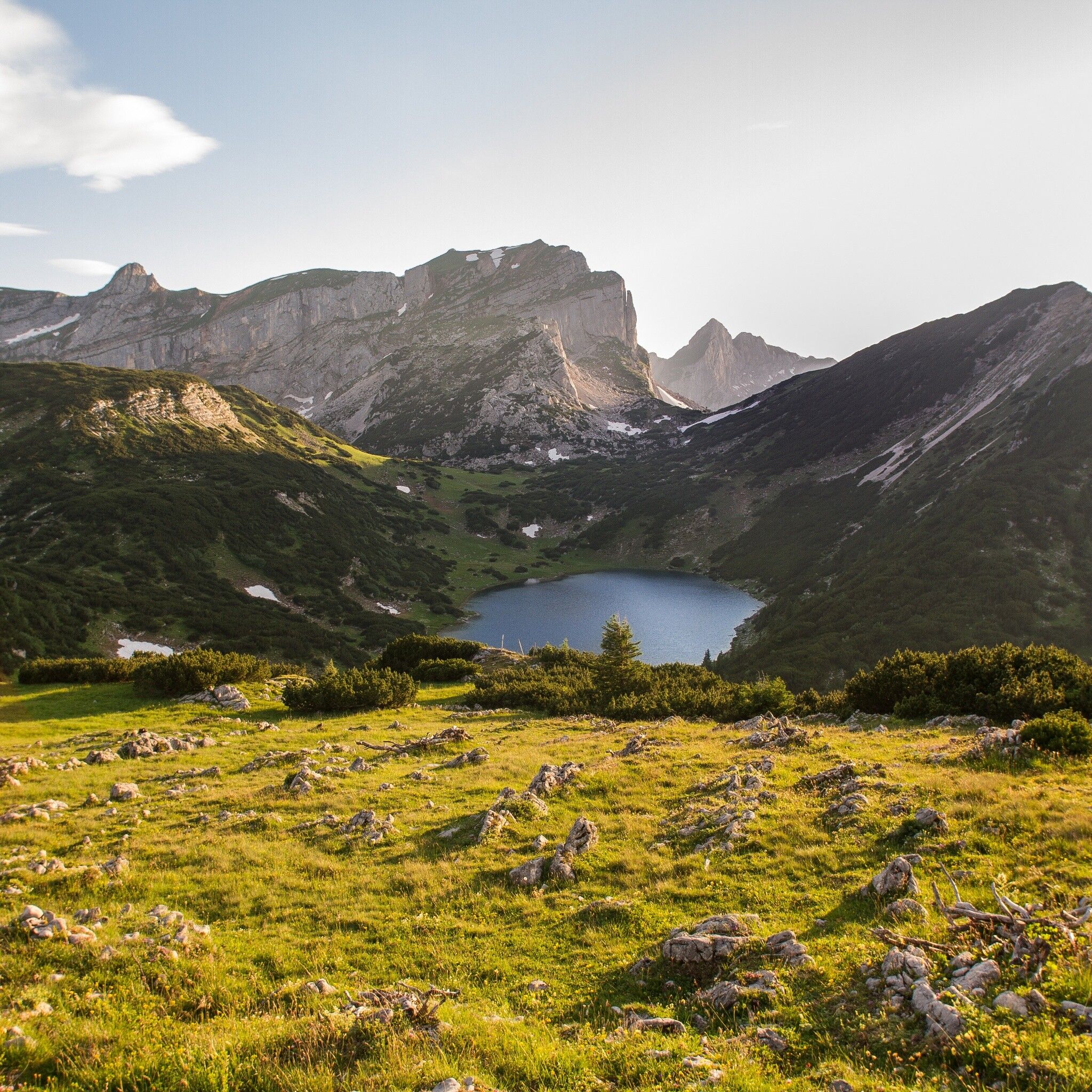
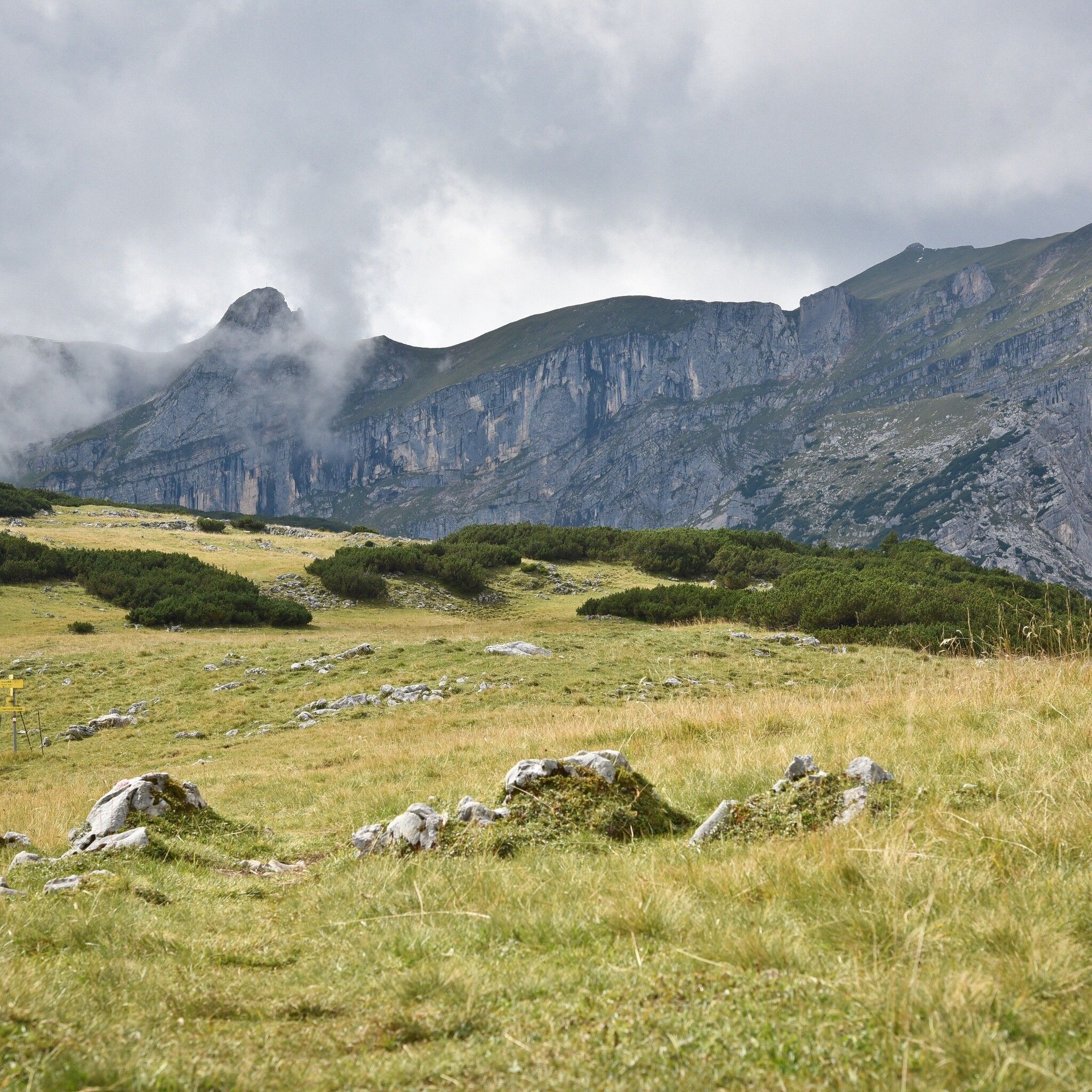
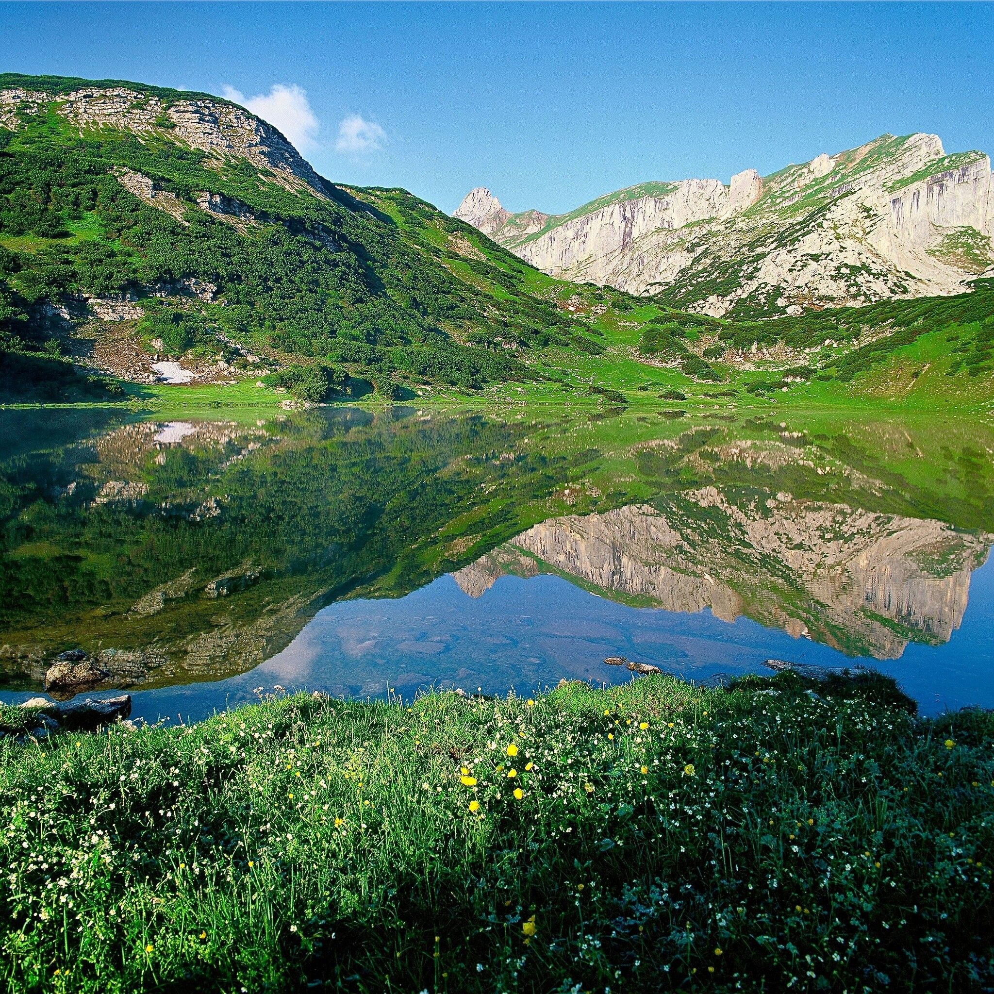
An alpine guided mountain hike with the impressive backdrop of the Rofan Mountains!

Tour information

  • Requirement: difficult
  • Length: 17.9 km
  • Duration: 6:00 h
  • Elevation uphill:709 hm
  • Elevation downhill:1,231 hm
Highest point1,899 m

Starting point

Kramsach parking lot former Sonnwendjoch cable car

Finishing point

Kramsach, parking lot former Sonnwendjoch cable car
  • Fitness level 6 / 6

Best time of year

  • January
  • February
  • March
  • April
  • May
  • June
  • July
  • August
  • September
  • October
  • November
  • December

Equipment

  • Hike not suitable for children under 12 years

sturdy shoes, weatherproof clothing and provisions

Source: Alpbachtal

Description

The highest mountain lake in Tyrol awaits you. Equipped with good fitness, desire for a demanding hike and a sense for beauty, this guided walk into the natural jewel Rofan Mountains becomes a true experience for you.

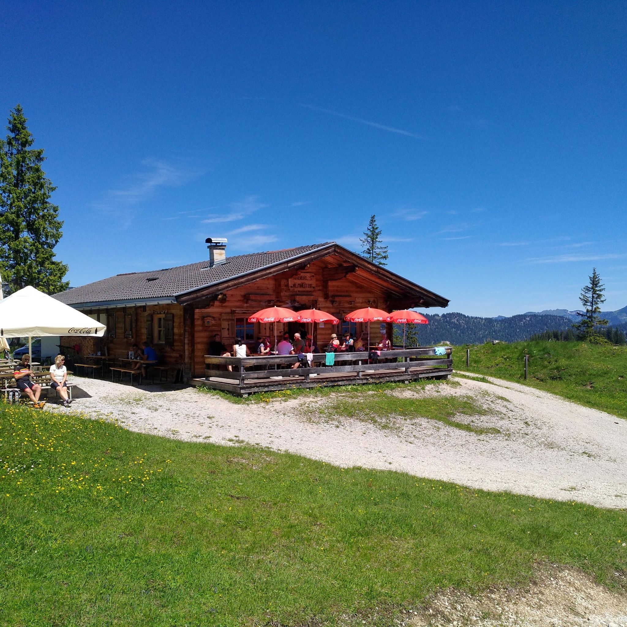
From the meeting point at Sport Ossi, the regional bus goes to Aschau. Then a transfer with a local taxi company continues to Eilalm. Here the hike begins and leads past Anderl's alpine hut (place to stop for refreshments), to the unmanaged Kreuzein Alm, and further over Roßwies to Zireiner Lake. Return via the Gappsteig trail back to Aschau bus stop.

Info about the guided hike with Sport Ossi

  • Day: Tuesday
  • Meeting point: 07:50 am Sport Ossi, Wittberg 105, 6233 Kramsach
  • Period: June 17 - September 16, 2025
  • Duration 8 h - pure walking time: approx. 6 hours
  • Participants: at least 1, maximum 7 persons from age 12
  • Refreshment possibility: Anderl's alpine hut
  • Registrations until the day before 4:00 pm at: +43 5337 21 200 20 or at the Alpbachtal Experience Shop

Price for the guided hike

for only 1 participant:

  • € 100.00 per person with the Alpbachtal Card
  • € 110.00 per person without Alpbachtal Card

for 2 participants:

  • € 49.00 per person with the Alpbachtal Card
  • € 59.00 per person without Alpbachtal Card

from 3 participants:

  • € 33.00 per person with the Alpbachtal Card
  • € 43.00 per person without Alpbachtal Card

including taxi fees with Alpbachtal Cardexcluding taxi fees without Alpbachtal CardPayment on site


Nearby huts and mountain restaurants

Getting here

  • Arrival by public transport

    www.vvt.at Bus 603 or 611

  • Parking

    Parking lot former Sonnwendjoch cable car

More tours in the surrounding area

  • 3-peak-tour Kienberg-Plessenberg-Heuberg

    Difficulty: medium
    Length: 8.6 km Duration: 4:30 h Elevation uphill: 779 m
  • Day 3: 4 days - 4 summits tour

    Difficulty: medium
    Length: 19.3 km Duration: 8:00 h Elevation uphill: 1,371 m
  • 4 days - 4 summits tour

    Difficulty: medium
    Length: 54.4 km Duration: 23:00 h Elevation uphill: 3,408 m
  • Day 1: 4 days - 4 summits tour

    Difficulty: medium
    Length: 9.8 km Duration: 5:00 h Elevation uphill: 984 m
  • Loop tour Juppi Zauberwald

    Difficulty: easy
    Length: 2.5 km Duration: 1:00 h Elevation uphill: 93 m
  • Kaiser Gorge - loop trail

    Opening hours: closed
    Difficulty: easy
    Length: 4.2 km Duration: 1:00 h Elevation uphill: 198 m
  • Voldöpper Spitze Loop Hike

    Difficulty: medium
    Length: 12.9 km Duration: 5:00 h Elevation uphill: 988 m
  • Kundler Klamm

    Opening hours: closed
    Difficulty: easy
    Length: 6.4 km Duration: 2:00 h Elevation uphill: 116 m
  • Discovering the Tiefenbach Gorge Hike

    Opening hours: closed
    Difficulty: medium
    Length: 5.7 km Duration: 3:30 h Elevation uphill: 669 m
  • 3-day Family Tour Alpbachtal

    Difficulty: easy
    Length: 18.3 km Duration: 7:00 h Elevation uphill: 998 m
  • Farmkehralm 1.521 m

    Difficulty: medium
    Length: 9.3 km Duration: 3:30 h Elevation uphill: 506 m
  • Wiedersberger Horn Panorama Path

    Difficulty: easy
    Length: 4.1 km Duration: 1:30 h Elevation uphill: 195 m
  • Barrier-free path Lake Reintal

    Difficulty: easy
    Length: 6.5 km Duration: 1:45 h Elevation uphill: 15 m
Newsletter

The mountain is calling? So does our newsletter!

In our monthly newsletter we reveal the best holiday tips for Tyrol.