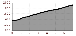
Kalser Glocknerstraße

Kals am Großglockner / Glocknergruppe
Route length: 7.0 km
Duration: 0:30 h

Most beautiful view of Großglockner!

Tour information

  • Length: 7.0 km
  • Duration: 0:30 h
  • Elevation uphill:603 hm
  • Elevation downhill:0 hm
Highest point1,919 m

Starting point

Kals / Burg

Finishing point

Lucknerhaus
Source: TVB Osttirol

Description

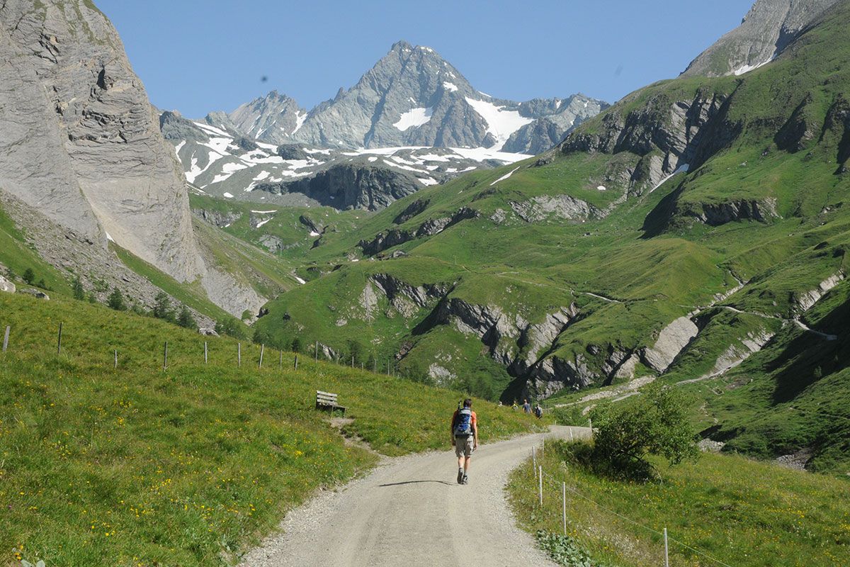
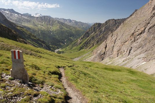
An unforgettable experience on Austria's highest mountain! The 7 km long toll road branches off in the district "Burg", is also easily accessible by bus and takes you to the picturesque Ködnitztal valley, one of the most beautiful mountain valleys in Tyrol. Directly from the Lucknerhaus car park, at the end of the road, you can enjoy the most beautiful view of Großglockner. Here is also the starting point for many hut hikes, mountain and ski tours in the Glockner and Schober group as well as the interesting educational trail "Glocknerspur - BergeDenken" to the nature and alpine history of the Grossglockner.

Toll fees:
Car until 3 h: € 4,00
Car until 6 h: € 7,00
Car until 1 day: € 10,00
Car up to 7 days: € 14,00
Bus up to 30 seats: € 30,00
Bus from 30 seats: € 60,00

More tours in the surrounding area

  • Hike to the Venedigerhaus Innergschlöß

    Difficulty:easy
    Length:8.6 kmDuration:2:30 hElevation uphill:184 m
  • Lucknerhaus - Stüdlhütte

    Difficulty:medium
    Length:9.3 kmDuration:5:30 hElevation uphill:862 m
  • Badener Hütte

    Difficulty:difficult
    Length:23.2 kmDuration:11:30 hElevation uphill:1,754 m
  • Hike to Kalser Tauernhaus

    Difficulty:medium
    Length:12.2 kmDuration:4:00 hElevation uphill:244 m
  • Hiking tour to Neue Sajathütte 2.600m

    Difficulty:medium
    Length:10.3 kmDuration:6:50 hElevation uphill:1,086 m
  • Hike to Neuen Reichenberger Hütte

    Difficulty:medium
    Length:18.2 kmDuration:9:00 hElevation uphill:1,252 m
  • Hiking tour to Lasörlinghütte 2.350m

    Difficulty:medium
    Length:14.6 kmDuration:7:10 hElevation uphill:1,080 m
  • Theme path "Virgen crossroads"

    Difficulty:easy
    Length:3.2 kmDuration:1:00 hElevation uphill:104 m
  • Figerhorn

    Difficulty:difficult
    Length:6.5 kmDuration:6:00 hElevation uphill:807 m
  • Lasörling altitude trail

    Difficulty:medium
    Length:57.0 kmDuration:25:00 hElevation uphill:3,740 m
  • Venediger altitude trail

    Difficulty:difficult
    Length:55.5 kmDuration:27:00 hElevation uphill:3,915 m
  • Muhs panorama trail

    Difficulty:medium
    Length:15.2 kmDuration:6:00 hElevation uphill:1,090 m
  • Rollitour with Swiss Trac

    Difficulty:easy
    Length:3.2 kmDuration:1:30 hElevation uphill:135 m
  • Rotenkogel

    Difficulty:difficult
    Length:3.9 kmDuration:3:00 hElevation uphill:383 m
  • Lasörling 3.098m

    Difficulty:difficult
    Length:21.9 kmDuration:12:00 hElevation uphill:1,940 m
Newsletter

The mountain is calling? So does our newsletter!

In our monthly newsletter we reveal the best holiday tips for Tyrol.