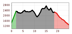
Interaktive Karte öffnenDiesen POI auf der interaktive Karte öffnenHöhenprofilArlberg Trail Alternative Stuben - Lech.gpx
Sonnenuntergang Wandern Herbst Möslalm Wörgl 2022@Region Hohe Salve - Mathäus Gartner (21).jpg © Mathäus Gartner Möslalmkogel via WörglSchwierigkeit:mediumLänge:10.3 kmDauer:3:30 hHöhenmeter bergauf:580 mZur WandertourZur Wandertour: Möslalmkogel via Wörgl
Scheffau_Brandstadl_Tanzboden_Panoramaweg_Wilder Kaiser © TVB Wilder Kaiser/Stefan Leitner Panoramic circuit Brandstadl–HartkaiserSchwierigkeit:easyLänge:6.0 kmDauer:1:50 hHöhenmeter bergauf:170 mZur WandertourZur Wandertour: Panoramic circuit Brandstadl–Hartkaiser
Leutasch Farm Shop Circular HikeSchwierigkeit:easyLänge:11.5 kmDauer:3:10 hHöhenmeter bergauf:111 mZur WandertourZur Wandertour: Leutasch Farm Shop Circular Hike
Stöttlalmbrücke circular hikeSchwierigkeit:easyLänge:8.7 kmDauer:2:30 hHöhenmeter bergauf:117 mZur WandertourZur Wandertour: Stöttlalmbrücke circular hike
BiathlonpfadSchwierigkeit:mediumLänge:14.0 kmDauer:4:00 hHöhenmeter bergauf:360 mZur WandertourZur Wandertour: Biathlonpfad
im Falzthurntal - in der Bildmitte der mächtige Gipfel des Sonnjoch © Achensee Tourismus Gramai Alm - Gramai Hochleger - Sonnjoch - Gramai AlmSchwierigkeit:difficultLänge:10.8 kmDauer:6:30 hHöhenmeter bergauf:1,200 mZur WandertourZur Wandertour: Gramai Alm - Gramai Hochleger - Sonnjoch - Gramai Alm
Oberer Wiesenweg im Frühwinter_Paar läuft auf Wanderweg_Blick auf Stadl und Hohe Munde.jpg © Region Seefeld W17: Winter circular hike on the WiesenwegÖffnungszeiten:gesperrtSchwierigkeit:easyLänge:6.2 kmDauer:1:45 hHöhenmeter bergauf:61 mZur WinterwanderungZur Winterwanderung: W17: Winter circular hike on the Wiesenweg
Hängebrückenrunde © mia Maria Knoll HBSchwierigkeit:mediumLänge:5.7 kmDauer:2:00 hHöhenmeter bergauf:260 mZur WandertourZur Wandertour: HB
Wandern Bettlersteig Kaistertal Naturerlebnis Kaisergebirge © Thomas Laukat 2-Day High-Altitude Tour around Kaisertal - Stage 2Schwierigkeit:mediumLänge:12.1 kmDauer:5:30 hHöhenmeter bergauf:700 mZur WandertourZur Wandertour: 2-Day High-Altitude Tour around Kaisertal - Stage 2
The Wildschönau High TrailSchwierigkeit:mediumLänge:14.8 kmDauer:6:30 hHöhenmeter bergauf:760 mZur WandertourZur Wandertour: The Wildschönau High Trail
Adlerweg Day TourSchwierigkeit:mediumLänge:16.0 kmDauer:8:30 hHöhenmeter bergauf:1,200 mZur WandertourZur Wandertour: Adlerweg Day Tour
Kranzhorn Gipfel mit zwei Kreuzen © Chris Borg Kranzhorn ErlSchwierigkeit:mediumLänge:8.8 kmDauer:3:30 hHöhenmeter bergauf:498 mZur WandertourZur Wandertour: Kranzhorn Erl
Summit hike Salfainssee - Schaflegerkogel (2,405 m) - Kemater Alm mountain hutSchwierigkeit:mediumLänge:14.8 kmDauer:7:00 hHöhenmeter bergauf:1,029 mZur WandertourZur Wandertour: Summit hike Salfainssee - Schaflegerkogel (2,405 m) - Kemater Alm mountain hut
Family hike-Golzentipp-Kindermeile-TVB-Osttirol-c-Attic-FilmGmbH-Obertilliach.jpg © Attic Film GmbH Children's mile GolzentippÖffnungszeiten:openSchwierigkeit:easyLänge:3.7 kmDauer:2:00 hHöhenmeter bergauf:140 mZur WandertourZur Wandertour: Children's mile Golzentipp
Sonnenuntergang am Bärenkopf mit Blick über den Achensee. Links liegt Pertisau am Fuße des Karwendelgebirges, rechts Maurach vor der Kulisse des Rofangebirges. © Achensee Tourismus BärenkopfSchwierigkeit:mediumLänge:16.3 kmDauer:6:15 hHöhenmeter bergauf:1,065 mZur WandertourZur Wandertour: Bärenkopf
Evening winter hike Kleinmutzkopf, NaudersSchwierigkeit:easyLänge:6.0 kmDauer:2:00 hHöhenmeter bergauf:70 mZur WinterwanderungZur Winterwanderung: Evening winter hike Kleinmutzkopf, Nauders
Griesbachklamm Gorge - Alpine LoopSchwierigkeit:mediumLänge:10.2 kmDauer:4:00 hHöhenmeter bergauf:480 mZur WandertourZur Wandertour: Griesbachklamm Gorge - Alpine Loop
Ellmau_Biedringer Platte_Winterwanderung_Wilder Kaiser © TVB Wilder Kaiser/Maria Luise Handl Winter walking Biedringer PlatteÖffnungszeiten:gesperrtLänge:12.7 kmDauer:5:30 hHöhenmeter bergauf:470 mZur WinterwanderungZur Winterwanderung: Winter walking Biedringer Platte
©-TVB-Tiroler-Oberland-Rudi-Wyhlidal-Radurschlklamm-Pfunds-2022 (5).jpg © Rudi Wyhlidal Klammsteig - GreitÖffnungszeiten:openSchwierigkeit:mediumLänge:7.5 kmDauer:3:20 hHöhenmeter bergauf:442 mZur WandertourZur Wandertour: Klammsteig - Greit
Koasamarsch © Freund der Berge 2-Day High-Altitude Tour around Kaisertal - Stage 1Öffnungszeiten:openSchwierigkeit:mediumLänge:14.0 kmDauer:6:30 hHöhenmeter bergauf:1,500 mZur WandertourZur Wandertour: 2-Day High-Altitude Tour around Kaisertal - Stage 1
Round tour OttenspitzSchwierigkeit:mediumLänge:7.0 kmDauer:3:30 hHöhenmeter bergauf:735 mZur WandertourZur Wandertour: Round tour Ottenspitz
Kirchdachspitze (2.840m) from TrinsSchwierigkeit:difficultLänge:16.0 kmDauer:8:00 hHöhenmeter bergauf:1,609 mZur WandertourZur Wandertour: Kirchdachspitze (2.840m) from Trins
Filzenkogel winter walk in MayrhofenSchwierigkeit:mediumLänge:3.6 kmDauer:1:30 hHöhenmeter bergauf:250 mZur WinterwanderungZur Winterwanderung: Filzenkogel winter walk in Mayrhofen
Kotalm Mitterleger - dahinter die mächtigen Klobenjoch Wände © Achensee Tourismus Achenkirch - Köglalm - Kotalm Mitterleger - Kotalm Niederleger – AchenkirchSchwierigkeit:mediumLänge:9.6 kmDauer:5:00 hHöhenmeter bergauf:720 mZur WandertourZur Wandertour: Achenkirch - Köglalm - Kotalm Mitterleger - Kotalm Niederleger – Achenkirch
Dalfazer Wasserfall - seitlich verläuft ein Klettersteig © Achensee Tourismus Dalfazer FallsSchwierigkeit:mediumLänge:9.2 kmDauer:4:00 hHöhenmeter bergauf:760 mZur WandertourZur Wandertour: Dalfazer Falls
Feedback geben und besondere Urlaubserlebnisse gewinnen!Hier geht's zur UmfrageHier geht's zur Umfrage
.jpg")


 neu.jpg")


.jpg")
.jpg")


.jpg")


.jpg")


