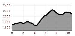
Open interactive mapOpen this POI on the interactive mapElevation profileArlberg Trail Lech - St. Anton (moderate alternative).gpx
Going_Moor&More_Wilder Kaiser © TVB Wilder Kaiser/Roland DeFrancesco “Moor & more” Rocky WayDifficulty: easy Length: 8.0 km Duration: 3:00 h Elevation uphill: 380 m See trailSee trail: “Moor & more” Rocky Way
web-wilder-kaiser-mountain-tours-summit-photos-behind-goinger-halt-herbst2022-stefan-leitner-6©stefanleitner © Stefan Leitner Hintere Goinger Halt summit tourDifficulty: difficult Length: 8.9 km Duration: 6:30 h Elevation uphill: 1,090 m See trailSee trail: Hintere Goinger Halt summit tour
Leutasch Farm Shop Circular HikeDifficulty: easy Length: 11.5 km Duration: 3:10 h Elevation uphill: 111 m See trailSee trail: Leutasch Farm Shop Circular Hike
BrixenbachalmDifficulty: medium Length: 4.4 km Duration: 3:30 h Elevation uphill: 290 m See trailSee trail: Brixenbachalm
BrechhornDifficulty: medium Length: 11.8 km Duration: 5:00 h Elevation uphill: 600 m See trailSee trail: Brechhorn
Round tour SpießnägelDifficulty: medium Length: 15.7 km Duration: 6:30 h Elevation uphill: 859 m See trailSee trail: Round tour Spießnägel
Arzler Alm 1 © TVB Pitztal/Chris Walch Arzler Alm – TiefentalalmDifficulty: medium Length: 11.3 km Duration: 5:00 h Elevation uphill: 1,000 m See trailSee trail: Arzler Alm – Tiefentalalm
Winterwandern in der Naturparkregion Reutte © Peter Neusser Hike to the Ehrenberg castle ruinsDifficulty: medium Length: 5.1 km Duration: 1:45 h Elevation uphill: 237 m See trailSee trail: Hike to the Ehrenberg castle ruins
Nons-Alm-712x533-650x488.jpg © Silberregion Karwendel Winter walk at Hüttegg am WeerbergDifficulty: easy Length: 8.0 km Duration: 2:50 h Elevation uphill: 313 m See trailSee trail: Winter walk at Hüttegg am Weerberg
Wandern Bettlersteig Kaistertal Naturerlebnis Kaisergebirge © Thomas Laukat Kaiserlift Tourentipp 5: From Brentenjoch into the Kaiser ValleyDifficulty: difficult Length: 17.6 km Elevation uphill: 425 m See trailSee trail: Kaiserlift Tourentipp 5: From Brentenjoch into the Kaiser Valley
Hike to the Small AhornbodenDifficulty: medium Length: 26.8 km Duration: 9:30 h Elevation uphill: 1,020 m See trailSee trail: Hike to the Small Ahornboden
Going_Ausblick vom Baumgartenköpfl_Wilder Kaiser © TVB Wilder Kaiser/Thomas Hennerbichler Tauernblick panorama circular hiking routeDifficulty: medium Length: 13.6 km Duration: 6:00 h Elevation uphill: 980 m See trailSee trail: Tauernblick panorama circular hiking route
Muttereralm - Saile (Nockspitze)Difficulty: difficult Length: 7.5 km Duration: 4:00 h Elevation uphill: 789 m See trailSee trail: Muttereralm - Saile (Nockspitze)
160827_ichmachefotos.com_005.jpg © Angelica Morales - Ichmachefotos.com Along the Wild Waters through the WolfsklammDifficulty: medium Length: 7.0 km Duration: 3:00 h Elevation uphill: 400 m See trailSee trail: Along the Wild Waters through the Wolfsklamm
sunnenseiten-weg-stubai-contwise-02.jpg © Andre Schönherr Sunnenseit'n Weg: Round tourOpening hours: open Difficulty: medium Length: 8.2 km Duration: 3:00 h Elevation uphill: 400 m See trailSee trail: Sunnenseit'n Weg: Round tour
Similaunhütte © Roland Grüner Vent - Similaunhütte - Ötzi-FundstelleDifficulty: medium Length: 14.9 km Duration: 6:00 h Elevation uphill: 1,397 m See trailSee trail: Vent - Similaunhütte - Ötzi-Fundstelle
Hängebrücke Längenfeld © Katharina Nösig Water Walk Brand-Burgstein LängenfeldDifficulty: medium Length: 6.7 km Duration: 2:30 h Elevation uphill: 396 m See trailSee trail: Water Walk Brand-Burgstein Längenfeld
Wanderung am Schlegeis mit Blick auf dem Stausee © Archiv TVB Mayrhofen Summit hike: Ginzling Schlegeis reservoir - Hoher RifflerDifficulty: difficult Length: 17.0 km Duration: 7:30 h Elevation uphill: 1,500 m See trailSee trail: Summit hike: Ginzling Schlegeis reservoir - Hoher Riffler
hochstubaihütte über seekarsee & himmelsleiter - sölden_img_56888636 © Ötztal Hochstubaihütte über Seekarsee & Himmelsleiter - SöldenDifficulty: difficult Length: 4.8 km Duration: 4:00 h Elevation uphill: 1,270 m See trailSee trail: Hochstubaihütte über Seekarsee & Himmelsleiter - Sölden
TaubenseeDifficulty: medium Length: 13.0 km Duration: 5:00 h Elevation uphill: 620 m See trailSee trail: Taubensee
Wildschönau Oberau Achentalalm © Wildschönau Tourismus Oberau - KragenjochkreuzDifficulty: medium Length: 7.9 km Duration: 3:00 h Elevation uphill: 513 m See trailSee trail: Oberau - Kragenjochkreuz
Summit hike PendlingDifficulty: medium Length: 8.6 km Duration: 4:00 h Elevation uphill: 600 m See trailSee trail: Summit hike Pendling
BichlachrundeDifficulty: easy Length: 10.5 km Duration: 3:30 h Elevation uphill: 295 m See trailSee trail: Bichlachrunde
Kranzhorn Wandern Kraftplatz © Sportalpen Marketing Kranzhorn ErlDifficulty: medium Length: 8.8 km Duration: 3:30 h Elevation uphill: 498 m See trailSee trail: Kranzhorn Erl
Wildschönau Wildschönauer Höhenweg © Wildschönau Tourismus H. Dabernig The Wildschönau High TrailDifficulty: medium Length: 14.8 km Duration: 6:30 h Elevation uphill: 760 m See trailSee trail: The Wildschönau High Trail
Give feedback for a chance to win a special holiday experience!Click here for the surveyClick here for the survey


_FULL12.jpg")


")

.jpg")


