Arrival by public transport
Line 210, Bus stop Pfunds Dorf, walking distance to Tscheylücke: 6,9 km
Line 273, Bus stop Pfunds Stuben, walking distance to Tscheylücke: 8,1 km
Tip: There ist a hiking shuttle to the Tschey every Thursday
A scenic hike through pine forests and across meadows to the summit cross with wide panorama.
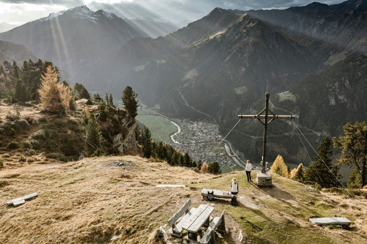
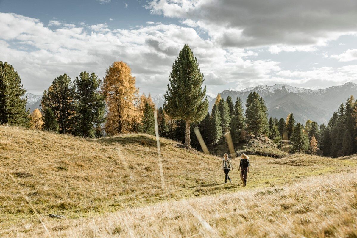
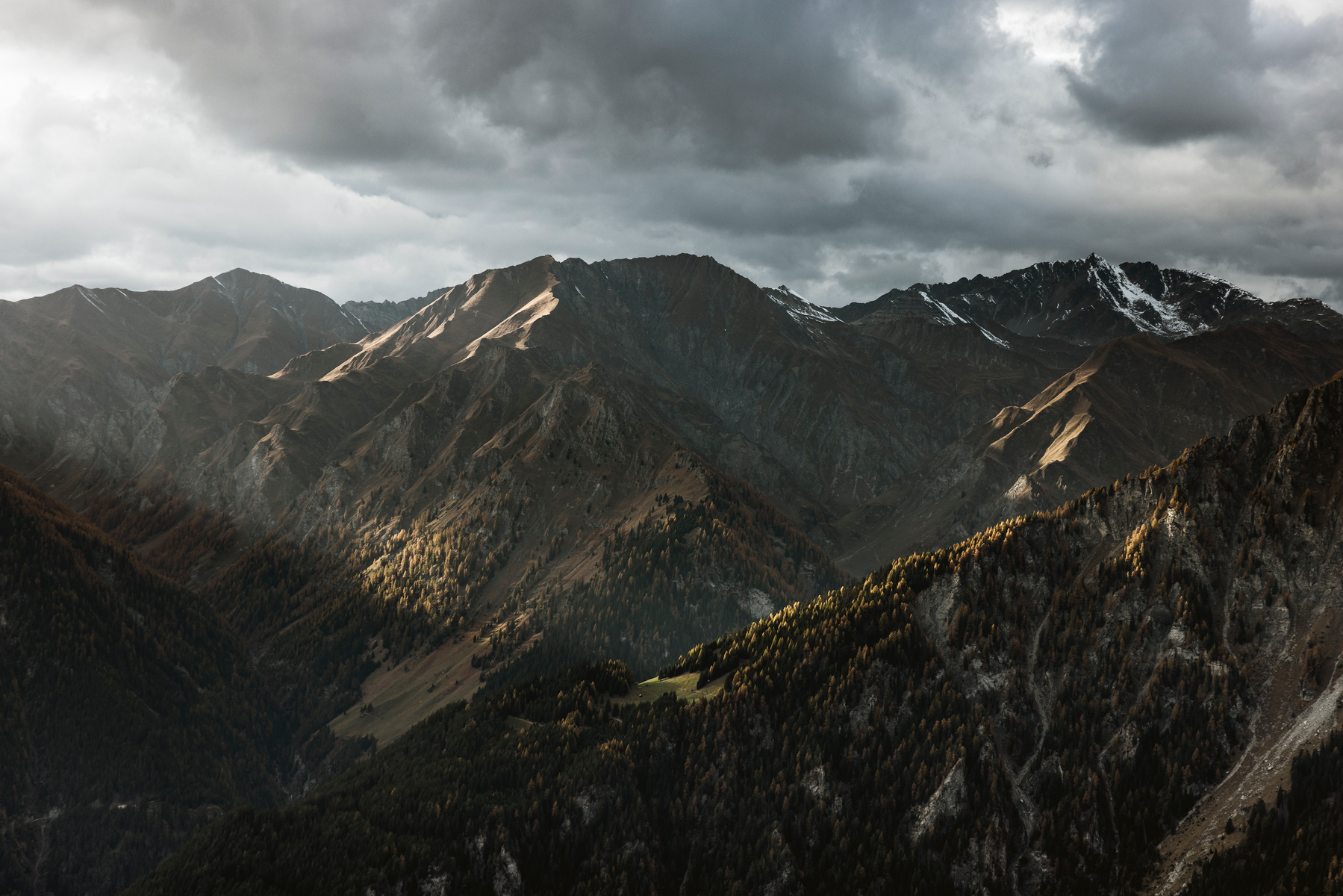
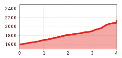
Drive to Greit up to the Tscheylücke. Here, at the beginning of the wonderful high valley of the Pfundser Tschey, a forest path starts on the left at the roundabout up to high mountain meadows. The sign Frudiger points to a path across pastures, through the Swiss stone pine forest up to the summit. A wonderful view of the neighbouring Samnaun group and the holiday resort Pfunds opens up.
Line 210, Bus stop Pfunds Dorf, walking distance to Tscheylücke: 6,9 km
Line 273, Bus stop Pfunds Stuben, walking distance to Tscheylücke: 8,1 km
Tip: There ist a hiking shuttle to the Tschey every Thursday
Parking area Tscheylücke, free of charge.


.jpg")


.jpg")
.jpg")


")
