Mountain hikes KitzTrail E-Bike & Hike

Difficulty ratings: difficult
Route length: 31.1 km

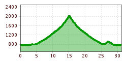
The KitzTrail E-BIKE AND HIKE takes us by electric mountain bike through varied landscapes to the wild and romantic Auracher Wildalm. After a well-earned rest there, we leave our bikes behind and climb to the peak of Mount Gebra on foot.

Tour information

  • Requirement: difficult
  • Length: 31.1 km
  • Elevation uphill:1,515 hm
  • Elevation downhill:1,515 hm
Highest point2,057 m

Starting point

Kitzbühel Tourismus

Finishing point

Kitzbbühel Tourismus

Trail condition

Tarmac road, gravel path

Equipment

Sturdy, ankle-high footwear, functional mountain clothing, waterproofs, sun protection, plenty to drink, a comfortable rucksack, hiking poles, snacks
Source: Kitzbühel Tourismus

Description

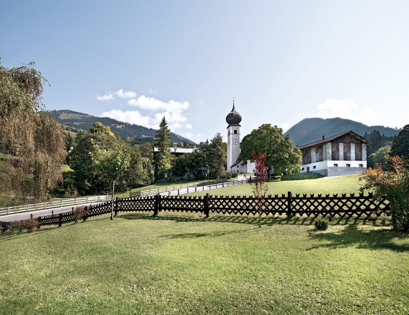
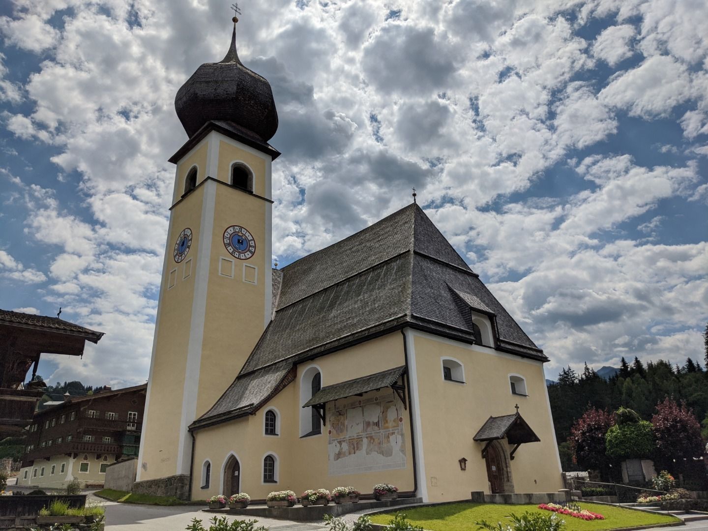
:: We start at the Kitzbühel tourism office in the centre of Kitzbühel. On our electric mountain bikes, we follow the Ache river towards Aurach. 
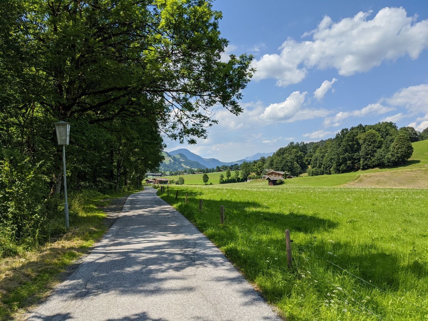
:: At Gasthof Auwirt, we initially head straight on for 200 metres. When the road branches, we head towards the Wildpark. Shortly afterwards, we reach the wild and romantic Oberaurach.
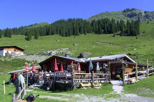
:: Shortly before the famous Wildpark, we take a gravel path to the Hochwildalmhütte, an establishment run
by Champions League-winning footballer Wolfgang Feiersinger (Borussia Dortmund), where we enjoy some delicious delicacies. You absolutely have to try a piece of mountain cheese, which is made in the immediate vicinity in the Auracher Wildalm by the Koidl family.
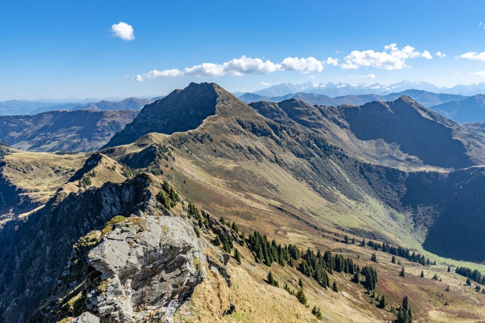
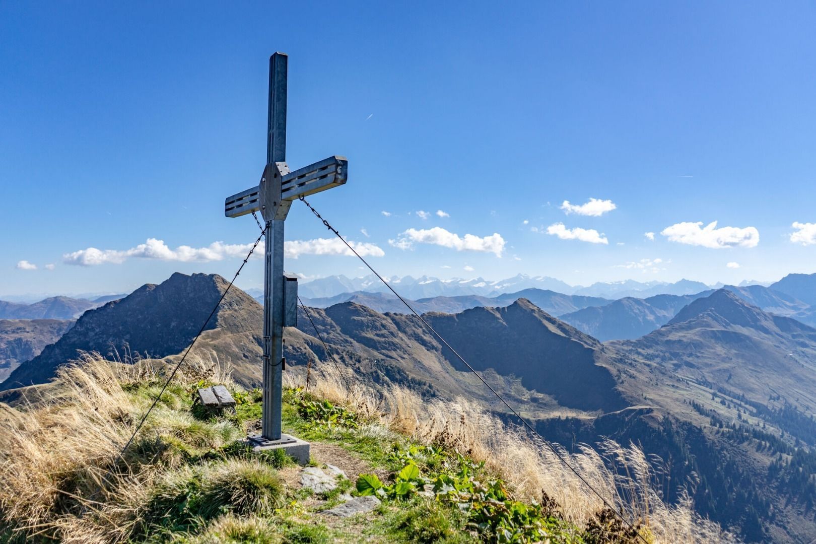
:: After a well-earned rest on the delightful sun terrace, we leave our bikes behind to head on foot to the peak of Mount Gebra, known locally as Ranggen. Once we reach the top, we enjoy an amazing view of the surrounding Tyrolean mountains. 
:: We head back to the Hochwildalmhütte, get back on our electric mountain bikes – and head to the tranquil holiday village of Aurach. In the town centre, the Hallerwirt awaits us – an original farmhouse with a restaurant, where we enjoy traditional Tyrolean cuisine.
:: Totally relaxed, we head back the remainder of the way to Gamsstadt in Kitzbühel via Auracher Dörfl and the Bichlhof sport and spa hotel.

TIP: You can hire a suitable electric mountain bike in Kitzbühel from Intersport Kitzsport, Sport 2000 Etz and element3. It’s best to bring your own cycle helmet. Please note: this route is only recommended for experienced mountain bikers.


Tip: Don’t miss out on the chance to try an ownreared “Jochberger Hummeln” steak!
 

Nearby huts and mountain restaurants

More tours in the surrounding area

  • Kundler Klamm

    Opening hours: closed
    Difficulty: easy
    Length: 6.4 km Duration: 2:00 h Elevation uphill: 116 m
  • Kaiser Gorge - loop trail

    Opening hours: closed
    Difficulty: easy
    Length: 4.2 km Duration: 1:00 h Elevation uphill: 198 m
  • 3-peak-tour Kienberg-Plessenberg-Heuberg

    Difficulty: medium
    Length: 8.6 km Duration: 4:30 h Elevation uphill: 779 m
  • 4 days - 4 summits tour

    Difficulty: medium
    Length: 54.4 km Duration: 23:00 h Elevation uphill: 3,408 m
  • Discovering the Tiefenbach Gorge Hike

    Opening hours: closed
    Difficulty: medium
    Length: 5.7 km Duration: 3:30 h Elevation uphill: 669 m
  • Voldöpper Spitze Loop Hike

    Difficulty: medium
    Length: 12.9 km Duration: 5:00 h Elevation uphill: 988 m
  • Loop tour Juppi Zauberwald

    Difficulty: easy
    Length: 2.5 km Duration: 1:00 h Elevation uphill: 93 m
  • Day 1: 4 days - 4 summits tour

    Difficulty: medium
    Length: 9.8 km Duration: 5:00 h Elevation uphill: 984 m
  • Wheelchair Circular Hike Runst-Achweg

    Difficulty: easy
    Length: 6.3 km Duration: 2:00 h Elevation uphill: 40 m
  • Ötztal Trek Stage 4

    Difficulty: difficult
    Length: 8.9 km Duration: 4:00 h Elevation uphill: 802 m
  • Ötztal Trek Stage 3

    Difficulty: difficult
    Length: 10.4 km Duration: 4:00 h Elevation uphill: 842 m
  • Ötztal Trek Stage 8

    Difficulty: difficult
    Length: 9.3 km Duration: 3:30 h Elevation uphill: 274 m
  • Ötztal Trek Stage 1

    Difficulty: medium
    Length: 18.6 km Duration: 6:30 h Elevation uphill: 1,561 m
  • Ötztal Trek Stage 14

    Difficulty: difficult
    Length: 6.3 km Duration: 3:00 h Elevation uphill: 1,004 m
  • Ötztal Trek Stage 18

    Difficulty: difficult
    Length: 9.5 km Duration: 9:30 h Elevation uphill: 979 m
  • Ötztal Trek Stage 12

    Difficulty: difficult
    Length: 4.8 km Duration: 2:00 h Elevation uphill: 592 m
  • Ötztal Trek Stage 22

    Difficulty: difficult
    Length: 21.5 km Duration: 8:00 h Elevation uphill: 647 m
Newsletter

The mountain is calling? So does our newsletter!

In our monthly newsletter we reveal the best holiday tips for Tyrol.