Arrival by public transport
Line 210, Bus stop Pfunds Dorf, walking distance to Tscheylücke: 6,9 km
Line 273, Bus stop Pfunds Stuben, walking distance to Tscheylücke: 8,1 km
Tip: There ist a hiking shuttle to the Tschey every Thursday
Lahnkopf
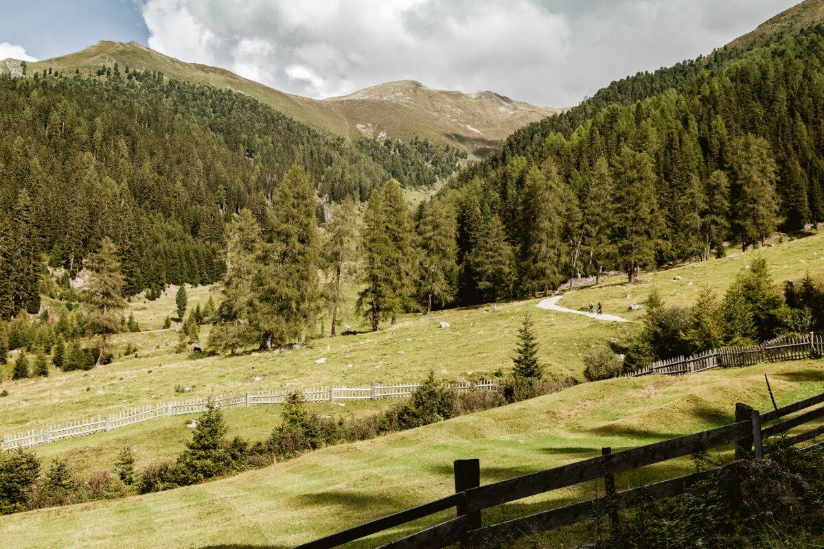

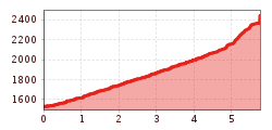
Starting at the Greiter Säge at the entrance to the Pfundser Tschey, follow the signposts towards the Gschneier Alm. A gravel road climbs steadily uphill in several switchbacks until reaching the alpine pasture. From there, the route continues on a hiking trail that leads further uphill, following the signs all the way to the summit of the Lahnkopf. At the top, hikers are rewarded with magnificent views of the surrounding mountains. The return follows the same route back to Greiter Säge or the Tscheylücke.
Line 210, Bus stop Pfunds Dorf, walking distance to Tscheylücke: 6,9 km
Line 273, Bus stop Pfunds Stuben, walking distance to Tscheylücke: 8,1 km
Tip: There ist a hiking shuttle to the Tschey every Thursday
Parking area Tscheylücke, free of charge
.jpg")
.jpg")
.jpg")
.jpg")
")
.jpg")

.jpg")
.jpg")
.jpg")
.jpg")
.jpg")
.jpg")
.jpg")

.jpg")

