
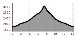
Difficulty:medium
Length:14.8 kmDuration:7:00 hElevation uphill:1,029 m
Muttler
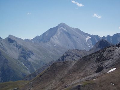
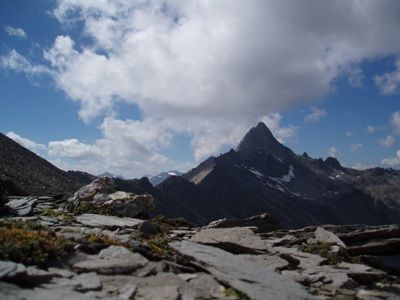
From Samnaun Dorf, the hiking trail leads into Val Maisas, passing the shepherd's hut and crossing alpine meadows until reaching Rossboden. The day's goal, Muttler, remains in view throughout the journey. We reach the Roten Seeli via Lange Seite, which turns red during the summer months. In recent years, the lake has often dried up almost completely, preventing the observation of this natural phenomenon. The red coloration is caused by algae. At Rossbodenjoch, the view opens up to Val Sampuoir and the Mundin group. From here, you can reach the highest peak in Samnaun, Muttler, via the North Ridge. The final steep section over crumbling slate stone is often wet or even icy, making it slippery. The summit panorama rewards your efforts, offering views over the Silvretta, Bernina, and Verwall groups to the west and north, the Ötztal Alps, and Ortler to the east and south. On a clear day, you can even see Lake Constance. The same route will lead us back to Samnaun Dorf.


.jpg")
")


")


 (1).jpg")


