
Opening hours:Today closed
Place:Dölsach
:Restaurant
Start your time journey through the former settlement area of the ancient Romans. Attention: The Mühlensteig Gödnach is temporarily CLOSED due to renovation work!
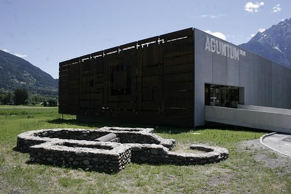
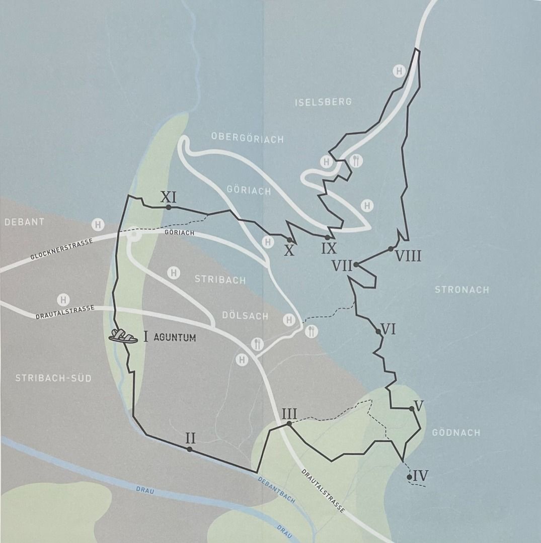
Starting from the only Roman city in Tyrol, called Aguntum, there is a hiking trail which leads through the national park villages of Dölsach and Iselsberg-Stronach.
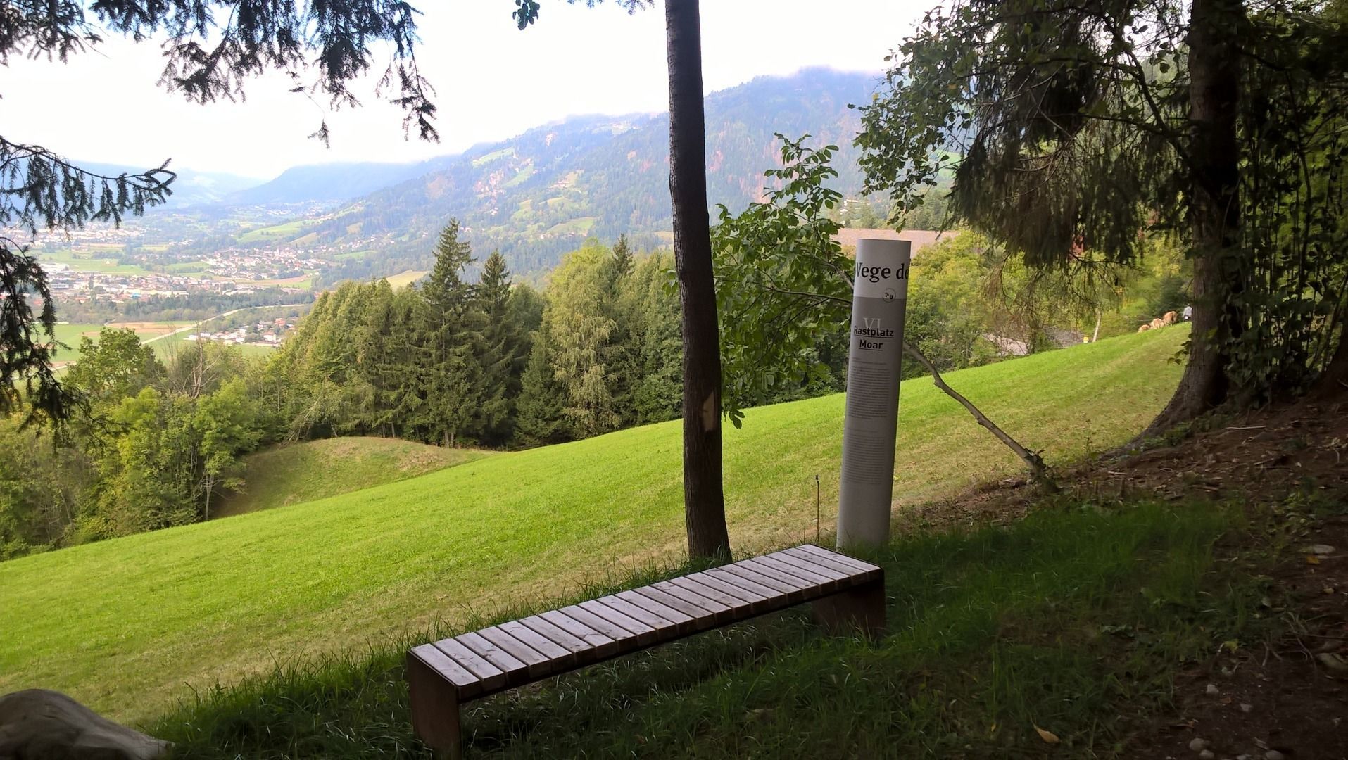
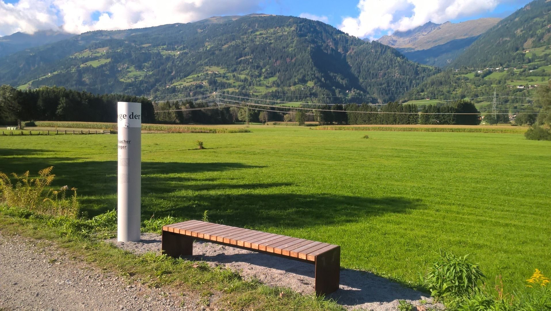
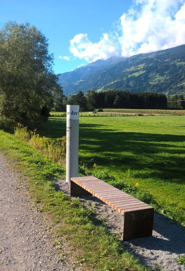
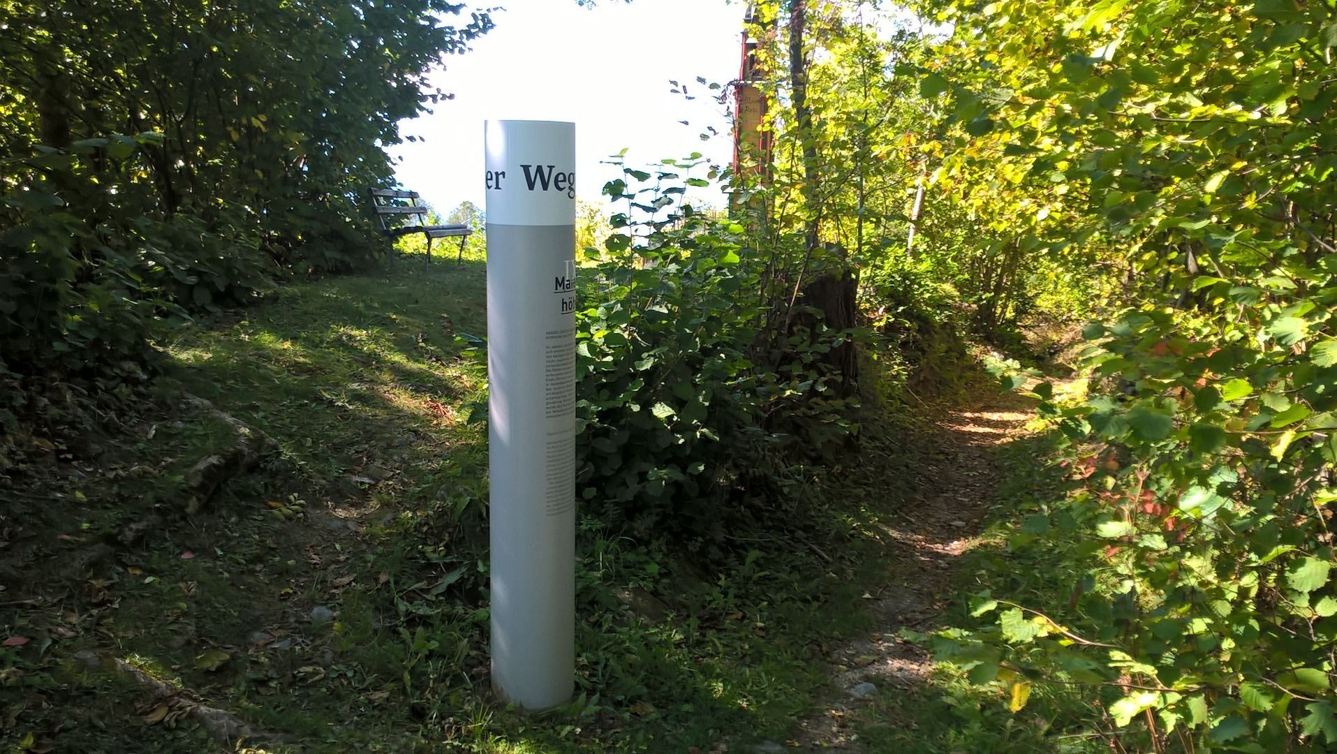
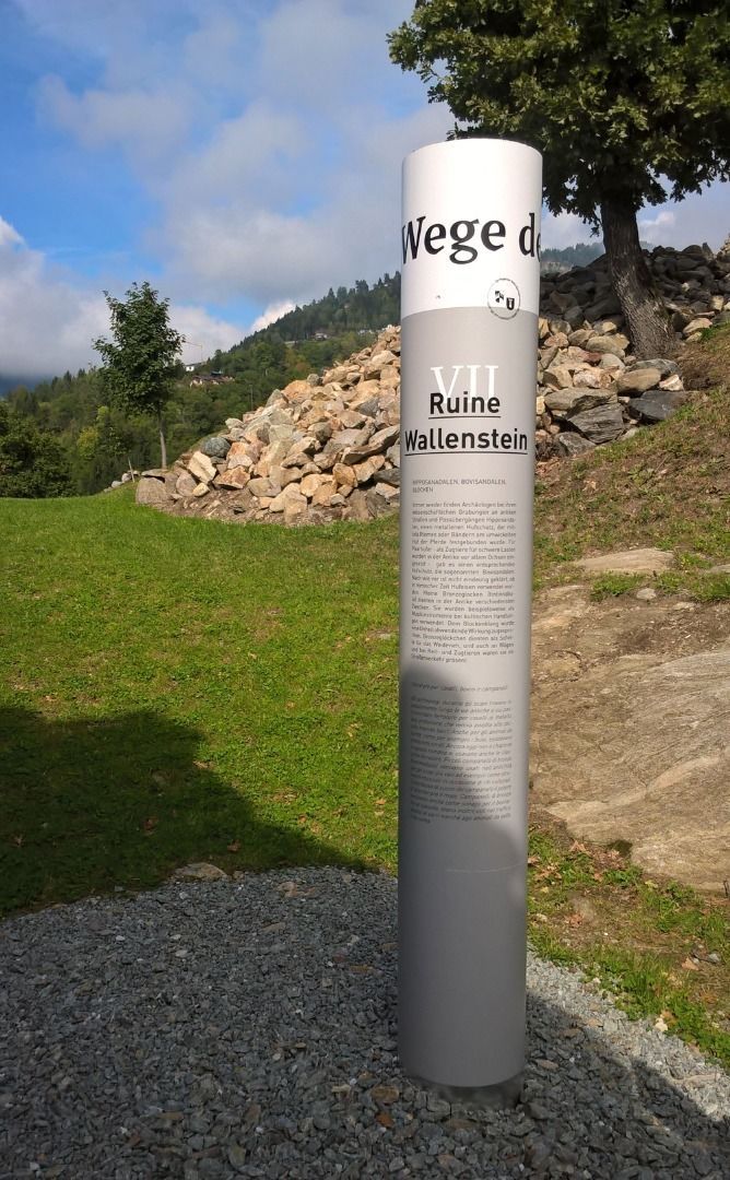
At selected stations you will receive information about the history of this landscape.
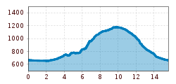
The trail "Römerweg" can be done in 3 stages.
1. Stage
Aguntum --> Dölsach
6 km | ca. 2 hours
Stations: Aguntum - Dölsacher Anger - Outdoor pool Dölsach - Chapel Görtschach - Mühlensteig Gödnach
2. Stage
Dölsach --> Iselsberg
4 km | ca. 1 hour
Stations: Rastplatz Moar - Ruin Wallenstein - Stronach
3. Stage
Iselsberg --> Aguntum
5 km | ca. 2 hours
Stations: Maienhöhe - Panoramic place Iselsberg/Lavantblick - Pondorfer Futterhäusl - Aguntum
From the train station in Lienz, take the nr 942 regional bus to the bus stop of Stribach Aguntum.
Parking space at the roman city of Aguntum


 Mirja Geh (26).jpg")


.jpg")
")


")


Manfred Pfister.jpg")


